
The route should have a cooler name but that’s all I can think of right now.
On October 26 I’m going to take public transportation to Reno, where I’m gonna do a bike trip south on my mountain bike. I’ll be riding up to the Tahoe area to ride the Flume Trail south along the east coast of the lake. I reckon I’ll resupply at South Lake Tahoe before heading south to the Blue Lakes area. That’s a cool looking valley with a paved and dirt road through it. Then I take the 4 east to the 89 to Walker. From there I’ll be following the Caldera 500 route for a bit, which climbs Mount Patterson, a peak I meant to climb on a ride a couple years back. Then south to Bodie, then down to Lee Vining for burgers and resupply, and maybe a secret climbing mission… anyway, head to Benton then up the 6 to Mustang Pass, which looks cool. Boundary and Montgomery peaks are there and I’d like to hike up em so that’s on the menu. Then down into the Nevada side of the White Mountains.
I wanna sleep above treeline in the whites if conditions permit/my balls don’t shrink too much, plus bag White Mtn Peak. Turn around and descend to Bishop via Silver Canyon or the other one, Black canyon I think? Otherwise I’d keep going south along the whites and descend to Big Pine. Depends on how much water I have, how much food I gotta get, etc, whatever. Big resupply spot for the next section, which is Death Valley. I’ll be following the Death Valley Dustup route for a bit. It goes from Big Pine up DV road to Eureka Dunes, somewhere new to me that I’m excited to see since I’ve been nerding out on dunes and mapping a lot of em. The route passes Racetrack Playa, Ubehebe Peak (looks like a fun scramble), up into the Hunter Mountain area, then I go further into Death Valley proper. Saline Valley Warm Springs is in there somewhere as well. I failed to climb Telescope Peak last year so it’s on the menu. I would like to ride out of DV via the Harry Wade Exit Route. I would then pass Ibex Dunes before getting on pavement to Baker. I have some ideas to take during the stretch to Baker but I’m not sure if they’ll go until I’m out there. I’d like to ride through and along the dry lakes to the west side of the road.
Resupply in Baker, then head south into the Mojave NP via dirt roads through Devils Playground. That area is one I’ve been daydreaming about for some time, so I’m excited to be there. After that I’ll be heading further west and south, roughly paralleling the Mojave Trail but staying further south along some old tracks. I’d like to see a certain valley out there, which will probably work out buuuut I don’t wanna jinx anything. Just some quiet remote places. Continue west to the Volcano House, then resupply along the freeway at one of the gas stations.
My next point of interest is probably Ord Mountain, which has a dirt road to the top. Ride that, descend, and continue to New Jack City. It has an unusual and conspicuous pass that allows one to cross from north of NJC over a short ride with a descent into the Luncerne Valley Road area. South and west from there to Hesperia, then Lake Arrowhead, then maybe an interesting route with Cleghorn Road as part of it through Cajon Pass. I reckon I’ll go over Baldy Notch before heading home, but I am leaving a lot of flexibility in the system, especially at the end. I’d like to take new-to-me routes.
I figured I’d update on here as a sort of blog post.
If you have any points of interest you think I should check out, holler at me. I’ll upload a map of the route later. Very ballpark estimate is 1,100mi with a big number of climbing, a lot. It is quite mountainous before it becomes very desert.
I wrote up most of this route to be ridden last year, but I didn’t have a suitable bike for it so I stuck to mostly pavement. I completed rebuilding my mountain bike to be able to carry a LOT of water, plenty of food, layers, and whatever special gear I’d need for bike mountain stuff. I’m going to need to carry 10+ liters of water, 3 days of food, and the clothes to be relatively happy in cold temps in places. Ballpark high temps are in the 80’s and lows in the 30’s. The highs in the Whites are in the 30’s and lows in the not-very-many’s, plus probably some strong cold winds. I’m bringing a 30* bag in my tyvek bivy sack, plus a Gatewood Cape, down jacket AND pants, down booties (man I love em), big gloves, small gloves, medium gloves, alpaca wool socks… down beanie, maybe a Pakol? Reckon I will ship the excess home from Bishop or Big Pine. Should probably insure that package. Probably light rain gear as well.
The desert should be chill. 80’s would be nice, but it’ll likely be cooler than that for the most part I’m guessing. I hope it doesn’t rain much beyond the occasional shower but you know how things can get sporty. Froze my balls off on Rogers Peak last year.
Probably gonna bring my nice camera on this trip.
Anywho, holla at me.
Reno to LA Mtb Trip 2025

-
JeffH

- Posts: 1406
- Joined: Sun Nov 28, 2010 7:09 am
Damn, that's ambitious. I bet the desert temps will be pretty low at night.
"Argue for your limitations and sure enough they're yours".
Donald Shimoda
Donald Shimoda
-
wesweswes
- Posts: 122
- Joined: Tue Feb 12, 2019 10:59 pm
- Location: Venice beach
sounds like an awesome ride
-
Taco

- Snownado survivor
- Posts: 6230
- Joined: Thu Sep 27, 2007 4:35 pm
Got to Reno at noon. The experience with the Eastern Sierra Transit Authority buses has been very nice. I was able to roll my bike into the bus and tie it down inside without disrupting other riders. Super convenient. There is a front rack on the bus as well.
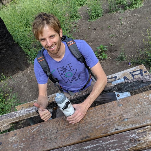
Roger picked me up and we got lunch at Sunrise Cafe. I got a lamb burger and he bought carnitas eggs Benedict. We split each dish. Pretty good. Had a good time and felt very fortunate to see one of my buddies before I head off alone for a while.
Around 1430 or so, I began riding up Mount Rose highway to the ski area. The normal dirt route was being worked on by ski area dudes, so I took pavement to the top. Took some very fun trails down the mountain and pushed to the next trail junction to see if there was too much snow ahead. I repeated this a few times until I came to the conclusion that I should just ride along the lake southbound, since the primary choice had me on north facing slopes which had a fair bit of snow on them. If I had waterproof footwear, preferably light alpine boots, and crampons and an axe, things would be different. The Flume Trail is closed anyway, so I am not too bummed. Tomorrow I will head south from Tahoe to Blue Lakes, and then the 4 to the 89 down to Walker. Mount Patterson (11,000 something feet) didn’t look too snowy on the way in, so I am hoping I can safely get up there then off via the south and east side without much trouble. It’s in the rain shadow so I shoulda gotten less snow, and I won’t be on northern aspects up there.
White Mountain may prove to be a challenge, as it had a light coat of snow. Granted, I’m just taking the dirt road up it, but if more fell than it looks like, or they didn’t plow it, I’ll have a decision to make (probably go down and start the Death Valley section).
Once I’m off White, I can probably send my extra cold clothes, rain gear, and a couple other things home. It’ll be a big water haul off and on (mostly on) for the next week plus. At least this section won’t have any snow, making it easier in that way.
-
Taco
- Snownado survivor
- Posts: 6230
- Joined: Thu Sep 27, 2007 4:35 pm
Woke up at the 8300ft bivy on Mt Patterson. Excellent bivy spot right off the road with zero traffic and a beautiful view of snowy Patterson and others. Dead silent up there all night. No animals, no people, only the contrails of eastbound flights lit up by the half-moon light. I wasn’t sure where I’d sleep, and I hadn’t brought much water, so I was happy to see Desert Creek flowing. I filtered a buncha water, looked for a bivy spot close enough to water but far enough to be left alone. Ended up going back to the plateau I’d just ridden over, which was a short push of maybe 5 minutes. A massive Mountain Mahogany had a flat clear spot under its canopy. This damn tree was impressive, and it’s part of a copse of them which are each impressive and different to their neighbors.
I set up my bivy and tried something new: wearing my Western Mountaineering down pants UNDER my normal pants. It worked and gives excellent warmth and durability. I figured I’d have to do this up on White Mountain, where it could be extremely cold and windy, and I’d be wearing almost everything just to keep moving at a comfortable temperature, or something approaching that. I doubt I will be testing my theory, as I think the Whites are too, white, for now. The white supremacism never escapes my wily gaze, those damn honkeys out here tearin it up, hootin and hollerin. Con sarnit! Point is I think there’s way more snow than I can handle with my current footwear, or possibly lack of crampons and axe. Dag nabbit, I’d miss climbing White. BUT, I would just follow most of the Caldera route south to Bishop, mixed in with things I wanna look at. I would be shipping home my cold and wet weather gear from Bishop.
The forecast shows light to medium rain on the 6th, but I should be in Death Valley by then, which does not appear to be getting a change in weather. It looks like mid 80’s in DV with lows around 60, and I reckon that was taken near sea level, so I reckon it’ll be a little cooler in the northern parts. I’m comfortable in up to 90 as I am now, though I’ll gladly take comfyboi temps. I’m assuming it’ll be in the high 80’s at times with maybe a day of 90, and sleeping temps around 45. Desert party mode. I will have a shitload of water on the bike, one regular bottle, two 750ml magnum bottles, a regular Nalgene, two of the bigass nalgenes, and two 3l bladders. I could also fill my 1.5l filter bag with water. At least one bladder will go in the frame bag, and I’ll carry the remaining bladder/s in my small scrunchy-downy REI Flesh 18 (flash, but flesh is cooler) pack, which spent most of its tortured existence as a rope bag for 200ft of canyoneering rope, usually C4 or that tough stuff that feels like a steel cable until it gets real wet. Mega durable. Point is this bag has been thrown off hundreds of rappels, smashing into a buncha rocks or a pool of water at the bottom. It is still in good shape, but there is also a lot of blood on it and some fish ‘essence’ which has not left despite several attempts to clean it.
Right now I am at a cool little hidden bivy spot just outside the gate for Bodie ghost town. Oh yeah, the rest of the ride. So I left the 8300ft bivy on Patterson and followed the Caldera route uphill. This next section of trail along Desert Creek is reallly beautiful, but I had trouble with my big bike going up it. It would be fun downhill on a hard tail. The route visible further up the mountain went through more snow than I was equipped to handle, so I just kept going until it became clear to me that I shouldn’t go. I got to this point at 9500ft or so, and could see that continuing would be a lot of work that I’m barely set up to do, with a big ball of worry in my gut over the descent down the other side, where I could see myself needing to self arrest on steep snow with a bike in approach shoes. I’d be a rocket ship. I do not want any of that, so I will have to come back yet again. My last attempt on Patterson was a few years ago, and I never got above the 395. Much closer now.
Once you push past the burn area getting into the Patterson area, it is all really beautiful. Rolling high elevation terrain with sagebrush everywhere and Pinion Pines slowly giving way to higher elevation pines. I didn’t bring a lot of water with me initially heading up there, cause I knew there was a source 2/3 of the way up, and I could see steams on the map. It was warm on the way up, and steep, with a little bushwhacking and some trail maintenance consisting of throwing dead Pinion Pine wood off the trail as they slowly fall out. The wood was curiously light, which made me enjoy clearing the trail more. Either way, this cost me more sweat. I would’ve been fine making it to the marked spot where I could get water, but approaching Desert Creek and hearing water flowing made me happy. It made the bivy nicer as a result.
Descending from where I made the decision not to attempt to summit Patterson, I followed a trail I’d previously marked in case I had to bail. This took me past the lake and down to the 395. The views of the Sierra were incredible. I could’ve taken more than twice as many photos. All the north faces have enough snow on em to look majestic. A coupe driving up in a side by side confirmed the route goes right down to the 395, which calmed my fear of getting boxed in by private property lines. This descent was very pretty, and quite easy. My brakes are incredibly loud, so I was making a lot of noise dropping down to 395. Once down, I put music on and did the 20mi or so down 395 to Bridgeport.
I had to get supplies and also wanted a burger or something. Bought a gallon of water, cheese, and avocados. There are two burger joints in town, right next to each other. I got a cheeseburger at each and was pleasantly surprised with both places. I also got a chogglit milkshake and it too was tasty. I did a lot of farting as I climbed up outta town. Up Aurora Canyon to Bodie Masonic roads. Sun set as I reached the first view of Nevada. I figured I’d stop somewhere up on the plateau for sleep, but I measured the mileage to Bodie and it was short enough that I decided to keep going. I’d still get a lot of sleep if I made it to somewhere within quick striking distance of Bodie. The road stays around 9,000ft or so, and feels like White Mountain Lite, pleasant and high but not so high that it’s much harder, and the peaks are a lil smaller. Really pretty. I would ride here again. It was very very quiet up there, absolutely silent. There were some light breezes but I was expecting it to be colder and windier. You could ride this on a gravel bike with a 2” tire, though the washboard on some descents, such as into Bodie itself, would suck bigtime. I rode my brakes the whole way down. I don’t have big balls on these trips. I reached the gate to Bodie and it said I’d get yelled at and get a fat ticket if I went through outside of business hours. Shocked and terrified, I looked for a place to sleep. Found a lil spot off the side of the road, out of view of prying eyes, and it’s flat! And not windy.
Tomorrow I’ll ride through Bodie, descend to Mono Lake, ride into Lee Vining, and probably make it to June Lake. I would like a beer there. I think there’s easy bivying sorta near June Lakes and 395 juction.
This morning I got up and passed through Bodie. Real quiet. Didn’t stick around too long, heading down Cottonwood road to Mono Lake for a delicious Pepper burger and coffee milkshake. Life is good. Heading to June Lake soon, hope to get a beer before I bivy.
You do not have the required permissions to view the files attached to this post.
-
Taco
- Snownado survivor
- Posts: 6230
- Joined: Thu Sep 27, 2007 4:35 pm
Just got to Bishop. Resupplying, heading south to Big Pine, then going over Death Valley Road to Eureka Dunes and the rest of the Death Valley Dustup route. Hoping to resupply at Panamint Wells or whatever the name is, then over to Stovepipe Wells and Badwater Road to West Side Road down to the Harry Wade route. Then a big meal in Baker in 6 days or so.
Looking forward to less constant up and down short climbs and descents, warmer weather, big views, and so on.
Looking forward to less constant up and down short climbs and descents, warmer weather, big views, and so on.
You do not have the required permissions to view the files attached to this post.
-
Taco
- Snownado survivor
- Posts: 6230
- Joined: Thu Sep 27, 2007 4:35 pm
On the way up Death Valley road with 14.5 liters of water and a weeks worth of food, I was crawling up as the sun set and it got real dark and had the usual endurance cycling issue of all I can see is the world lit up by my headlight. Sometimes I have trouble keeping positive during this headlight-world. I had to talk to myself out loud to root out the negativity and was doing pretty well with that. I was making terrible progress, as that road is pretty long for only being like 16 miles to the high point and 3,000ft of gain, kinda like going up GMR from Glendora. I had to walk parts of it when my ass hurt too much (gallon in my pack on my back), which was sadly faster than I was able to ride. At one point near Devils Gate I think it's called, a narrow spot on the road, I pulled over, removed my pack, drank water and thought of my options.
I had viable concerns about what I was doing. I was carrying a lot of weight, I'd be 'alone' for a week, with the only other people out there being offroad guys occasionally passing. The strongest feelings I've had on this trip are loneliness. I wasn't looking forward to another week of being alone, having had my required dose of solitude I suppose. I got rid of the negative self-talk and was now calmly thinking of my options. I could simply turn around and head down the long descent into Big Pine and get a bus ride home and be back in LA within 24hrs. The Eastern Sierra Transportation bus system had proven to be a very pleasant, inexpensive, and helpful experience, so for the previous week I realized how much easier it would be for me to come back up here and ride up White Mountain or into Death Valley or any of the other options for $40-80 and almost no trouble.
I decided to turn around and change my plans. I didn't feel good inside about doing the rest of my route by myself with my heart gnawing at me. I dumped out most of my water, effectively severing the line to Death Valley, and I turned around and began the fast descent under full moon light. I didn't feel bad about my decision, nor did I feel the familiar feeling you get when you quit on something and feel temporary relief only to be overcome by disappointment in self for quitting, having bailed on countless rides and climbs in the past. I got back down into Big Pine and got a beer and sat on a bench thinking of my next move. I got a room at the Bristlecone Motel, took my first shower in a week, and got my ticket home.
Took yesterday off to do nothing, just sleep and dick around. I still have two weeks off in my vacation, and decided to do something adventurous that will have me seeing my buddies so I'm not just some lonely bum farting around in the sand or the mountains. Tomorrow I will ride up over the San Gabes to hang out with my homie Mikey at El Mirage, camping and seeing what the SCTA dry lake bed race lifestyle is like. The next day after the races I'll head east through the desert to Yucca Valley, maybe stopping to see King Clone (https://en.wikipedia.org/wiki/King_Clone) on the way. I've wanted to take Burns Canyon road up from Pioneertown to Big Bear for years now, then move through Holcomb Valley westbound to Cajon Pass and home via whatever feels right in the SG's.
A lot of these trips for me are about figuring some shit out in my head away from distractions. Sometimes I come away motivated to do more riding somewhere, sometimes I just wanna see my peeps. I think this time I got the solitude I wanted after a very busy tiring year of work at the shop (with an amazing crew), a much needed 'recharge'. I also confronted some things within myself without beating myself up about it and feeling like an idiot or loser. I want to do the same route through Death Valley, but would like a partner or two (or more) to go with. Considering how cheap and easy it is now to get up the 395 without a car, I'm not stressed about time. I plan on taking another shorter (week long) trip up through DV this winter when the weather is nicer. I was a bit worried about not having enough water on this trip since it's been real warm out there, 90 during the day instead of in the 70's when I use much less water.
If anyone is interested in riding through DV with me on dirt roads, lemme know. Ideal time is December through early March.
-
simonov

- Posts: 1110
- Joined: Tue Nov 27, 2007 5:44 pm
- Location: Reno, NV
If I had known about this I would have suggested the Z Bar patio in Midtown Reno, a half mile from my house.Taco wrote: Tue Oct 07, 2025 6:02 pmIf you have any points of interest you think I should check out, holler at me.
Nunc est bibendum