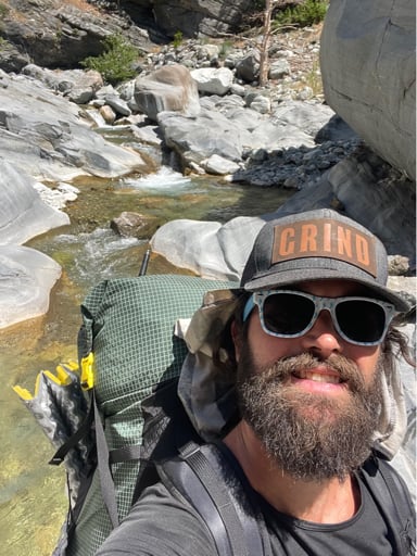
The other day, I hiked Ross Mountain via Baden Powell. I was itching to get out on the trail, but I waited til the hot temps of the last week or so moderated a bit. There’s also been a lot of smoke and haze in SoCal due to the many fires going on, but it wasn’t too bad in the mountains.
Since tekewin just posted a TR about Ross I won’t go into full TR mode but I wanted to share some pics.
I will say though that climbing Mount BP from Ross is one of the hardest ascents I’ve done. It’s MUCH harder than climbing BP from Vincent Gap.
There is a bit of poodle dog bush to contend with when you get further down the ridges to Ross. I’m sure it’s growing fast so you should go soon before it takes over!
The views from the Ross ridge are amazing, you’re right in the middle of the East Fork San Gabriel canyons. It was super cool looking down into upper Iron Fork and over to Copter and Hawkins ridges. The views of Baldy, Iron, Fish Fork, and Falls Gulch were the best I’ve seen. Ross is perfectly placed to view all this stuff.
Definitely a fan of the views, but the ascent back to BP was killer. Not sure if I’d return again, but after eyeing Hawkins and Copter ridges, it’d be cool to check them out. They don’t look as steep as Ross. I’m obsessed with Iron Fork, so it’s cool to be above it all and look deep down.
Anyway, here’s some pics:
Early morning view of haze and smoke to the west
View down Baden Powell ridge to distant Ross
Nice views of Baden Powell’s summit ridges. Definitely some of the most rugged in the range.
This flat plateau in between BP and Ross was a lovely walk in the park.
View over to Baldy
Views down to Ross
View over Iron Fork to Hawkins and Copter Ridge
View back up to Baden Powell
Yuccas at 7500 feet
Growing areas of poodle dog bush near Ross
New sticker on Ross summit register.
Views of Iron and into East Fork
View to Baldy and Fish Fork
View down to burned Prarie Fork and Mine Gulch
Wally Waldron Tree
Burned but still beautiful view at Inspiration Point.
The Bridge Fire really did a number on the Sheep Mountain wilderness area. I’m glad it’s open again but it’s really sad to see firsthand.
Pics from Baden Powell & Ross Mountain 8/13
-
MtGoatMan

- Posts: 47
- Joined: Thu May 05, 2022 7:38 pm
You do not have the required permissions to view the files attached to this post.
