There is a new blockage about half a mile east of Redbox. Pretty minor deadfall, but it's pushing people off the trail. A small folding saw should be sufficient to clear it.Tom Kenney wrote: Since this section has been worked, as well as Kenyon-Devore, I'm guessing the deadfall between Red Box and Kenyon-Devore has also been cleared.
Gabrielino Trail (Big Santa Anita - West Fork - Arroyo Seco)
-
Sean

- Cucamonga
- Posts: 4238
- Joined: Wed Jul 27, 2011 12:32 pm
-
psykokid
- Posts: 80
- Joined: Fri Mar 18, 2016 1:15 am
I was out there the 18th and saw the deadfall that you spoke of between Redbox and Valley Forge. Had my little silky saw with me and managed to clear a lot of it until the tip of my saw snapped. Cleared out a lot of the small stuff that was surrounding it, but the main branch that was across the trail was still there.
-
Girl Hiker

- Posts: 1442
- Joined: Fri Apr 04, 2014 7:46 am
-
sshiker

- Posts: 9
- Joined: Tue Aug 21, 2012 10:27 am
So the Gabrielino Trial is really completely open this year 2018.
Here is the story from Mt. Wilson Bicycling Association:
https://mwba.org/news/gabrielino-trail- ... omment-651
But it seems as with all trails that they need continuous maintenance.
Here is the story from Mt. Wilson Bicycling Association:
https://mwba.org/news/gabrielino-trail- ... omment-651
But it seems as with all trails that they need continuous maintenance.
-
psykokid
- Posts: 80
- Joined: Fri Mar 18, 2016 1:15 am
I ran the section between redbox and the turn off to switzer falls / bear canyon a couple of weeks ago and it was in great shape. There were a two or three spots of deadfall that you had to clamber over or under once you got to the bottom of the main decent from redbox.
-
ReFreshing

- Posts: 68
- Joined: Mon Nov 26, 2018 1:00 pm
Can't wait to eventually do this! Just waiting for more water.sshiker wrote: So the Gabrielino Trial is really completely open this year 2018.
Here is the story from Mt. Wilson Bicycling Association:
https://mwba.org/news/gabrielino-trail- ... omment-651
But it seems as with all trails that they need continuous maintenance.
-
Tom Kenney

- Posts: 386
- Joined: Sat Sep 29, 2007 7:51 pm
Fall color is sslloowwllyy turning in the upper West Fork area. It's quite nice, though!
You do not have the required permissions to view the files attached to this post.
-
Tom Kenney

- Posts: 386
- Joined: Sat Sep 29, 2007 7:51 pm
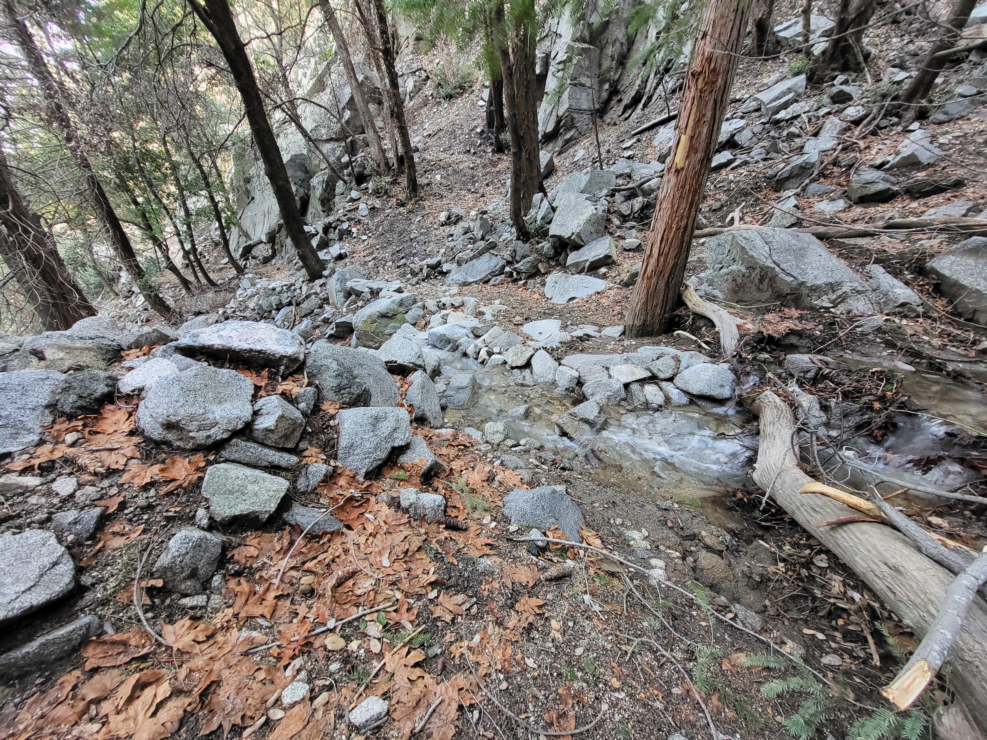
Lowelifes were out working the Kenyon Devore/Gabrielino junction area yesterday, as well as some of the remaining 'big problems' on Kenyon Devore. The sutter wall at the Blackberry Falls crossing (KD) is being replaced, and the re-re-re-growth of Strudel-Daag is being cut again. The improvements on Kenyon Devore are dramatic, really nice work! Previous rock work at some gully crossings has paid off (see pic below). From a bicyclist's perspective, they've removed some of the fun, but it's not my party so I'll follow along happily.
They had a group campout at West Fork CG, few trucks and lots of tents and bikes. I had a long chat with one of the crew, and since I will repeat hearsay of hearsay, I will not name, and not affiliate. Rumor is that Rim Trail and maybe Newcomb-Devore section of Gabrielino, and Rincon Road, should not have remained closed last spring. There was confusion about lines on the various maps in use, and it was becoming burdensome admin overhead, so they (various volunteer/advocacy groups?) took what they could. Good news is the FS seems to be coming to some epiphany. Guy I spoke with said the problem in recent years is the sawyers and such were all aging out. Retired, goodbye, better San Juan than this blue collar hell. So the FS has been cornered into some compromise re: allowing volunteer groups to do 'heavy lifting' so to speak.
Guy I spoke with looked/talked like a sometime smoke jumper, or other hotspot front-liner. Odd, that.
Water features abound, thanks carl swindle for posting the great pics!!! My picture is below, as promised! This is on the second switchback below the summit of Mt Wilson, on Kenyon Devore Trail. The rock work helped a lot here. This was, prior to last year, a bouldery mess trying to decide 'scree or talus' as a life plan.

-
Sean

- Cucamonga
- Posts: 4238
- Joined: Wed Jul 27, 2011 12:32 pm
I'll bet a dollar that men who play with saws don't enjoy dealing with politically "correct" desk jockeys. But that's not even the real problem.
Incompetence. The FS simply doesn't know what they're doing. When they get out of the way and let volunteers in, and let their few good employees run free, that's when progress is made.
Incompetence. The FS simply doesn't know what they're doing. When they get out of the way and let volunteers in, and let their few good employees run free, that's when progress is made.
