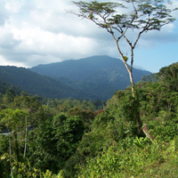
Recently a couple of friends and I did the hike from Heaten Flat to Vincent Gulch, as an overnighter which took in the Narrows and the Bridge to nowhere. We saw some cool wildlife along the way(Bighorn sheep, bear tracks, snakes) and it was a pretty good challenge for our group.
I am interested in another route up either the West SanGabriel, or the North fork that ends up at Baden Powell/Vincent Gap area.
I was looking at West fork to Bear creek, via Crystal lake.
Has anyone attempted anything similar?
Thanks
SanGabriel Valley to Wrightwood
-
AW~

- Posts: 2093
- Joined: Mon Oct 01, 2007 12:00 pm
as you noted the upper Bear Creek trail is "closed" and so is Hwy39 for now. But assuming that wasnt material, then your hike would look like the following:
You would have to contend with 30 river crossings w/ trail from the West Fork SG river to the WF Bear Creek. The first one is the hardest. Then you would have to go to the Upper Bear creek trail. This would be the most challenging part of your hike and nothing like the East Fork, this one is tedious going upriver...in addition, short yd swimming is all but guaranteed.
Good resource is http://www.summitpost.org/trip-report/2 ... trail.html
From the saddle you would then go for pk 5495.....
http://www.summitpost.org/mountain/rock ... -5495.html
The other way would be to go back down to Hwy39 and fool with getting to Crystal Lake. The North Fork SG river at that point would be like a torture walk, so dont even think about it. This particular elevation is quite dense with brush and the only way to avoid a long Hwy39 walk is to use a discontinued road and hike up a steep hill. Theres nothing really worth the walk to see here, although water is around, such as Solider Creek.
Anyways, once you get to Crystal Lake, I would hike west and 600ft gain a long ridge that leads to Mt.Islip...alternative is the Windy Gap trail..yikes, or continuing on Hwy39..note: there is at least one landslide covering Hwy39 near Hwy2 and this should be noted as dangerous.
-
Bill

- Posts: 332
- Joined: Thu Jul 24, 2008 6:09 pm
Thanks AW. That's good info. 
That is what I was looking for.
Impressive postings from Vic Hanson and Taco.
I'm still thinking May or June of 09' for this one.
That is what I was looking for.
Impressive postings from Vic Hanson and Taco.
I'm still thinking May or June of 09' for this one.
