On Saturday I woke up before the crack of dawn, and my hiking buddies picked me up at 5 am. We carpooled to Joshua Tree to meet the rest of the group at 8 am. I was so excited to summit Eagle Mountain.
We started our trek at the Lost Palms Oasis trail. The forecast was 80-degrees but it was overcast and cool until noon. My friend Matthew led this hike. He said he had hiked this trail three times but each time he took a slightly different route. I've hiked with him for a few years now, so I had complete faith in him. However, this time was different.
The first three miles were beautiful, hiking through the valley The rock formations are massive and cool. The main attraction is the short trail to the Mastodon rock. Our itinerary was to go beyond that off trail.
We saw quite a few desert lizards, Ocotillo plants, cacti blooms, cholla and yucca. Unfortunately, I was impaled by a cholla thorn and it had to be removed with pliers.
After the easy three miles we began the off-trail trek. We traversed the ridge with lots of rock scrambling while trying to avoid the unforgiving desert plants. It was a bit tiresome and we took our first real break on a cool rock outcropping. We had views of the Salton Sea.
I should have mentioned earlier that there was a guy new to our group. He said he was an experienced hiker. He volunteered to be the sweep. It was obvious he was inexperienced with off-trail rock scrambling. This was one of the reasons why it took us so long because we had to keep waiting for him to catch up. By this point it was too late to turn back and we could only move forward.
We continued on a couple of grueling ridges as we descended and ascended a few more times. But the rock formations were more interesting and colorful.
We arrived at another resting point and it was almost 4 pm. We still had to drop down once more, then climb up the final ridge to the summit. By this time, I was exhausted. I decided not to summit. I knew that if they continued on they would be hiking after the sun set. Not to be selfish but I wanted to make sure my ass was back on the valley floor before nightfall. One of the guys, Wendall, agreed with me. I believe that our leader and the rest of the group were desperate to summit.
Anyways, we went our separate ways after deciding on a meeting point. I was in good hands. Wendall had a GPS and was a strong hiker. I am sure he could have continued on but he stayed with me. The two of us ascended a short distance to the top of another ridge to get back to the trail leading to the canyon that would lead us to the valley below.
We had to descend a treacherous 2,880 feet, trying to avoid getting impaled but failing, this time it was a yucca plant.
We found a resting place by a dry waterfall but still had quite a ways to go down the canyon. I started to get worried because it was now 5:30 pm. I told Wendall we should not wait any longer. We waited a little bit more and by 5:45 pm we could see the group scrambling down to our location so we waited.
Matthew told us he couldn't find the route to the peak and they all turned back. By this point the rest of the group was not too happy. The new guy looked pretty beat up and everyone offered to carry his backpack so he could hike faster. On a positive note he still had lots of water and gave some to a few hikers who ran out.
We scurried down the last 250 feet of the canyon trying to beat sundown. At this point it was obvious we were going to be hiking in the dark, and the group had mixed emotions.
Matthew made a poor judgement and was unsure of which direction to take back to the cars because there was a couple of routes. He said to the group, "I'll go this way and if you think you can find a better route then go that way." He did not have a tracking device and was doing this all by memory.
We ended up separating again. How? I am unclear. With my group of four, two of us were tracking the hike. We decided not to take the same route back and found a shorter, direct route to the cars. We ended up hiking the last three miles in complete darkness but had flashlights.
Unfortunately, our leader was with the slow guy and three others. They ended up taking the longer route. We waited an hour for them to return safely to the cars. I am not sure why or how Matthew got off track. He had always been a good leader, he hikes with the Sierra Club and had never gotten us lost.
Well, this is the second experience I will never forget. The first one was when Sean and I hiked for 19 hours and struggled to get out of a canyon in the dark. Haha!
I would love to go back and summit but start at 6 am because now I have the track.
Never again with Matthew.
Stats: 11 miles, 3000+ feet of gain and a grueling 12 1/2 hour hike in the desert.
I will post some of the cool rock formations in a separate post. If you want to see all the cool pics you can check out my blog in a few days.
The peak was beyond this first ridge ascent.
Scrambling up the first steep ridge after the first three miles.
Are we there yet?
The first rest break.
The descent.
Waiting for the group before the final descent.
EAGLE MOUNTAIN ATTEMPT
-
Sean

- Cucamonga
- Posts: 4251
- Joined: Wed Jul 27, 2011 12:32 pm
First mistake: taking a stranger with unproven abilities on an advanced desert adventure.
Second mistake: apparently not having the route mastered, or not possessing the skills to figure it out--while leading a group.
Third mistake: apparently ignoring the man with the GPS machine who knows what he's doing.
Good grief. Basic mistakes.
By the way, when we struggled through upper Trail Canyon, I wasn't lost, and I knew you could do nasty bushwhacking. My mistake was not bringing enough water to backtrack on the ridge if necessary, and instead expecting to refill from the canyon. This was a minor error in planning that cost us some pain and time, but we hit all our summits and finished the loop.
-
JeffH

- Posts: 1352
- Joined: Sun Nov 28, 2010 7:09 am
It's good day if you return from a hike. Looks like a lot of steep up and down, miles of that would be exhausting.
"Argue for your limitations and sure enough they're yours".
Donald Shimoda
Donald Shimoda
-
AW~

- Posts: 2093
- Joined: Mon Oct 01, 2007 12:00 pm
How many people were in this group?
Navigation is an art, not a science. Anybody who has gone with me the painter, throws away their gps so to speak, at least once we get off the beaten path.
Hehehe, being lost is par for the course....I dont mind others taking a stab at leading, its always interesting.
But if they want to bring the gps, aka magic 8 ball, or lucky rabbits foot,whatever.
-
Girl Hiker

- Posts: 1446
- Joined: Fri Apr 04, 2014 7:46 am
AW -there were 9 of us. Two of us were tracking the hike from the start. One guy actually had a GPS device.
I just think that our leader didn't want to admit that he was lost in the beginning.
In fact someone tried to tell him we were off course but he didn't listedn
I was with the guy with the GPS unit and I had the track so we found our way back to the cars before the leader.
It was just a crazy day.
I've learned to track my hikes but this was a first with this group.
-
David R
- OG of the SG
- Posts: 630
- Joined: Sun Jun 12, 2011 10:28 pm
People keep on saying that hiking solo is more dangerous then hiking with groups. I have disagreed for ever and this story is a classic why groups are usually more dangerous, there are too many variables of decision making and skill set. I would reckon the strongest hiker could have finished this hike in 50% of the time you were out there and instead everyone was put at risk.
-
Girl Hiker

- Posts: 1446
- Joined: Fri Apr 04, 2014 7:46 am
Hi David- yes I agree . Most of us were strong hikers. We should have been able to summit.David R wrote: People keep on saying that hiking solo is more dangerous then hiking with groups. I have disagreed for ever and this story is a classic why groups are usually more dangerous, there are too many variables of decision making and skill set. I would reckon the strongest hiker could have finished this hike in 50% of the time you were out there and instead everyone was put at risk.
-
AW~

- Posts: 2093
- Joined: Mon Oct 01, 2007 12:00 pm
2 ways to look at it....half full , half empty. Personally I side with the nobodies...and not by choice.David R wrote: People keep on saying that hiking solo is more dangerous then hiking with groups. I have disagreed for ever and this story is a classic why groups are usually more dangerous, there are too many variables of decision making and skill set. I would reckon the strongest hiker could have finished this hike in 50% of the time you were out there and instead everyone was put at risk.
I say I cant compete...just semi-recently , I was siting and moping looks quite pathetic...you do not want a prana commercial by me.
But then......I was on Sespe and this guy comes up the ridge...says theres a couple that needs help for a foot injuries. I kept looking at him, as in what are you doing about it? He had to get back before noon had some things to do. Places to go. So you are calling SAR? No, he says, im talking to you. Oh...you plan on SAR not coming. Interesting. I told him if he knows they are in trouble then call once he gets back. But he wont do anything else...saynora. How does he know I am worth anything....must be the rope and backpack. But I tell him Im not SAR. Oh well. hes out of time.
As it was they were just a little ways down. And nobody cared. I cooled them down since it was about 100 degrees and they were clearly overheated. I gave them water, all you can drink. And shade. It was really just the woman w/ bad feet. She had worn some kind of slippers on the hike, chacos or whatever. We made a deal at the top of the ridge because they said 'i had to' go to experience the hot springs. It was 'to die for'...but young adults...whatever.
Down near the springs I ask if they saw that couple and they had. But are they responsible for doing anything besides splashing in the water. I guess not.
Were they to 'die for'? Nah, not even close. Im spoiled. But there was a couple from Germany there, they came specially for. A video of strong hikers no doubt.
-
tekewin

- Posts: 1385
- Joined: Thu Apr 11, 2013 5:07 pm
Wow, quite a story!
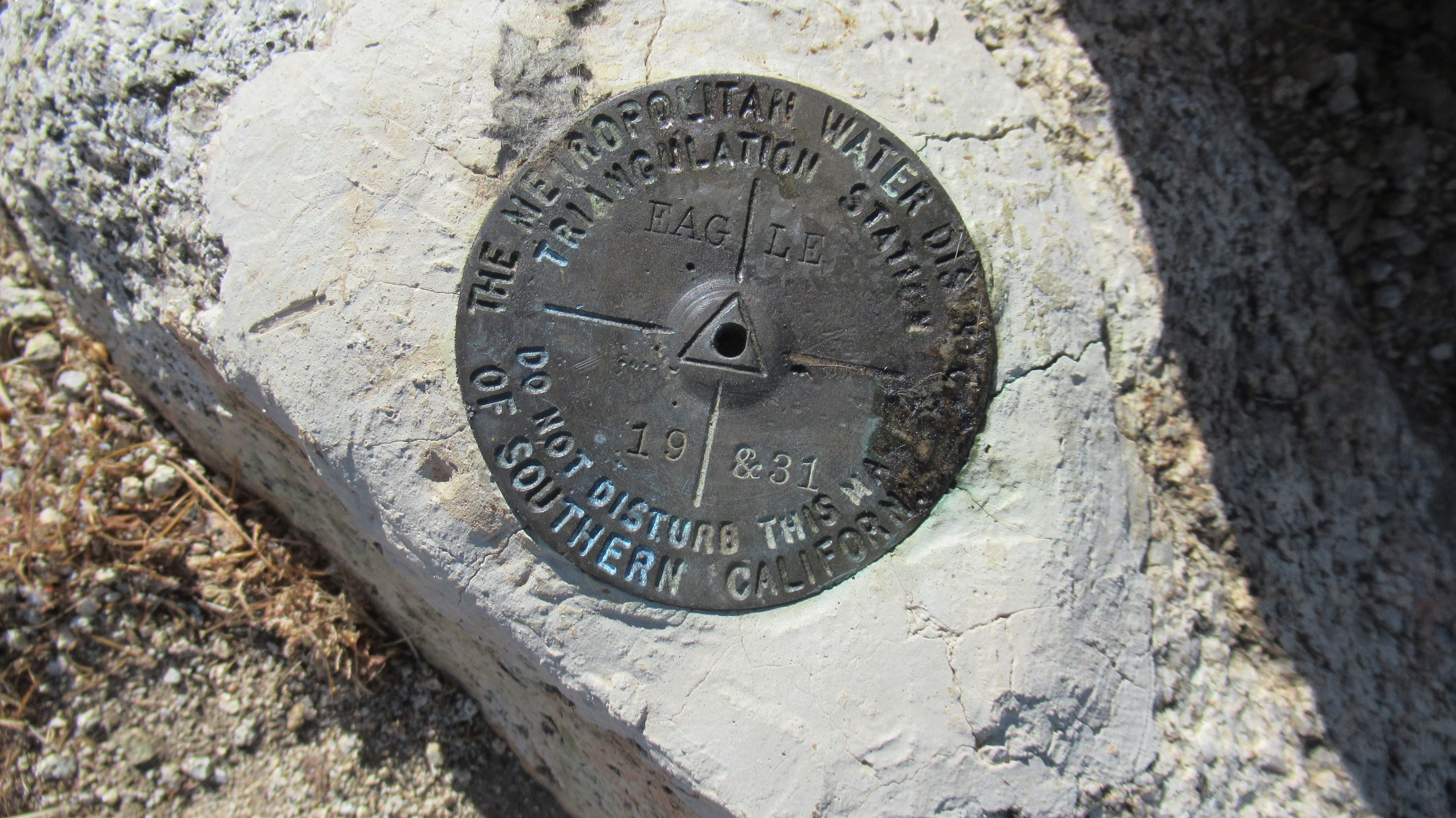
I summited Eagle in 2020 solo. I had a good track and took the main gully up. It looks like you guys went more directly at least in part over rougher terrain. There is some route finding to do all the way to final bit of ridge. I remember a few cairns on the little plateau area before the final bump, but it wasn't much.
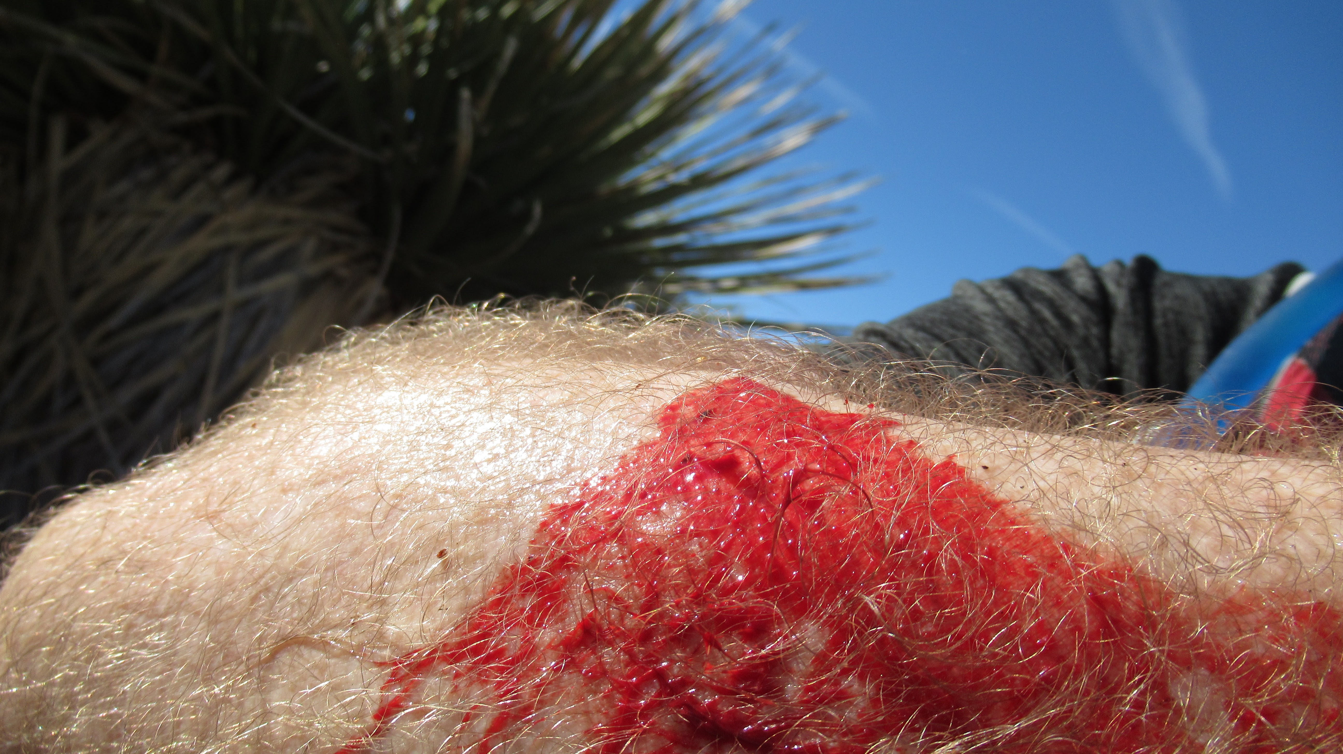
I also didn't make it out with a big yucca strike. Bled like a pig for a while, had to wrap in gauze and tape. Still great fun!
The open desert between the gully and Cottonwood can be hard or easy depending on how far south you drift. There are big gullies and rocks to deal with if you head back too far south. That might explain why the other half of your party took so long.


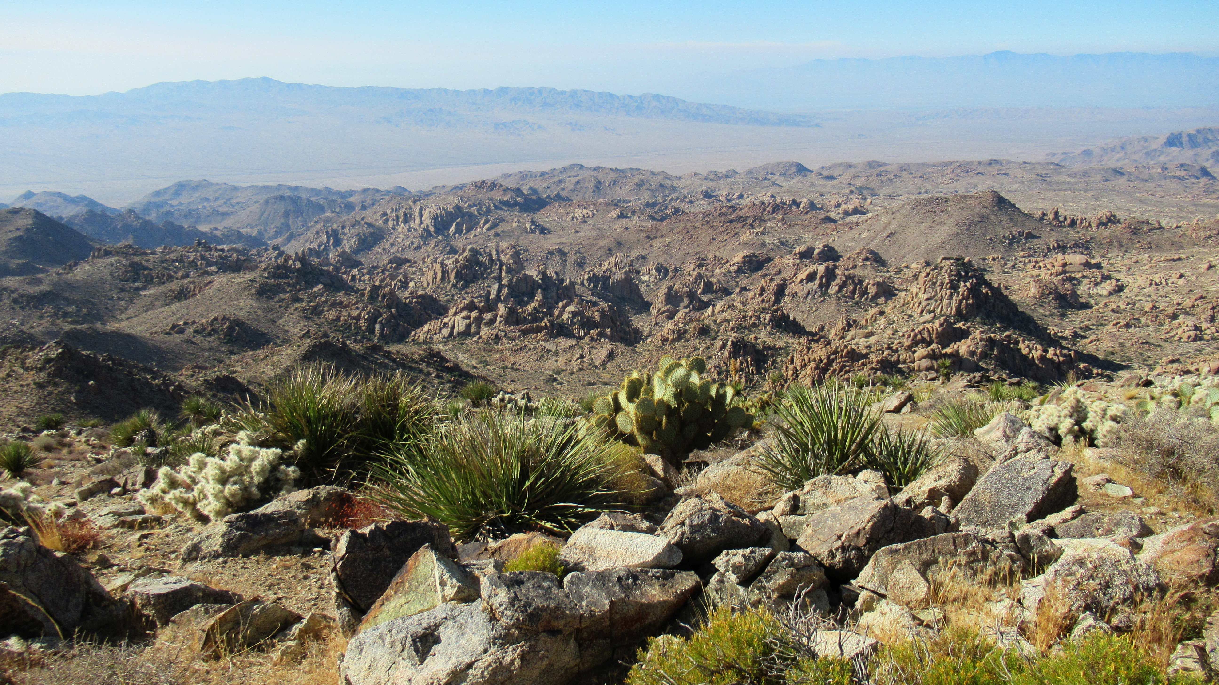
This view is looking south from the summit to an area I call the "Wrecked Tangle", a rectangular area filled with jaggy towers. I hope to visit it this year to climb at least the middle one. I think it is rarely if ever visited area, and I expect it to be difficult.

Don't worry, you'll nail it on the next try!!
I summited Eagle in 2020 solo. I had a good track and took the main gully up. It looks like you guys went more directly at least in part over rougher terrain. There is some route finding to do all the way to final bit of ridge. I remember a few cairns on the little plateau area before the final bump, but it wasn't much.
I also didn't make it out with a big yucca strike. Bled like a pig for a while, had to wrap in gauze and tape. Still great fun!
The open desert between the gully and Cottonwood can be hard or easy depending on how far south you drift. There are big gullies and rocks to deal with if you head back too far south. That might explain why the other half of your party took so long.
This view is looking south from the summit to an area I call the "Wrecked Tangle", a rectangular area filled with jaggy towers. I hope to visit it this year to climb at least the middle one. I think it is rarely if ever visited area, and I expect it to be difficult.
Don't worry, you'll nail it on the next try!!
