
Four years ago we celebrated this forum's tenth anniversary with a hike to Mt. Baldy and lunch at the Notch. It has now been fourteen years since Travis and Ryan created this home for pirate hikers, and so we again celebrated the occasion. This time we camped at Gobbler's Knob, hiked up Lytle Creek Ridge, and ate grilled cheese sandwiches on the summit of Wright Mountain.
It all started with me trying to get everyone together around the end of September (9/27 being the anniversary date), but due to a forest closure and people's schedules, that didn't happen. Ultimately we agreed on October 23-24 and hoped for good weather. As it turned out, we beat a storm by one day and we had a beautiful, partly cloudy to sunny experience the whole weekend.
Six of us drove up on Saturday evening via 3N31 to Gobbler's Knob camp, which is just an end-of-the-road parking area where you can pitch a tent. 3N31 has a rough scree section, which David spent some time improving before everyone else drove up. Thank you, David! Then Ira and Madison joined David, and I arrived shortly after sunset around 7pm. Madison handed me a beer and life was good. Dima and Sondra rolled up a little later, and life was even better. We watched the moonrise and picked out Jupiter in the night sky. Then we all tried to get some sleep for the main event the next morning.
I woke up around 5am and couldn't get back to sleep. David also woke up early. We spoke a bit and around 6am noticed the eastern sky begin to lighten.
At 7am I figured I should start my car and charge the battery for awhile. We were expecting two more pirates, Jeff and Cecelia, around 8am, so it was time for everyone else in camp to start getting up. But I forgot that Madison was sleeping in his car right in front of mine, and he received the brunt of the engine noise. Sorry, Madison!
I had slept in my tent without a pad, even though I brought two blankets for such a purpose. Still, I managed to sleep a few hours, and it was that much easier to put away my stuff before Jeff and Cecelia arrived shortly after 8am.
Now, with all eight of us, life was perfect. We soon headed out on the Pacific Crest Trail up the Lytle Creek Ridge. After dipping into the 40s at night, the weather was now sunny and warming. It was going to be a great day for hiking.
Since the camp is located at the base of Gobbler's Knob, both Madison and Dima tagged that peak first. Jeff and Ira would climb it later, on the return.
Initially the PCT here has open views all around as you cross from one side of the ridge to the other.
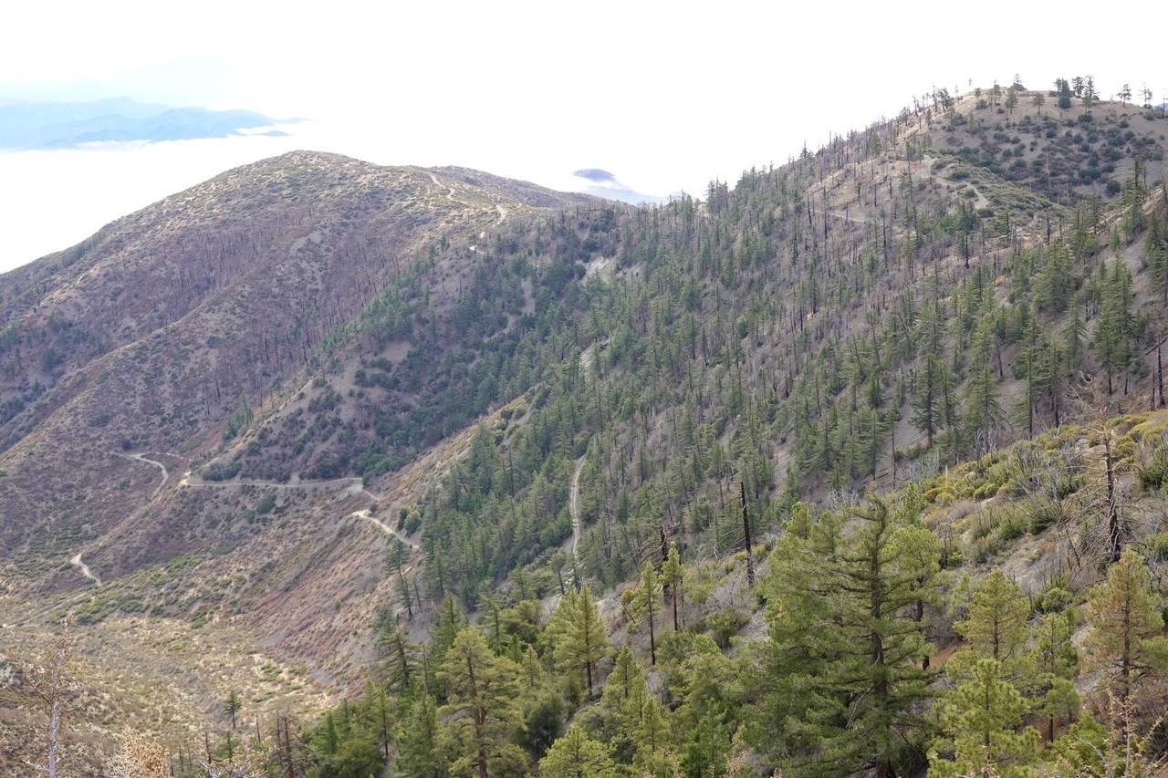
Looking back we could see the low cloud layer creeping up the Cajon Pass into the high desert, with Gorgonio and Jacinto in the background.
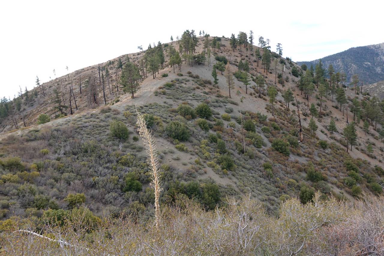
Pretty much all day we enjoyed clear views of Telegraph, Thunder, Harwood, Dawson and Pine.
It's approximately five miles one-way to Wright Mountain. Around the midway point the ridge becomes more populated with tall trees.
The trail enters this forest and begins contouring around a couple bumps. Dima found a shortcut here using the old firebreak, which has several of those triangular metal signs spread out along the ridgetop.
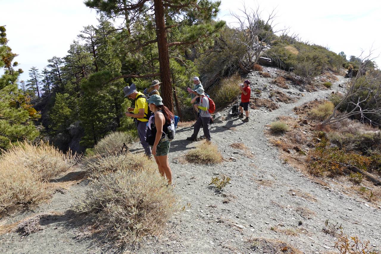
While Dima took the shortcut, the rest of us stuck to the PCT. We all gathered up again at the junction with the Blue Ridge Road, then we took the east ridge route to the summit of Wright Mountain. We found a nice, sunny spot near the highpoint for a group photo.
A week prior to this, Jeff and I had hiked the Middle Fork of Lytle Creek. When we got to Commanche Camp, I told him that I was craving a grilled cheese sandwich, and he said he could make that happen on the anniversary hike. So I asked Cecelia to buy the bread and cheese and butter and bring them up on Sunday morning since she was carpooling with Jeff, but it turned out that Jeff also bought bread and cheese and butter, so we had plenty of ingredients. However, we then forgot to pack the pan and the butter! Shortly after starting on the trail, Jeff remembered the pan and ran back to his truck to fetch it. He also checked on the butter situation and added that to his pack. So, a big THANK YOU, Jeff, for making the grilled cheese hike happen!
Your cooking was delicious and it somehow made life more than perfect.
EisPiraten's Grilled Cheese Anniversary Hike to Wright Mtn
-
Sean

- Cucamonga
- Posts: 4257
- Joined: Wed Jul 27, 2011 12:32 pm
You do not have the required permissions to view the files attached to this post.
-
Uncle Rico

- Posts: 1481
- Joined: Thu Mar 20, 2008 7:48 pm
So fun. Thanks for organizing.
Grilled cheese sammie on Wright was an awesome bit of inspiration.
Grilled cheese sammie on Wright was an awesome bit of inspiration.
You do not have the required permissions to view the files attached to this post.
-
Uncle Rico
- Posts: 1481
- Joined: Thu Mar 20, 2008 7:48 pm
A few more.
You do not have the required permissions to view the files attached to this post.
-
dima

- Posts: 1774
- Joined: Wed Feb 12, 2014 1:35 am
- Location: Los Angeles
Thanks for setting this up, Sean. Here's a few photos I took.
I climbed to the top of Gobbler's Knob at the beginning. There's a bullet-ridden triangular post there. This is also the only point in the day when Baldy was visible. It was hidden behind Dawson peak at all other times.

The clouds sitting in the valleys were really pretty. It was cool to see them dissipate on the desert side of the pass. Sean posted a photo already, but here's mine:

I took an old-fire-break shortcut at the tip of the Blue Ridge. The PCT went around, and I went straight up. At the tip of the ridge (34.32737, -117.60765) is another triangle post:

And at the top an expansive view opens up:

We talked for a bit about what the various peaks were. Rico thought that we were looking at the Panamints and the Sierras. I thought those would be too far, but he turned out to be totally right! A half-assed contrast-enhanced view of the horizon (click for full-res):

And an interactive render:
https://caltopo.com/view#ll=34.3327,-11 ... -1.66,16.7
The big dry lake in the center is El Mirage. Rogers Lake (Edwards AFB) is on the left. Harper Lake is far-off on the right. Telescope Peak (Panamint mountains high point) is the big peak to the right of El Mirage. Maturango peak (on China Lake base) is the big peak seen above El Mirage. Olancha (South Sierra!) is seen in the clouds, above the right edge of Rogers Lake.
It was a good day to be out in the mountains, and nice to see everyone.
-
Girl Hiker

- Posts: 1449
- Joined: Fri Apr 04, 2014 7:46 am
-
Elwood

- Posts: 622
- Joined: Fri Aug 15, 2008 5:23 pm
Many, many thanks to Sean, Girl Hiker, David, Uncle Rico, Jeff, Dima and Sandra (forgive me if I've misspelled your name) for an extraordinary time in our beloved San Gabriel Mountains. The anniversary hike has been well covered in the earlier trip reports so I'll just add a few pictures that I managed to grab.
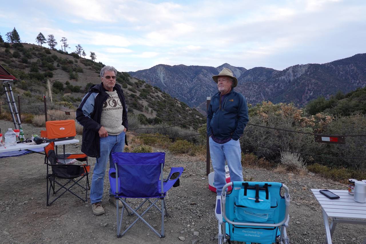
David and Uncle Rico as we all got settled on Saturday evening.
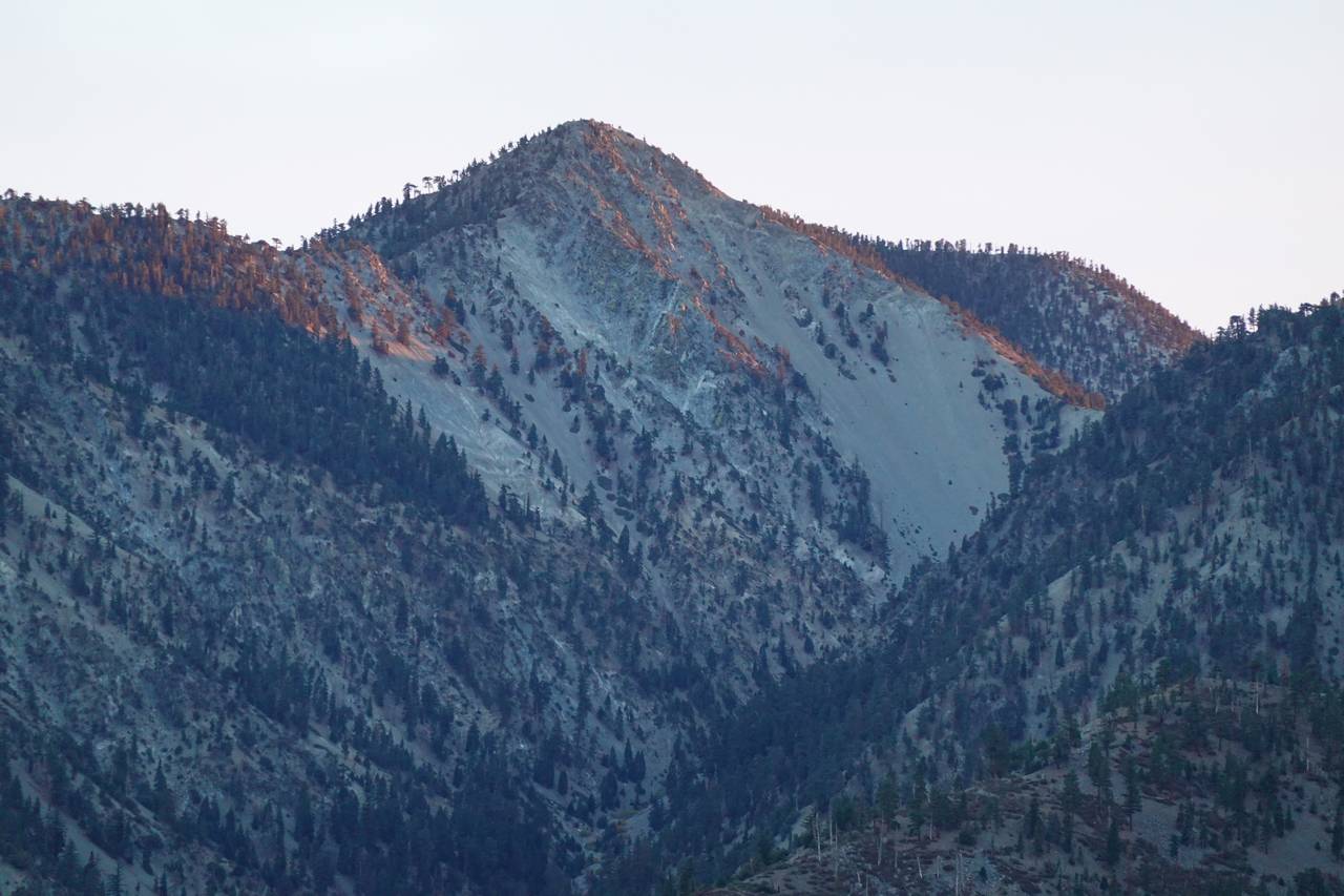
Telegraph Peak as the sun was headed down.
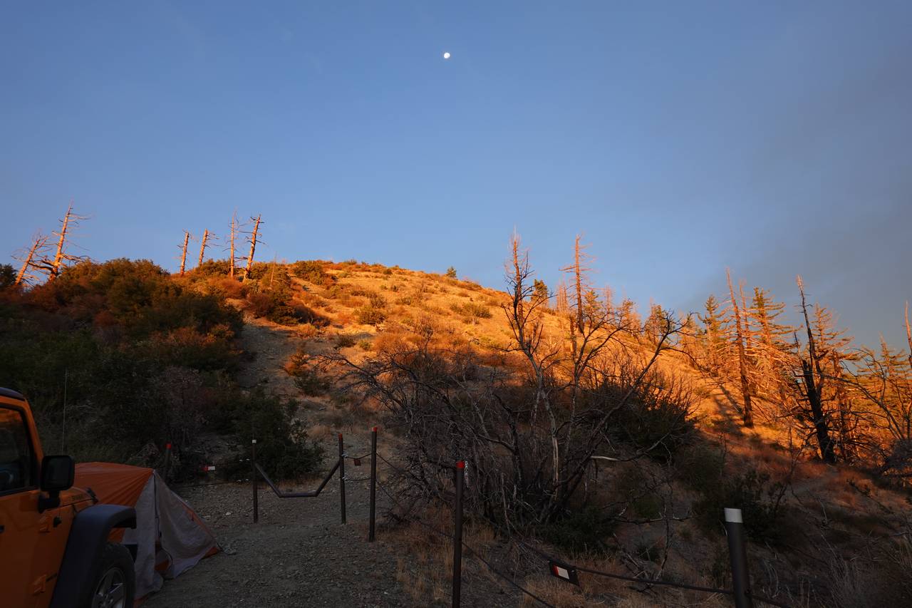
Gobblers Knob 'alpenglow'.
Looking westward from our camping site.
(Slightly) easier west approach to Gobblers.
3N31's snaking route from Lone Pine Canyon.
Taking a little break along the Pacific Crest Trail.
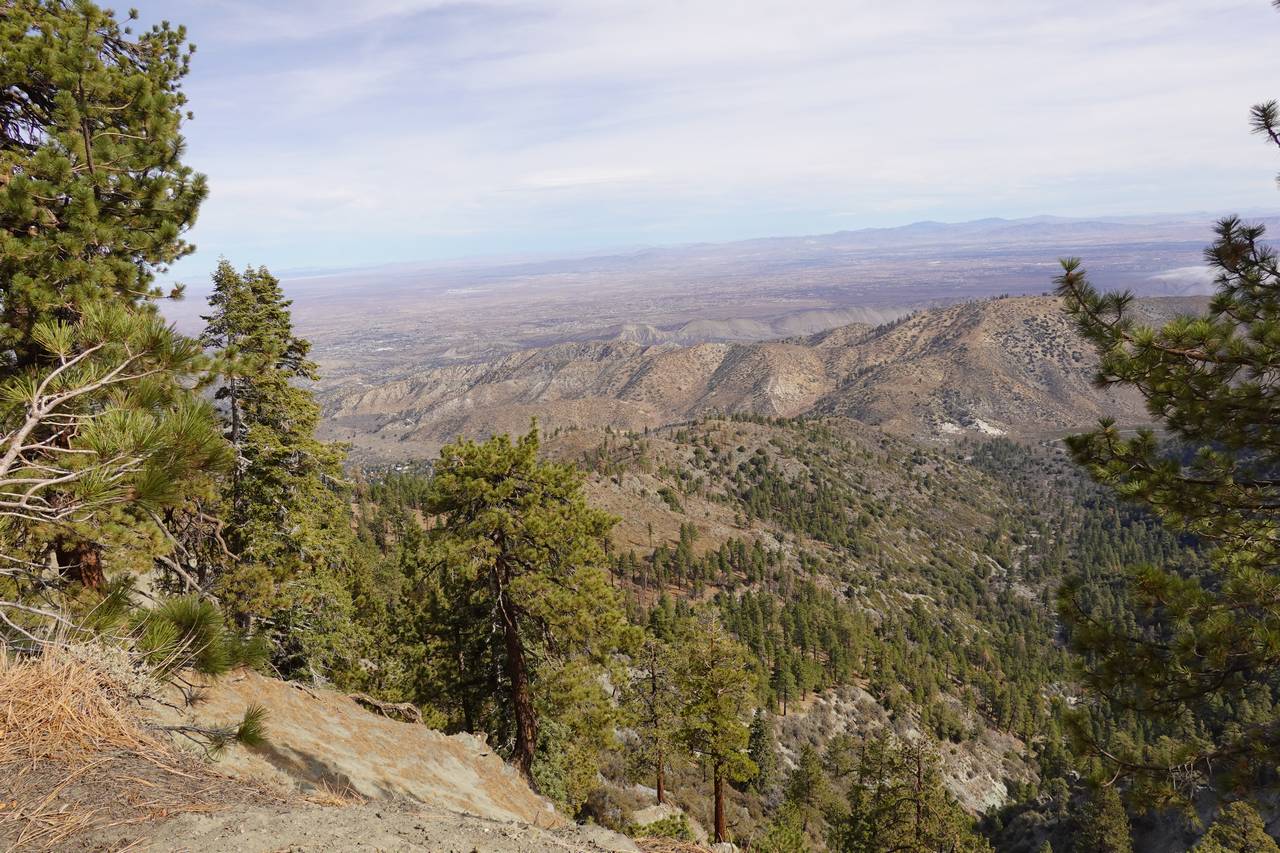
Looking towards the High Desert from Blue Ridge.
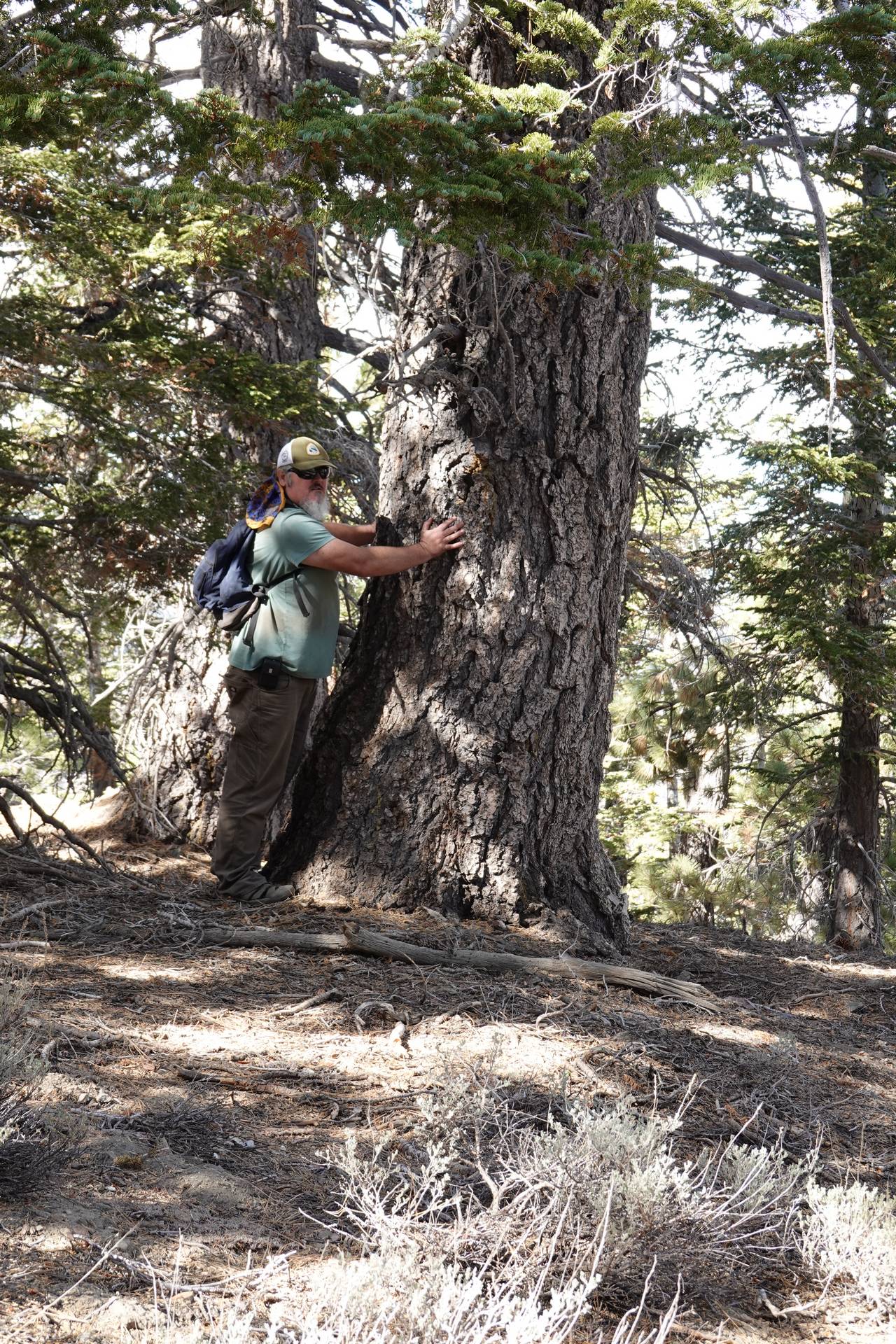
Precision tree measurement.
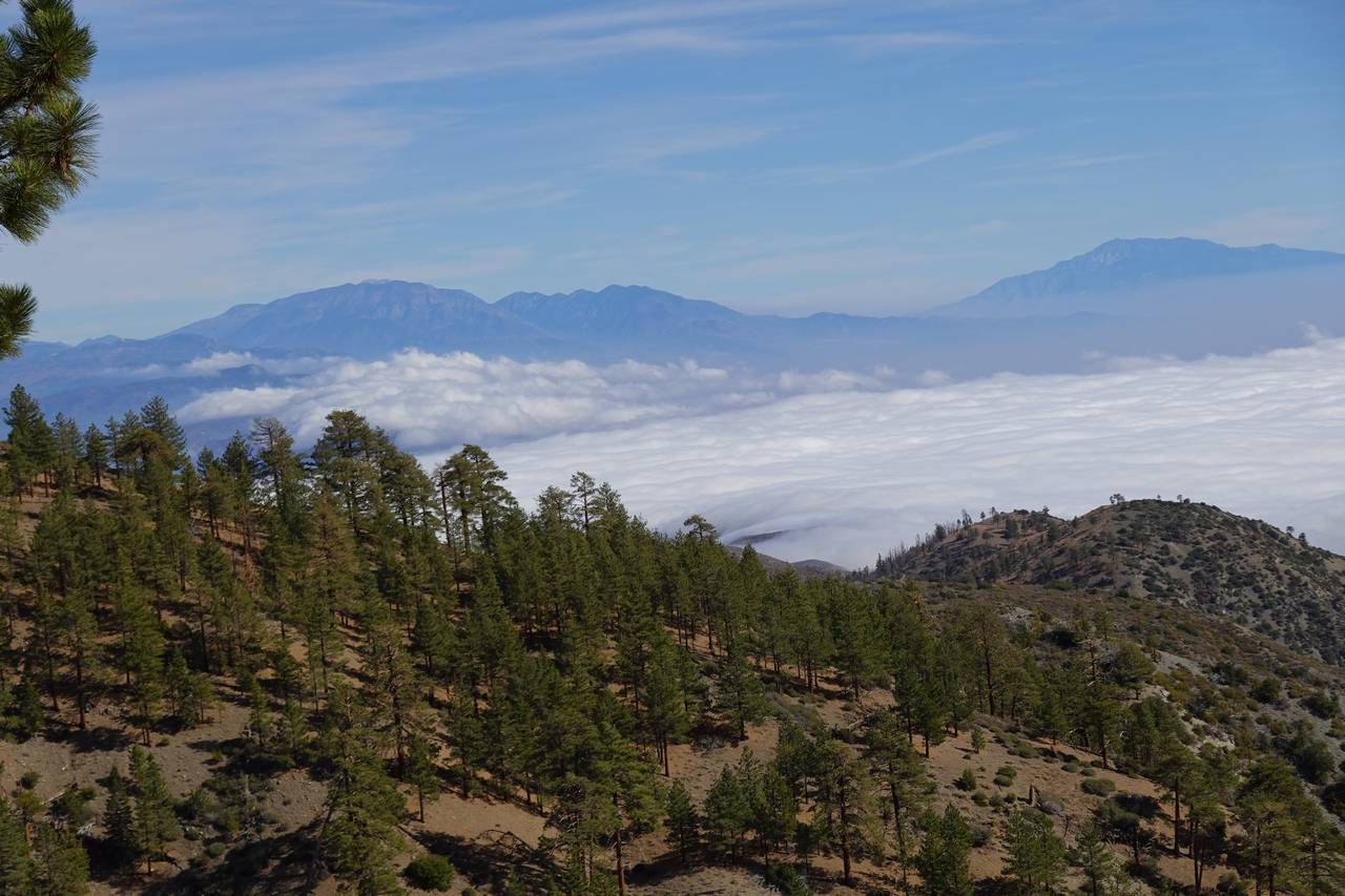
San Gorgonio, Yucaipa Ridge and San Jacinto floating on a sea of clouds and smog.
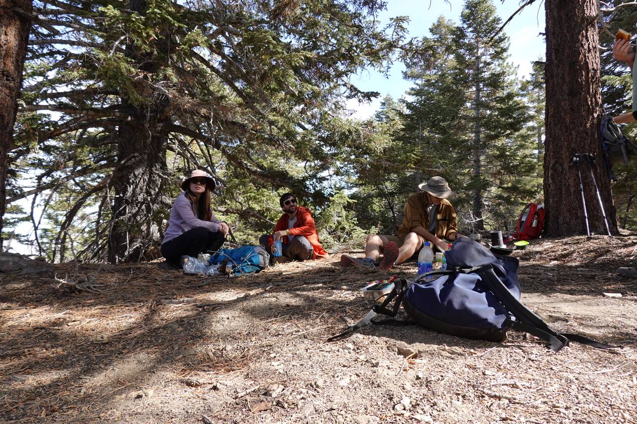
Enjoying snacks and heavenly grilled cheese on Wright Mountain.
David and Uncle Rico as we all got settled on Saturday evening.
Telegraph Peak as the sun was headed down.
Gobblers Knob 'alpenglow'.
Looking westward from our camping site.
(Slightly) easier west approach to Gobblers.
3N31's snaking route from Lone Pine Canyon.
Taking a little break along the Pacific Crest Trail.
Looking towards the High Desert from Blue Ridge.
Precision tree measurement.
San Gorgonio, Yucaipa Ridge and San Jacinto floating on a sea of clouds and smog.
Enjoying snacks and heavenly grilled cheese on Wright Mountain.

-
David Martin
- Posts: 86
- Joined: Sun Nov 08, 2020 7:08 pm
Thanks everyone for the hospitality and companionship this weekend. It was a great hike and I was really glad that Dima thought to invite me. My wife and I had spent 2 nights camping at Carpinteria Beach and I'd just finished unpacking everything when I saw his email so in that respect the timing was unfortunate. But really the timing was perfect, because my hiking buddy was away last weekend and I was hungry for something to do. At first I just planned to go for the day and hike but my wife urged me to re-pack the car and camp Saturday night. (“Get out there! Support your team!”) She had the right idea, as usual.
The 210 looked awful (as usual) on Sigalert and I hadn’t driven the back side of the range for a while, so I took the 14 / Pearblossom approach and was glad of it. I reached the bottom of 3N31 a minute past 3 and spent some time clearing rocks and smoothing out some of the humpy sections of that road while heading up, which was still slightly challenging in my 2WD 4Runner, especially around the big switchbacks near the top. Heading into the hills I ascended up into the clouds and then topped out above them. It was like being in the hills above Sausalito but Gobbler’s Knob camp was sunny, with excellent views in all directions. Moments after I drove into the camp (really just a dirt clearing at the roads end) Elwood pulled in and then a little later, Rico.
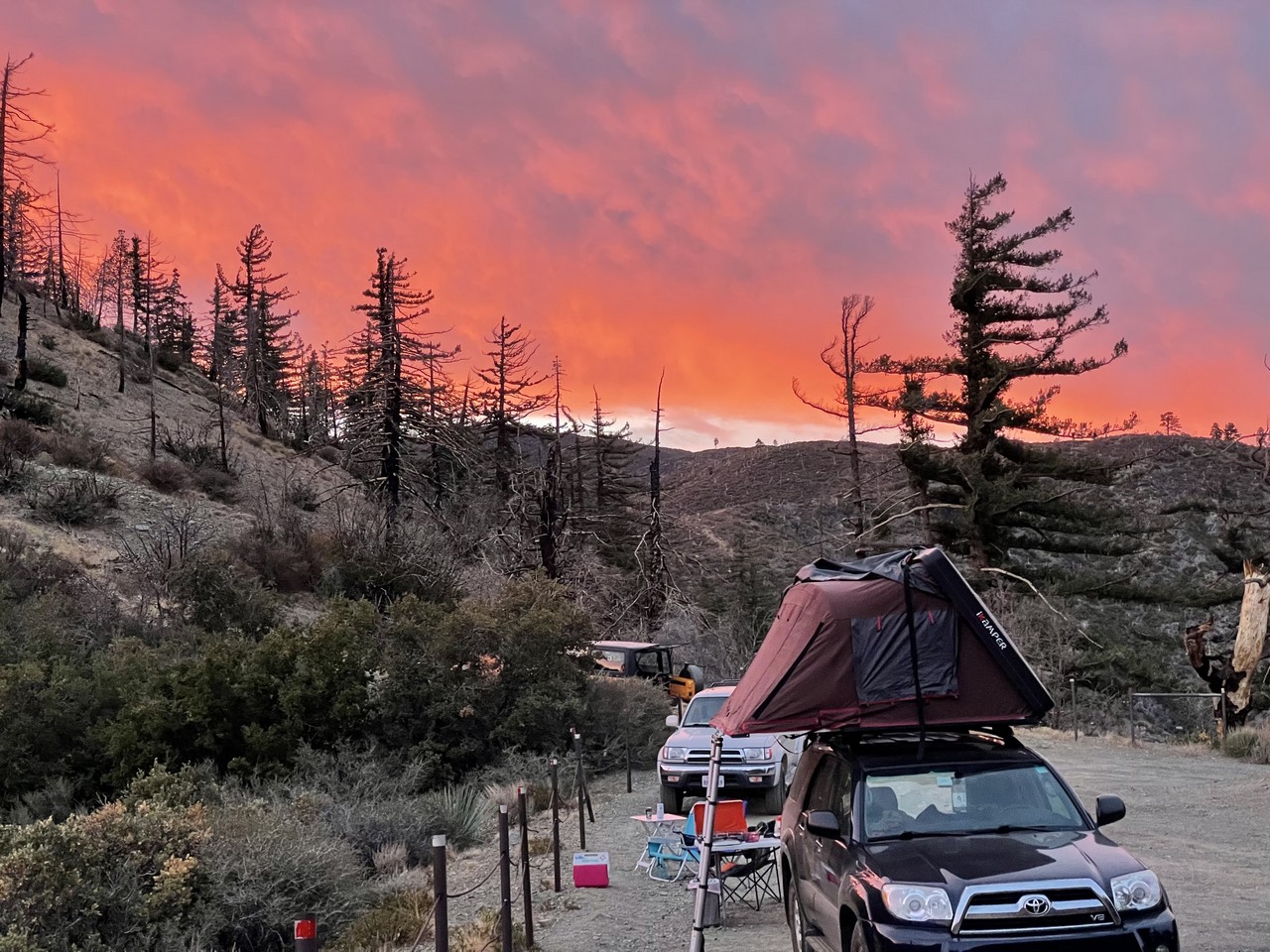
Soon after we arrived the clouds in Lytle Creek boiled upwards and nearly enveloped us, but then they dropped back down again, leaving us with blue skies and shirtsleeve temperatures for about an hour. We were treated to a few minutes of blood-orange sunset, then the sky darkened and night was upon us. Sean showed up a little later, then Dima and Sondra. Rico, thanks for playing those Dead songs through your Bose speaker. That went perfectly with my re-heated pizza and Shiraz.
I woke at 5:30, with the first hint of dawn in the direction of Cajon Pass. Sean was already up, dressed, and wandering around. It was a beautiful morning. Dima made me a cup of freshly ground and brewed coffee — with notes of raspberry and mocha, was it? Not sure, but a nice treat. After breakfast and some packing up, and Jeff and Cecelia’s arrival, everyone was suddenly ready to go at the same time.
Others have described the hike well here, so I'll just add that I really like this corner of the SG’s and though I’d walked this section of the PCT earlier this year, was happy to return. And with so many folks taking photos along the way I didn’t use my camera much, but here are a few more shots.
Reading this thread, I enjoyed Dima’s description of our views to the northeast. It's amazing to me that we were actually seeing the Panamints and Telescope Peak, but that’s how clear it was.
My Strava recording shows 11.01 miles. https://www.strava.com/activities/6162614004
Fantastic hike and wonderful group. Thanks again!
The 210 looked awful (as usual) on Sigalert and I hadn’t driven the back side of the range for a while, so I took the 14 / Pearblossom approach and was glad of it. I reached the bottom of 3N31 a minute past 3 and spent some time clearing rocks and smoothing out some of the humpy sections of that road while heading up, which was still slightly challenging in my 2WD 4Runner, especially around the big switchbacks near the top. Heading into the hills I ascended up into the clouds and then topped out above them. It was like being in the hills above Sausalito but Gobbler’s Knob camp was sunny, with excellent views in all directions. Moments after I drove into the camp (really just a dirt clearing at the roads end) Elwood pulled in and then a little later, Rico.
Soon after we arrived the clouds in Lytle Creek boiled upwards and nearly enveloped us, but then they dropped back down again, leaving us with blue skies and shirtsleeve temperatures for about an hour. We were treated to a few minutes of blood-orange sunset, then the sky darkened and night was upon us. Sean showed up a little later, then Dima and Sondra. Rico, thanks for playing those Dead songs through your Bose speaker. That went perfectly with my re-heated pizza and Shiraz.
I woke at 5:30, with the first hint of dawn in the direction of Cajon Pass. Sean was already up, dressed, and wandering around. It was a beautiful morning. Dima made me a cup of freshly ground and brewed coffee — with notes of raspberry and mocha, was it? Not sure, but a nice treat. After breakfast and some packing up, and Jeff and Cecelia’s arrival, everyone was suddenly ready to go at the same time.
Others have described the hike well here, so I'll just add that I really like this corner of the SG’s and though I’d walked this section of the PCT earlier this year, was happy to return. And with so many folks taking photos along the way I didn’t use my camera much, but here are a few more shots.
Reading this thread, I enjoyed Dima’s description of our views to the northeast. It's amazing to me that we were actually seeing the Panamints and Telescope Peak, but that’s how clear it was.
My Strava recording shows 11.01 miles. https://www.strava.com/activities/6162614004
Fantastic hike and wonderful group. Thanks again!
You do not have the required permissions to view the files attached to this post.
-
Uncle Rico
- Posts: 1481
- Joined: Thu Mar 20, 2008 7:48 pm
Another bit of good inspiration was Cecelia bringing chips, salsa, and guac for afterword. That was the best!
David, send trip reports from Chiang Mai.
David, send trip reports from Chiang Mai.
-
JeffH

- Posts: 1367
- Joined: Sun Nov 28, 2010 7:09 am
I got grilled by the neighbors on Sunday evening as we were sitting out front having a cocktail. "Jeff left the house this morning at 6:45 with some woman....!"
It was a fun day from the drive up to meeting a couple new people to seeing some new country. I had never been back to that side of the mountains until last week, and certainly had no idea the views were that spectacular.
Thanks Sean for the locale, thanks Cecelia for the chips and dip and butter, thanks Rico for the walk and talk on the way back and thanks to all for making the trip to get there. I'd be in favor of another group hike.
A requirement to post a few more pics:
Sunrise as we turned around on Lone Pine Canyon Road after missing the turnoff. Ansel Adams in training. Steep drop-offs all around. Let's keep going to Canada. Weary sign on top of Wright. Pacific Crest Trail. The Knob. A most excellent post-hike refreshment. https://www.alltrails.com/explore/recor ... in-3d57fe6
You do not have the required permissions to view the files attached to this post.
"Argue for your limitations and sure enough they're yours".
Donald Shimoda
Donald Shimoda
-
JeffH
- Posts: 1367
- Joined: Sun Nov 28, 2010 7:09 am
No problem, it was good entertainment for all the neighbors.Girl Hiker wrote: Sorry Jeff, next time I will meet you at the dirt parking lot now that I know exactly where it is.
"Argue for your limitations and sure enough they're yours".
Donald Shimoda
Donald Shimoda
-
dima
- Posts: 1774
- Joined: Wed Feb 12, 2014 1:35 am
- Location: Los Angeles
You missed the turnoff too? I totally did that. I also missed the exit to the 138, and had to tag Hesperia.