Seeking property in Cattle Canyon

TRs for the San Gabriel Mountains.
Post Reply
User avatar
dima
Posts: 1319
Joined: Wed Feb 12, 2014 1:35 am

Post by dima »

A recent post talks about the abandoned mine in Cattle Canyon. Getting there implies running afowl of some private property, but it was never clear to me which areas are private specifically, and who the owners are. Yesterday I visited the area to see what access is like.

Conclusions: the road is gated off at Cow Canyon Saddle. The property at the saddle only crosses about 1/4 mile of the road. Down in Cattle Canyon (7 miles later) is the Thompson Ranch, which is also private. There are gates at each public/private boundary, each in roughly the right spot. The road between the inholdings is public, but access is discouraged. I updated OpenStreetMap with the gate locations and the public/private boundaries, based on where the county assessor says they are. I haven't actually been to all of them, and don't know where the gates actually are, or if they even exist. If anybody knows specifically, please edit OSM, or feed me info and I'll do it. Specifically want to know about the West, North sides of Thompson Ranch, South side of Widman Ranch.

I looked up the property lines at the county assessor's site. As expected, most of the road is public. The Thompson Ranch is down in Cattle Canyon; that property is small; doesn't come up anywhere near Cow Canyon Saddle. The property at Cow Canyon Saddle is big-ish, but for the most part it isn't at the saddle. There're actually two parcels, and much of the property is actually South of Glendora Ridge Road. Technically, the road to Sunset Peak starts on their private property.

So what are the legalities of blocking off access to a big chunk of public road because a sliver of your private property covers the road? The owners don't have to provide an easement? Is this a situation where they're just waiting for somebody to sue them to provide this easement? In this case that simply means removing the gates on the road. The not-on-the-road area already has an extra gate.

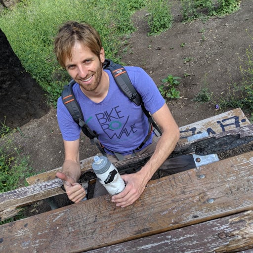
Trip report: I biked up to Cow Canyon Saddle. The dirt road to the North is now gated off, with a fairly serious gate. For years and years this was open, so I hopped the gate to travel the road. If I get yelled at, at least I would know who's doing the yelling.

Past the gate the road travels North for 1/4 mile. Then you get to a saddle. Straight (N) is a firebreak to (eventually) Lookout mountain. Right is a turn to the private property. This used to be the RV park; I don't know what it is now, so I'm going to call it the RV park. This also has a beefy gate. The road goes left, and very soon you hit another gate. At this point were two dudes in two big trucks. They were travelling West, and were in the process of closing the gate after them. When I got to the dude in the second truck, I asked him if I could pass. He said yes. When I got to the dude in the first truck, he had a very different opinion. Eventually he asked the guy in the back, was surprised to find out that it was fine with him, so they let me pass. These were the Thompson Ranch folks. Before they let me go, they made it very clear that their property is a no-go area, and that I was to return the way I came. Plenty good-enough for me.

These people were cleaning up the road. The first truck towed a very large tire to smooth out the surface, and would periodically stop to throw the larger boulders off the roadway.

The road runs ~ 7 miles and drops ~1500ft to get to the Thompson Ranch gate.

Image

Road is in good shape down to Cattle Canyon. The Cattle Canyon crossing and the section that runs along the canyon is rough, but doable on a bike.

Image

Everything is pretty.

Image

Image

On the return I biked a bit into Cattle Canyon. The road exists initially, but becomes permanently washed out quickly. I didn't go in very far, but I still found an abandoned bulldozer, some sort of abandoned Caterpillar vehicle with treads, and a pickup truck (I think) buried almost completely in the river. Can be seen nicely here (may need to click to zoom in):

Image

Near the first bulldozer is a pile of metal. A closer look revealed that it's some sort of old gate:

Image

Welcome Mt Baldy
RV park
Entrance
------->

This place feels like the East Fork, but without the people. There are critters:

Image

Large scats unpictured. And there were critters:

Image

On the return, I crossed paths with the Thompson Ranch people again. They were now quite friendly. Maybe because I was now riding away from their property. Shortly thereafter, gunfire sounds filled the canyon. I guess if the next intruder is more persistent, they'll be ready. Found some paper shooting targets too.

I ran into jeko1034 at Cow Canyon Saddle. He reports that Cattle Canyon from the East Fork side is flooded and unpassable. As we chatted, the sun started to set, setting Ontario Ridge on fire (figuratively)

Image
User avatar
HikeUp
Posts: 3847
Joined: Thu Sep 27, 2007 9:21 pm

Post by HikeUp »

Nice TR. Gate locations don't show when I click on OSM (whatever the fuck that is).
User avatar
jeko1034
Posts: 132
Joined: Mon Nov 30, 2015 8:25 am
Location: Pasadena

Post by jeko1034 »

HikeUp wrote:Nice TR. Gate locations don't show when I click on OSM (whatever the fuck that is).
OSM stands for Open Street Map
User avatar
Anthony
Posts: 322
Joined: Mon Jun 05, 2017 11:53 am

Post by Anthony »

Nice shots. I hiked Lookout Mountain from Cow Canyon Saddle last year and encountered someone driving on the road. The opened the gate for us at the saddle. They didn't seem bothered that we were there.
User avatar
dima
Posts: 1319
Joined: Wed Feb 12, 2014 1:35 am

Post by dima »

Zoom-in to see the gates. I only added them where I know they exist: E end of Thompson Ranch, N end of Widman Ranch, both ends of the "RV park" property. If you know where the others are, tell me, and I'll add them.
User avatar
HikeUp
Posts: 3847
Joined: Thu Sep 27, 2007 9:21 pm

Post by HikeUp »

I don't see any gates marked. But of course if I have to zoom in to see them then I would know where they were - otherwise where would I zoom in to?
User avatar
dima
Posts: 1319
Joined: Wed Feb 12, 2014 1:35 am

Post by dima »

https://www.openstreetmap.org/#map=19/3 ... -117.67185

The two lines with a slash indicates a gate. OSM is a public dataset that everyone who isn't Apple or Google or Microsoft uses. The data is freely licensed, giving everyone explicit license to use it in pretty much any way they like, without charge. And the data doesn't suck in areas that aren't full of businesses that can potentially buy advertising. The tiles at openstreetmap.com are one of infinite possible renderings of this data, and you've probably already used OSM-based maps countless times. You should contribute :)
User avatar
HikeUp
Posts: 3847
Joined: Thu Sep 27, 2007 9:21 pm

Post by HikeUp »

OK thanks. Now I think I can see what you might be referring to. FYI it is only about 2 or 3 pixels wide no matter how far I zoom in. Anyway to make things bigger and add a legend that includes that symbol? Good info - just can't see it.
User avatar
CrazyHermit
Posts: 343
Joined: Mon Sep 07, 2015 1:03 pm

Post by CrazyHermit »

Image

Here a couple of photos I found in an old newspaper called the Azusa Pomotropic. The cabin on the left
(located in Cattle Canyon) belonged to John Knox Portwood, the psycho killer of the canyon.
He killed a German guy up in the Narrows and was tried for murder but eventually they acquitted
him. After he was freed he threatened a couple of women he saw talking to rangers near Graveyard Canyon.
When the rangers came knocking on his door he came out blasting. They shot him in the head and that was that.

The guy on the above right is Billy Heaton's son Benjamin. After Portwood was killed he claimed the
cabin as his own. Benjamin had his own problems and went on an alcoholic rampage one night when
he beat his mother up for booze money. He died pretty young, in his 50s, probably due to alcoholism.

Image

This is a famous photo of John Knox Portwood. He killed at least six men, and even had notches carved
in his gun handle. There was a seventh murder he was suspected of (a skeleton was found in Coldwater Canyon),
but there wasn't enough evidence to charge him with. Portwood was a miner, but he also ran supplies
up and down the canyon. The night he killed the German guy he was playing poker with George Trogden up
at his Iron Fork cabin.

The photo below was Trogden's second cabin, the first one he gave to his son in law. One of the prospectors up there
showed me where this used to be, but it was wiped out in the same flood that destroyed the road leading to Bridge To Nowhere back in 1938.

Image
User avatar
hikeandhike
Posts: 46
Joined: Mon Sep 09, 2013 7:20 pm

Post by hikeandhike »

Thank you for the report. Very interesting.
Did you happen to see any fish back in the canyon at the creek crossings? I imagine it's too exposed for them to survive that stretch.

There were military vehicles seen at the RV camp recently, did you see anything like that?

The info on John Knox Portwood is fascinating. Real wild west back there. Thanks for sharing CrazyHermit.
User avatar
dima
Posts: 1319
Joined: Wed Feb 12, 2014 1:35 am

Post by dima »

Didn't see any fish, but I didn't look very hard. Right where the road crosses the creek there is probably not enough water?

There's a military-looking truck thing next to the road on the old RV park property. I stayed on the road, so that's all I know. It's not clear what that property is now.
User avatar
Taco
Posts: 6001
Joined: Thu Sep 27, 2007 4:35 pm

Post by Taco »

Cool.

I ride to the western gate for Thompson Ranch occasionally over the years. Last time was several weeks ago. Lots of water crossings, but most can be done while riding my bike.

The military vehicle is a CUCV, or Commercial Utility Cargo Vehicle, a Chevy Blazer bought by the military. One of the ranchers owns it. I’ve seen him driving back there several times before.

Cheers
User avatar
dima
Posts: 1319
Joined: Wed Feb 12, 2014 1:35 am

Post by dima »

I just discovered that caltopo has a "land management" overlay layer. They don't source the county assessor's maps I think, but a cursory look shows similar things. Here's the edge of the Cow Canyon Saddle property
User avatar
headsizeburrito
Posts: 279
Joined: Wed Nov 15, 2017 1:18 pm

Post by headsizeburrito »

Nice bit of exploration, sounds like your new bike is serving you well!
User avatar
wesweswes
Posts: 54
Joined: Tue Feb 12, 2019 10:59 pm

Post by wesweswes »

oh, this post seems to answer my question... i had just revived an old thread before finding this. Sounds impossible to access iron #1 via cattle canyon due to thompson and widman ranches... BUMMER
Post Reply