I went out on Sunday with the intent of walking up the ridge just south of Sunset and then catching the road or fire breaks over to the TV antennae nearby. I also brought some clippers and did a little gardening, trimming lots of thorny bushes from the use trail to keep it a little more passable. After reaching the top of that ridge, I followed some footprints around but could not find a reasonably safe way down from there. The road was a steep drop away, I could see a faint trail on the little peaklet below me, and I never found a good way to reach either destination. Since I had already invested some time getting there I wandered over to Sunset, and on the way I found some debris I never saw in all the times I've been up there. Seems there was a three-sided structure called the Sunset Hut with a semi-improved floor, park bench and tree trunk seats scattered around. I talked with a couple guys up there and they mentioned that FS had torn down the hut in the past couple of years, although it was just abandoned near it's original home. That makes me wonder if it was actually FS or just other folks.... Anyway, it was another great day to be out, wearing shorts while hiking in December is always a good thing.
I'm planning another visit at the end of February for the full moon if anyone wants to join me.
AllTrails claimed it to be 6.7 miles and nearly 1600 feet elevation gain.
I took the route starting in San Dimas Experimental Forest, the ridge is upper left after a bit of road walking.
On the ridge - that slope up to the right is man-made, at one time wide enough for a vehicle.
Baldy and Lookout from somewhere around the previous photo. A little bit of GRR can be down below me.
Some steep sections this way, I also followed a couple of bike tracks up (they were going down). Neither rider used the jumps set up on the trail.
At the top of this little peak looking at the antennae. So close yet so far....
Closer look at the route - no easy way to get to that fire break. The road goes a long way around that little hill, I watched a truck driving for a while.
Former hut debris. When does it change from relic to litter?
Floor and sign. Bench is right of here with a great view of the inner SG mountains.
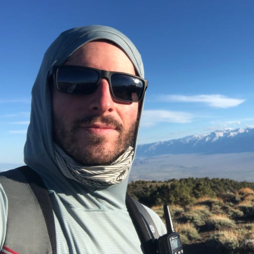
Pose on Sunset summit. I send this stuff to family in cold parts of the country.
AllTrails interpretation of my day.
Plan B Sunset Peak
-
JeffH

- Posts: 1367
- Joined: Sun Nov 28, 2010 7:09 am
You do not have the required permissions to view the files attached to this post.
"Argue for your limitations and sure enough they're yours".
Donald Shimoda
Donald Shimoda
-
Anthony

- Posts: 332
- Joined: Mon Jun 05, 2017 11:53 am
Nice adventure. I've hiked the fire road but never the ridge. I prefer it over the main route as it's less crowded.
-
Sean

- Cucamonga
- Posts: 4257
- Joined: Wed Jul 27, 2011 12:32 pm
