
Bobcat Fire in West Fork
-
walker

- Posts: 248
- Joined: Mon Apr 08, 2013 11:14 pm
Yes, appears to be in the upper reaches of the East Fork - Not sure if it's crossed upper clamshell road but might be approaching White Horse Peak - bad news for Chantry and vicinity
-
dima

- Posts: 1596
- Joined: Wed Feb 12, 2014 1:35 am
- Location: Los Angeles
You're just looking up at the hill to see that?
-
Sean

- Cucamonga
- Posts: 4179
- Joined: Wed Jul 27, 2011 12:32 pm
Comparing current towercam image with daylight image.dima wrote: You're just looking up at the hill to see that?
You can see how the fire is spotting on the near side of the ridge now. Maybe they Phos-Cheked the ridge to slow down the spread, but the fire appears to be getting over.
You do not have the required permissions to view the files attached to this post.
-
walker
- Posts: 248
- Joined: Mon Apr 08, 2013 11:14 pm
The prominent fireball is in front of Clamshell/Rankin/Monrovia summits and appears to be moving down along the East Fork basin headwall.
Note how the moon presides over the scene...
You do not have the required permissions to view the files attached to this post.
-
Sean
- Cucamonga
- Posts: 4179
- Joined: Wed Jul 27, 2011 12:32 pm
Look at the fireball on the north headwall. That thing is massive!
You do not have the required permissions to view the files attached to this post.
-
walker
- Posts: 248
- Joined: Mon Apr 08, 2013 11:14 pm
The morning after. Looks like it didn't progress much further down canyon overnight. Hopefully the wind won't pick up too much today.
You do not have the required permissions to view the files attached to this post.
-
walker
- Posts: 248
- Joined: Mon Apr 08, 2013 11:14 pm
Someone has compiled a time lapse of the first 20 hours or so of the fire:
-
patrick

- Posts: 33
- Joined: Sat Aug 15, 2020 5:24 pm
Looks like it moved pretty far east overnight though, maybe across highway 39 — https://caltopo.com/map.html#ll=34.2662 ... a=modis_mp
That surprised me a bit, given news reports of Santa Ana winds, which would be going east to west...?
In that time lapse, when the fire starts, you can see cogswell dam just in front of it... maybe along that bikeway somewhere?
That surprised me a bit, given news reports of Santa Ana winds, which would be going east to west...?
In that time lapse, when the fire starts, you can see cogswell dam just in front of it... maybe along that bikeway somewhere?
-
Sean
- Cucamonga
- Posts: 4179
- Joined: Wed Jul 27, 2011 12:32 pm
My best guess is this started near/at Glenn Trail Camp. If you zoom in when the first flames appear, they seem to be behind that ridge that separates the Arroyo Seco and Mt. Baldy districts, in the vicinity of the campground.
You do not have the required permissions to view the files attached to this post.
-
HikeUp

- Posts: 3994
- Joined: Thu Sep 27, 2007 9:21 pm
Our resident Sherlock!Sean wrote: My best guess is this started near/at Glenn Trail Camp. If you zoom in when the first flames appear, they seem to be behind that ridge that separates the Arroyo Seco and Mt. Baldy districts, in the vicinity of the campground.
1599419692.jpg
1599419692~4.jpg
Screenshot_2020-09-09-10-06-03.png
-
Sean
- Cucamonga
- Posts: 4179
- Joined: Wed Jul 27, 2011 12:32 pm
And, yeah, it spread to the north fork of the San Gabriel River last night, reaching the highway.
You do not have the required permissions to view the files attached to this post.
-
AW~

- Posts: 2077
- Joined: Mon Oct 01, 2007 12:00 pm
You mean the forest service might not know where things are?
Bobcat canyon, Glenn, Baldy..its all the same place?
I think the confusion came because it was initially West Fork campground. But that was changed to 'the dam to West Fork day use area'.
It was 100% Glenn. And there is a 'hmm' suspicion from me about this one. Lets just say this : Joe 'camping clown' Public narrative has too much smoke for now.
-
dima
- Posts: 1596
- Joined: Wed Feb 12, 2014 1:35 am
- Location: Los Angeles
That sounds right. Looking at it from the PCT right after it started, the flames were just E of the switchbacks above the dam, which would be in Glen canyon, or on the ridge just W of it.
-
maxmapper
- Posts: 56
- Joined: Fri Jan 17, 2020 5:50 pm
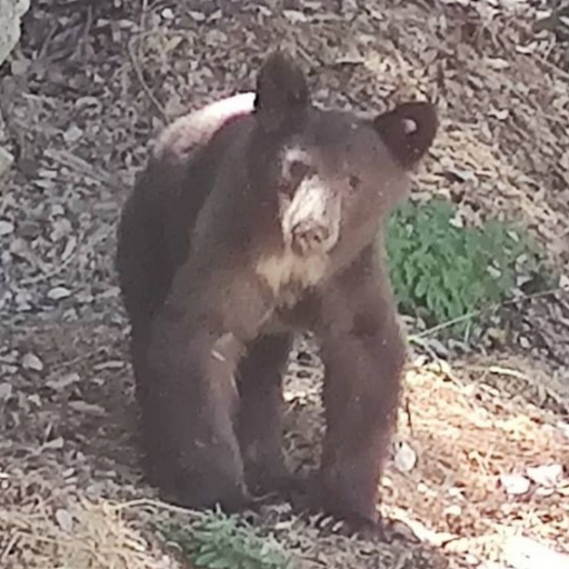
Was looking at my old photos of bear canyon. RIP BUDDY
You do not have the required permissions to view the files attached to this post.
-
maxmapper
- Posts: 56
- Joined: Fri Jan 17, 2020 5:50 pm
Hahah good point... look at all those pesky trees
You do not have the required permissions to view the files attached to this post.
-
patrick
- Posts: 33
- Joined: Sat Aug 15, 2020 5:24 pm
This picture is from the top of the dam looking east (the rocks at the bottom are fill for the backside of the dam). You can see a lot of powerline-looking stuff a bit east of the dam, which would be shielded by that ridge with the fire road from Mt. Wilson. Right around the spot where you can see the flames start in the time lapse
You do not have the required permissions to view the files attached to this post.
-
HikeUp
- Posts: 3994
- Joined: Thu Sep 27, 2007 9:21 pm
Is that dam a power producer or just flood control?
-
patrick
- Posts: 33
- Joined: Sat Aug 15, 2020 5:24 pm
Apparently I took a pic of the sign too, which says flood control and water conservation. There’s a smattering of buildings nearby, for some purpose or other
You do not have the required permissions to view the files attached to this post.
-
maxmapper
- Posts: 56
- Joined: Fri Jan 17, 2020 5:50 pm
-
dima
- Posts: 1596
- Joined: Wed Feb 12, 2014 1:35 am
- Location: Los Angeles
There isn't any power-producing anything over there. It's a very low-key operation
-
Gene

- Old Dam Man
- Posts: 204
- Joined: Mon Dec 26, 2011 7:54 pm
it is for flood control. There is an office and storage building at the dam and three homes for the dam operators along with some shops and cabins for summer workers.patrick wrote: Apparently I took a pic of the sign too, which says flood control and water conservation. There’s a smattering of buildings nearby, for some purpose or other
-
AW~
- Posts: 2077
- Joined: Mon Oct 01, 2007 12:00 pm
Also, if the detectives would find out where the 2 CL 415 superscoopers are since the media ..never mind the media.
But LA county received the 2 last week for the usual lease
But LA county received the 2 last week for the usual lease
-
AW~
- Posts: 2077
- Joined: Mon Oct 01, 2007 12:00 pm
This Sunset peak cam shows the fire moving up towards Hwy 39 on the path towards Crystal Lake. Smith Mtn = "peak 5495". Distance to Hwy 39 say 1.5 mile.
Tweet: Cascadia Fire Season @barkflight 22m
Per scanner, the #BobcatFire is making a "significant run" from the Bear Creek drainage up to Smith Mountain. "We're getting smoked in up here."
-
HikeUp
- Posts: 3994
- Joined: Thu Sep 27, 2007 9:21 pm
Not a breath of wind - some forecasts are just so wrong that they are...um...evil! lol
-
dima
- Posts: 1596
- Joined: Wed Feb 12, 2014 1:35 am
- Location: Los Angeles
There's a good firebreak along Smith mtn ridge. Do those things generally hold?
-
Sean
- Cucamonga
- Posts: 4179
- Joined: Wed Jul 27, 2011 12:32 pm
All I'm saying is that they still claim in their updates that the fire started at 12:21. Either they're under some misguided assumptions, or Mt. Wilson needs to recalibrate its towercam clock. Sherlock Holmes would not be pleased with such inattention to detail. Hopefully the actual investigators know what's what.AW~ wrote: You mean the forest service might not know where things are?
-
AW~
- Posts: 2077
- Joined: Mon Oct 01, 2007 12:00 pm
Thats the Station break...millions spent on the 'last stand' . I think its now mostly gone, down to single path.dima wrote: There's a good firebreak along Smith mtn ridge. Do those things generally hold?
After I posted the pic, I notice the break has already been broken. in the picture there looks like a V gap between 5495 and Hwy 39, but there is no such gap. Thats the fire already on Coldbrook side of the ridge sneaking its way down.
At Highway 39, yeah, its big parking lot.
recent tweet "Some units have shifted to Crystal Lake as the fire picked up. "....so its a nice place to hold the line. For now at least...it'll be part of the new chapter 'Curve fire Redux'...aka the fight at Islip Saddle.
-
HikeUp
- Posts: 3994
- Joined: Thu Sep 27, 2007 9:21 pm
I think I see a plane...da plane...
edit to remove useless crap
edit to remove useless crap