Devil's Chair, Punchbowl, P5270

TRs for the San Gabriel Mountains.
Post Reply
User avatar
tekewin
Posts: 1259
Joined: Thu Apr 11, 2013 5:07 pm

Post by tekewin »

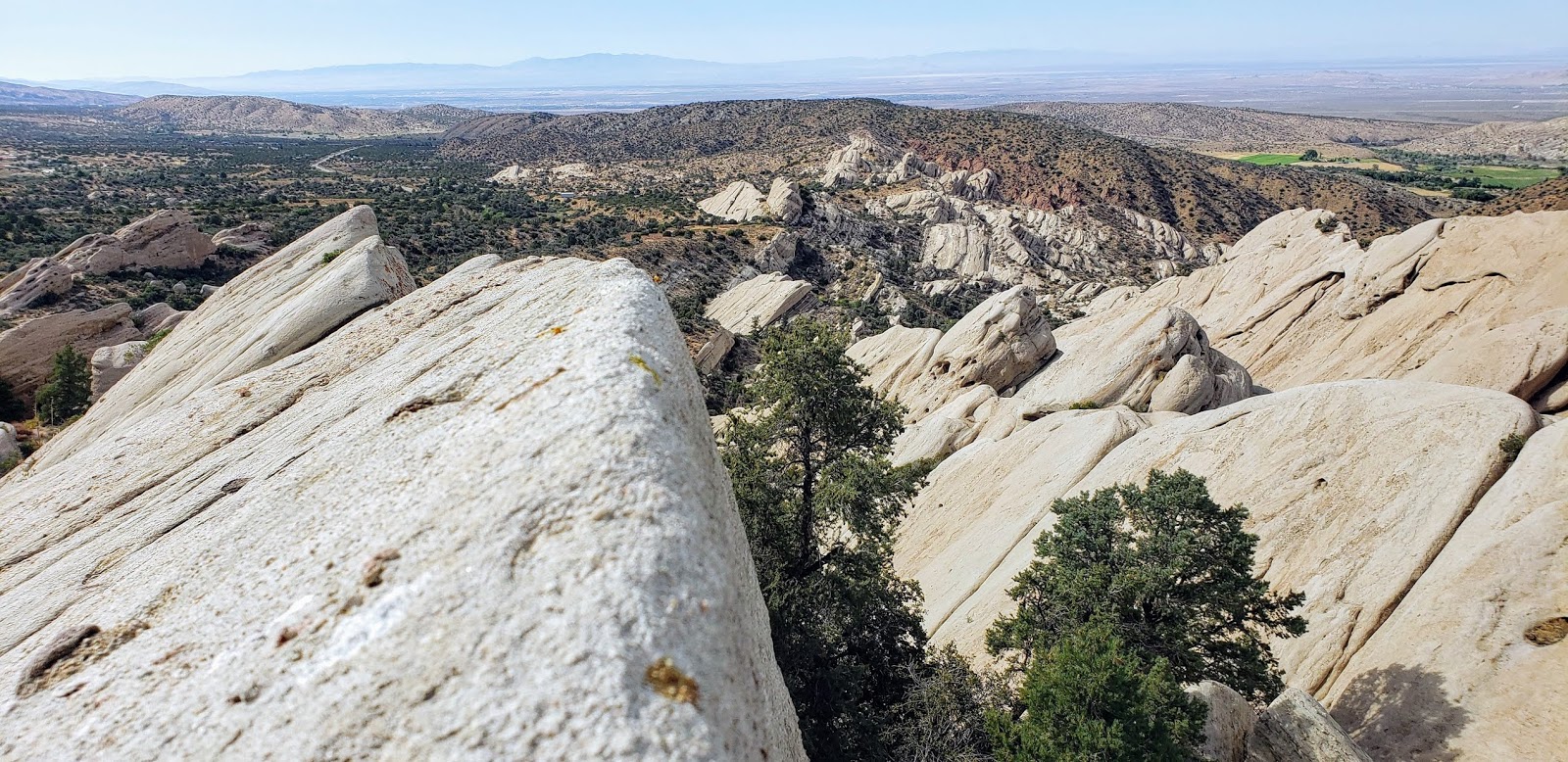
This was an AW inspired trip to Devil's Chair. The Devil's Punchbowl park has amazing geology and is free. It has plenty of parking, restrooms, and a visitor center. Weird that LA County extends to the other side of the mountains. There are two trails from the parking lot. One does a one mile loop through the slabs, and the other heads into the mountains to the Devil's Chair.

I started at 1:00 PM, a potential idiot move at the hottest part of a 90 degree day. The trail heads south rising gently into the foothills. At 0.9 miles, the Burkhart Trail comes in sharply from the right. I stayed on the Devil's Chair trail, meeting parties on their way down. When the trail turned east, I was in pleasant pine forest with a fair amount of shade and my concerns about roasting in the sun eased. Phantasmagoric geology was on display the rest of the way. Rocks and clay were varied in colors and formations in dark green, red, pink, tan, and white. The photos don't capture the richness of the color. While the trail undulated between 5200' and 5300', it felt mostly flat until the 400' drop at the end to the Chair. The Devil's Chair is a ramp of white rock into the open air above the Punchbowl. A fence is built around it on both sides to keep people from falling off. Nice views and worth the effort. I saw two large bear scats on the trail. There's plenty of bear food at this elevation. I took a 10-minute side trip to peak 5270 on a use trail on the way back. I'm not sure the diversion was worthwhile, though someone had left a lawn chair on the summit.

Image

Image

Image
The Devil's Chair is the upper white protrusion

Image

Image

Image
View from the Chair

Image

I couldn't leave the Punchbowl without a quick scramble on the slabs. I headed for the highest slab in the park, which meant leaving the loop trail and taking one of the many criss-cross use trails down to the rocks. I climbed over a lower slab to get to the base of the big one. I found an out of place benchmark on the lower slab. The slabs appear to be mainly sandstone conglomerate with small rocks sticking out of the surface. I started up the main crack facing the road which was a mix of class 1/2/3. Half way up the crack, there was a landing where I dropped my pack. I followed the crack the rest of the way to its terminus just below the peak, but could not find a way up the final 12'. I backtracked down the crack to a lone bush. The way up there was tough class 3 and required trusting your weight to one or two inch holds on the rocks sticking out of the surface. The first 10' above the bush was the crux. I tested the first couple of rocks and they held, then I worked my up to the top. It was tricky coming down and I ended up sliding the last five feet of the crux section back to the main crack. It was a fun way to end the hike.

Image

Image
This was on the lower slab, the 5869 stamped on it is not the elevation here, strange

Image

Image
class 3 here

Image
Dropped my pack below

Image

Image
User avatar
Anthony
Posts: 327
Joined: Mon Jun 05, 2017 11:53 am

Post by Anthony »

Nice. I bet that was toasty.

GPX?
User avatar
tekewin
Posts: 1259
Joined: Thu Apr 11, 2013 5:07 pm

Post by tekewin »

Anthony wrote: Nice. I bet that was toasty.

GPX?
It was warm but surprisingly shaded once you got to the cruising part of the trail. Also a slight breeze kept it tolerable. I met about 10 other people on the trail so I wasn't the only one out there.

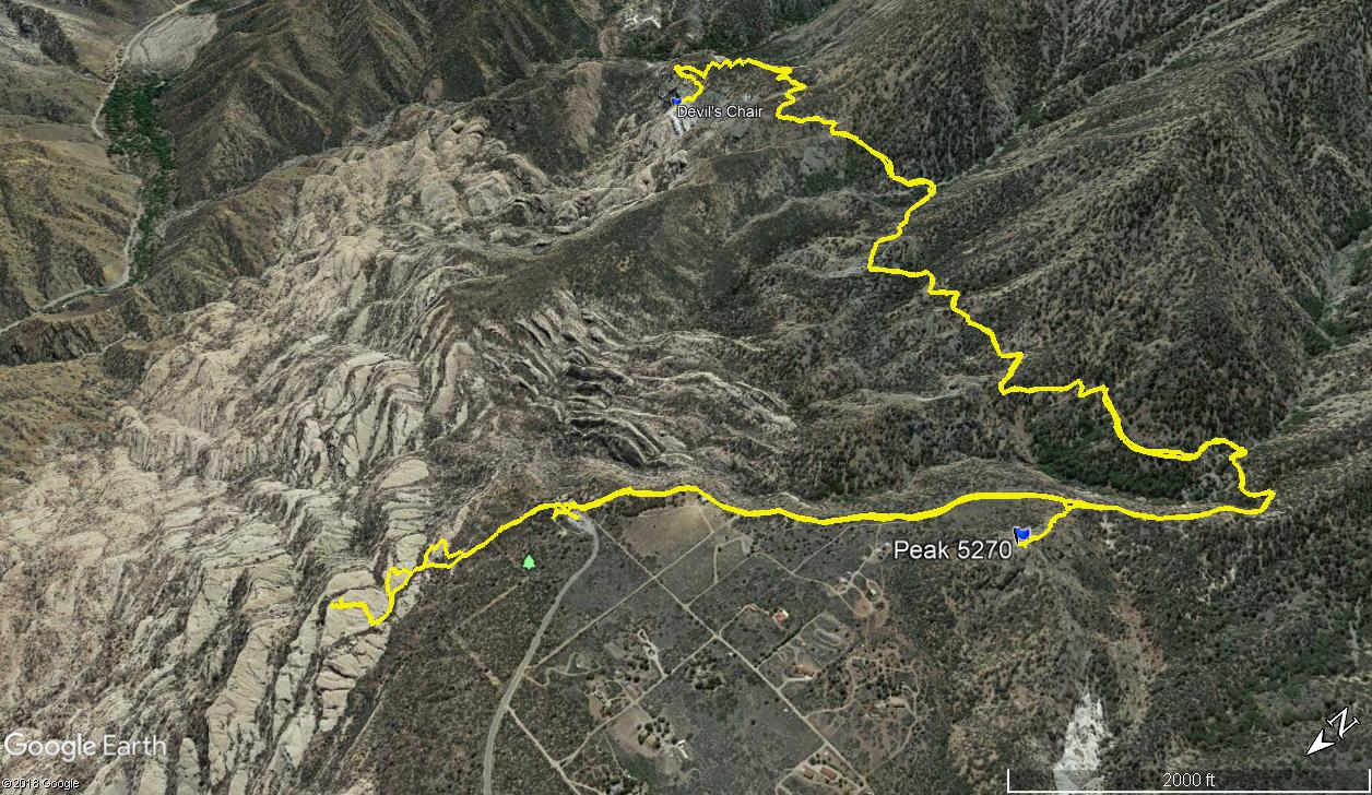
Here is what the track looks like (you can download it from peakbagger.com if you want):

Image
User avatar
Anthony
Posts: 327
Joined: Mon Jun 05, 2017 11:53 am

Post by Anthony »

Ah yes, I know which peak you went to. I've thought about hitting it myself. Thx for sharing!

On a related note: I'm hitting Will Thrall this weekend from Buckhorn. Maybe I'll see the Punchbowl?
User avatar
tekewin
Posts: 1259
Joined: Thu Apr 11, 2013 5:07 pm

Post by tekewin »

Anthony wrote: Ah yes, I know which peak you went to. I've thought about hitting it myself. Thx for sharing!

On a related note: I'm hitting Will Thrall this weekend from Buckhorn. Maybe I'll see the Punchbowl?
That should be a nice hike. You will definitely be able to see the Punchbowl from there.

I plan to hike Will Thrall and Pallett BM some time this year, but not sure if I will go from Buckhorn or the Punchbowl. Both ways look great.
User avatar
Sean
Cucamonga
Posts: 4054
Joined: Wed Jul 27, 2011 12:32 pm

Post by Sean »

I don't think you can see the Punchbowl from Thrall. Even from PVR HP I could only see the Sandrocks. It's too far west.
User avatar
tekewin
Posts: 1259
Joined: Thu Apr 11, 2013 5:07 pm

Post by tekewin »

Sean wrote: I don't think you can see the Punchbowl from Thrall. Even from PVR HP I could only see the Sandrocks. It's too far west.
Oh, you're right. I could see part of the Punchbowl from the ridge with the C-119 on it, but Thrall and PVR are pretty far back from that with a lot of intervening mountains.
Post Reply