Mount Pacifico Lookout?

TRs for the San Gabriel Mountains.
Post Reply
User avatar
missy
Posts: 83
Joined: Thu Jul 31, 2014 2:14 am

Post by missy »

I found a LA Times article that published a story mentioning a Mount Pacifico fire lookout on December 4, 1932:
“A marvelous view of hills and mountains and desert can be had from this point. A short walk from the car brought us to the foot of the look-out tower and the more hardy of our party climbed the steel rungs to the small platform, where an unending panorama was had for miles in every direction. The glistening Mojave was right at our back, and seemed to be directly under our feet although in reality it was many miles away.” LA Times article
Image
Image
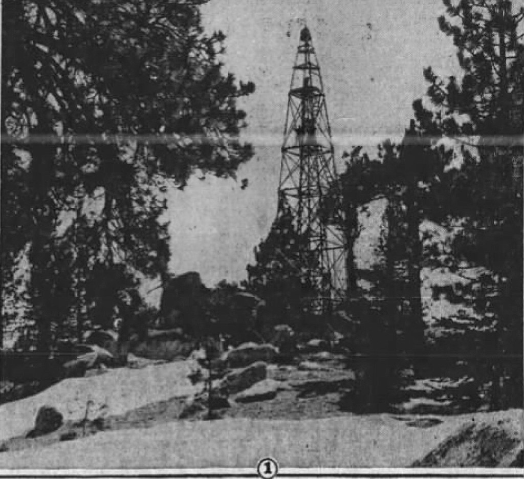
If you excessively strain your eyes, you can see two people standing on a platform of the tower. The boulders featured in this photo bear resemblance to the boulders on Mount Pacifico today, although I could not find a perfect angle to recreate this photographer’s perspective. This gave me doubts about whether this was built on the summit proper itself. However, anyone that has visited Mount Pacifico has noticed the metal posts on the tallest boulders. I wish the above photo had better resolution.
Image
Image

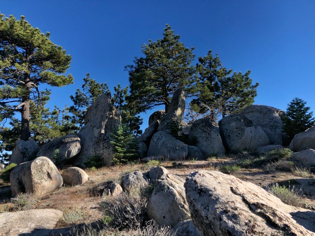
Two metal posts cemented on each boulder
Image

Image
Image
Image

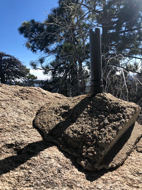
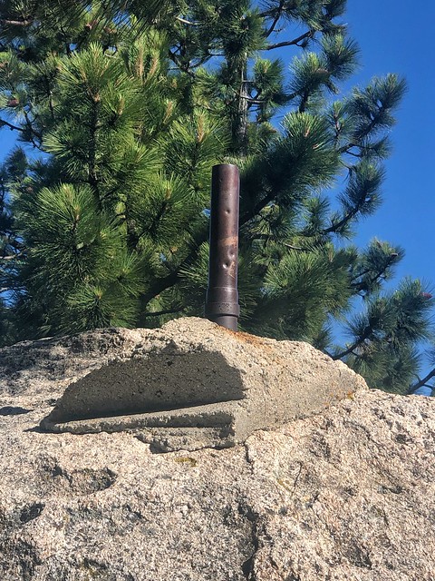
Metal post and concrete that may have served as a base for the lookout. Is the center hole where the benchmark used to be?
Image
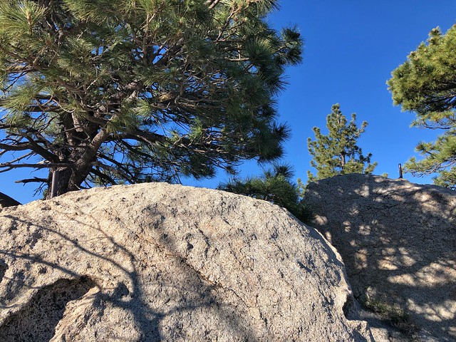
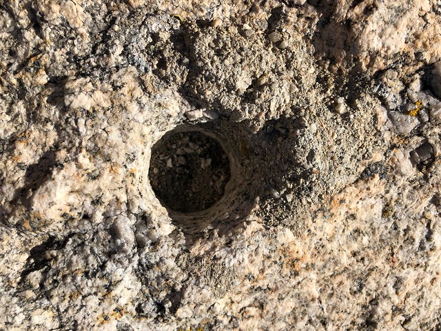
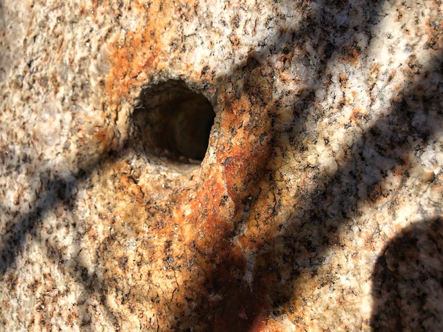
A few other interesting remnants along Mt. Pacifico I found were drill holes on the sides of surrounding boulders as well as other hardware bolted or laying around. I have yet to figure out how it all came together.
Image
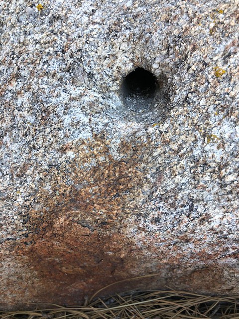
A metal post may have been fixed in this drill hole. A tail of metal corrosion left behind.
Image

Image

Image

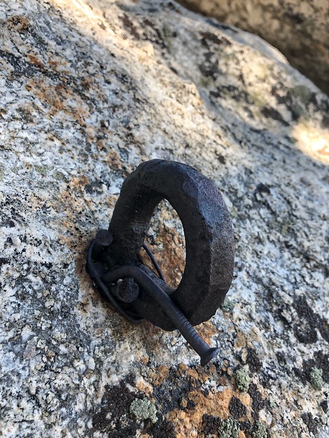
Hardware anchored onto the boulder
Image
Image
It’s also interesting to note that although this article called it a fire lookout tower, it doesn’t look like the other lookouts built in the San Gabriels around this time. In fact, it’s the only one that does not remotely resemble the others. All the other towers were built with cabs. So why this kind of lookout was built in Mount Pacifico is a mystery. Regardless of how it looks, the main objective of the early forestry was to get up over the treetops so early lookouts might have climbed a tree, a water tower or building to look for smoke. Besides, similar fire lookout towers without cabs were built throughout the states.

One kind of fire lookout is the Aermotor Windmill towers, often erected with no cab. A representative example is the Minnesota State Forest Service Lookout Tower, 1922.
Image
A similar fire lookout tower without a cab was located at Schley Ranger Station in the Chippewa National Forest in Minnesota, 1912.
Image
Another lookout without a cab.
Image
The Pacifico tower really looks similar to towers used for triangulation surveying. Survey towers were used by U.S. Coast and Geodetic Survey teams from the mid-1800s through the 1980s to obtain clear lines-of-sight between survey points. One of the most widely used survey towers was the Bilby tower.
Image
Image
However, survey towers meant to be a temporary fixture. It was portable, reusable and quick to assemble and dismantle....

And fire lookout towers used to look like this!
Image
Image
Image

So I guess anything is possible?
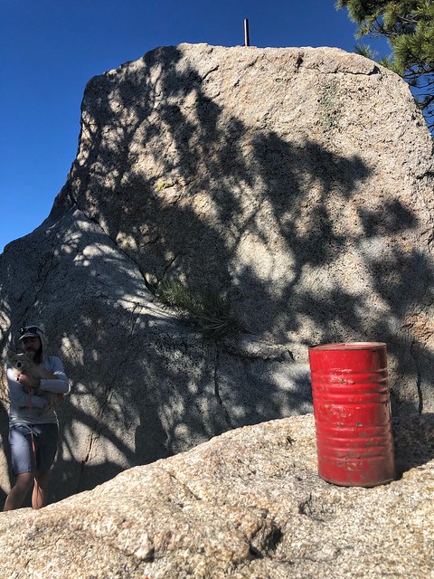
On a side note, I find it interesting that the main station benchmark is not on the tallest boulder?
Any thoughts on the tower?
http://angelesadventures.com/mtpacificolookout/
User avatar
dima
Posts: 1349
Joined: Wed Feb 12, 2014 1:35 am

Post by dima »

Thanks for the photos! I don't have any answers for you, except to note that the LA public library (central branch in DTLA) has microfilm of the LA Times archives, which would give you a better image. I'll grab it next time I'm down there, if I remember. Or you should go there to get it yourself. Check out their map collection while you're at it. It is fantastic.
User avatar
tekewin
Posts: 1195
Joined: Thu Apr 11, 2013 5:07 pm

Post by tekewin »

It doesn't look like the metal feet of the tower go into the highest block. Surveyors don't always place the mark at the highest point, especially if it is inconvenient. Interesting pictures of the tower and tower styles. It's a whole world.

I think there is usually about a 3' pipe that gets buried below then the mark is cemented in place on top. That would not be easy on Pacifico. I used a rope to get on top, but not everyone does. Still, the location may just have been easier.
User avatar
David R
OG of the SG
Posts: 534
Joined: Sun Jun 12, 2011 10:28 pm

Post by David R »

The article is interesting for those that like to find mines as it mentions numerous digs driving around including an abandoned quartz mine at Horse Flats.
User avatar
CrazyHermit
Posts: 343
Joined: Mon Sep 07, 2015 1:03 pm

Post by CrazyHermit »

Interesting. That looks almost like a WWII plane spotting tower I saw at Beek's Place in the Santa Ana Mountains.
I've noticed those rods in the rock up there and always wondered what they were.
If you hike up from Mill Creek Summit there are a number of mines in that area, including the Monte Cristo, Falcon and Lucky Strike.
User avatar
Sean
Cucamonga
Posts: 3783
Joined: Wed Jul 27, 2011 12:32 pm

Post by Sean »

According to the datasheet in 1978 there was still a station mark and two reference marks atop the boulders south of the campground. They might be gone now.

Screenshot_20190719-075737~2.png
User avatar
missy
Posts: 83
Joined: Thu Jul 31, 2014 2:14 am

Post by missy »

Sean wrote: According to the datasheet in 1978 there was still a station mark and two reference marks atop the boulders south of the campground. They might be gone now.

Screenshot_20190719-075737~2.png
Yup!! I read:

PAC 2 NCER IS A STANDARD U.S.GEOLOGICAL SURVEY DISK STAMPED---PAC 2 NCER---CEMENTED IN A 5 FOOT BY 10 FOOT BOULDER THAT PROJECTS 3 FEET ABOVE THE GROUND. IT IS LOCATED 16 FEET SOUTHEAST OF THE STATION AND 8 FEET LOWER THAN THE STATION.


so yeah There used to be s main station. Any who, im taking a trip to DTLA today to get tall a better picture of this lookout! Will report back !!
User avatar
missy
Posts: 83
Joined: Thu Jul 31, 2014 2:14 am

Post by missy »

Not sure if this is any better. The microfilms weren’t all that much better than the already digitized form.
84BC4B45-B135-4A95-B27C-D15B69DA0ACB.jpeg
User avatar
dima
Posts: 1349
Joined: Wed Feb 12, 2014 1:35 am

Post by dima »

That's too bad. I've used it to get clearer photos of crash sites, with great success. But the newspapers I've looked at were from the 1940s, which is 10 years after your photo. Maybe the photo and printing tech got a lot better..
User avatar
walker
Posts: 248
Joined: Mon Apr 08, 2013 11:14 pm

Post by walker »

Very nice - There are some short "Your hike today" or "Today's hike" articles in the LA times from around 1937-39 by Will Thrall that describe trips to Mt Pacifico, but no mention of the tower - perhaps it was already gone?
Could it have been used for surveying purposes on all the highway projects nearing completion back then?
Post Reply