
Last year I did a loop around Elsmere Canyon Watershed. On that hike I noticed from a distance, in the fading dusklight, a narrow-looking section of rocky cliffs in the main branch. This vision stayed in the back of my mind until yesterday, when Willie and I finally accepted the challenge.
From the parking lot it's 1.3 miles via the Creek Trail to the XC portion. There is a major split where the Creek Trail continues to the right, following the south branch, while a use trail heads leftward (east), and keeps you in the main branch.
From this point the main branch has a sporadic, overgrown path, which eventually deteriorates into nothing.
Annoying bushwhacking slowed our progress. Also, navigating in this canyon is tricky, with multiple tributaries that look like they might be the main branch.
In addition to the normal obstacles, this area also put tar seeps in our way.
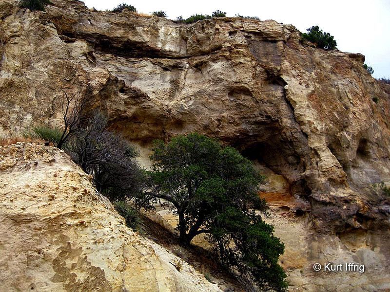
This stretch of the canyon was indeed narrow. A few bits got down to about six feet wide.
The cliffs were also impressive.
The rock, however, seemed generally too unstable to climb. Much of it is very decomposed and brittle.
After scrambling about 0.7 miles through the narrows, we hit this tall cascade.
This cascade and a couple prior ones were fairly easy class 2/3 climbs. But at this point we realized that somehow we had missed our exit tributary. So instead we clambered out of the main branch via the nearest ridge to the fire road, which we then took back to the parking lot.
Elsmere Canyon Narrows
-
Sean

- Cucamonga
- Posts: 4259
- Joined: Wed Jul 27, 2011 12:32 pm
You do not have the required permissions to view the files attached to this post.
-
headsizeburrito

- Posts: 279
- Joined: Wed Nov 15, 2017 1:18 pm
I've never come across tar like that while hiking, neat! Looks like some fun scrambling too.
-
Sean
- Cucamonga
- Posts: 4259
- Joined: Wed Jul 27, 2011 12:32 pm
There are tar seeps right along the trails in Towsley and Wiley canyons. Much easier to access.headsizeburrito wrote: I've never come across tar like that while hiking, neat! Looks like some fun scrambling too.
-
Tom Kenney

- Posts: 386
- Joined: Sat Sep 29, 2007 7:51 pm
Ha! I watched a Huell Howser episode where he poked a tar seep with a stick for 15 minutes while discussing oil exploration history with some Maricopa residents.
-
CrazyHermit

- Posts: 343
- Joined: Mon Sep 07, 2015 1:03 pm
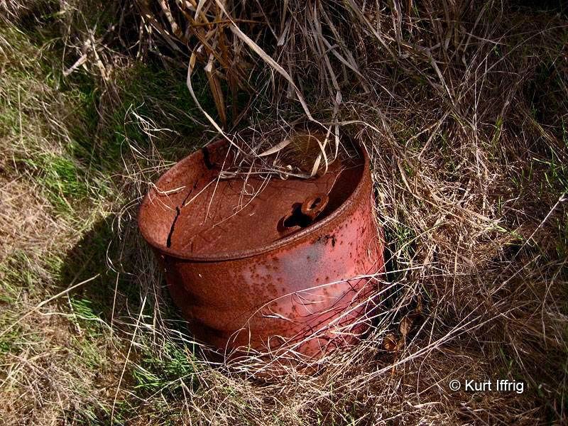
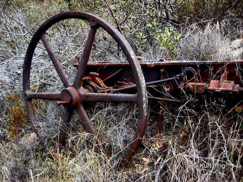
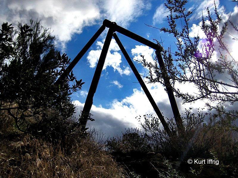
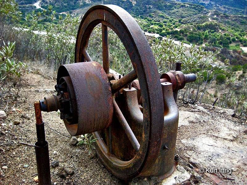
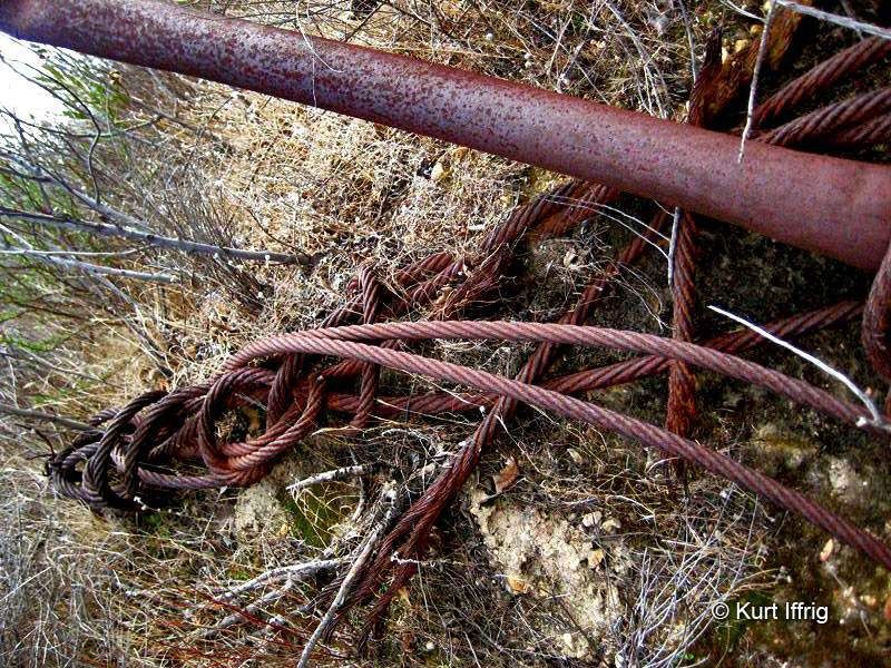
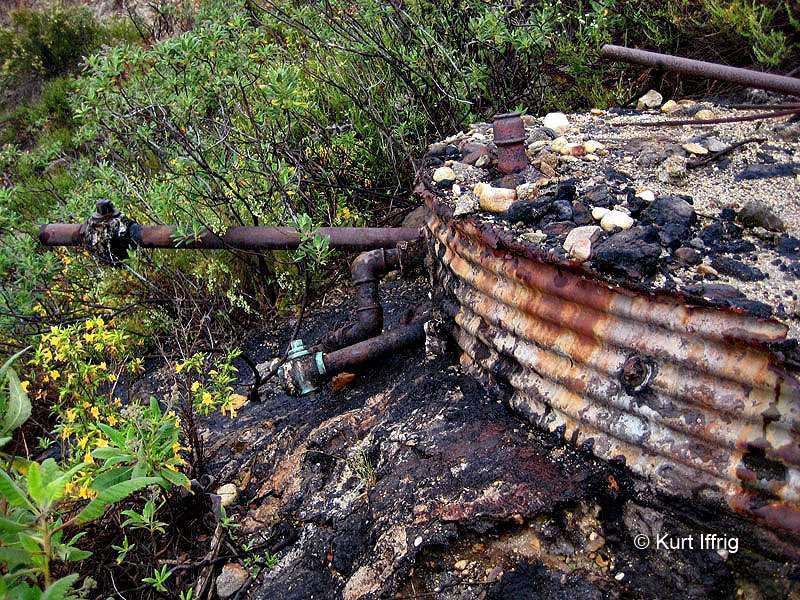
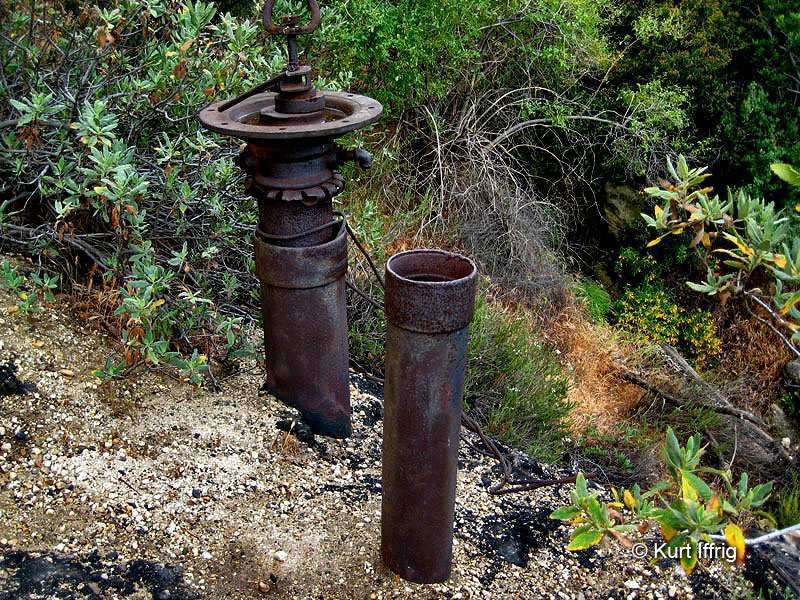
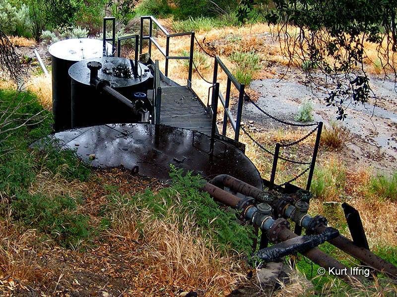
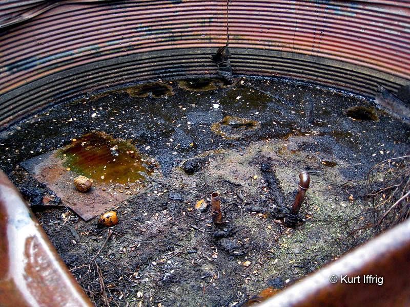
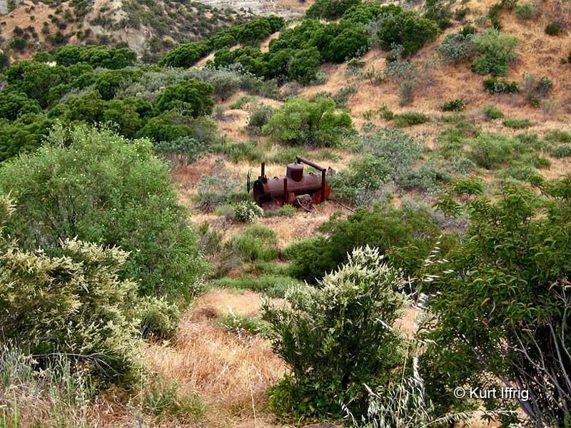
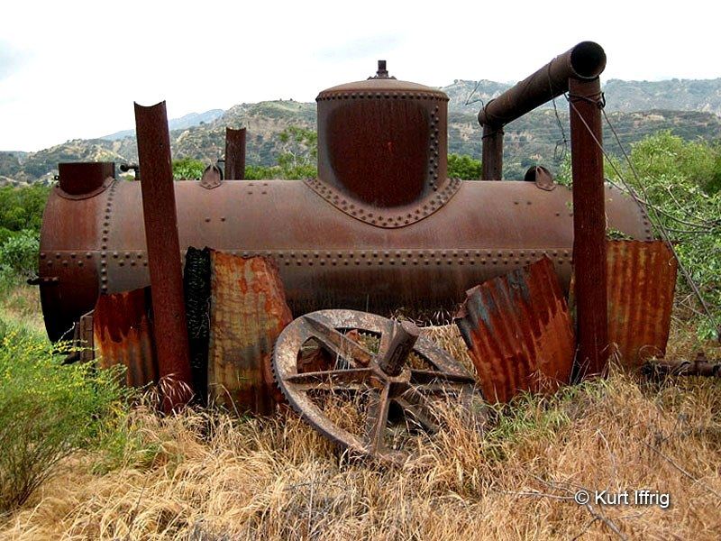
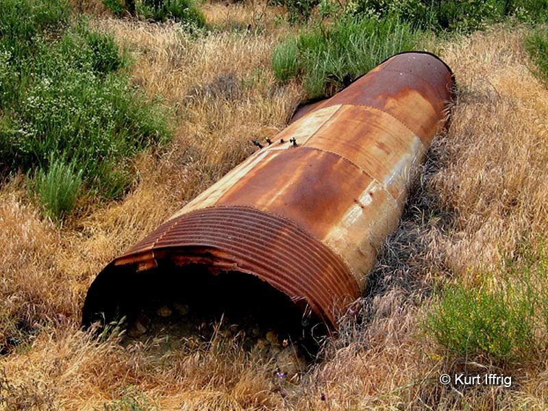
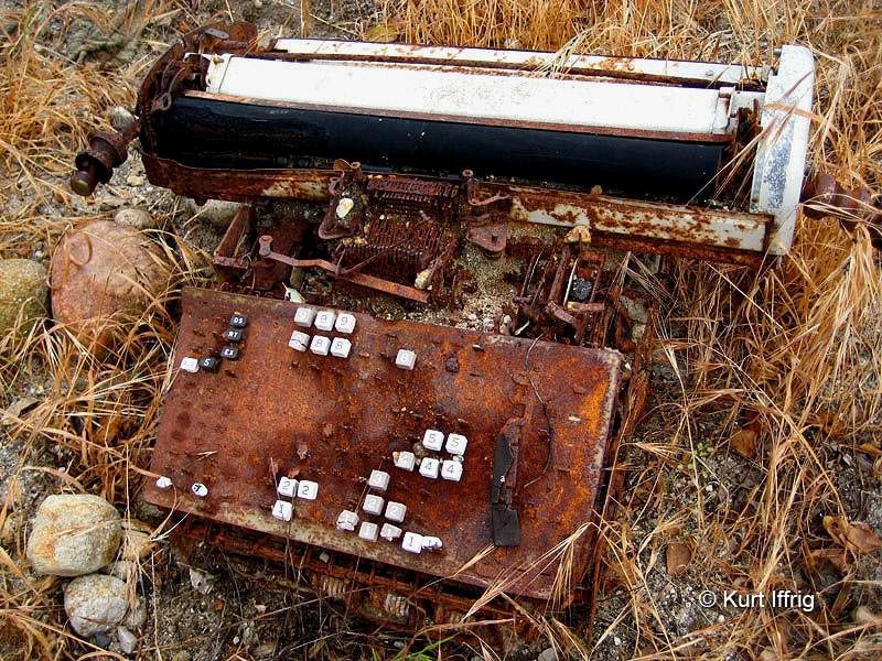
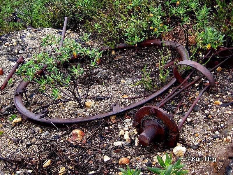
Elsmere Canyon and the heights above it were the site of some of the oldest oil fields in California. That tar you stepped in is called bitumen, or natural asphalt, same type that was found at the La Brea Tar Pits. I've never been as far as you went in the canyon, but if you take a loop trail above the cliffs to the south of it you'll see all kinds of remnants of the oil days. Supposedly there are even oil "mines" in Elsmere, that pre-date rig drilling, designed to capture the oil seeps in the hillside. Here's some photos it you're ever in that area again.
-
Sean
- Cucamonga
- Posts: 4259
- Joined: Wed Jul 27, 2011 12:32 pm
I'll have to look for these next time. Thanks for the information.CrazyHermit wrote:...if you take a loop trail above the cliffs to the south of it you'll see all kinds of remnants of the oil days.
-
CrazyHermit
- Posts: 343
- Joined: Mon Sep 07, 2015 1:03 pm
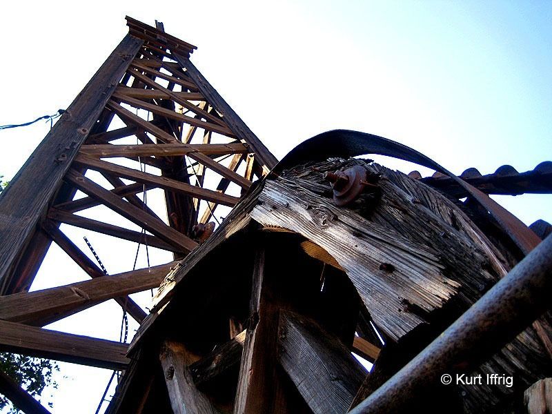
There's also an oil ghost town of sorts fairly nearby called Mentryville, in Pico Canyon.
And if you walk for a mile past it you'll see the last standing wooden oil rig in the Santa Clarita Valley.
And if you walk for a mile past it you'll see the last standing wooden oil rig in the Santa Clarita Valley.