

We made it to the Fall Creek Road (3N27) turnout and started hiking down by 7am. Big Tujunga Creek looked worthy of its name.
It's always nice to see loads of water in this streambed after marching down the old service road.
After the Big T crossing we began an uphill portion of the road, climbing along the opposite side of the canyon. We crossed gently flowing Fall Creek, squeezed through some minor overgrowth, and passed by a few electrical towers, before finally reaching Brennen's Saddle.
My original plan was to follow Brennen's guide for Lower Fox Creek. Unfortunately there is a mistake on his map, which caused me much confusion and a little bloodshed during the drop-in. I'll get to that in a bit.
First, we had no trouble identifying the best spot to leave the road and scramble up a few yards to the saddle.
From the top of the saddle we also easily recognized the lower, second saddle across the headwall.
Looking at Brennen's map, he negotiated this stretch by going straight down from the first saddle and then across and up to the second. But Dima noticed a faint animal/use track that contoured more gradually and directly across the headwall. This path ended up being pretty solid and not too difficult to follow. In fact we both liked it so much that we used it again for the return.
(Dima contouring up the headwall on the return.)
This route landed on the destination ridge only a few yards above the second saddle.
Getting from the second saddle down into Fox Creek was slightly more challenging. I mistakenly relied upon Brennen's hand-drawn topo track, when I probably should have re-read his narrative description, because the two accounts don't exactly match. His report talks about dropping straight down a slope from the second saddle, whereas the track follows a small ridge on the left. Here is what the slope looks like. (It turns into a small, manageable ravine lower down.)

Unfortunately a use path enticed us over to the ridge, then we promptly got pushed off that ridge by brush. We ended up hanging from whatever would hold our weight in the next gully over.
And this is where I ate it. With Dima about fifteen feet directly below, I tried a butt-slide move with very poor holds. I lost my grip and fell freely for ten feet before gaining enough friction to stop myself on some brush a couple feet before slamming into Dima, who was preparing to catch me. I checked my scraped limbs. A few small spots of missing flesh. But there was nothing gushing out of my body. And after a brief equipment check, I was eager to make the remaining short distance to the stream, where we washed up and strapped on our river sandals.
We had slid into Fox Creek a little downstream from the tributary on Brennen's map. Webbing dangled from a tree nearby. So perhaps some canyoneer also had trouble following Brennen's directions. Heading upstream we quickly came to the tributary on the right. Later, after re-reading Brennen's narrative, I realized the map error, and we found the much better route for our exit plan.
Here is Brennen's map of the drop-in. His drawn track is in blue and conflicts with his comments. I've sketched our exit route in green.

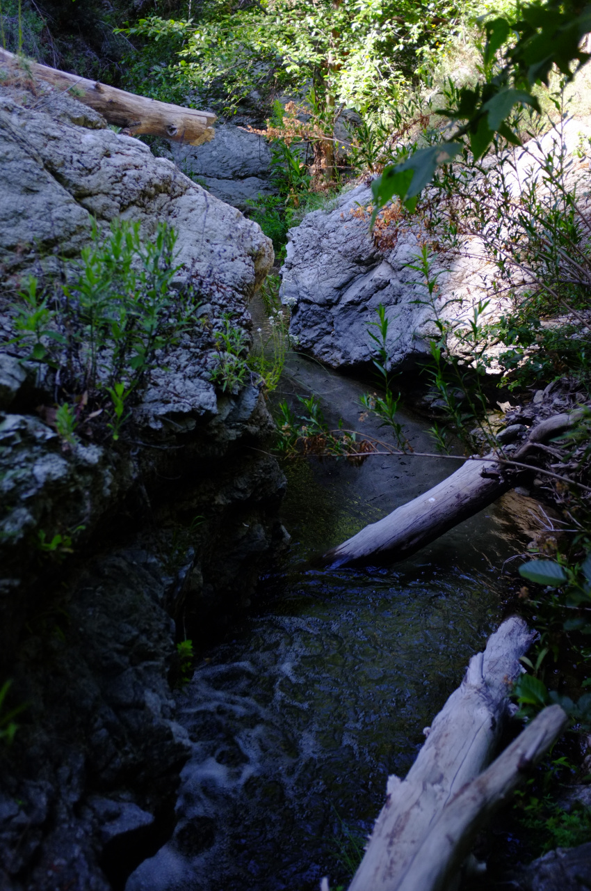
From the tributary junction we scrambled up Fox Creek for a quarter-mile.
(Photo by Dima)
The canyon awed us. It was full of clear, refreshing water that cascaded under trees and between high granite cliffs.
We were forced into the stream many times.
Dima avoided a few wades by clinging to the rocky sidewalls.
Just before the finale there was an impressive cascade with a slippery bypass on the right ledge. A fall here could have been tragic. But we were able to manage in our sandals by grabbing clumps of vines and grasses for support.

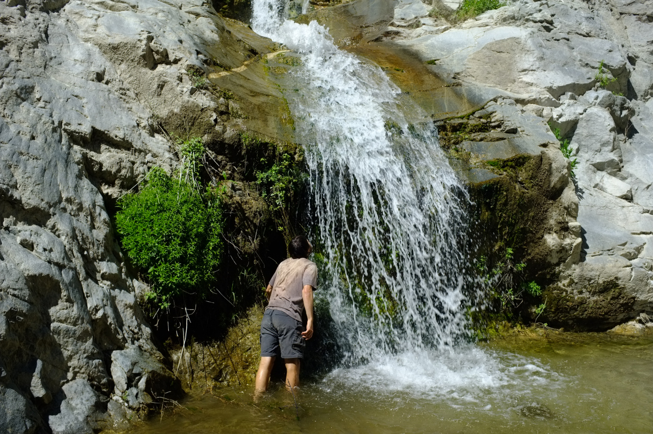
And then came the WOW!

We found ourselves at the sunlit base of a marvelous, pristine gorge with vertical walls stretching to the sky. Roaring through the narrow slot were the Great Falls of the Fox. The water flow was strong. The lower tier overhung our pool just enough so that we could stand directly under the spray.
We spent a good forty-five minutes hanging out. Dima found a neat bug living in the stream.
I found a flower.
And after some little debate, I think we maybe agreed that this was our favorite waterfall in the Gabes.

Though Fish Canyon still holds a special place in Dima's heart.

