Stanley-Miller Mine

TRs for the San Gabriel Mountains.
Post Reply
User avatar
Sean
Cucamonga
Posts: 3787
Joined: Wed Jul 27, 2011 12:32 pm

Post by Sean »

On Monday Dima, Willie, and I took on the challenge of locating the Stanley-Miller Mine. Well-prepared with several maps and GPS tracks, we started up the East Fork of the San Gabriel River around 9:30am.

Image

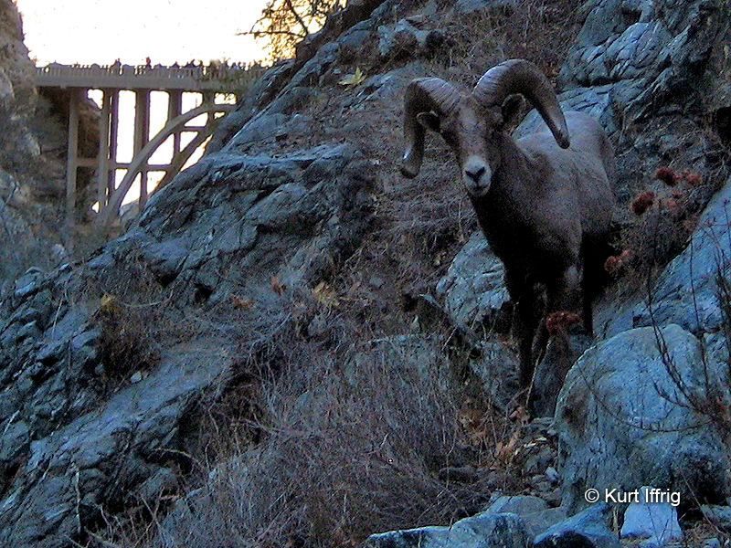
This was my first time up the East Fork, so I took a lot of pictures of popular sights like the Bridge to Nowhere.

Image

After a little break on the bridge, we continued up into the Narrows.

Image

The river-crossings were not terrible, but our shoes still got a little wet here and there.

Image

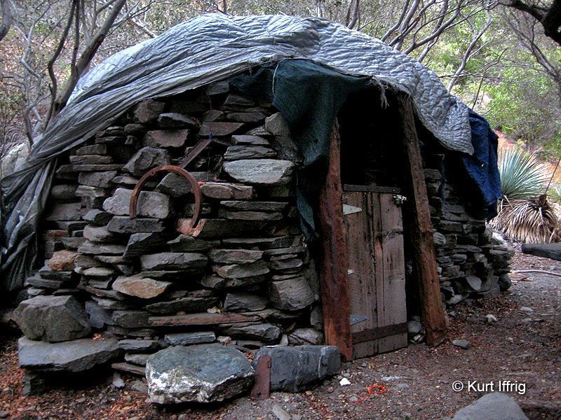
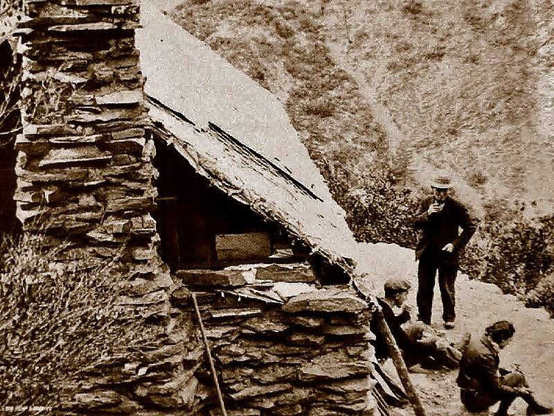
About a mile beyond the bridge we found the hobo hut.

Image

Nobody was home, so we promptly started searching for a key landmark in our quest to find the mine: cabin ruins!

Image

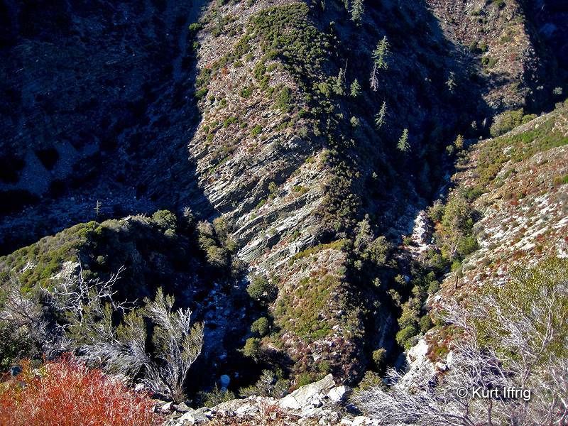
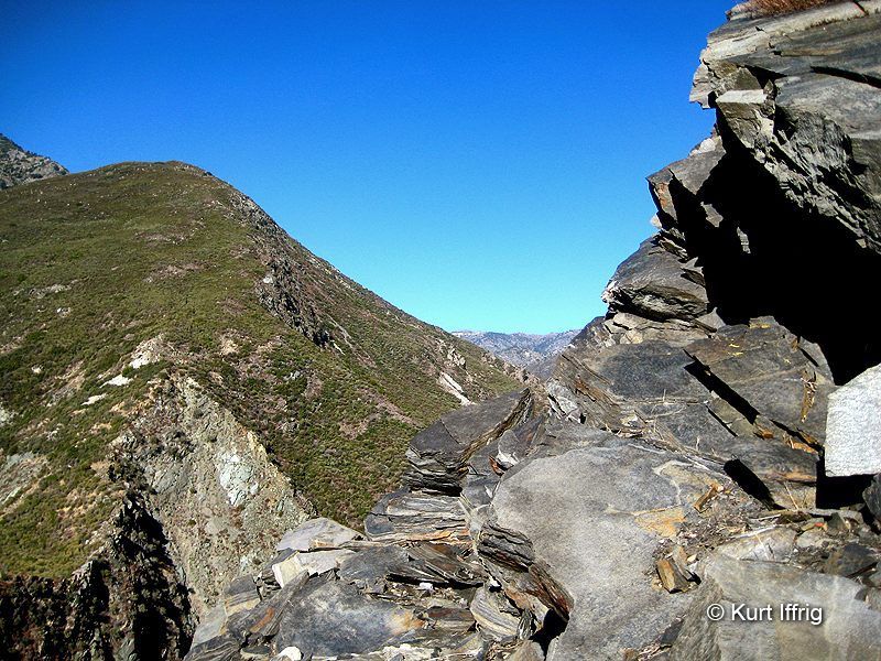
From the ruins, which are above the hobo hut, we backtracked down-canyon about 50 feet and found an agreeable scree slope to ascend.

Image

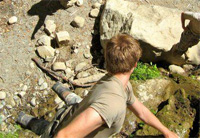
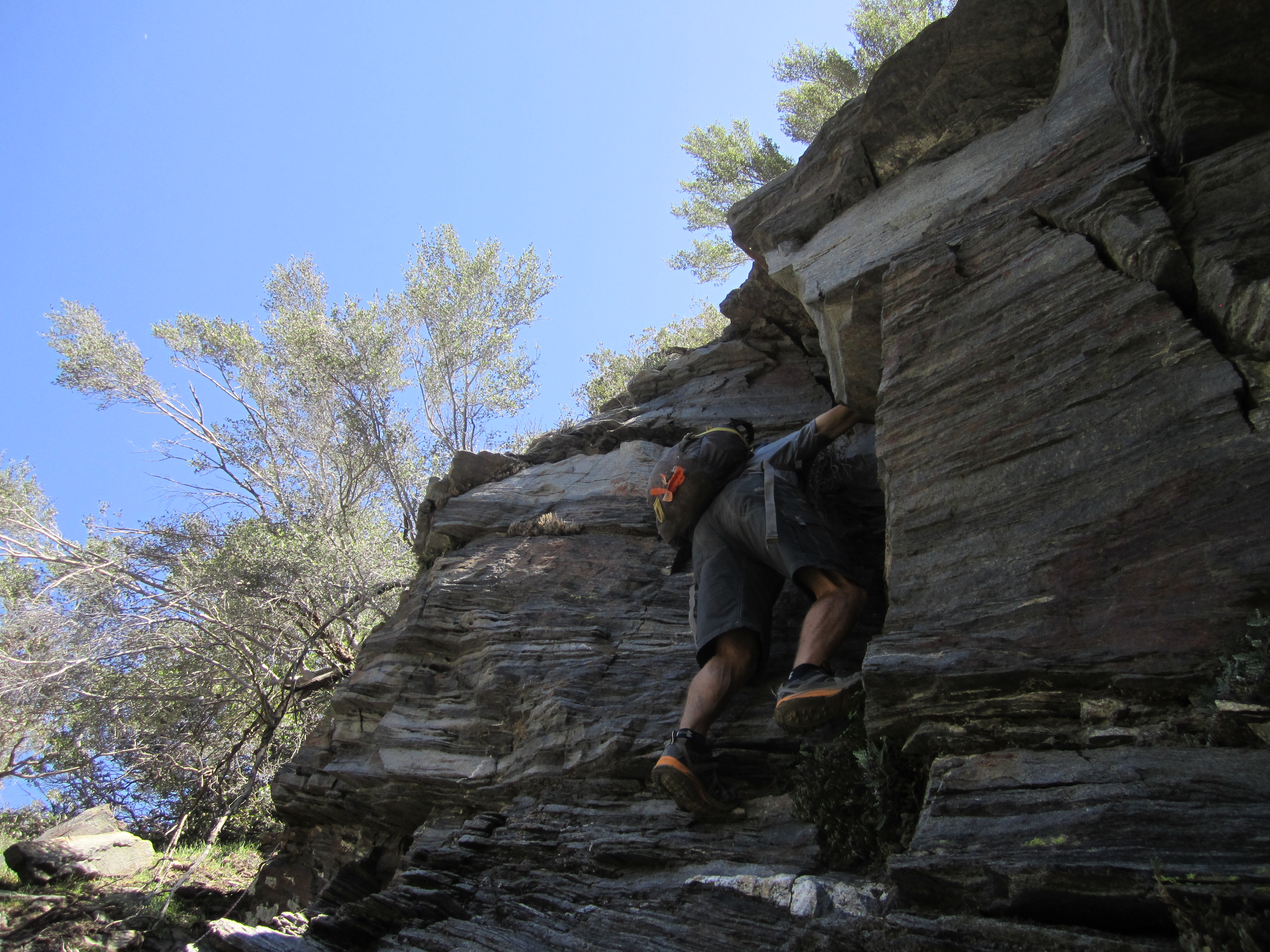
Depending on how you criss-cross through this section, you might encounter some slightly exposed and steep ledges requiring moderate climbing skills. People have affixed a rope and a cable to trees in order to assist such daredevils.

Image

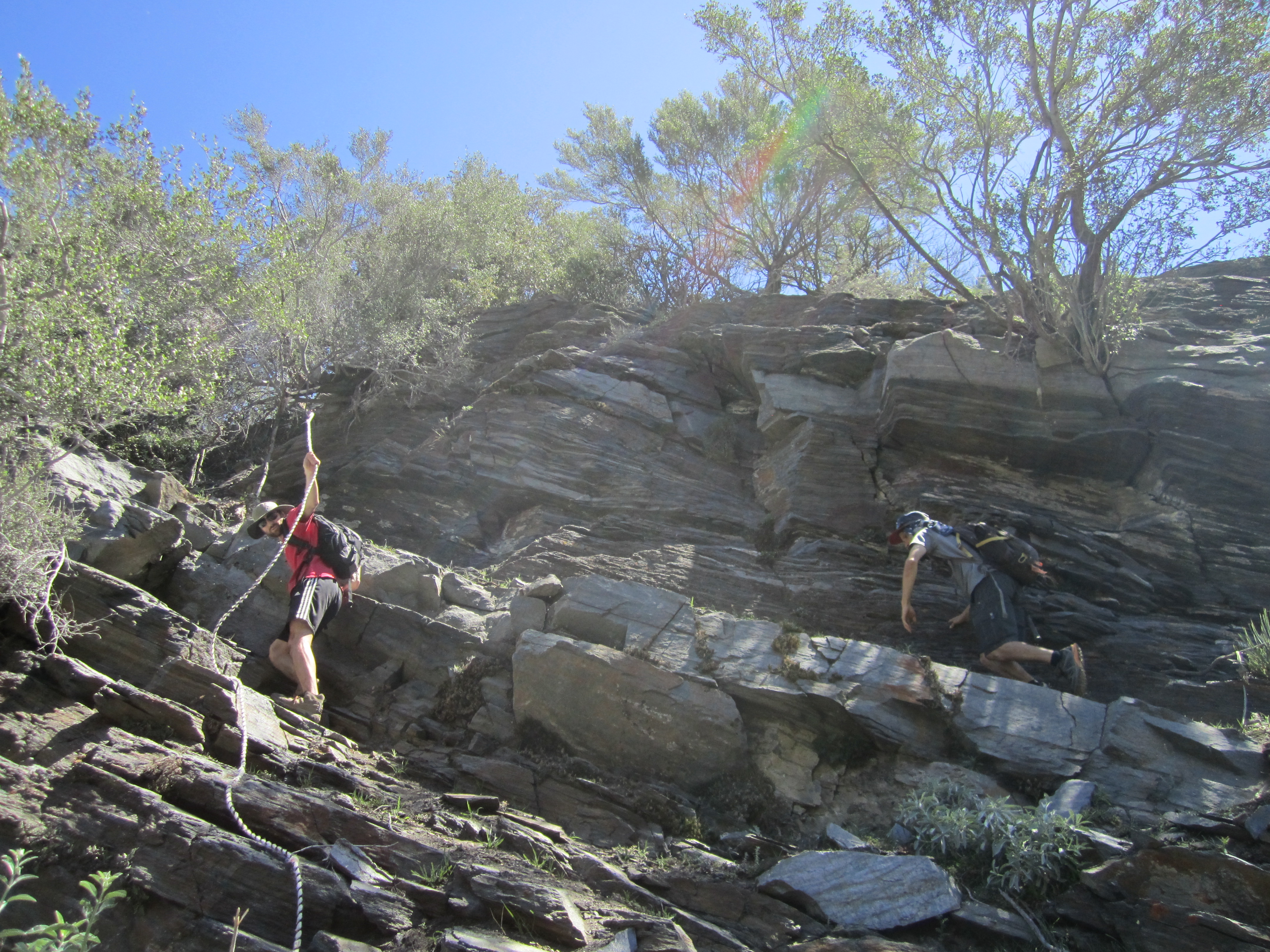
Or you can risk life and limb like Willie.

Image

After that there's some more easy but steepish hiking on a well-used sheep trail up to some trees. This is where we began our search for the mine, as the GPS indicated it should be close.

Image

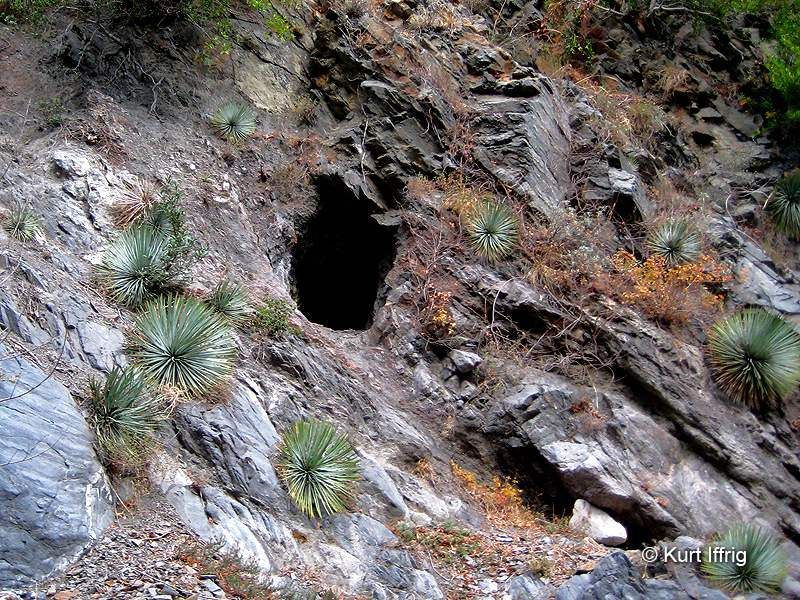
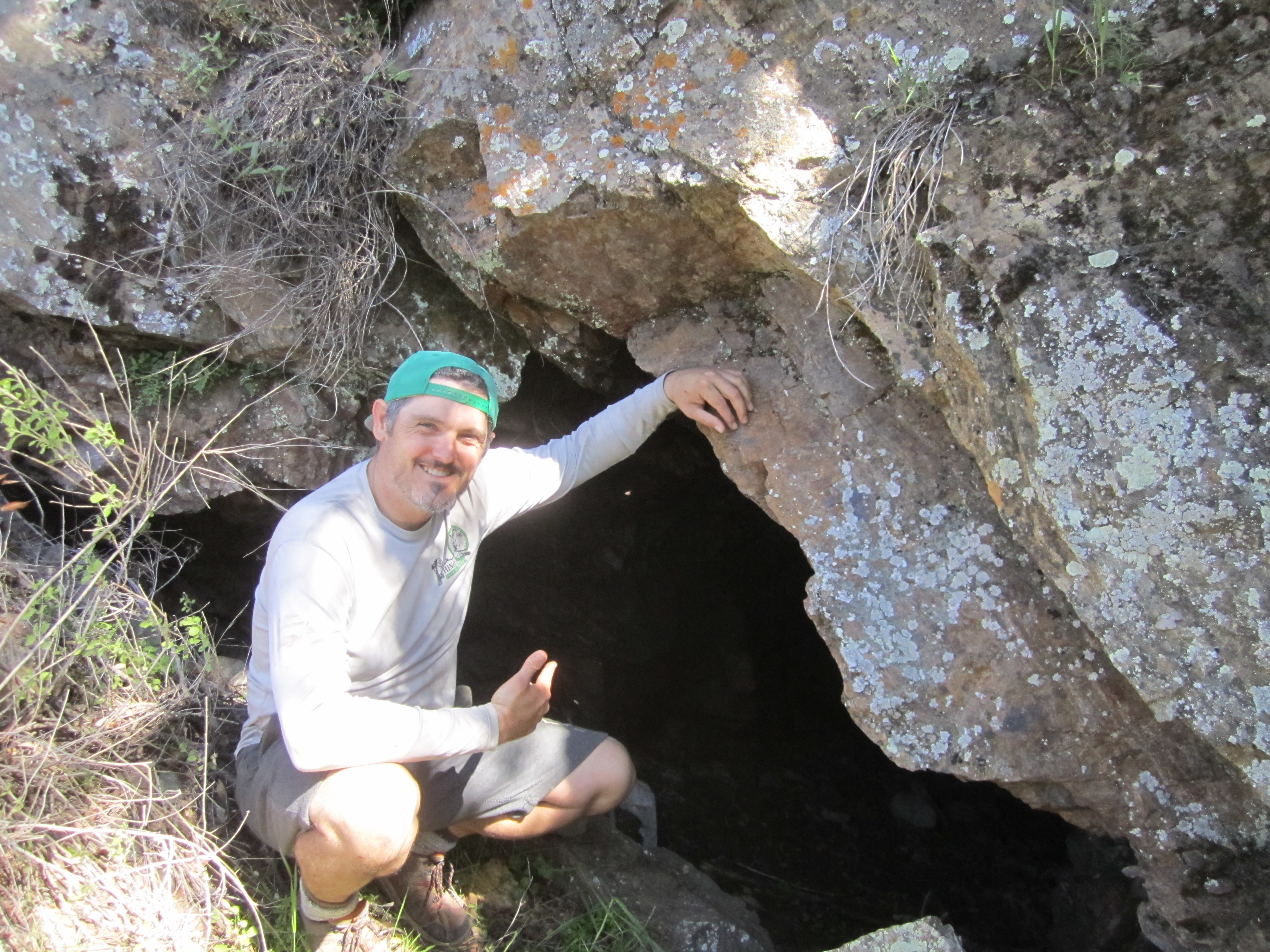
After scrambling around for awhile we finally found some holes in the side of the mountain.

Image

These were small, perhaps exploratory, or caved-in, mines. But nearby we found the big one.

Image

Inside there was an ore cart.

Image

The tunnel network was somewhat extensive, and Willie saw most of it, as he climbed up to the top level.

Image

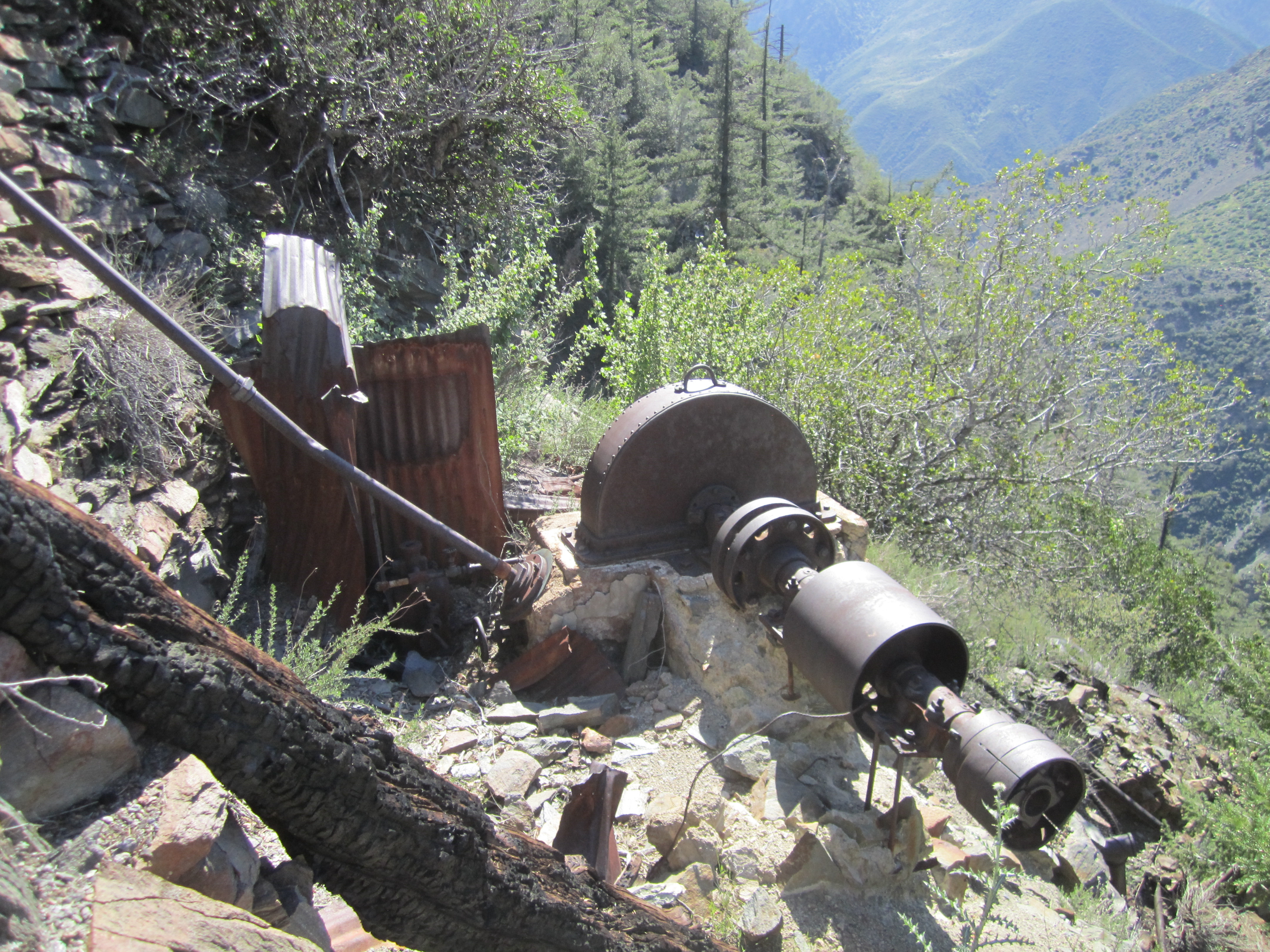
We also visited the mill.

Image

And the cabin.

Image

Image

Now I must go because the library is closing.

Image

Dima's Pictures
User avatar
Uncle Rico
Posts: 1402
Joined: Thu Mar 20, 2008 7:48 pm

Post by Uncle Rico »

Legit 2 (or too)
User avatar
tekewin
Posts: 1195
Joined: Thu Apr 11, 2013 5:07 pm

Post by tekewin »

Awesome report. So, is this mine on the north side of Big Iron?

I was wondering if you explored inside and the pictures answered that question. Always amazed that people could get heavy machinery out there on the side of a steep mountain without helicopters.
User avatar
Sean
Cucamonga
Posts: 3787
Joined: Wed Jul 27, 2011 12:32 pm

Post by Sean »

tekewin wrote: So, is this mine on the north side of Big Iron?
It's on the west side of Iron, across from Iron Fork.
User avatar
rade
Posts: 8
Joined: Sun Sep 18, 2011 8:54 pm

Post by rade »

wow that is badass! I've hiked the Narrows often and never knew here were so many mines in the area!
User avatar
Sean
Cucamonga
Posts: 3787
Joined: Wed Jul 27, 2011 12:32 pm

Post by Sean »

Forgot to include a link to Dima's pictures of this trip. He takes much better pictures than me.
User avatar
Hikin_Jim
Posts: 4686
Joined: Thu Sep 27, 2007 9:04 pm

Post by Hikin_Jim »

You guys found more stuff than I did on my trip. One thing I found that tripped me out was a huge cast iron stove, probably for cooking for the entire crew. It was a size of a desk.

I also found a tunnel that apparently was used as a trash can after the ore played out. The bottom of the tunnel was "paved" with flattened cans. Pretty cool.

I guess none of the chimneys of the old cabins are still standing? Truth be known, that's how I found the mine. I didn't cheat unlike some people (ahem) who use GPS. I did it with map and compass. I knew I was getting pretty close, when what did I espy but a chimney sticking out of the brush. Eureka!

HJ
User avatar
CrazyHermit
Posts: 343
Joined: Mon Sep 07, 2015 1:03 pm

Post by CrazyHermit »

I tried this one last weekend, but ran out of time before finding the mine. Hats off to you for making it. This one's a bitch.


One million ways to die on Iron Mountain

Image


A six foot spear found on the way up (lost as I was sliding towards a cliff)

Image


One of three Bighorns who kept knocking rock down

Image


Slate shelf looking northward

Image


Small mine found in the Narrows (my consolation prize)

Image


The hobo hut (it even has a fireplace inside)

Image


My buddy near the bridge (I was hiding behind a rock when I took this shot)

Image
User avatar
dima
Posts: 1354
Joined: Wed Feb 12, 2014 1:35 am

Post by dima »

You didn't find the mine, but it still sounds like a very productive outing. How deep was the mine in the Narrows?
User avatar
CrazyHermit
Posts: 343
Joined: Mon Sep 07, 2015 1:03 pm

Post by CrazyHermit »

dima wrote: You didn't find the mine, but it still sounds like a very productive outing. How deep was the mine in the Narrows?
That mine was only about six feet deep, on the east wall. I've walked past it a couple of times without seeing it.
User avatar
CrazyHermit
Posts: 343
Joined: Mon Sep 07, 2015 1:03 pm

Post by CrazyHermit »

dima wrote: You didn't find the mine, but it still sounds like a very productive outing. How deep was the mine in the Narrows?
Those mines have an interesting history. Originally there were 12 patented claims. Supposedly five tunnels still exist, but two of them are clogged. Stanley was the miner, and Miller worked on the trail, called the Wetwater Trail, which was 3 feet wide directly above the Narrows with a 300 foot drop straight down. The reason they called it the Wetwater Trail was because at one point a natural spring splashed out across the trail, which caused major problems when pack mules were hauling in supplies for the cabin and the ball mill. They did not want to go under that water, and often tried to turn around, with certain death looming below. I don't know if any remnants of the trail still exist. There was also a trail that connected the Stanley-Miller Mine to the Allison Mine, though I've never found any trace of that either. Here's a photo of the Stanley Miller cabin in 1939...

Image
User avatar
Sean
Cucamonga
Posts: 3787
Joined: Wed Jul 27, 2011 12:32 pm

Post by Sean »

Super shot of the bighorn. Thanks! Cecelia and I got right up on a herd once in Anza-Borrego. Spectacular animals.
User avatar
CrazyHermit
Posts: 343
Joined: Mon Sep 07, 2015 1:03 pm

Post by CrazyHermit »

Those old stone cabin ruins belonged to a guy named Oliver Justice who moved up into the canyon when Azusa became a dry town (no liquor). This was long before Prohibition, but the town had so many murders they decided to outlaw booze. He used to be the Postmaster General for the city. After he moved into the Narrows he became the most successful individual prospector in that area. He lived in the canyon for about 50 years, until they found him dead in his cabin one day. He had been mostly eaten by animals when they found him, and the Sheriffs buried him on top of the hill right behind the cabin.
Post Reply