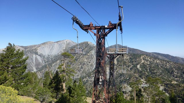
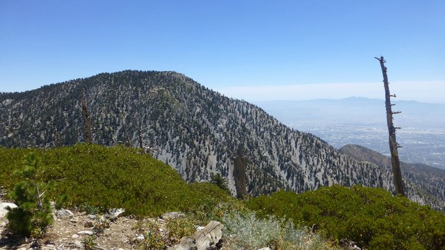
I had an awesome day yesterday in the San Gabriel mountains. I got out of my car around 6 am and hiked up the icehouse canyon trail to the saddle. I then headed to thunder mountain. I looked at my watch there and it was a few minutes short of 9 am. I ran/hiked my way back, adding the peaks of telegraph and timber. Once at the saddle I kept my momentum going up towards ontario followed by bighorn. Ran my way back and made it to car a few minutes after 1:30 pm. I was fortunate enough to feel really good through the whole thing, maybe because I ate so much food. This route had been on my list for a while and you can imagine how I feel now
That is a lot of peaks to compress into 7.5 hours! You may have seen my wife and I Saturday. We were between Thunder and Telegraph around 9 to 11. Can you give us a trail conditions report? The switchbacks on Telegraph's south side have been reported as being in bad shape. The mid section of the Icehouse Saddle trail between the Cucamonga Wilderness boundary and the 2 mile post is also reported as bad. How were they to you? Any damage from the Saddle to Kelly Camp and Bighorn/Ontario? Thank you for the report!
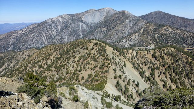
Hey Richard, good to hear, maybe we said hi to each other! It was a nice day out there too. Well the trail from Timber to Telegraph got weird a few times; it would kind of disappear between small ravines created by that storm. I actually kind of gave up on it at some point and just decided to follow the ridge so I could get good views of Tele's south face. But I quickly ran into it again and it seemed OK from that point. I am looking at google earth and I will take a guess and say that this happened at around ~8,300 feet along the ridge. The rest of the trail looked fine to me, although it was my first time on it, so I could not tell you the difference unfortunately. I found the icehouse trail to be in really good shape after seeing some of those flashflood videos! There was one area near the beginning that confused me for a bit but other than that I think it was all good. And although it was also my first time going up B/O, I did not see any apparent damage to the trail there, or around Kelly Camp. I ran that whole section and it was super enjoyable! Hope this helps, sorry to sound so ambiguous
Thanks tekewin! And thanks for the tip, you're the man!
The Ice House Canyon trail has been repaired and it is now in good shape and easy to follow. There are cairns at the point across the largest slide. Chapman has some washouts but the trail is obvious so all it does is slow down the pace a bit.
It does not sound like any repairs have been done between Telegraph and Timber. I was up on Ontario on Thursday and the trail is in great shape.