I quickly hiked up 2N66 to the Ken Burton trailhead (12W19). Neither the skull and crossbones nor the hand-written "unmaintained" on the trail marker were heeded. To be fair, the footbed is mostly O.K., and there are very few exposed spots along Ken Burton. Roughly a tenth of the passage requires pushing through hip to shoulder-height brush.
After turning NNW on to the last switchback (where the trail clearly once crossed the gully at 34.2431, -118.1803) I could not find what I considered to be a safe route down to Oakwilde. I tried several "use trails" to no avail. The only remaining options to me were to downclimb the aforementioned gully or return from whence I came. Since the condition of Gabrielino between Oakwilde and Paul Little was unknown to me, I opted for the unpleasant latter course of action. Since the return route would delay me somewhat, I contacted a friend of mine in Calabasas on the handy-talkie and asked him to call Mrs. Elwood's cell phone and leave a message regarding my safe condition and delayed arrival at home.
The return hike was uneventful, though I opted to take 2N66 all the way back down to the Arroyo. The frogs were singing their chorus beautifully and loudly along the darkened trail. Two things I might have done differently: 1) started with more robust beta regarding ACTUAL contiguous trail condition 2) Had more than a single Clif Bar in my pack for food for this energetic seven hour hike. As an aside, there was a family gathering, bundling, and removing shopping carts full of good-sized branches from the trail. How legal and/or ethical is this on National Forest lands?
I'll post pictures and GPS info later. Some idiot also forgot to put fresh batteries in his GPS and it finally crapped out somewhere on the way up Burton.
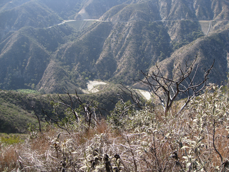
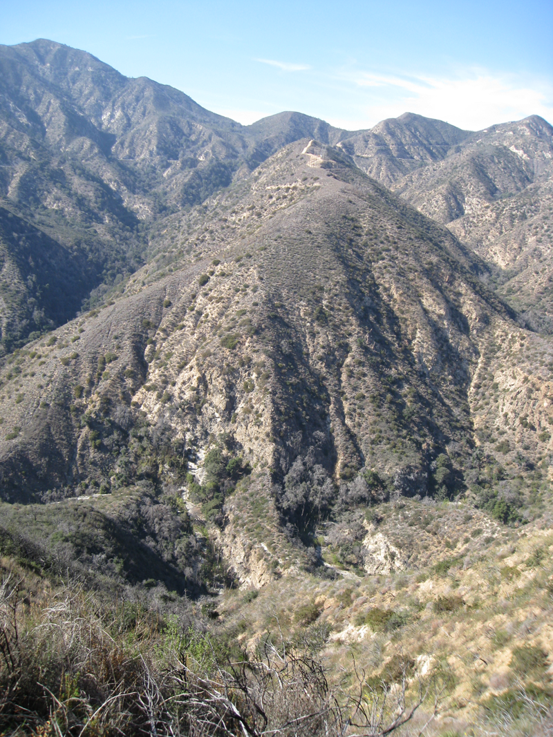
Oakwilde area as it first came into view from Ken Burton Trail.
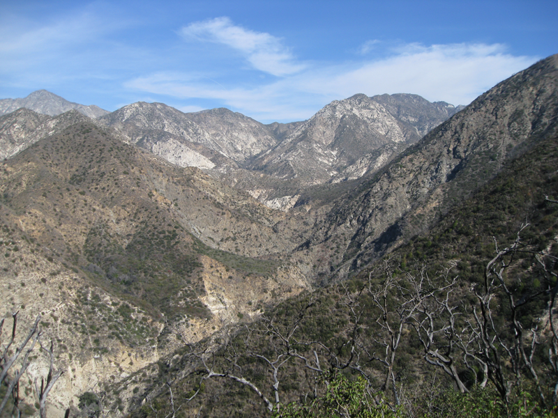
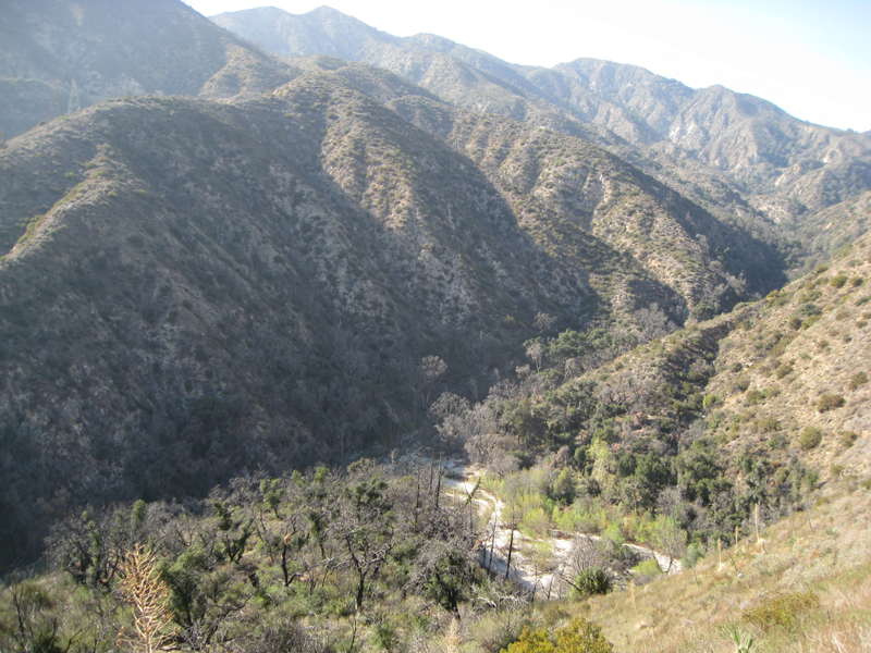
South fork of the Arroyo Seco, looking east towards Bear Canyon.
Easier stretch of the Ken Burton Trail, think looking up Long Canyon.
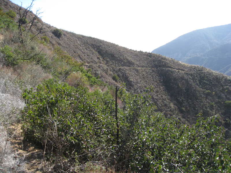
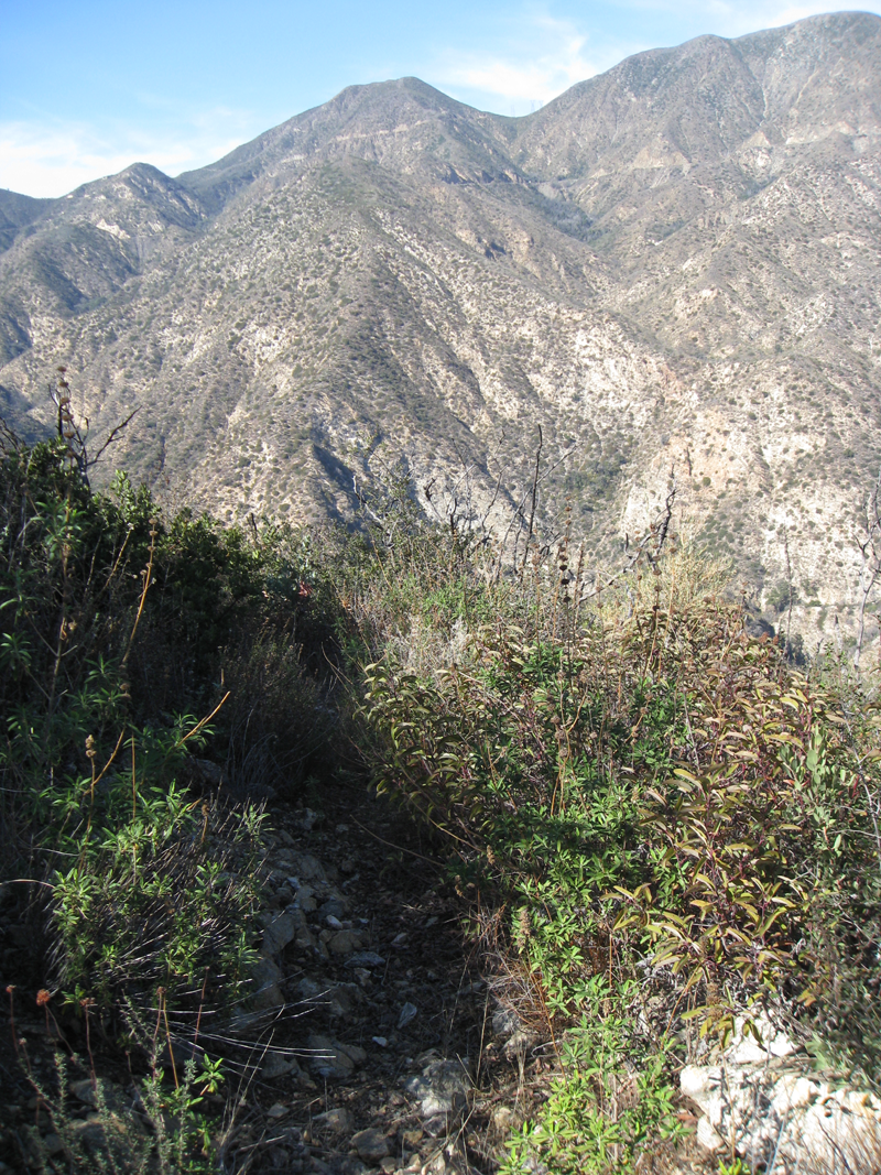
Traversing section of Ken Burton Trail between the trailhead and switchbacks.
'S' curve in Gabrielino Trail northeast of Oakwilde site.
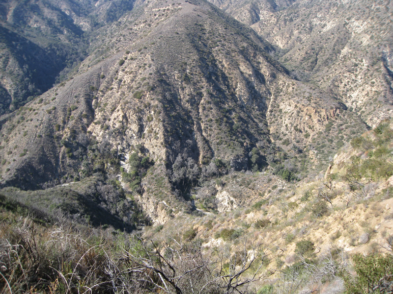
Toe of CCC Ridge, Dark Canyon to its left.
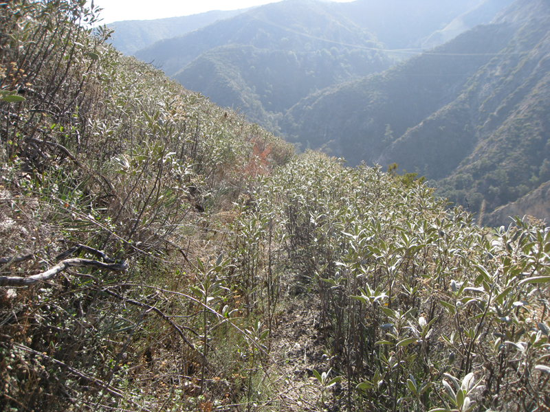
Another of the gentler, more passable sections of Ken Burton.
Bench just above Oakwilde, that I couldn't find a satisfactory route off of.
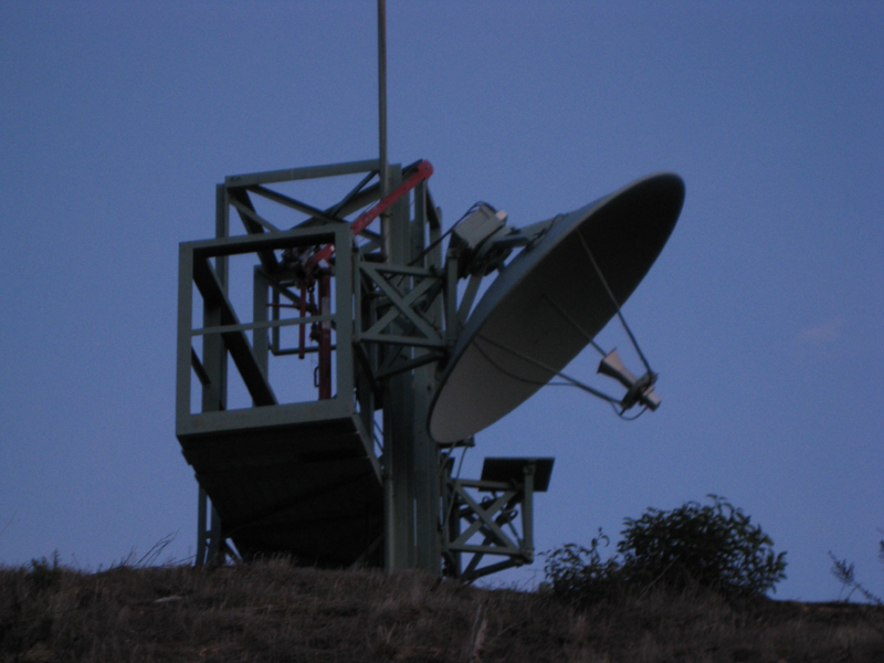
Very interesting piece of microwave telemetry. I assume Pasadena Water uses this to relay flow and/or control data from equipment in the Arroyo via the VHF stick up top.
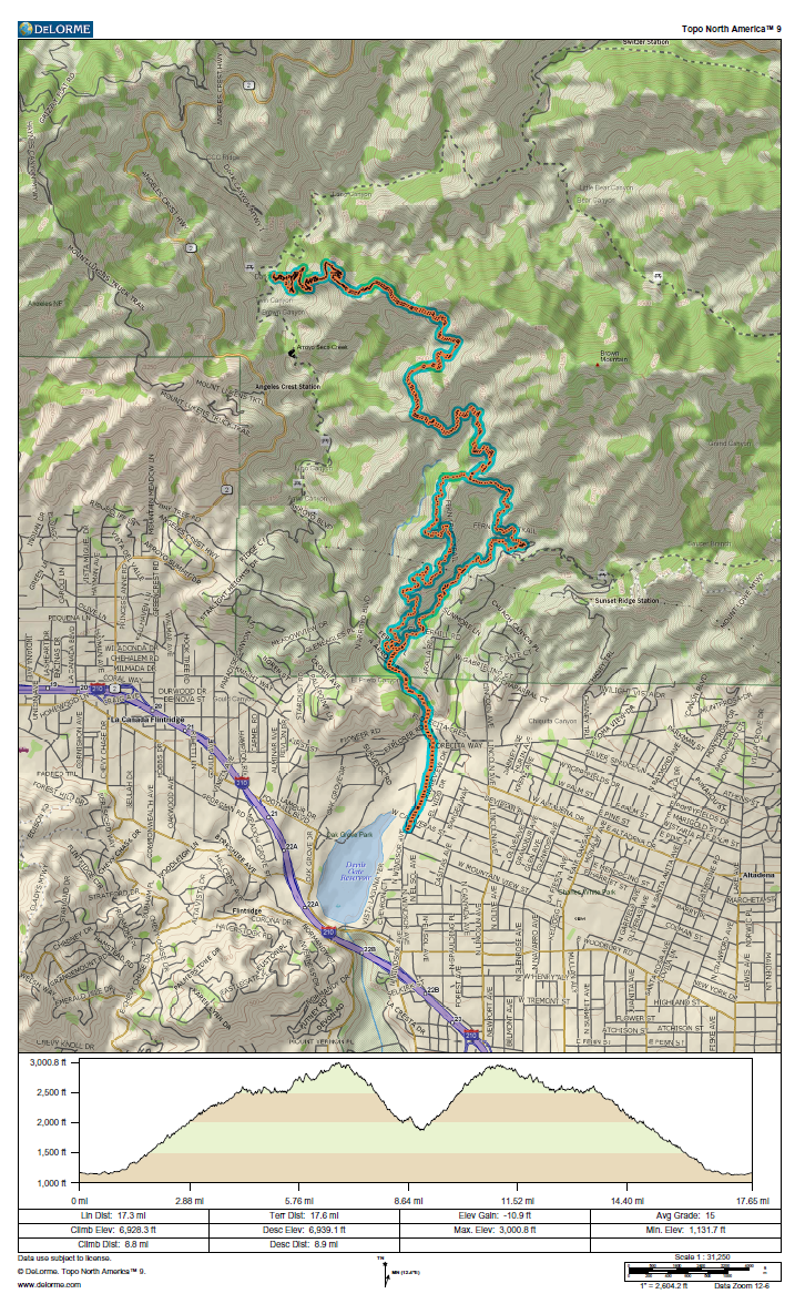
GPS track and elevation plot.