Sean wrote: outwhere wrote: So the original road that got washed out in the '38 flood was built on the bottom of the canyon right by the river?
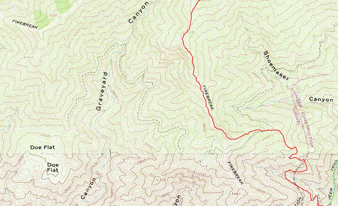
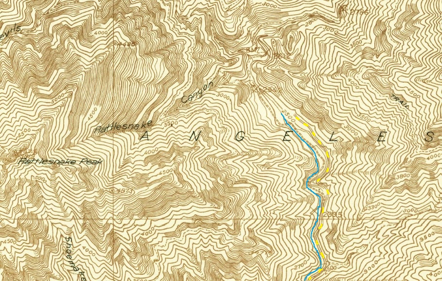
The original road was sometimes 50 feet or less above the stream. In the 1934 Camp Bonita topo it's depicted up to right before Rattlesnake Canyon. The map is a little hard to read, so I've color-coded the road with yellow dashes and the river with a blue line.

Very cool update Sean... thanks for this map too... it sparked my memory of the chunks of road on the east side of the river. Rivers, especially rivers in the mountains, sure add an interesting/beautiful dimension... they're so nice, i don't even mind the wet feet

Was hoping to find more info about this east fork road - and whamo, there ya go, happily stummbled into this...
Enter Shoemaker Canyon Road.
Summit Post by Travis
http://www.summitpost.org/rattlesnake-p ... ory/275276
Travis included/credits this Switchfoot link for some cool Shoemaker history !!
By Switchfoot - March 03, 2007
http://everything2.com/?node_id=1868467
There are many ridiculous things from the Cold War, backyard bomb shelters, duck and cover drills that would "protect" schoolchildren from a nuclear bomb attack, and then there are those that could have only been conceived from paranoia and government pork.
In the paranoia of the 1950s with the "looming threat" of a possible nuclear attack by the Soviet Union or its allies, concerns were raised to the lack of escape routes from Los Angeles. As a result, potential escape corridors were evaluated, one of those that was approved was a road in the San Gabriel Mountains that went through the East Fork of the San Gabriel River. The road would wind through the East Fork and connect with the Angeles Crest Highway near the small mountain community of Wrightwood, just 15 miles away from Interstate 15 and the Mojave Desert.
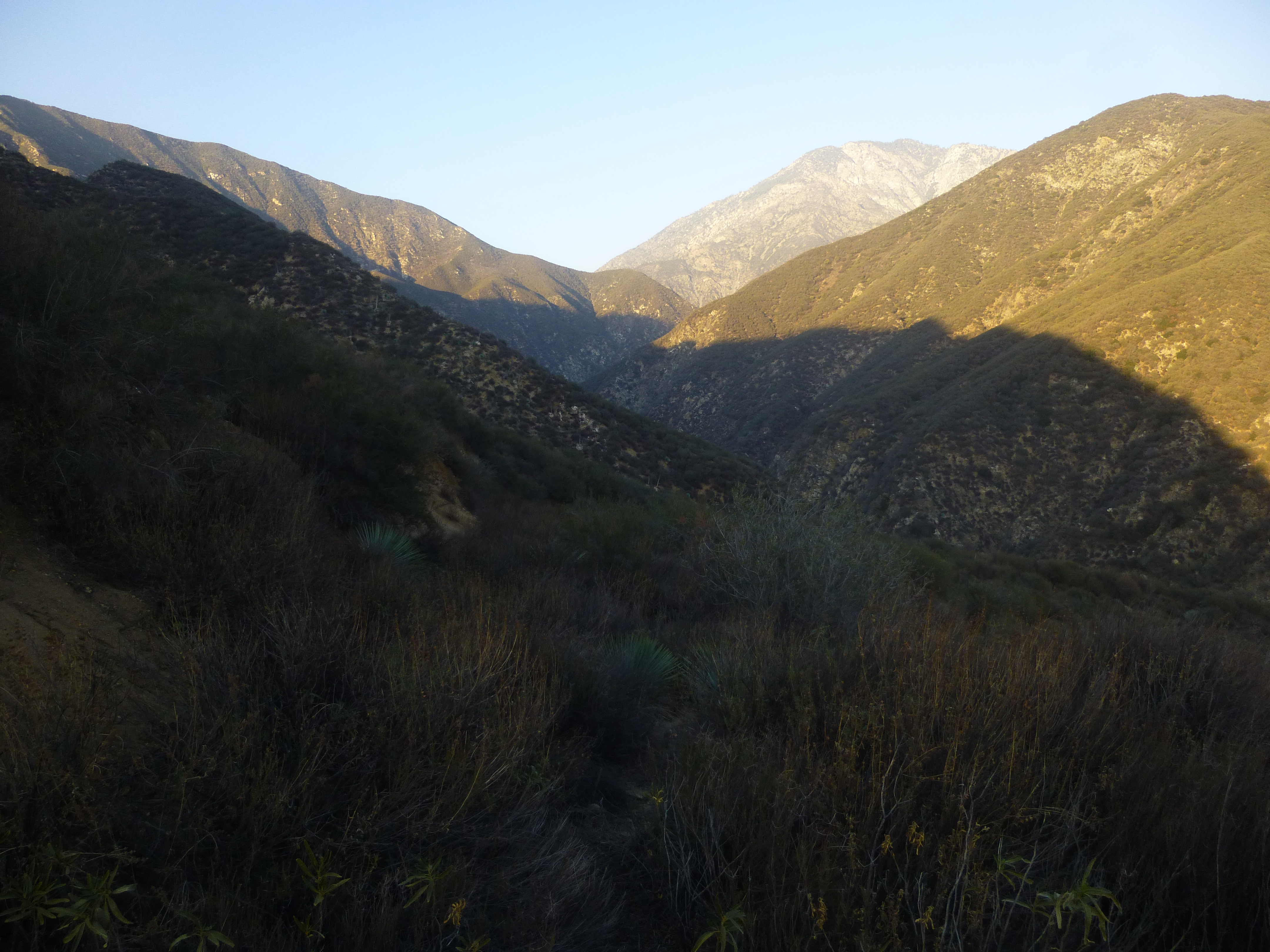
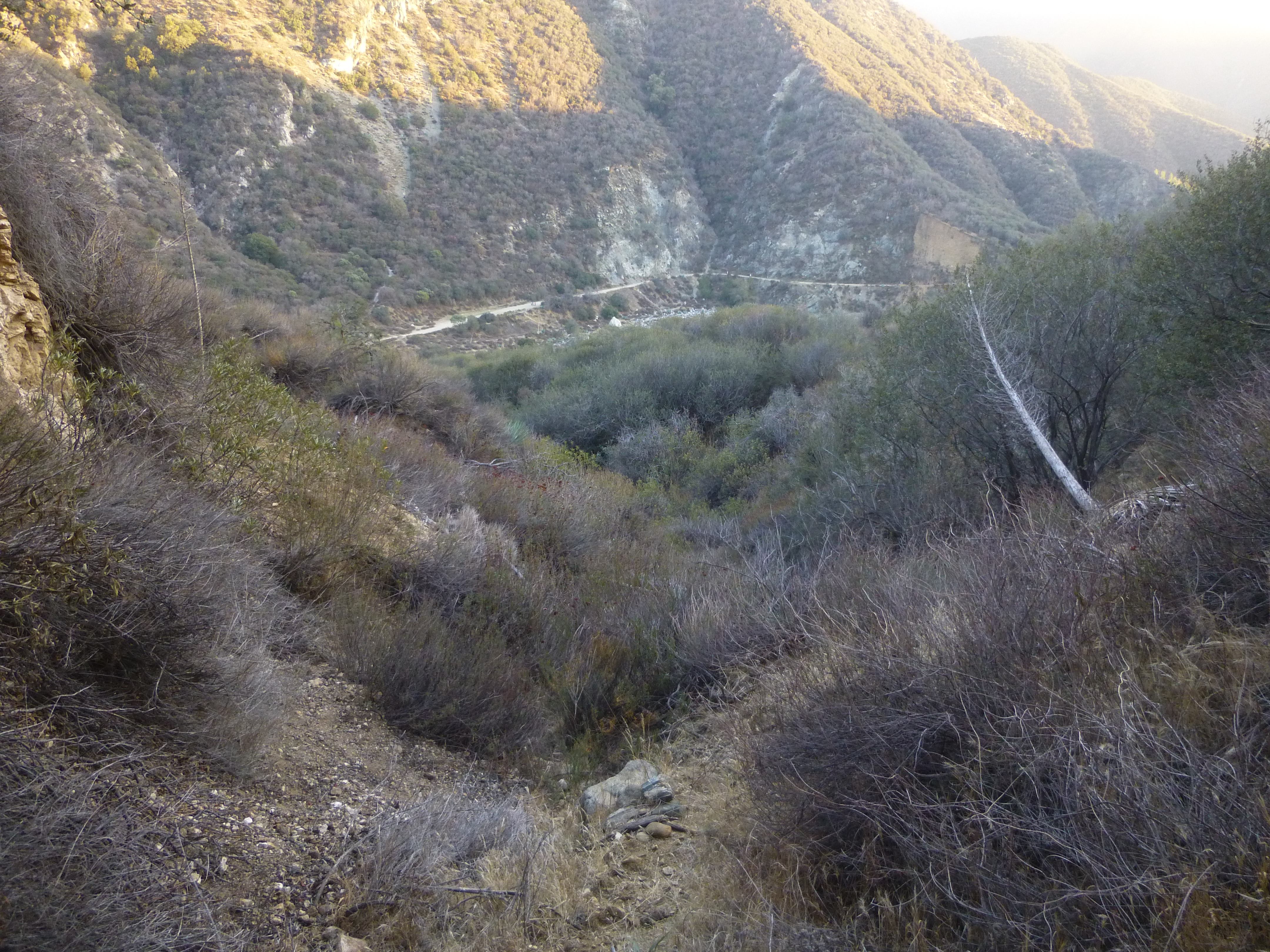
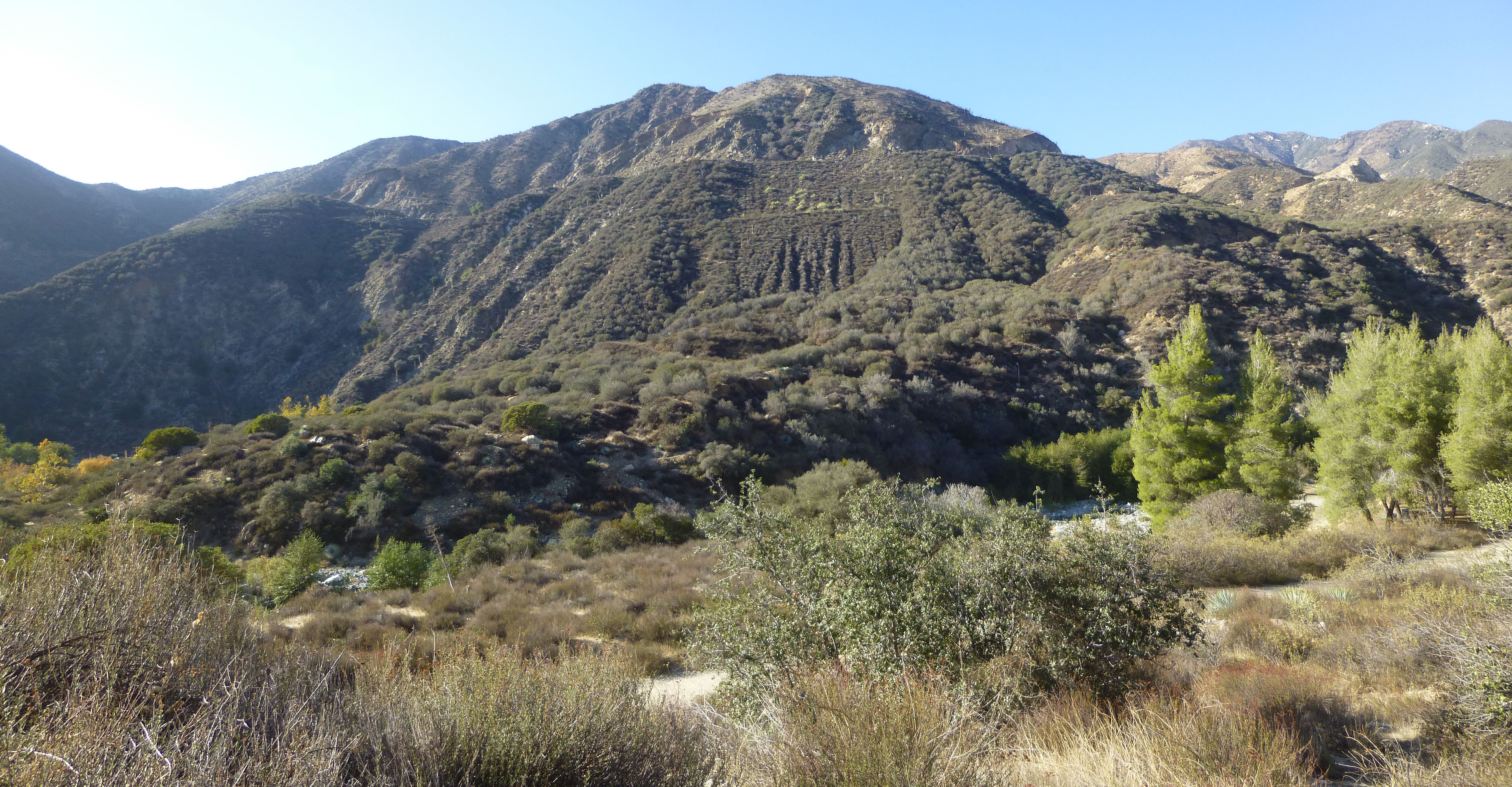
The idea of a road through the East Fork was not original, an earlier attempt had been made to make the community of Wrightwood more accessible to the people of the Los Angeles Basin in the 1930s. At the time, the San Gabriel Mountains were full of campers, hikers, fishers enjoying themselves and dozens of camps welcomed visitors who wanted to spend a rustic weekend. Today, much of the same is true, driving down the East Fork on a Friday afternoon one encounters people fishing on the side of the road or near their car sitting on the side of the road enjoying the lush canyon scenery, but there's still no road that grants direct access to Wrightwood through the East Fork for good reason—it's too difficult.
The East Fork contains some of the most rugged terrain in Southern California—hikes such as those to Iron Mountain and Rattlesnake Peak routinely rank among some of the most strenuous and difficult hikes in the San Gabriels—the river itself is also subject to violent flash flooding during storms. Unsurprisingly, the initial attempt to carve a road in the 1930s (which largely kept close to the riverbed) was obliterated in a large storm and the project abandoned, due to concerns about the stability of the area. Today all that is left is some crumbling evidence of the road bed and a beautiful 1930s-era concrete arch bridge that crosses the East Fork at the Narrows—the deepest gorge in Southern California—almost 5 miles away from the nearest road.
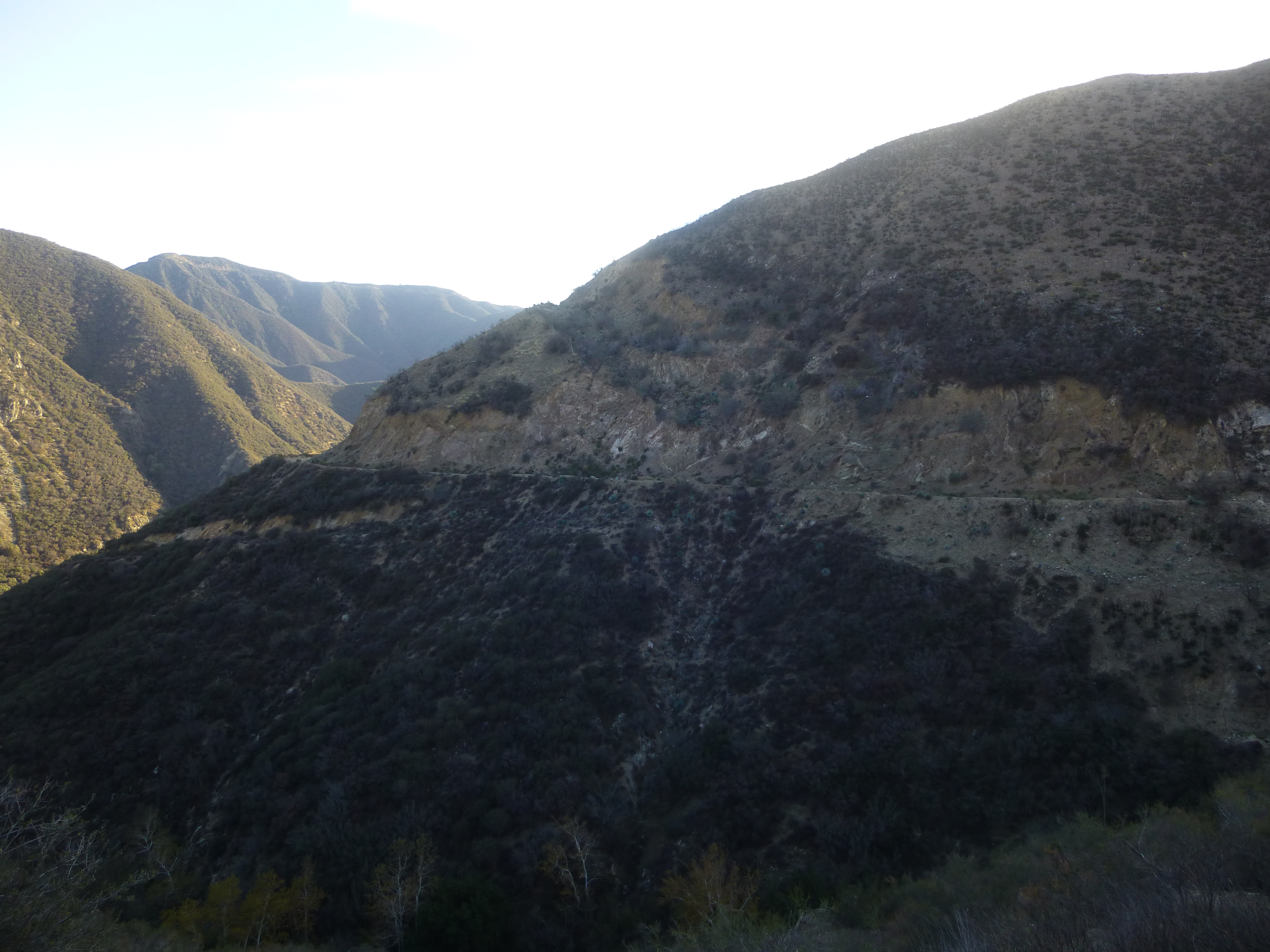
Despite the unforgiving terrain and past history, engineers decided to forge ahead using convict labor from the California Men's Institution in Chino, earning the road the nickname, "Convict Road". To avoid the potential washouts that consumed the earlier road, the new road was constructed high above the East Fork itself. The road starts at the lower end of the canyon at an elevation of approximately 1700" and was intended to join with the Angeles Crest Highway at Vincent Gap with an elevation of 6629". The terrain is so bad that in the 15 years of construction, from 1954 to 1969, workers only managed to complete 4.5 miles of work to an elevation of 2700".
By 1969, the lack of progress, budget constraints, and growing ecological concerns regarding the project lead to its demise and work was halted. Despite the abandonment of a road through the East Fork, it appears that the project had become absorbed into the vast California highway system as part of Highway 39. When Shoemaker Canyon Road was abandoned, the connection with Angeles Crest Highway was rerouted to Islip Saddle, more than 8 miles away from the original junction at Vincent Gap. The road opened in 1961, but the 6.2 mile section from Crystal Lake (a small camping area and lake) to Angeles Crest Highway has been closed since 1978 due to unremitting landslides. CalTrans seems to have an interest in restoring the section, but has been thwarted due to lack of funds.
Today, not much has changed. There is still no effective eastern access to the back ranges of the San Gabriels and Shoemaker Canyon Road remains little more than an odd historical footnote in the San Gabriels. It has become a popular day hike for people interested in local history or the simple curiosity of exploring a "Road to Nowhere".
Getting There
If you feel compelled to visit this odd, unfinished, and ill-advised piece of civil engineering…
Proceed north on Azusa Avenue (Highway 39) from the Interstate 210 or Interstate 10 exits
Continue on Azusa Avenue/San Gabriel Canyon Road for approximately 12 miles until one reaches the junction with East Fork Road.
Cross the bridge and proceed for about 3.3 miles until the junction with Shoemaker Canyon Road (there may be a small brown sign that says "Shoemaker Road").
Drive the 2 miles that are paved up to the locked gate and park in the dirt area around the gate.
What's Left?
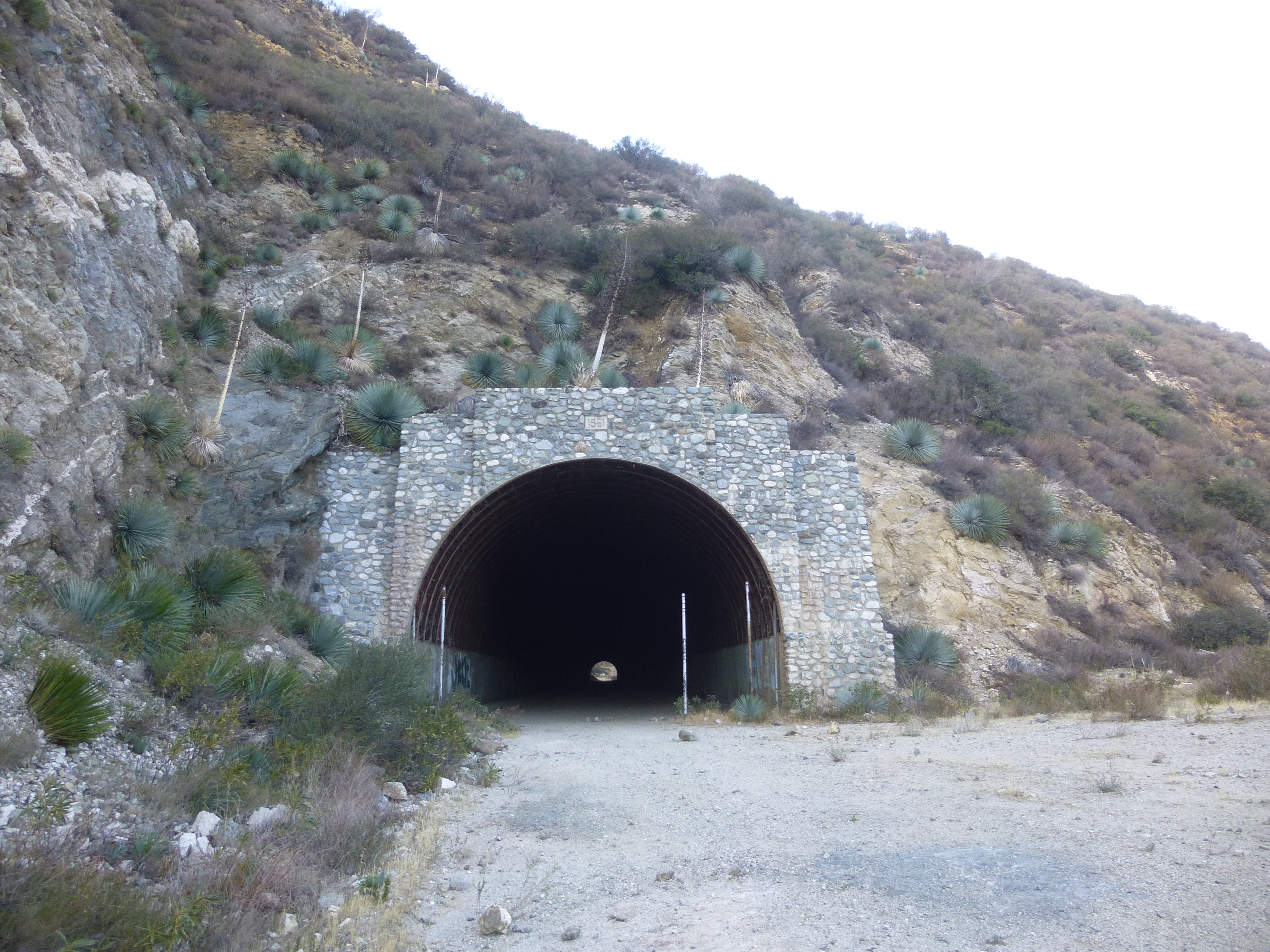
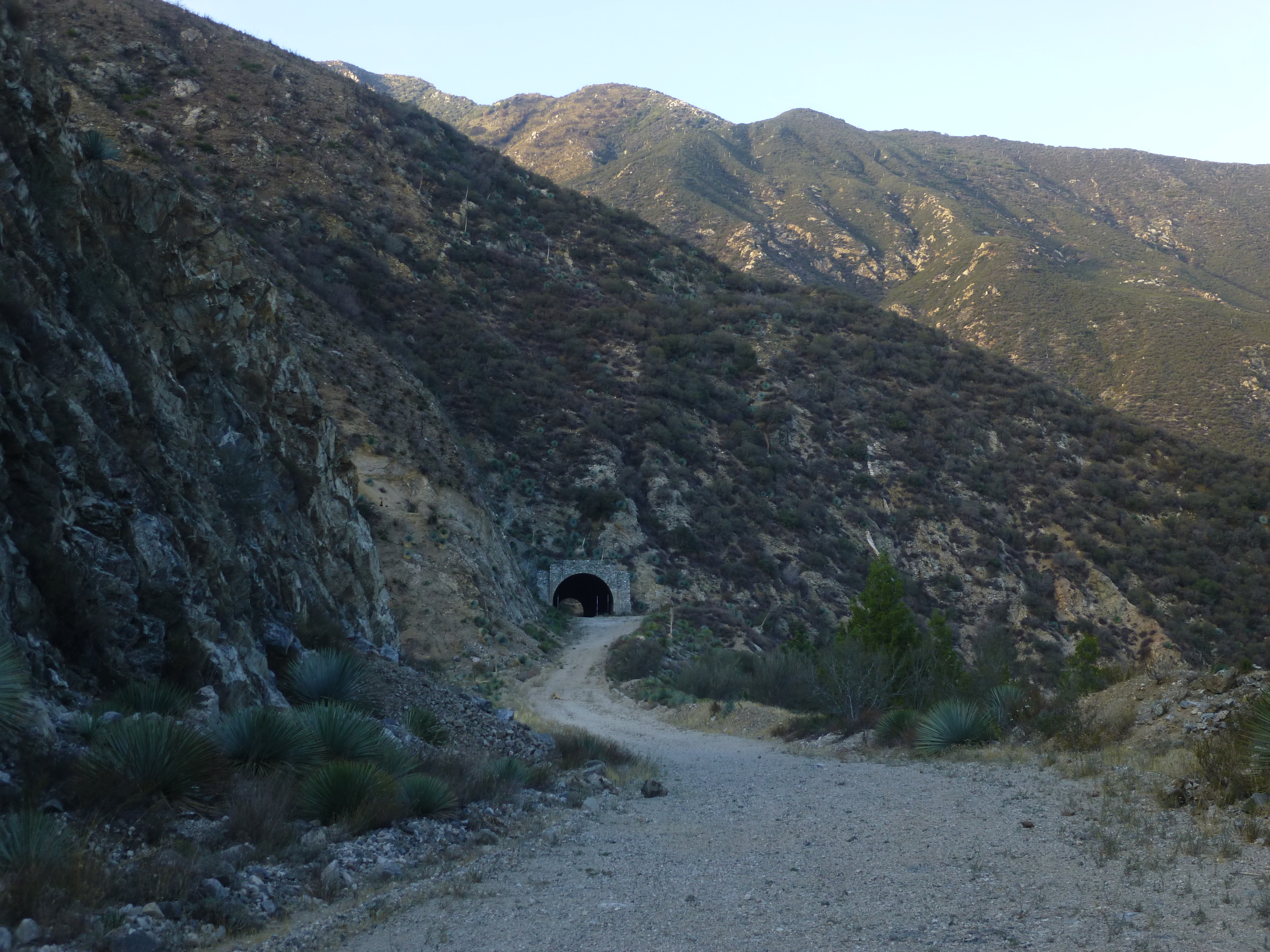
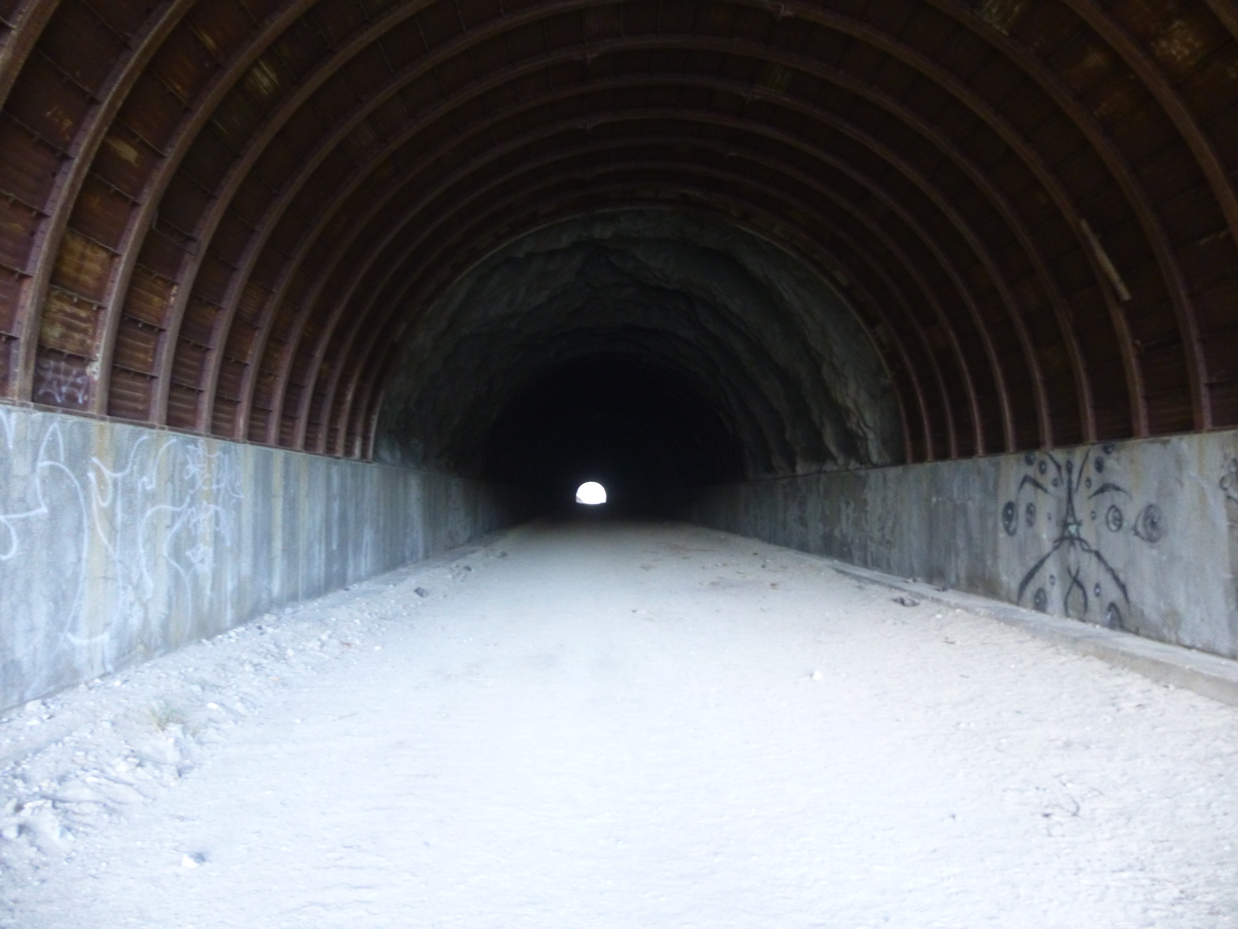
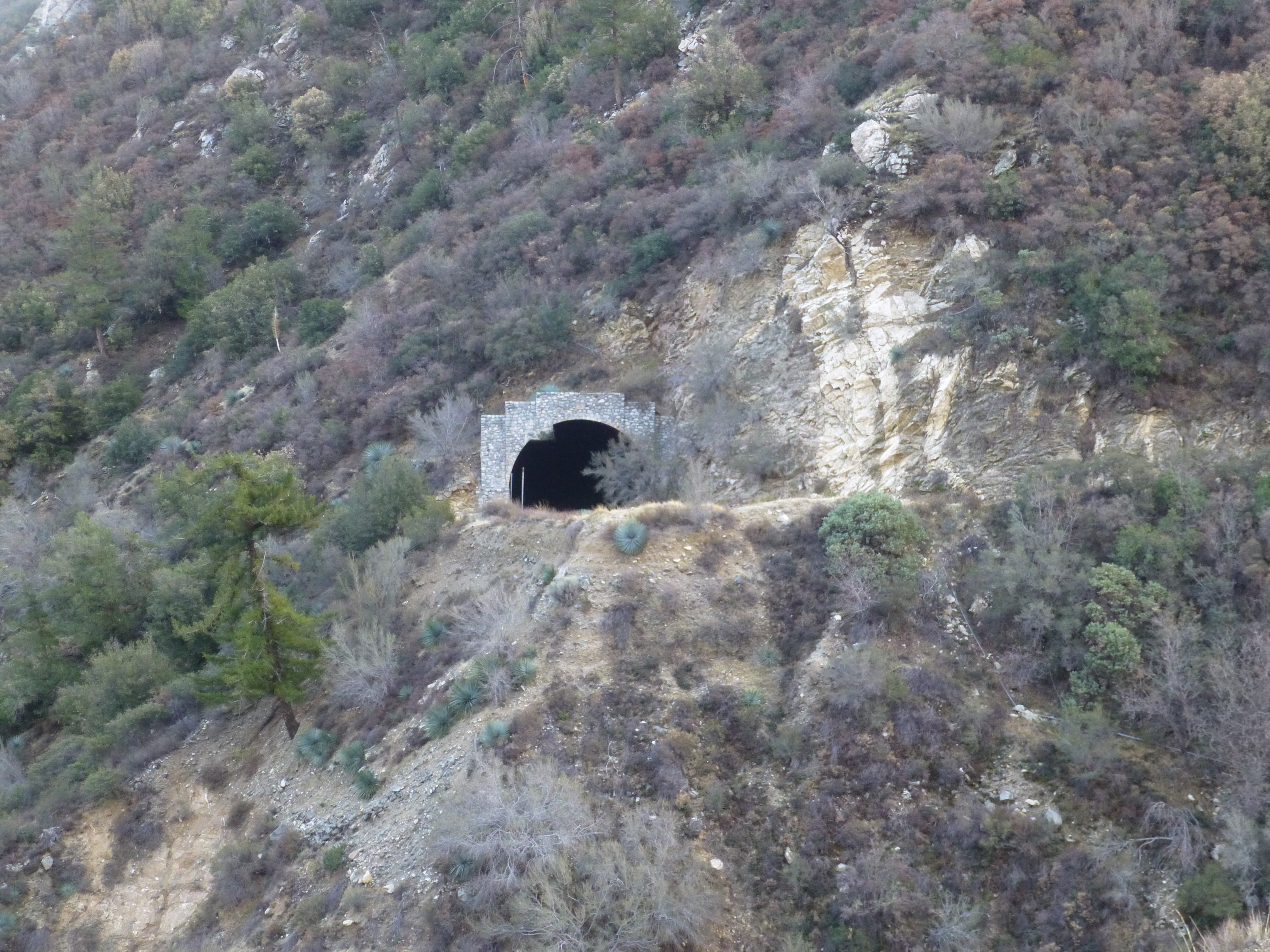
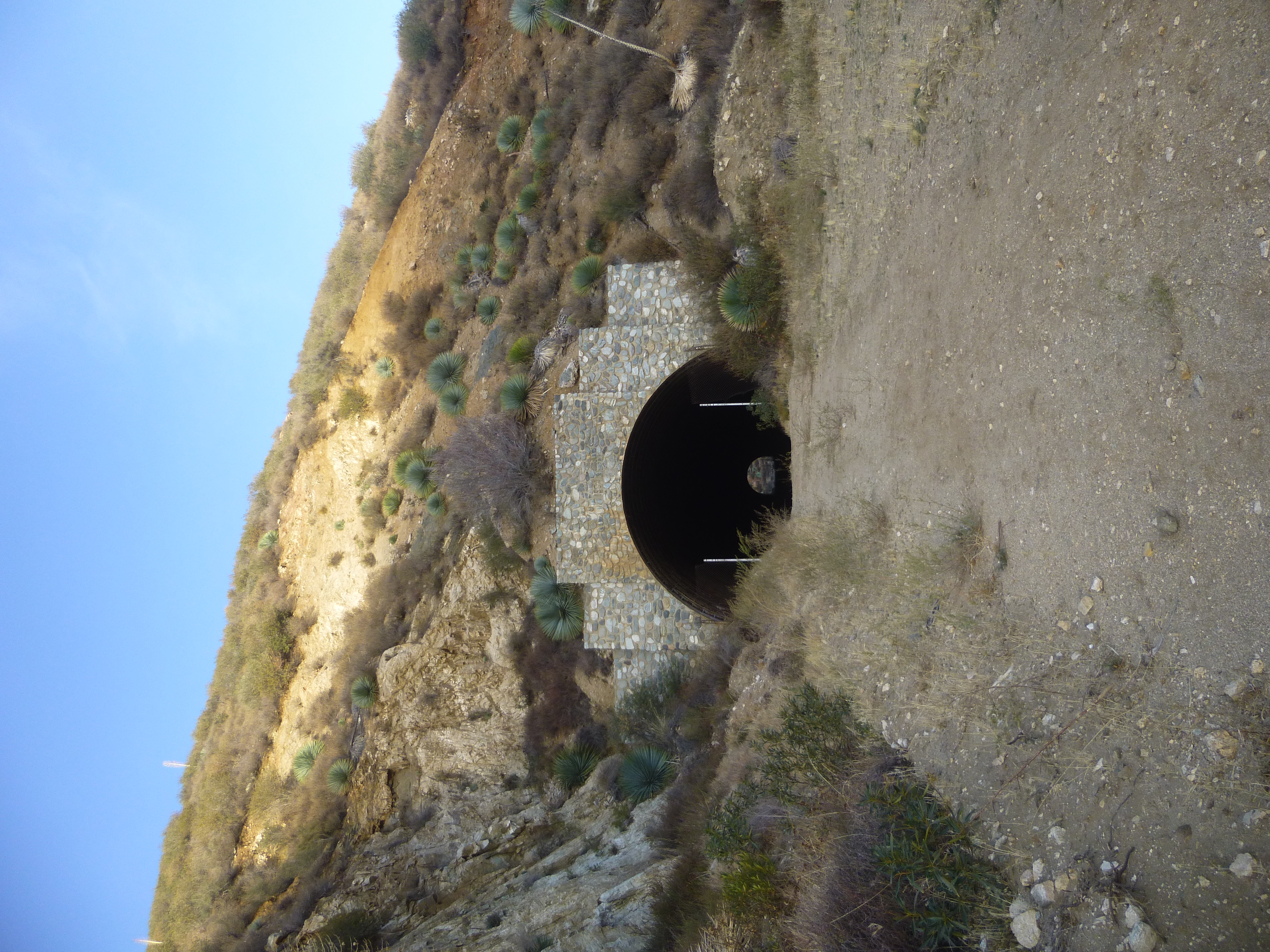
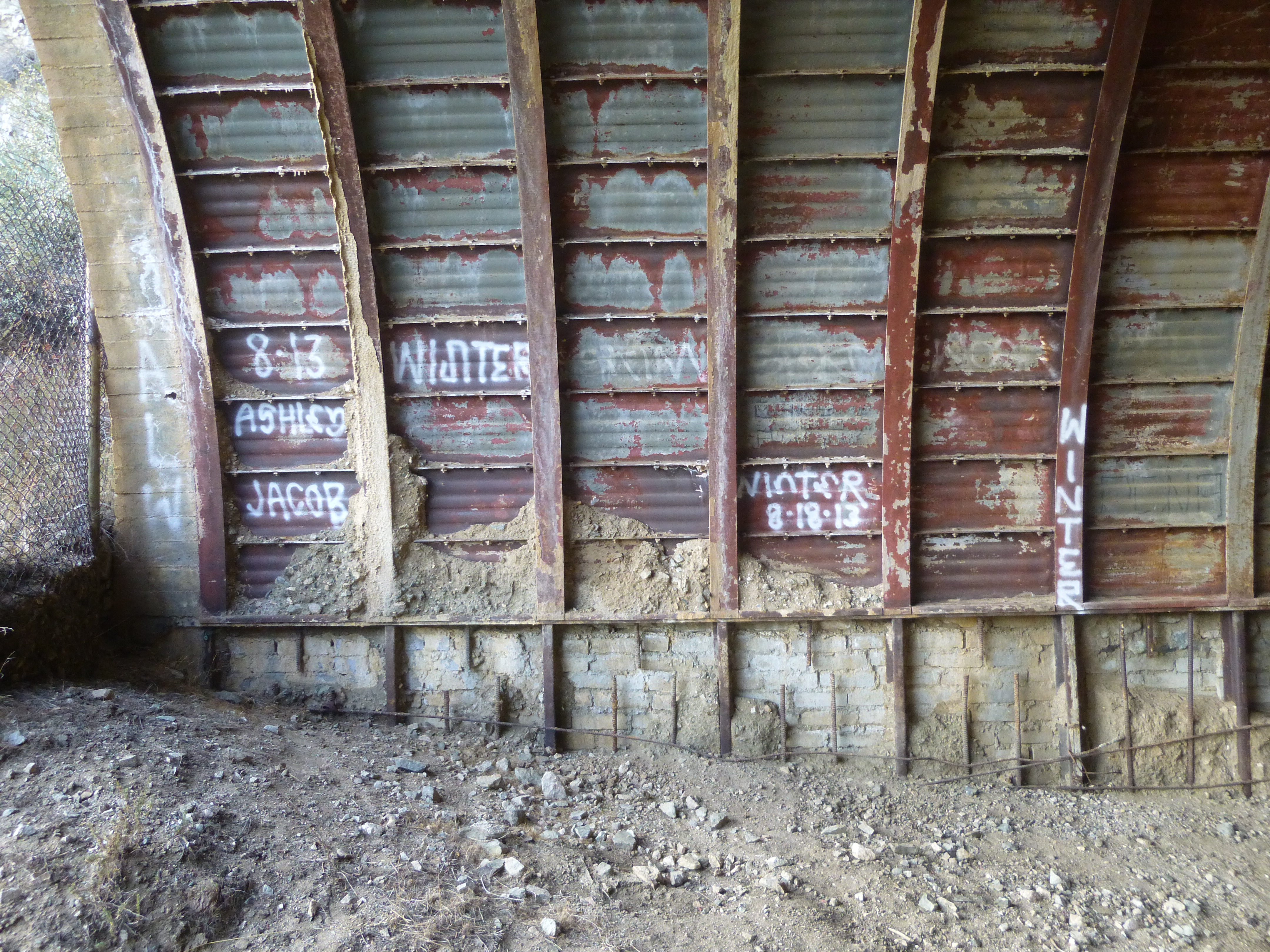
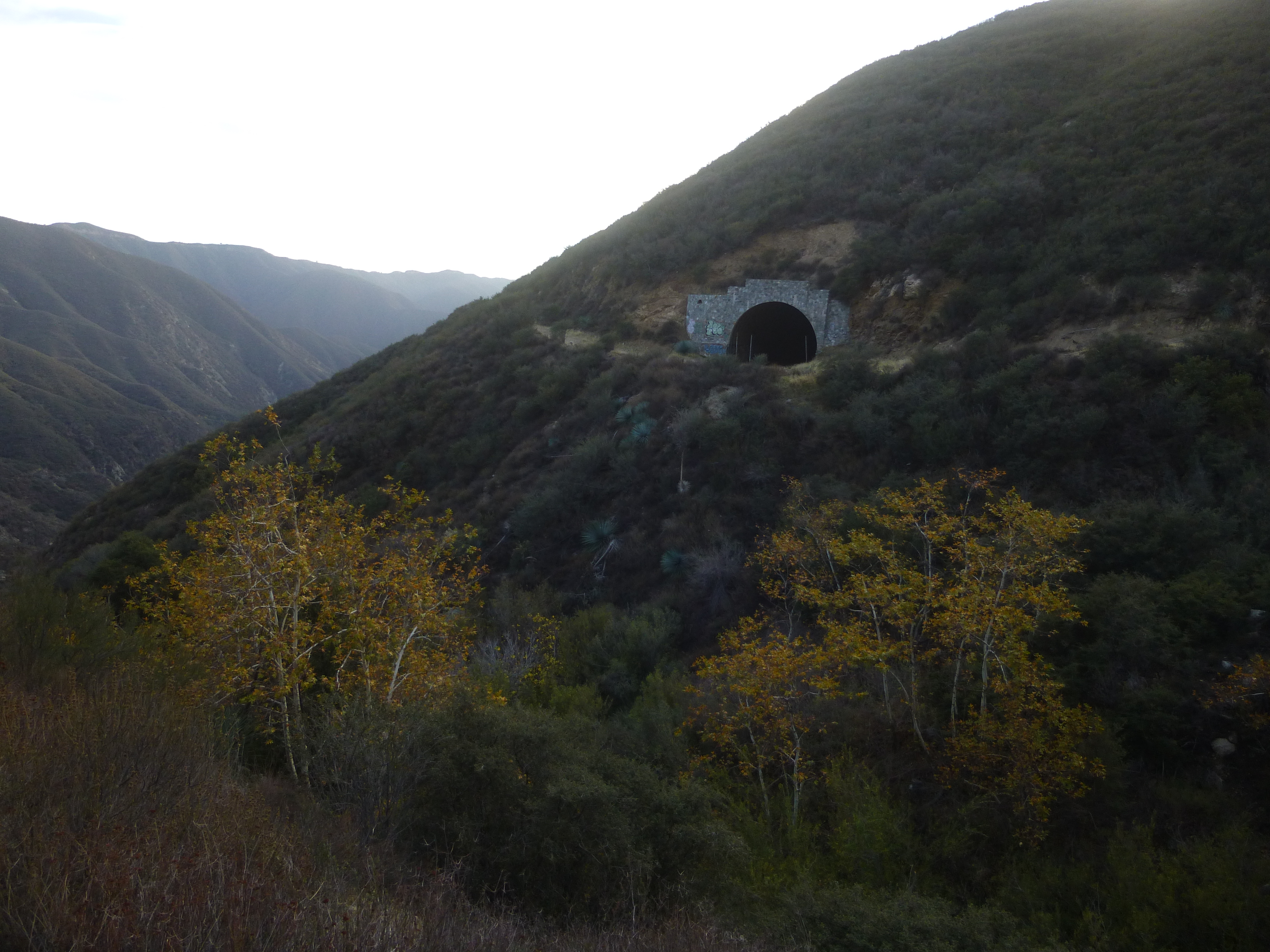
Aside from the two miles of paved, drivable road? Past the locked gate is an additional 2.5 miles of graded roadway and even two tunnels that were constructed: the first is about 1,000" long, constructed in 1961; the second is shorter at about 700" constructed in 1964. Upon emerging from the the last tunnel the roadbed suddenly stops. A footpath continues for a short distance afterwards, but all reports seem to indicate that the poorly maintained trail is hardly worth the bushwhacking necessary to navigate it.
Works Referenced
"Convict Road, The". wejc.com. 27 November 2006. .
Faigin, Daniel P. "State Route 39". cahighways.org. 2006. .
"Shoemaker Canyon Road, East Fork of the San Gabriel River" LocalHikes.com 26 November 2005. .
Simpson, Daniel E. "Shoemaker Canyon Road" Dan's Hiking Pages. 13 March 2005. .