Misc. News (Archive)

Rescues, fires, weather, roads, trails, water, etc.
User avatar
AW~
Posts: 2064
Joined: Mon Oct 01, 2007 12:00 pm

Post by AW~ »

Speed May Be Cause of Fatal Crash Near Claremont 4/17/13
http://glendora.patch.com/articles/upda ... -claremont
"The 21-year man killed in rollover crash on a rain-slick mountain road near Claremont was identified by today as Kyle Crampton, 32, of Chino Hills....The single-vehicle crash on Mt. Baldy Road at Mountain Avenue was reported around 10:40 p.m. Monday, said California Highway Patrol Officer Patrick Kimball. The victim was pronounced dead at the scene, he said....Light rain and excessive speed were likely factors in the crash, a CHP officer told a news photographer at the scene....The driver was headed downhill without wearing a safety belt and ended up pinned in the badly crumpled car, the photographer reported."

Two airlifted after crashes in OHV area in San Gabriel Mountains 4/14/13
http://www.sgvtribune.com/breakingnews/ ... an-gabriel
ANGELES NATIONAL FOREST - Two people were airlifted from the off-highway vehicle area in two separate incidents near San Gabriel Road and East Fork Road in the San Gabriel Mountains on Sunday, officials said.Los Angeles County Firefighter Sean Travis said the patients suffered limb fractures and were airlifted in separate incidents at the same location. Both incidents involved collisions between off-highway vehicles near the water's edge, he said.No further information was available on the condition of the patient
Note: This particular day was the off-road finals
http://www.facebook.com/pages/Azusa-Can ... group_id=0

Image
2013 Climb for Heroes @MtBaldy 4/14/13
http://heroes.convio.net/site/TR?fr_id=1040&pg=entry

Beware of Dog: The Little-Known Story of the Poodle-Dog Bush and Its Nasty Bite
http://www.rei.com/share/rei-blog/2013/ ... -bush.html
"...From a safe distance, I got a look at the beast during a recent visit to SoCal. Kerry Johnston, a botanist with the Angeles National Forest (which includes the San Gabriel Mountains and other wild terrain north of Los Angeles), showed me a spot where poodle-dog bush is flourishing. Here’s what I learned:....
REI: What do you know about the plant?
Johnston: The scientific name was recently changed to Eriodictyon parryi. Its old name was Turricula parryi. It is a sub-shrub, meaning it’s not a perennial—it’s not going to complete its lifecycle in 2 years. It’s not going anywhere right now. I’m assuming after the canopy closes and the shrubs start taking over, it will just die back. We’re just watching to see when. When is that going to happen? We work around it all the time, and it makes it difficult getting to all these planting units [where seedlings are being planted to restore the forest] because you’re trying to go around it and avoid it, and it’s made doing that really difficult...."

Paramount ticks test positive for Lyme
http://www.theacorn.com/news/2013-04-18 ... _Lyme.html
".....Paramount Ranch was one of three Santa Monica Mountains park sites that came back positive for Lyme disease in tests conducted by the Los Angeles County West Vector and Vector- Borne Disease Control District. The other two locations were Tapia Park and Malibu Creek State Park, both located within a short distance of one another.Robert Saviskas, executive director of the L.A. county agency responsible for conducting the tests, said this was the first year his agency tested for Lyme disease at Paramount Ranch, among approximately 12 sites tested within the Santa Monica Mountains. The first tick known to carry Lyme disease was found in the mountains in 1998.“We’re finding that about 1 or 2 percent of western blacklegged ticks in the area carry the Lyme disease bacteria, so it’s important for us to identify where the problem is occurring,” Saviskas said. “This particular tick is most active from late November through May.”

Historical from 2009:Of Telescopes and Ticks: How Mount Wilson Observatory Became an Infectious Disease Study Site
http://www.scientificamerican.com/artic ... -mt-wilson
"...Schwan agreed to run a DNA test on the ticks and confirmed that they contained the spirochete Borrelia hermsii. "With the vector and spirochete found in the very room where Larry was exposed," Schwan says, "I was convinced he had contracted relapsing fever."If it was true, Schwan realized, it would be the first new case of relapsing tick fever in Los Angeles County since the 1930s...."
link from article:
http://wwwnc.cdc.gov/eid/article/15/7/0 ... rticle.htm
".....A few vertebrate animals potentially involved with this focus were investigated. Douglas tree squirrels (Tamiasciurus douglasii), which are important hosts for O. hermsi ticks and B. hermsii spirochetes, inhabit the Sierra Nevada Mountains to the north but are absent from the San Gabriel and San Bernardino Mountains (9,24,25). Other sciurids, including the California ground squirrels (S. beecheyi), Western gray squirrels (Sciurus griseus), and Merriam chipmunks (T. merriami), are abundant on the observatory grounds. Several species of mice (Peromyscus spp.) are also found at the observatory. In 1947, Longanecker collected 90 O. hermsi ticks from an active deer mouse nest near Big Bear Lake (26). Many larval and nymphal ticks had recently fed, and some specimens were infected with spirochetes. Our serologic results suggest that brush mice (P. boylii) are involved in the enzootic focus on Mt. Wilson.Western bluebirds (Sialia mexicana) are also abundant around the observatory and nest in tree hole cavities. O. hermsi ticks have been found in bluebird nests in the Sierra Nevada Mountains and in British Columbia, Canada (26,27); these birds may also serve as hosts for the ticks in this site. Further work is needed to determine the role that these and other mammals and birds may play in maintaining the ticks and spirochetes in the mountains of southern California...."

Historical 2010: East Fork San Gabriel River 2010 Summary Report
https://nrm.dfg.ca.gov/FileHandler.ashx ... ntID=40820
A detailed 24 page analysis of fish in the East Fork SG river from Heaton upstream to Prairie Fork.With an average depth less than a foot, the river was calculated at 17 CFS. If you were way off on how many fish you thought were there before reading, I suspect you arent alone.
Fishies from page 12
Image
User avatar
AW~
Posts: 2064
Joined: Mon Oct 01, 2007 12:00 pm

Post by AW~ »

Vandals Target Los Angeles Area National Forests
http://www.zimbio.com/pictures/8ufloubs ... F4fSJGgPJV
The complete photo gallery of the Cucamonga canyon graffiti/thrashing thread

The Terrible Beauty of California's Powerhouse Fire
http://www.theatlantic.com/infocus/2013 ... re/100527/
"... a wildfire started in California's Angeles National Forest, north of Los Angeles, near a hydroelectric plant called as Powerhouse No. 1. The Powerhouse fire was pushed by erratic dry winds, destroying at least six homes near Lake Hughes, damaging many more, and leading to the evacuation of several thousand residents...."

Photo gallery sample:
Image

Campfires banned on southern PCT
http://www.pcta.org/2013/campfires-bann ... pct-12941/
"...The Bureau of Land Management, U.S. Forest Service, and National Park Service have released restrictions that essentially ban campfires along most of the Pacific Crest Trail south of Yosemite, even with a campfire permit. This is the southern 930 miles of the trail....BLM Fire Prevention Order Number CA-060-2013-01 establishes seasonal “Stage II” Fire Restrictions for BLM land along the PCT from the Mexican Border to Walker Pass/Highway 178 (PCT mile 651). The seasonal restrictions will run from May 15th through October each year...."

blogroll:
http://cucamongawilderness.org/
Developing blog of the Eastern section of the Cucamonga wilderness
".... Stonehouse Camp: Water flow GOOD (Updated: 6/20/2013)
Third Stream Crossing / Camp: Water flow GOOD (updated: 6/20/2013)
Commanche Camp: Water flow LOW (Updated: 6/20/2013)..."
older news:1N34 - San Sevaine Road - Closed
Date(s): Mar 17, 2013
Forest Road 1N34 (San Sevaine Road) is closed until further notice.

Mt. Waterman to open resort to cyclists
http://www.lacanadaonline.com/news/tsn- ... 4958.story
"After two dry winter seasons made skiing at Mt. Waterman all but impossible, owners of the facility in Angeles National Forest plan to open up their small mountain resort to cyclists next month.....Six bike trails, as well as scenic lift tours to the top of mountain, will be offered in the summer season starting in July, according to the resort’s Facebook page. The official opening date has not yet been confirmed.
Mt. Waterman will also serve food and drinks at the warming hut, located at the top of ski lift No. 1.Prices are $20 for a single bike ride or $40 for an all-day pass. A trip up the mountain without a bicycle will cost $10 for adults, $5 for seniors and children ages 7 to 12. Children six years or younger can get a lift up the mountain for free. Hours are Friday through Sunday, 9 a.m. to 4 p.m..."

Not using headlights on the ACH
http://www.lacanadaonline.com/news/tn-v ... 5277.story
"...June 19- Receiving stolen property: Angeles Crest Highway at Greenridge Avenue, 4 p.m. A 23-year-old Glendale man was pulled over for not using headlights in the Angeles National Forest. He was arrested for wearing a stolen "City of Los Angeles' Public Works" vest and driving without a license...."

Historical:Back-country rescue of wounded man took six weeks to complete in 1901
http://www.pasadenastarnews.com/news/ci ... z2XXEcgHPN
"Pine Flats, now known as Charlton Flats, looks peaceful in this photo by Ralph J. Wyatt.It is easily reached today by the Angeles Crest Highway. In 1901, Pine Flats was way in the back country requiring many miles of hiking or riding......They were scouting a canyon, looking for game. Ward heard a rustling in the underbrush, and fired, thinking it was an animal.It was Fred Buchanan in the underbrush.Fred had been hit in the neck and seriously wounded...."Camp Buchanan" where he lay for six weeks, partially paralyzed.Friends and family brought supplies by pack train. Information about his condition was sent to Pasadena by carrier pigeons and signal devices.Finally, after six weeks, it was decided he could be moved and he was carried for six days over narrow trails, camping at night. They rested several days at Sturdevant's Camp...At home, Buchanan seemed cheerful and regained the ability to walk although his left arm remained paralyzed.The Buchanans even threw a party for those who had helped, including such foods as rattlesnake salad and tenderloin of burro...."

San Gabriel Mountains Piper PA-18 N1256A 6/15/13
http://joeidoni.smugmug.com/Aircraft-Cr ... &k=KKBRN55
Finding crashed planes in the San Gabriels
User avatar
AW~
Posts: 2064
Joined: Mon Oct 01, 2007 12:00 pm

Post by AW~ »

MOUNT BALDY: Packing it in — on a mule
http://www.pe.com/local-news/san-bernar ... a-mule.ece
Youtube video: "Mount Baldy: Mules assist trailbuilders"
"...Jonathan Schultz, 50, of San Dimas, had been promoted as a mule skinner, but the worst thing he did to one Friday morning, July 19, was load it up with a couple hundred pounds of cargo. The other mule he brought to the trailhead of Ice House Canyon near Mount Baldy carried him. Two of the three horses he hauled to the trail also got pack loads. The other bore a rider that brought up the rear of the train.
Schultz laughed about the title.
“A mule skinner is one that works with mules,” he said, the spurs on his boots ringing occasionally as he walked around his trailer, prepping his animals for a journey up the trail. “It’s just a term the old cowboys used.”
Schultz had come at the request of Ben White, leader of the San Gabriel Mountains Trailbuilders, a 25-plus-year-old volunteer organization that helps improve and maintain trails in the San Gabriel Mountains. White said when a big project comes along involving the transport of heavy material into the forest, he calls Schultz....
This particular job involved carrying 57 wooden 4-by-4 beams and metal support materials one mile up the Ice House trail. The materials will be used to build a retaining structure called a Sutter wall above and below a section of trail that has chronic problems with slides. Schultz figured it would take several trips and most of the day to finish the work.
It’s slow work, just like it was in 1905 when the U.S. Forest Service was established...."

The Second Waterfall
http://www.pasadenamonthly.com/articles ... 2013-06-28
"...On a recent scorching hot sunday afternoon, three members of the Los Angeles Sheriff’s Department’s all-volunteer Altadena Mountain Rescue Team, Tom Afschar, Zach McFarland and Mark “Tak” Takahashi, took their weekly patrol deep into the heart of Eaton Canyon in the Angeles National Forest...One would think the insistence of authorities and the descriptions of Suen’s grievous injuries in the news media would have had some dissuading effect on hikers.
They have not.
“We are still up there all the time,” Takahashi said. “At least once a week. At least.”
Just two days before the team’s rounds, in fact, world-renowned rapper The Game and several of his friends attempted to find the second water- fall-only to get lost. The Game was able to find his way to safety, but one member of his crew was not. Pasadena Fire Department helicopters were called to locate the man, and with their help, McFarland and other rescuers hiked in and escorted him to safety, unharmed.
There were 14 rescues like this one in Eaton Canyon in the first four months of 2013 alone -accounting for more than half of all AMRT’s operations. Twenty hikers have been plucked from the canyon, seven of whom were injured. According to Afschar, a single rescue helicopter costs taxpayers nearly $4,000 per hour for an operation.
There is no truly safe passage to the second waterfall, but hikers who get into trouble usually do so in one of two fashions: They lose their way, or they fall victim to “the Nub.”.....The Nub is a narrow gap in the Razorback Trail where hikers have little more to cling to than a sheer, decomposing rock wall. For hikers with no rock-climbing experience, the only apparent way to navigate the Nub is to hug the rock face for dear life and shimmy as delicately as possible from side to side. Lose your footing or panic and it’s 120 feet straight down to the canyon floor....
Back on patrol in Eaton Canyon, Afschar estimated that nearly 20 people climb to the second waterfall on a busy day-even after Suen’s death. “We’ve had people pass us on the Razorback in the middle of a rescue,” Takahashi added. “Ultimately, you can’t save people from themselves.”
Indeed, as word of the danger spreads, the allure of the second waterfall may only be growing.
“We’ve put signs up before,” Afschar explained. “They get taken down or vandalized. We recently put up several signs up on the ridge where the deaths occurred. They were gone within three weeks.” ....."

Marijuana bust in Los Padres National Forest: 3 arrested
http://abclocal.go.com/kabc/story?secti ... id=9179728
"Three Kern County men have been arrested following a major marijuana bust in Ventura County. In May, a Ventura County sheriff's helicopter and narcotics detectives found several large marijuana cultivation operations in the Los Padres National Forest, along the north slope of Pine Mountain. Since then, more than 55,000 marijuana plants from seven illegal growing operations have been confiscated. The street value of the seized plants is estimated at $165 million..."

Beachcombing: Southern California's geologic history, as told by the sand on our beaches
http://www.scpr.org/news/2013/07/15/381 ... s-told-by/
"....The sand on beaches between Point Dume and Redondo Beach comes in part from the San Gabriel Mountains: silvery mica, milky quartz, whitish-gray granite with flecks.“Sediment that’s derived from granite type watersheds is generally comprised of a lot of quartz,” says Orme. “It tends to be light in color.”
...."

Surviving in "Extreme" Conditions
http://quantumfrontiers.com/2013/07/22/ ... onditions/
"....This morning I woke up and looked at the Mt. Wilson horizon and decided to drive up there. I left my morning ballet class early to make time for the drive. The road to the observatory is not simple. HWY 2 is a pretty serious mountain road and accidents happen on it regularly. This is the first thing: to have access to observatories, I need to be able to drive there safely and reliably.
Fortunately I love driving, especially athletic mountain driving, so I am looking for almost any excuse to drive to JPL, Mt. Wilson, and so on. I’ll just stop, by saying that driving is a hobby for me and I see it as a sport, a science, and an art.
The first portion of the 2 is like any normal mountain road with speeding locals, terrifying cyclists and daredevil motorcyclists......
The first thing visitors see is the Cosmic Cafe. It has a balcony going all around the cafe with a fascinating view when there is no smog or fog. Last April, Caltech had its undergraduate student Formal here. We dined at this cafe and had a dance platform nearby. Driving up here, I could not help thinking how risky this was: 11 high-rise buses took a large portion of the Caltech undergraduate student body up to the top of this mountain in fog so dense we could barely see the bus ahead of us. The bus drivers were saints. Hiking or running shoes are the best shoes to wear here, so I cannot imagine how we came here in suits, dress shoes, tight dresses, and merciless heels.....
I parked at the first available lot, right in front of the cafe and near some large radio towers. When trying to lock my car, I had some trouble. I have an electronic key which operates as a remote outside the car. The car would not react to my key and would not lock. I tried a few more times and finally it locked. I figured the battery in the key was dying, but that didn’t seem right. If any battery were dying, it would be the battery in the spare key that I am not using.
I walked around a bit to take some pictures and came upon another parking lot. This one was full of Ferarris. It turns out that today was a Ferrari Club field trip to the observatory and the happy Ferrari owners were getting a tour of the domes.....
I went back to my car and realized that I could not open my car no matter how much I tried. ...This wasn’t going very well.
Fourth thing: if you’ve spent enough time in lab and on problem sets, you know that despairing is very useless. So, I did not despair and went to the domes to find the Ferrari group. I figured that their tour guide would have a radio so I could at least make some contact with the people down below the mountain — there is no phone reception on Mt. Wilson.
I found the Ferrari group and hopelessly showed my key to them, explaining that I thought my key battery had died. They glanced at my non-Ferrari key and moved on. However, their guide was very helpful and said he did not think it was the battery.
Earlier a Porsche-driving visitor had a similar problem. He figured out that the radio towers were causing too much interference with the key’s signal to the car’s receiver. This made sense! Fifth thing: things we learn are actually applied in real life and often in very practical and non-abstract ways!...."

David Wu’s Angeles Crest Ride
http://whiteowlscyclingblog.blogspot.co ... -ride.html
A serious contigent of cyclists ride up from Duarte to the ACH and back through Hwy39...passing the ferraris at the bottom of the ACH.
Image

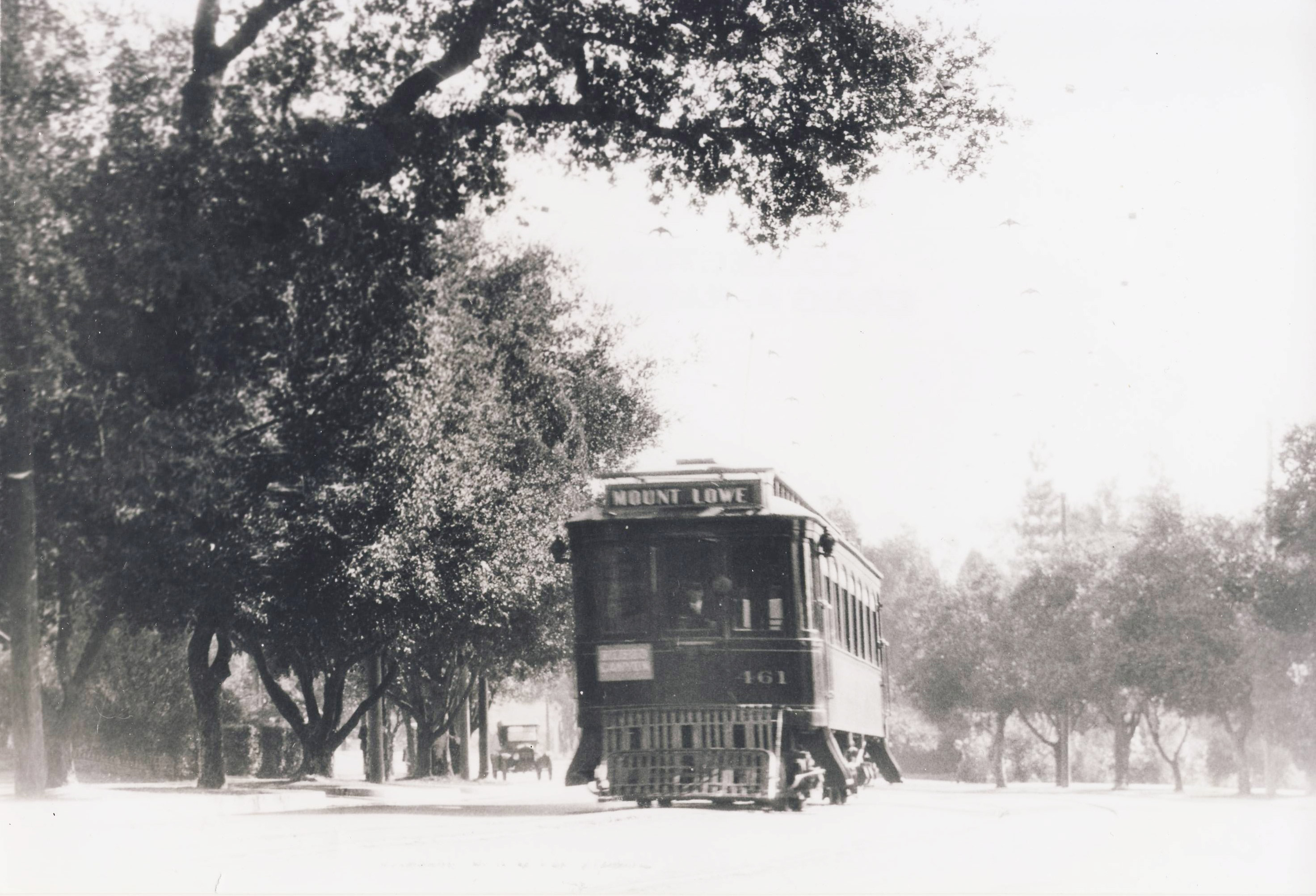
Historical image: 461 Heads to Rubio Canyon
http://www.pacificelectric.org/pacific- ... bio-canyon
Image
User avatar
AW~
Posts: 2064
Joined: Mon Oct 01, 2007 12:00 pm

Post by AW~ »

This weeks news was all historical

Film:Baldy for the Blind(2010)
http://www.baldyfortheblind.com/about-the-film-5/
"BALDY FOR THE BLIND is the story of 11 blind students attempting to summit the highest peak in Los Angeles County. "

Mt Baldy summer ski jump (status:destroyed)
http://www.skisprungschanzen.com/EN/Ski ... Baldy/748/
A few pictures of a plastic ski jump that used to exist at Manker Flats.

MOUNT BALDY'S REAL NAME IS MOUNT SAN ANTONIO
http://museumsanfernandovalley.blogspot ... t-san.html
Picture of MtBaldy's summit with unlisted date...but heck of an old photo.

Mount Lowe, California, circa 1913. "Electric car at Ye Alpine Tavern, Mount Lowe Railway
http://www.shorpy.com/node/9389?size=_original
The uniqueness of this particular photo is its LARGE size.

The Monte Cristo mine
http://www.millsite.com/
Detailed history of Monte Cristo

Angeles Forest Highway Reconstruction Project, Los Angeles County
http://www.roadsbridges.com/angeles-for ... les-county
An extremely detailed posting about the resurfacing of the AFH.
"....The road exhibited significant pavement distress. With an average pavement condition index (PCI) of 47, the road seriously needed to be rehabilitated, according to Imelda Diaz, P.E., with the Los Angeles County Department of Public Works and head of the county’s pavement-management unit. In an effort to improve its performance, in the summer of 2011, the county debuted its first-ever cold in-place recycling (CIR) project, which earned a Roads & Bridges/Asphalt Recycling and Reclaiming Association Recycling Award......The lead unit was the milling machine, a Caterpillar PR-1000 with a 12.5-ft-wide, down-cut milling head. Unlike most of today’s milling machines, the PR-1000 is rear loading, “which is pretty unique because they don’t make rear-loading machines anymore,” Emerson told Roads & Bridges. (PRS owns six rear-loading milling machines.) Three inches of existing pavement were taken off the top, intended for recycling as the new base course for the roadway since the subgrade was still strong..."

Tectonics and Topography in the Transverse Ranges: Landscape response to increasing rock uplift rate across the transition from soil-mantled to rocky slopes
http://www.public.asu.edu/~kwhipple/c_tect_topo.htm
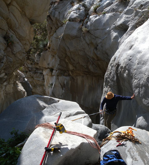
OK I only mentioned this because the photo for this study is that of Great Falls of the Fox rap1.
Image

blog: http://mtwilsonmtbadventure.com/
This company offers shuttle service(incl mtn bike) to MtWilson...listed at $15 per person, min 5 people from JPL.

Misadventures on a Mountain 11/4/13
http://www.withlove-rachel.com/2013/11/ ... ntain.html
"....At some point, around 7:30 pm, an hour after the sun set, we found ourselves hobbling down Mount Wilson with only a cell phone and small headlamp for light. We hadn't seen another human for at least 2 hours, my toes felt as though a hammer were smashing down on them with each step, and we were both exhausted and discouraged, maybe too exhausted to pay too much attention to the steep drop down the side of the mountain that lay beyond the darkness of our small beams of light.

"Do you think we should be worried about mountain lions?" C asked?
"The thought crossed my mind. I hope not. Maybe our flashlights scare them. I guess the best we can hope for is using our poles as defense," I responded.

How the hell did it come to this?..."
User avatar
cougarmagic
Posts: 1409
Joined: Wed May 07, 2008 5:21 pm

Post by cougarmagic »

Thanks for the ANF news update as always.

I like to see detail described about the road. It's not just about how fast you can go on a motorcycle. Realize that human beings just like us are working to find good solutions to problems in this very difficult place. (by the way, if you have a problem with it, use your own feet to get there...)
User avatar
VermillionPearlGirl
Posts: 239
Joined: Wed Apr 06, 2011 9:57 am

Post by VermillionPearlGirl »

This is consistently one of my favorite parts of this board.

And in other news, this happened:
http://www.latimes.com/local/lanow/la-m ... z2kTrycVWs
User avatar
AW~
Posts: 2064
Joined: Mon Oct 01, 2007 12:00 pm

Post by AW~ »

Ride Report: Ken Burton Trail 11/12/13
http://dfishdesign.wordpress.com/2013/1 ... ton-trail/
Image
"....One of these trails was the Ken Burton tail. Perhaps never loved as it’s siblings El Preito or Sunset, it was still part of the intricate web that made up the endless miles of trails. Along with some friends I climbed to the summit of Brown Mountain and dropped into the Ken Burton Trail, only to find it overgrown and beyond disrepair. We hiked and hacked our way down for three miles of overgrown brush. Working our way down to the Secco Arryo we continued to hike our bikes along the riverbed. After what seemed like endless hours of hiking our bikes, wrong turns, and being ripped to shreds by yucca plants we managed to clear the debris damn and finally ride our bikes....."

Cloud seeding, no longer magical thinking, is poised for use this winter
http://www.sacbee.com/2013/11/11/589898 ... rylink=cpy
"As California concludes a second drought year and water managers hope eagerly to avoid a third, utilities across the state are poised for that first mass of pillowy gray clouds to drift ashore from the Pacific Ocean.....California has been seeding clouds for at least six decades. The first couple of decades were experimental, but since then it has been routine practice for a number of water agencies and hydroelectric utilities. In any given winter, there are cloud-seeding projects underway in 15 California watersheds, from Lake Almanor in the north to the San Gabriel River in the south. Most were up and running for the season as of last week, ready to take advantage of the first cold storms...."

{untitled}
https://plus.google.com/106910649342277114605/posts
Photo gallery of post-Station Fire graffiti at the Big Tujunga River at Stoneyvale/Wildwood

'Zen' amidst graffiti
http://distilleryimage10.s3.amazonaws.c ... 9d45_8.jpg
Image

A Visit from the Hulk 11/14/13
http://www.crescentavalleyweekly.com/ne ... isit-hulk/
"....Ferrigno is a well-known actor who portrayed the Hulk from 1978 to 1982 in the television series, “The Incredible Hulk;” however, for the last eight years, he has been a reserve deputy with the Los Angeles County Sheriff’s Dept....“We were called out to two motorcycle accidents but were canceled,” Leum said. However the team did stop to assist a U.S. Forest Service officer who had stopped 10 hunters. They were, of course, armed with firearms. At times, this type of situation can become tense.
“I think the officer was glad we were there,” Leum said. Especially when he realized one of the supporting officers was Ferrigno...."

Officials plan test of Azusa early warning siren 10/25/13
http://www.insidesocal.com/sgvcrime/201 ... ing-siren/
".....Police are teaming up for the exercise with a group of local volunteers known as the Azusa Amateur Radio Communications Emergency Services, Fleming said. The group exists to provide emergency communications in the event of a disaster.“The siren is intended to evacuate residents in close proximity to the mouth of the Canyon in the event of a forest fire of flood,” Fleming said. “It is not expected that all residents would hear the siren if indoors, which is why the siren is complementary to emergency response personnel announcements, as well as door-to-door notification as part of the city’s emergency response procedures."

Forensic Geology: Paper Balloons and Sand
http://www.hgs.org/node/5272
"The bit chatters and the cuttings come over the shaker covered in sticky brown drilling mud. After washing off the mud, the bits of Pliestocene alluvium from 900 feet below North Hollywood in California’s San Fernando Valley glisten in a multitude of colors and shapes. The angular rock fragments were sourced from the exposed hard rock formations in the surrounding San Bernardino, Santa Susana, Verdugo, and San Gabriel Mountains. These source rocks include the grantoid Palm Canyon Complex, the Mendenhall Gneiss, and the Lowe Granodiorite. This unique assemblage of rock fragments is characteristic of this location and only this location. Expert analysis of this handful of alluvium would be able identify the the exact location of its origin....."

Historical: Mountain Men: Pioneers and Outlaws of the San Gabriels
http://www.kcet.org/socal/departures/sa ... riels.html
Essay and a number of photos about Robert Owens,The "Brown Boys",The Rankins, Tiburcio Vasquez, and Charles Tom Vincent.

Historical:Arrowheads found in Big Tujunga Canyon
http://digital-library.csun.edu/cdm/ref ... VH/id/3310
photo from the Little Landers Historical Society collection -
"Arrowheads from the Tongva tribe. The Tongva village at the mouth of Big Tujunga Canyon was the largest Native American settlement in the Los Angeles area, and dated back to 435 A.D. "

Historical/really late trip report
Allison Mine hike, circa 1973 (yes, friggin’ 1973!)
http://www.otherhand.org/home-page/misc ... ggin-1973/
"In the early 1970s I was obsessed with finding an old mine in the San Gabriel Mountains of California called the Stanley-Miller Mine...I had studied historic USGS maps of the area which showed several old trails going to the Stanley-Miller. One of these trails traversed the easterly slopes of the East Fork of the San Gabriel River Canyon, and well…It needed checking out. Along the way it passed by a mine called the Allison Mine. Didn’t know much about it as this was the days of libraries, not the Internet...."


12th Annual Parade of Lights - Wrightwood
Friday, Nov. 29 and Saturday, Nov. 30, 2013
Finally got to post this before it happens:D
http://wrightwoodchamber.org/wrightwood ... -of-lights

blogroll:
http://www.weedingwildsuburbia.com/
Native Plants

https://shoestringadventures.com/
New blog...with a few stylish 'weekend warrior' entries thus far

http://www.funwithchrisandjane.com/
hiking around socal and beyond
A trip to Baden-Powell 11/2/13 notes defacement to the memorial..specifically the word "God".

http://www.run100s.com/
Runners website portal for schedules, blogs, etc
User avatar
AW~
Posts: 2064
Joined: Mon Oct 01, 2007 12:00 pm

Post by AW~ »

VermillionPearlGirl wrote: This is consistently one of my favorite parts of this board.

And in other news, this happened:
http://www.latimes.com/local/lanow/la-m ... z2kTrycVWs
The fatality was updated as that of Kevin La, 19 years old. Theres also a youtube video post-accident, pre-air5. The video doesnt show any blood, so I suppose it is left with only knowing he went unconscious from the water after jumping off the standard spot, and not where things could have been improved.
User avatar
Augie
Posts: 345
Joined: Fri Sep 28, 2007 2:17 pm

Post by Augie »

Thanks for that update on this bike trail. I remember back in the day when you could go down this trail and swing over to that campground near Dark Canyon (no longer there I understand) onto the trail passing by the Brown Debris Dam and back out to the JPL parking area. That was a wonderful loop.

I was out to the Alison mine about 5 years ago. Amazing how they got all that equipment up there. Came down Alison Gulch-only 3 rappels here as I recall and a long way back out to the East Fork trailhead.
User avatar
Hikin_Jim
Posts: 4686
Joined: Thu Sep 27, 2007 9:04 pm

Post by Hikin_Jim »

Cool Allison flick. First time I visited was in the 80's. There was still an outhouse standing -- and it still hand the TP spindle in it. None of those cabins were there, but the mill and the tracks leading to it were still there.

I went to the Stanley-Miller too. Much harder to find, particularly with a 1:62,000 map with 80' contour lines. I got into the vicinity -- and then spotted some rock chimneys sticking up out of the brush. I found an old cast iron stove (big!) and multiple mine shafts, including one full of a lot of crushed cans.

HJ
User avatar
Uncle Rico
Posts: 1439
Joined: Thu Mar 20, 2008 7:48 pm

Post by Uncle Rico »

Ride Report: Ken Burton Trail 11/12/13
Well, I guess that answers my Ken Burton question. Good stuff AW.
User avatar
VermillionPearlGirl
Posts: 239
Joined: Wed Apr 06, 2011 9:57 am

Post by VermillionPearlGirl »

User avatar
Hikin_Jim
Posts: 4686
Joined: Thu Sep 27, 2007 9:04 pm

Post by Hikin_Jim »

Wow. That was a dramatic one.

HJ
User avatar
VermillionPearlGirl
Posts: 239
Joined: Wed Apr 06, 2011 9:57 am

Post by VermillionPearlGirl »

Yeah, I like that they were supposed to meet up to hike. And when they didn't, they both went hiking anyway. It's equal parts pleasant and problematic.
User avatar
AW~
Posts: 2064
Joined: Mon Oct 01, 2007 12:00 pm

Post by AW~ »

Three Missing Hikers in Angeles National Forest Found Thursday 3/13/14
http://monrovia.patch.com/groups/police ... d-thursday
"...Sierra Madre police Sgt. Ruben Enriquez said radio traffic indicated searchers had made contact with the missing hikers, all men in their 20s, just before 4 a.m.Enriquez said police received a 911 call from one of the hikers around 9:17 p.m. Wednesday. The caller told a dispatcher the trio had hiked from the Chantry Flats picnic site and trailhead up to the Mount Wilson Observatory and had got lost coming back down. "
Note: KTLA reports the hikers were found on Redbox/Rincon road

Patrols, signs in Cucamonga Canyon to cost $70,000
http://www.dailybulletin.com/government ... cost-70000
"...Law enforcement and city officials anticipate spending $70,000 in the next year on crowd control and preservation efforts at Cucamonga Canyon.Officials expect to spend at least $45,000 to continue increased patrolling and another $25,000 to improve street signs at the popular wilderness hiking area. City leaders expect costs for policing the canyon will be offset by fees and fines issued by sheriff’s deputies....One of those measures, which could be implemented soon, is a paid parking program on Almond Street, Bell said.Staff is still working out details of the program and expect to bring it back to the City Council for approval. Residents would not have to pay, Bell said.....The San Bernardino County Sheriff’s Department and U.S. Forest Service help with the increased patrols, which began in 2013. Last summer, deputies and Forest Service patrol officers issued 585 citations and made 11 arrests.In 2013, 701 hours of enforcement activity were logged, not including assistance from volunteer groups such as Citizens on Patrol and the Sheriff’s Explorers, said Anthony Onodera, chief of the Sheriff’s Department’s Rancho Cucamonga station.....This past year several city staffers, law enforcement officers and U.S. Forest staff visited Cedar Creek Falls in the San Diego area, which has similar problems. Local leaders used the visit to draw inspiration. During that visit, officials got the idea for increased signage and a paid parking program, Bell said...."

Santa Ana Mtns:Wife of mountain biker who died in storm angry about delayed rescue
http://www.latimes.com/local/lanow/la-m ... z2vyFvAUW8
"...Arista said her husband called her around 5:30 p.m. saying he was lost and was heading down the mountain, but didn’t think he could make it. She told the Press-Enterprise that her husband’s speech was slow, and he had difficulty answering questions. He also told her he had fallen.Riverside County Sheriff's Lt. Zach Hall said in a statement that a search for Marin was initiated at 5:45 p.m., but that the extreme weather, rough terrain and other unsafe conditions prevented rescue teams from making their way up the trail that Marin had taken. The weather also prohibited the use of a helicopter and motorized vehicles.Hall also said they could not pinpoint’s Marin’s exact location using cellular network towers. The department decided to wait until Sunday morning to resume searching .Unwilling to wait, Christyna Arista, 33, an experienced hiker, told the Press-Enterprise she set out to look for her husband with the help of other family members.Marin was later discovered at 10 a.m. Sunday on North Main Divide Road in an Orange County portion of the Cleveland National Forest.Arista said her husband's body was found in a seated position on his mountain bike, leaning against the side of a hill. His arms were on the handlebars, feet on the pedals. His body was purple....."

link:Montrose Search & Rescue Team Monthly(Feb 2014) Recap
http://www.crescentavalleyweekly.com/ne ... y-recap-2/
Crescenta Vally Weekly has been publishing this monthly for some time....if its given to them.

Smoking pot before hitting trail didn’t help lost hikers 2/14/14
http://civicbee.com/2014/02/14/smoking- ... st-hikers/
"...Los Angeles County Sheriff’s Deputy Andy Cronin updated Littlerock residents on the two hikers who went missing off the Vincent Gap Trail in the Angeles National Forest last weekend....According to Deputy Cronin, the missing hikers were separated from their two friends who knew the trail and ended up losing their flashlights when it got dark.“They ended up straying off the trail, and they kind of went in circles,” Cronin said. “They finally did a smart thing. They stopped for the night and built themselves a little fire to keep themselves warm.”....When Deputy Cronin interviewed the hikers, he noticed a telltale smell emitting their vehicle.
“I said, did you guys smoke out before you left for hiking?” Cronin imitated a dazed-and-confused response from one of the hikers: “Uh … no.”Noting that the mild temperature of the mountains that morning helped the stranded hikers, Deputy Cronin said, “These guys got really, really lucky. Their situation was very survivable because it wasn’t freezing cold.”And yes, the moral of the story is a matter of common sense:“Don’t smoke weed before you go hiking,” Cronin said. “Don’t lose your flashlight, and, if you all are going to go hiking, make sure you take a trail that you can handle.”

Azusa ‘A’, Garcia Trail still off limits
http://www.sgvtribune.com/general-news/ ... off-limits
"....But the Azusa “A” has been missing from the foothills since Jan. 16, one of the Colby Fire’s casualties.....Plans for a permanent A have been in the works for more than a year, he added, and the mayor pro tem has been in talks with Rosedale Land Partners, the deed holder for the land the A is on."RLP and the city of Azusa are actively discussing options related to the transfer of the Garcia Trail hillside property, but we have no news to announce on the disposition of the property at this time,” said Bill Holman of Rosedale Land Partners.RLP attempted to transfer the deed twice, in August 2011 and October 2012, but the city has not yet accepted the deed for the property, which includes portions of the Garcia Trail.The city has not accepted the deed, Macias said, and while he would be in favor of the city taking control of the land, there are other options to consider.“I know there are concerns as far as liability and maintenance,” he said. “But we can look at either the city or a nonprofit taking it over, or having a group of volunteers working with a nonprofit to take it over....”

blogroll:http://www.1w-nature.com/blog.html
hiking around SoCal... http://www.1w-nature.com/2/post/2014/03 ... day-1.html

Bavaria’s “Everywhere”: Up Close and Behind the Scenes 2/16/14
http://www.ghostdeep.com/2014/02/bavari ... he-scenes/
Image
"...Director Mark Dadlani took the mood and themes of "Everywhere" and envisioned a spiritual transformation from Nature to Civilization. We follow a lost soul into a foggy valley[Buckhorn?] while an animal spirit watches him and guides him deeper into her domain. He tries to climb a great height to meet her, but tumbles to his death..."
video:

old photo:
Image
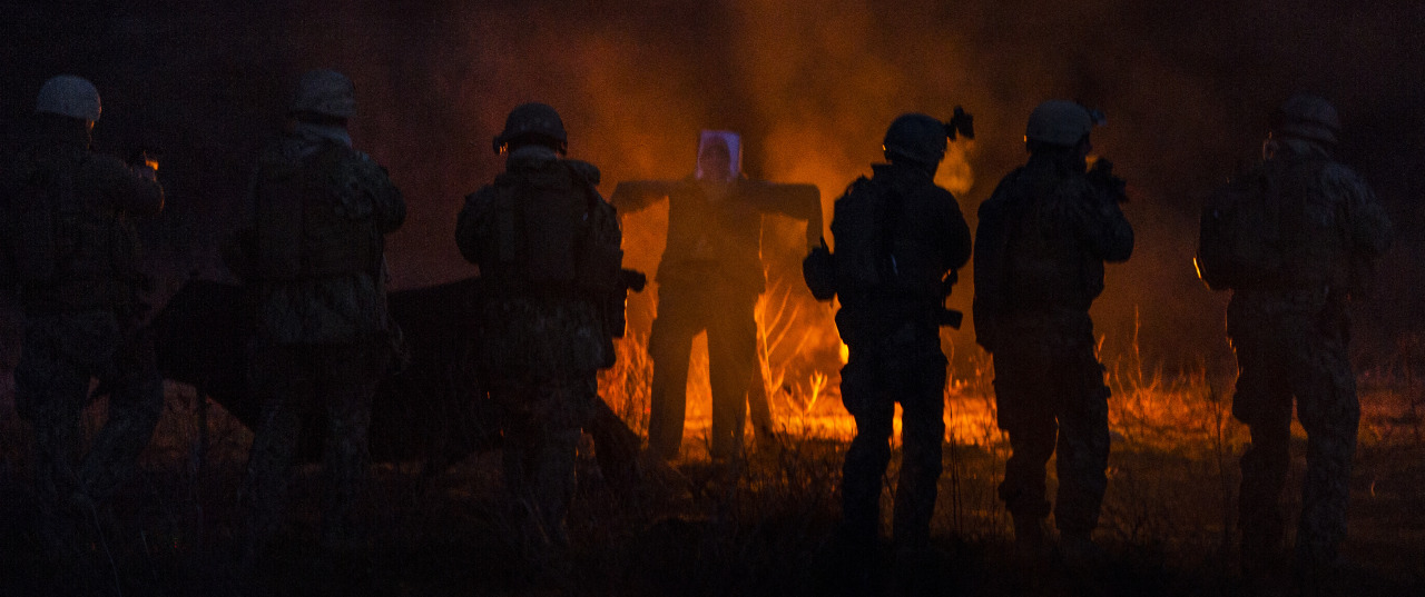
U.S. and Canadian service members engage targets at a simulated enemy camp during Fleet Combat Camera Pacific’s Winter [Feb 2013]Quick Shot 2013 combined field-training exercise in the Angeles National Forest near Azusa, California.Quick Shot is a semi-annual exercise that improves combat camera service members’ ability to operate in a tactical environment.
San Gabriel Mountains Bighorn Sheep Survey 2014
https://www.flickr.com/photos/mechanoid ... 3/?view=lg
One Bighorn found...

Deer photos...
http://breathelighter.wordpress.com/201 ... dventures/
"...I am surprised I saw this little guy, so nearly camouflaged in the brush. But then, before I moved on, brothers and sisters crossed the street right in front of me, and joined their sibling for some late afternoon munching...."

Plant: http://claytonia.org/tag/san-gabriel-mountains/
One of the plants found in rocky terrain

Wistaria Festival: How did Sierra Madre's record-setting wisteria get so big?
http://www.scpr.org/news/2014/03/14/427 ... teria-get/
"This Sunday the town of Sierra Madre holds its 97th annual Wistaria Festival, during which the public is invited to check out the massive woody vine that’s grown so big it’s in the Guinness Book of World Records as the largest blooming plant.....North says the San Gabriel foothills are great for wisteria. The area is not too windy. It’s warm with very few hard frosts. And since the plant is non-native, there aren’t as many natural pests and diseases to harm it.Wisteria is a legume, and North says that means it has a very unique relationship with naturally occurring bacteria in soil called rhizobia.These rhizobia enter the plant's roots and interact with them to create an enzyme that pulls nitrogen from the air into the soil."So it never suffers for lack of nutrients," North explained. "Basically it can grow in very poor soil and manufacture its own fertilizer."Frank McDonough, the Botanical Information Consultant with the Los Angeles Arboretum, thinks the Sierra Madre wisteria might also be tapping into an underground water source."For a plant to get that big, especially a vine, it's going to need a lot of water," he said.Luckily for the wisteria, McDonough says the area around Sierra Madre is unique in that it has pockets of water not too far underground. Some are fairly isolated, and he thinks the plant may be tapping into one of those pools...."

Little fish causes big headache
http://www.signalscv.com/section/36/article/115884/
"A critter the size of a goldfish has wiggled its way into a controversy that has turned off some canyon residents’ tap water, halted bulldozers and periodically flooded a road in the Santa Clarita Valley.....By now, the creek bed is nearly level with Bouquet Canyon Road in places, and when water flows down the creek in any significant volume, it floods the road.
The Los Angeles Department of Water and Power has reduced flow from the dam at the top of the canyon to a trickle, concerned about accidents on the flooded road.And that has left many residents downstream with inadequate water for their homes — and in some cases with no water at all.Concerned for the well-being of Bouquet Canyon residents, Los Angeles County supervisors on Feb. 25 approved a declaration of local emergency aimed at allowing agencies to bypass costly permits needed to clean up the creek bed.The move promised to enable the “county to work with state and federal agencies to help resolve the crisis in Bouquet Canyon and restore the flood-carrying capacity of Bouquet Canyon Creek,” Supervisor Michael D. Antonovich, who represents the Santa Clarita Valley and introduced the motion, wrote in a statement shortly after the emergency declaration.U.S. Forest Service officials contacted via phone calls and email during several days last week did not respond to questions from The Signal about the possibility of cleaning out the creek bed so water can be restored to Bouquet Canyon residents.“The Forest Service has been very active in advocating for a resolution,” said Linda Purpose, spokeswoman for the United Water Conservation District. The district represents Ventura County farming interests that receive water from the Santa Clara River, including its tributary Bouquet Creek.
“They have not been willing to continue to deal with the situation on an emergency basis because they were working to motivate (Public Works) to develop a feasible plan to effectively solve the problem, rather than a series of temporary solutions,” Purpose wrote in an email to The Signal. Unruh is not so sure about a resolution.“It looks like it’s going sideways,” he said last week. “Give me a double-bladed truck and one guy on the road with a cell phone to tell when cars are coming, and I’ll clear the creek bed and fix the problem in a day.”

Damaging exotic mussels in area lake are impossible to eradicate
http://www.scpr.org/news/2014/02/19/422 ... impossibl/
"....The mussels are now known to exist in 26 lakes in Southern California. Lake Piru is the first lake not fed by the Colorado River to get the species. ...A pair of adult quagga mussels can produce up to a million offspring. Scientists say that their high productivity and small size make them practically impossible to eradicate.Solomon said there is no chance that the mussels would grow to a point that they would choke off water supplies to residents and farmers that rely on them. He said that the water district would clean off accumulated growth regularly.That kind of program can be costly and time consuming. An official for the Metropolitan Water District said it spends three-to-five million dollars a year controlling quaggas.“We clean it once, twice a year. We go down with divers. We visually inspect it. If it appears to be getting clogged, then we’ll send divers down, and they will literally jetwash it and clean it manually,” said Jim Green, water systems operations manager for MWD...."
User avatar
Taco
Snownado survivor
Posts: 6036
Joined: Thu Sep 27, 2007 4:35 pm

Post by Taco »

I think we should start planting Wisteria in the San Gabes to kinda balance out all the terrible shit that grows there now.
Post Reply