Eagle Mine

TRs for the San Gabriel Mountains.
Post Reply
User avatar
Sean
Cucamonga
Posts: 3787
Joined: Wed Jul 27, 2011 12:32 pm

Post by Sean »

While the sun was setting, Henry and I zombie-walked past "No Trespassing" signs at Widman Ranch, still eight long miles from our cars. Suddenly we heard someone exclaim, "What the fuck!!!"

-----

Our day began at 4:30am. I had never met Henry before. But both of us shared a dream of visiting some of the most remote mines of the San Gabriel Mountains. And so we joined forces on a Saturday, with grandiose hopes of reaching Gold Dollar, Eagle, and Widco/Baldora--in that order.

The predawn ascent to Coldwater Saddle included perfectly cool weather, a star-studded sky, and the lightbeams of hunters moving into position along the Glendora Ridge Road on the opposite side of Cattle Canyon.

After some breakfast, we started on the Allison Trail toward Coldwater Canyon. Put simply, the old path was dangerously washed out and exposed in many places.

Image

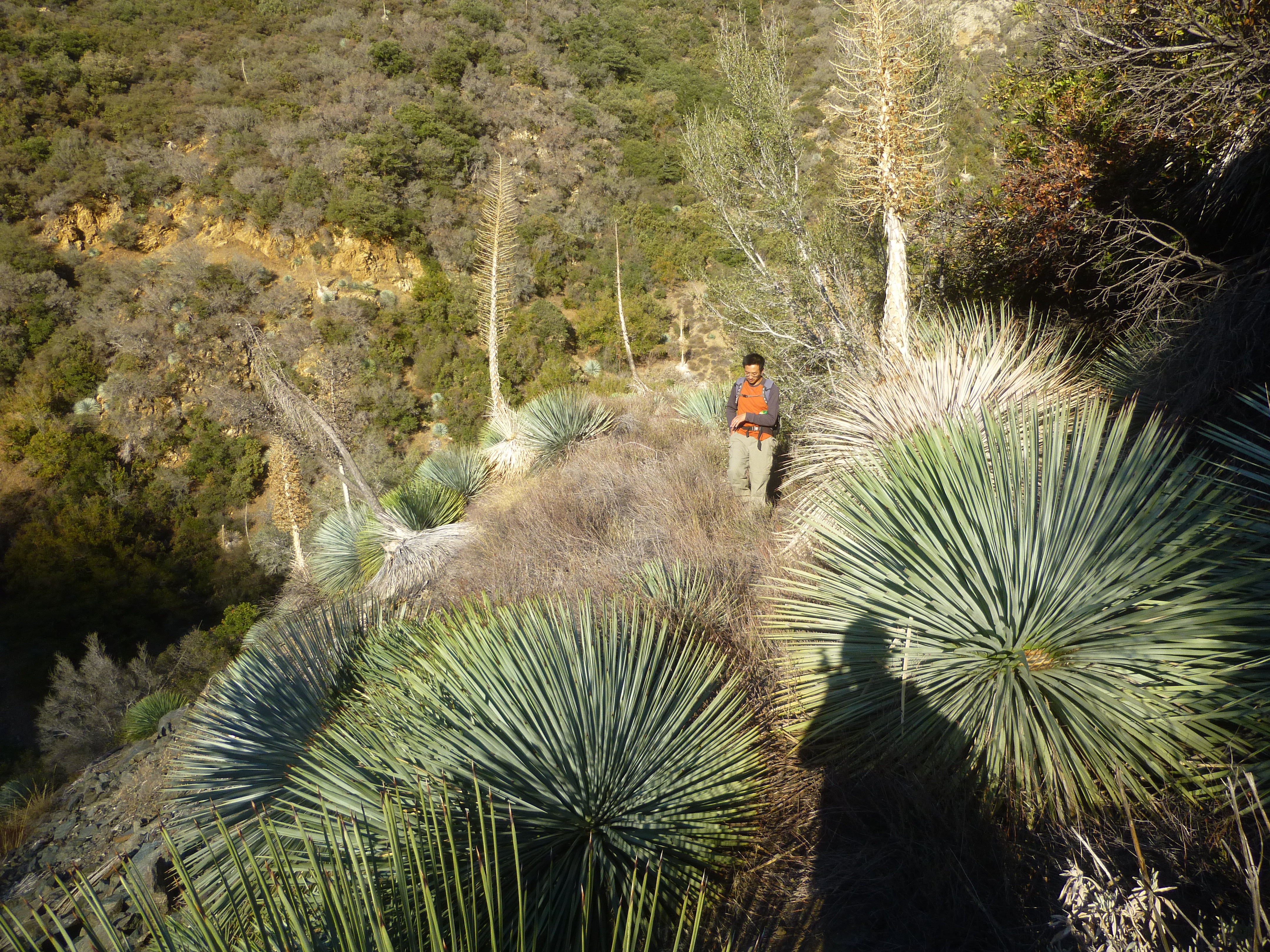
Then the trail became an old roadbed covered in massive yucca plants.

Image

After 1.4 miles from the saddle the road ended, and we climbed down a fixed rope into Coldwater Canyon.

Image

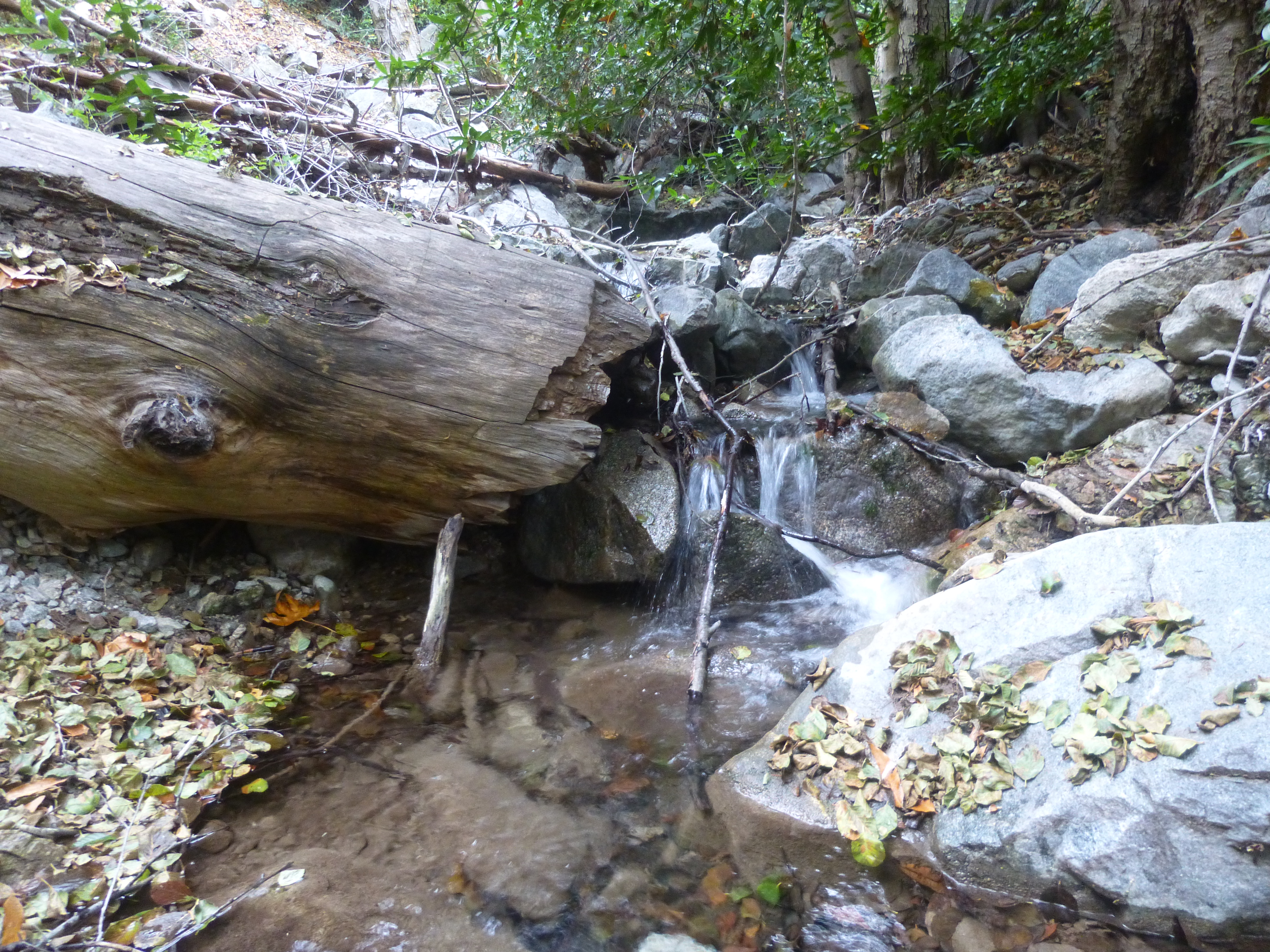
I filled up on water,

Image

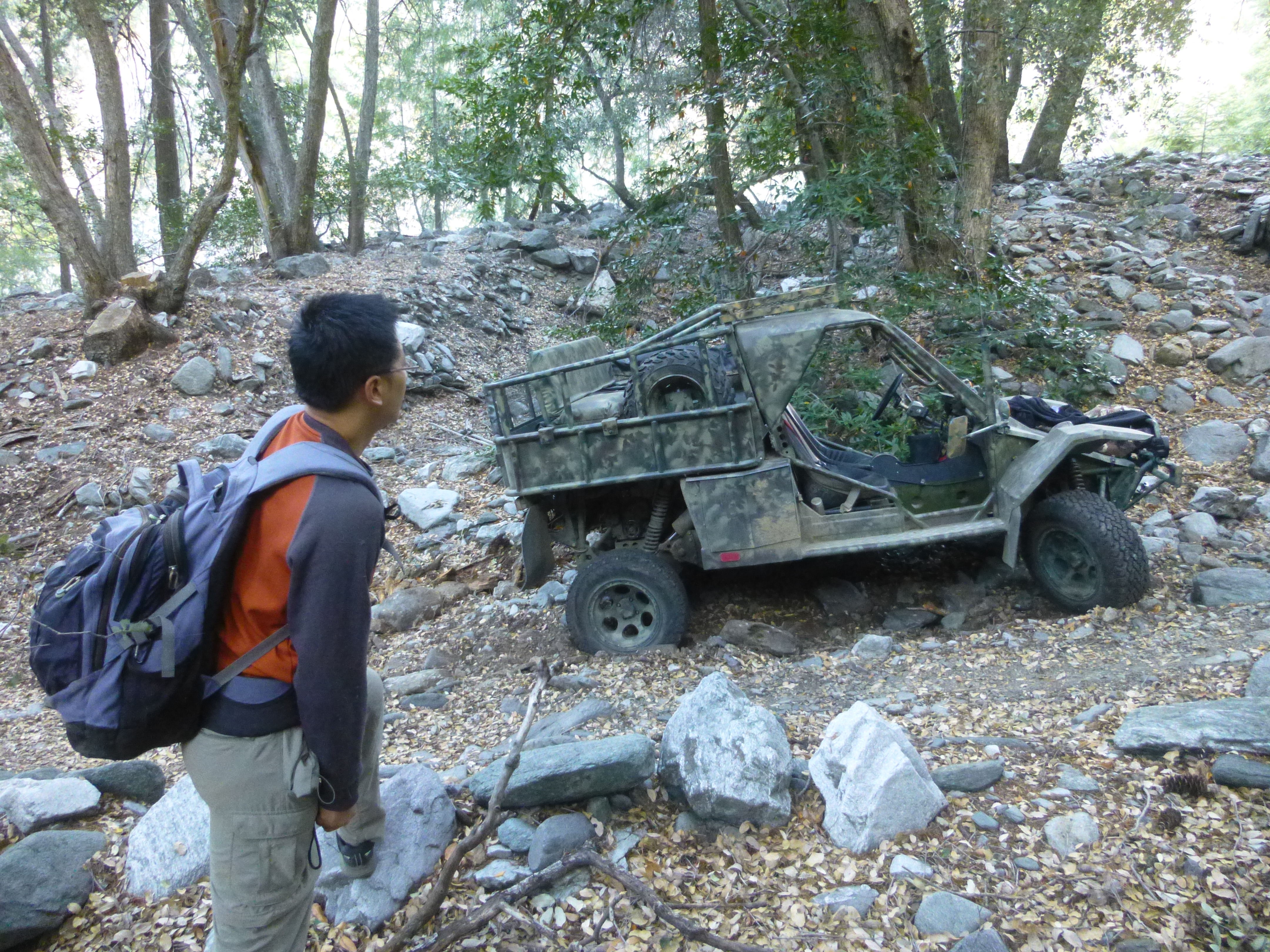
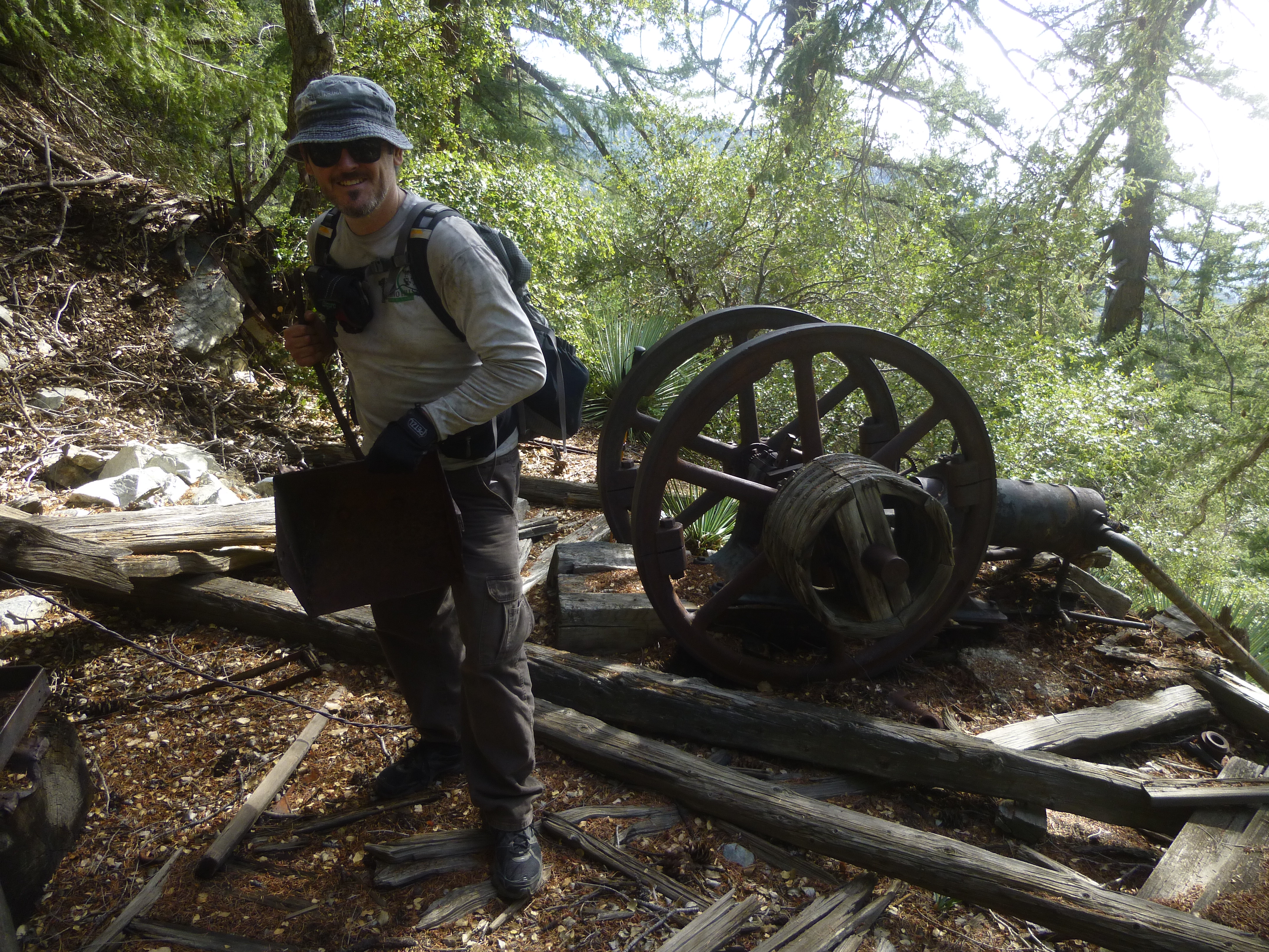
while Henry admired some found objects.

Image

Image

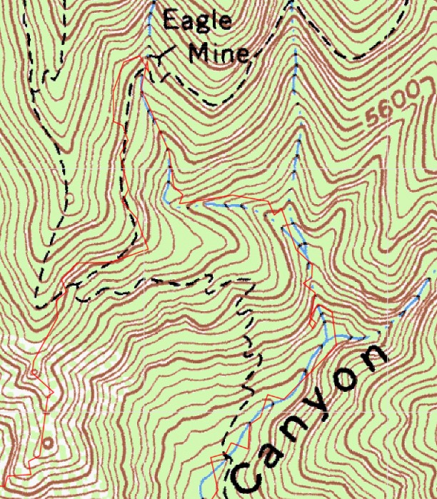
We then proceeded up-canyon to the foot of Gold Dollar Ridge, where we generally followed some animal trails on the righthand side until achieving the ridgecrest around 4400'.

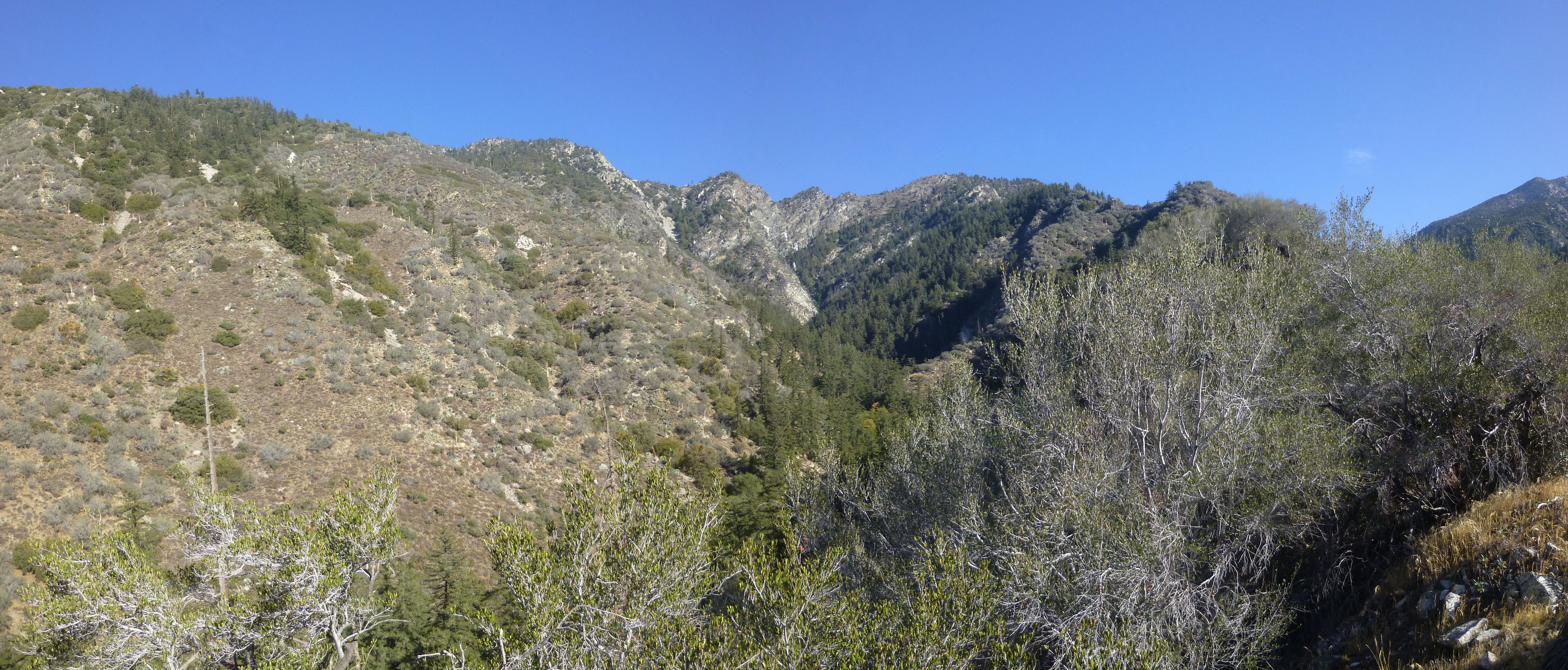
To the right Big Horn Ridge raged uphill like a beast. Below, Coldwater Canyon twisted and turned its way, seemingly in all directions.

Image

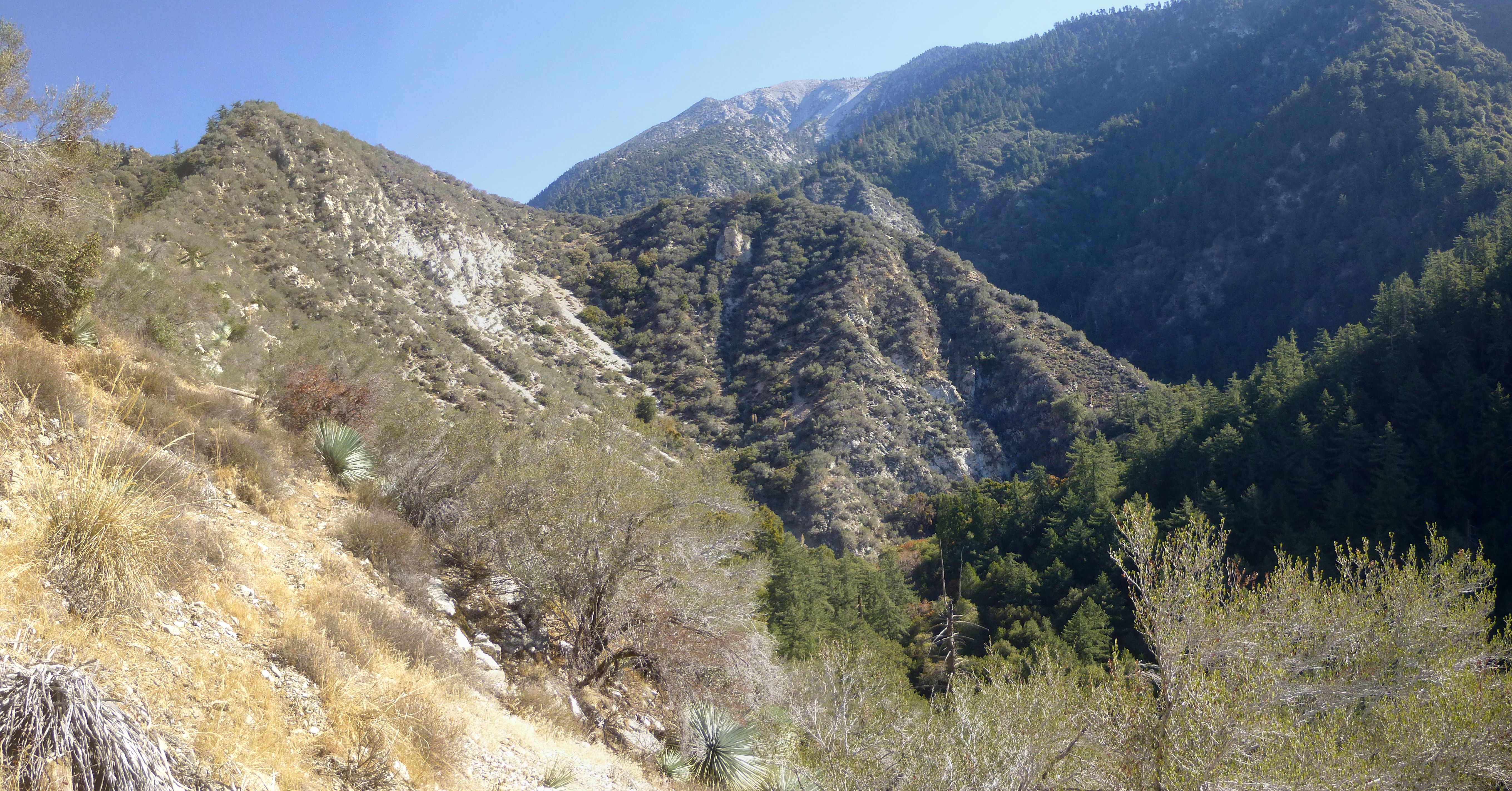
And on the left Dry Gulch pointed the way to Gunsight Notch.

Image

Our plan was to take the ridge all the way up to Gold Dollar Mine, then backtrack to Eagle and Widco/Baldora. But the wilderness had other plans for us.

Image

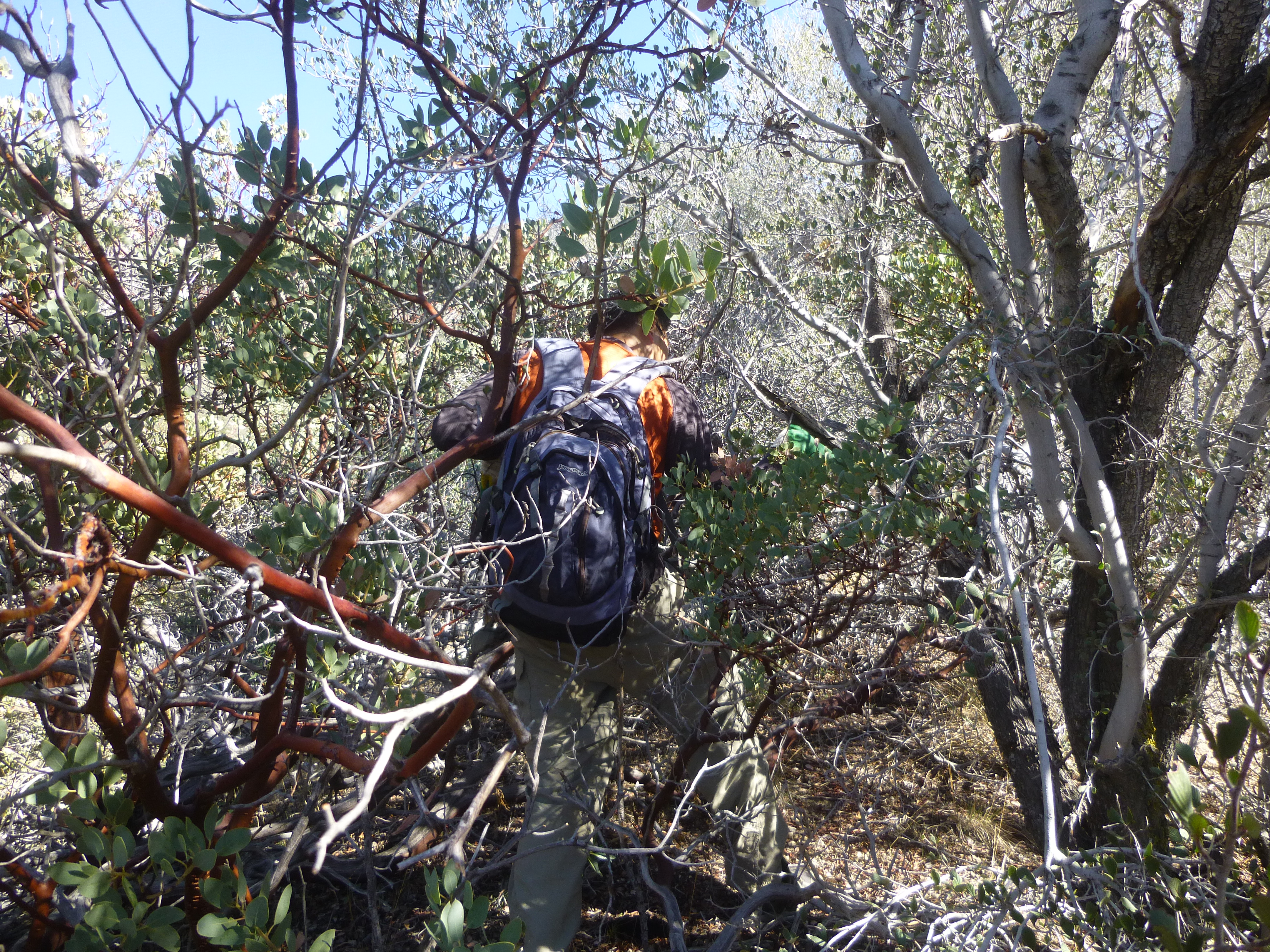
We bushwhacked and climbed for a seeming eternity, only to realize a measly 1.4 miles in well over three hours. At 5600' the idea of touring all three mines had been repeatedly discarded, and we found ourselves drifting away from the ridgetop, contouring toward the beckoning pine trees of Eagle Mine Canyon, sometimes on old trail fragments.

Image

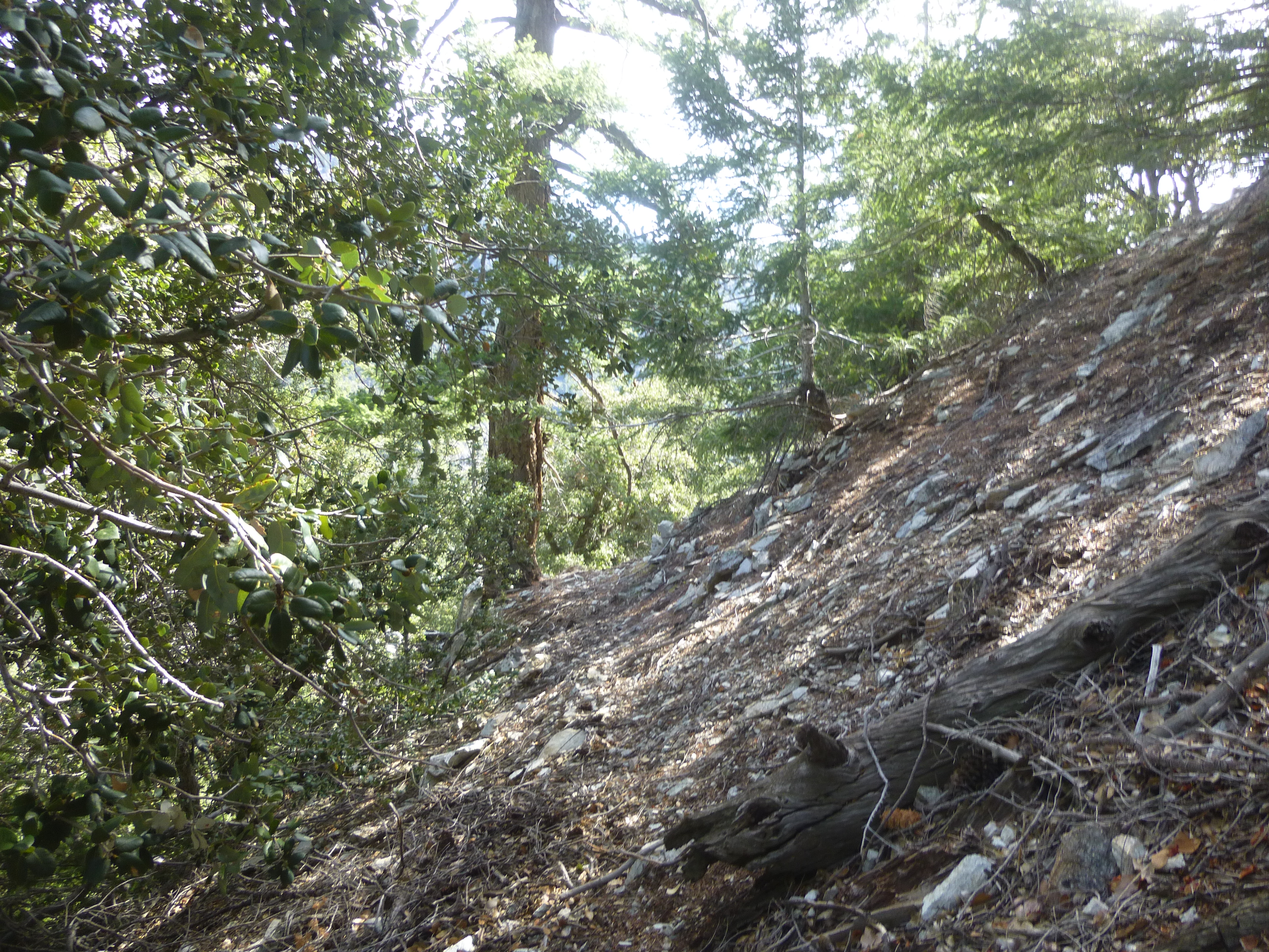
Finally, nine hours after leaving the East Fork, Eagle Mine appeared through the trees across the gully, exactly where my Garmin said it would be around the 5800-foot mark.

Image

Image

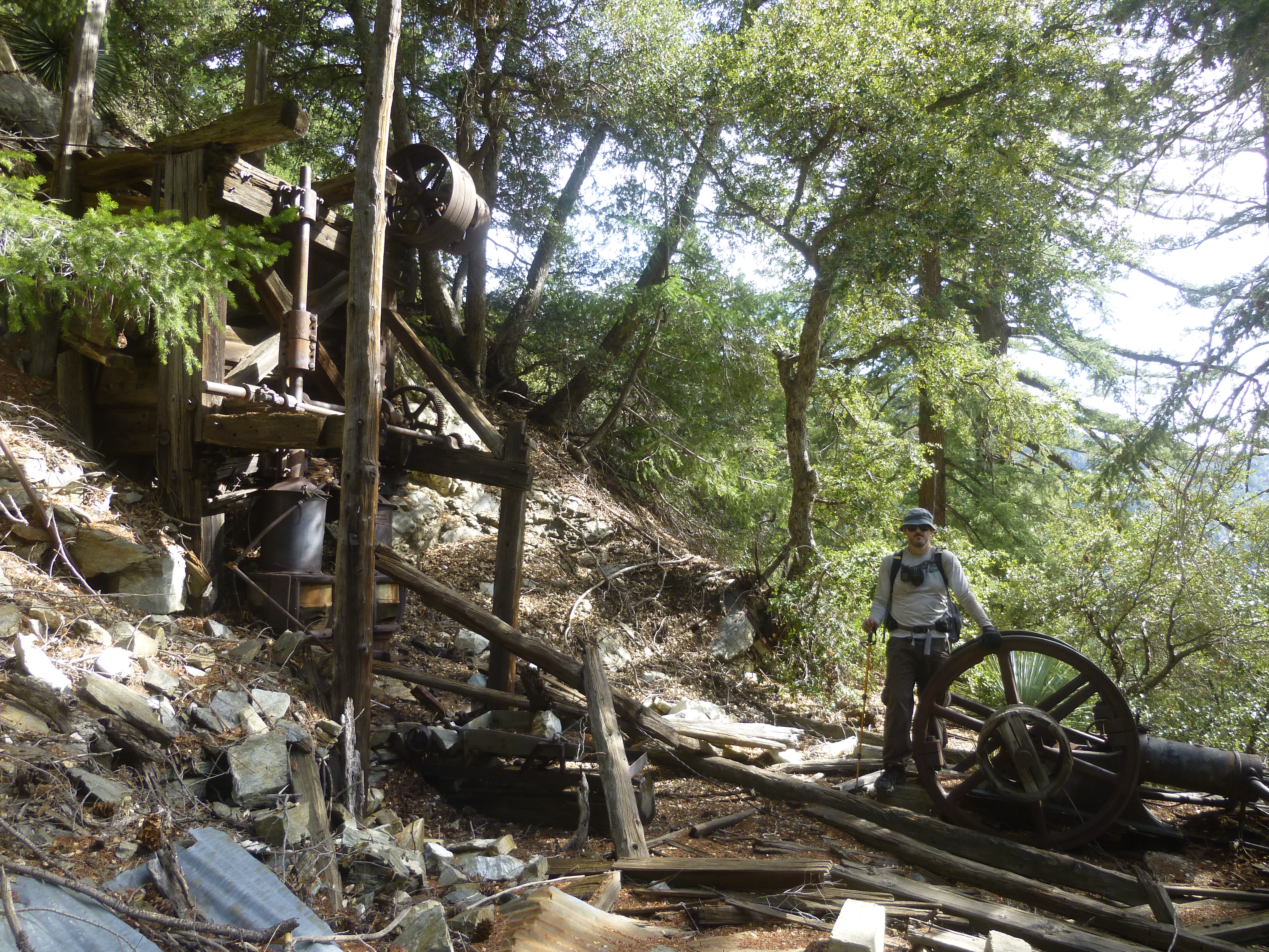
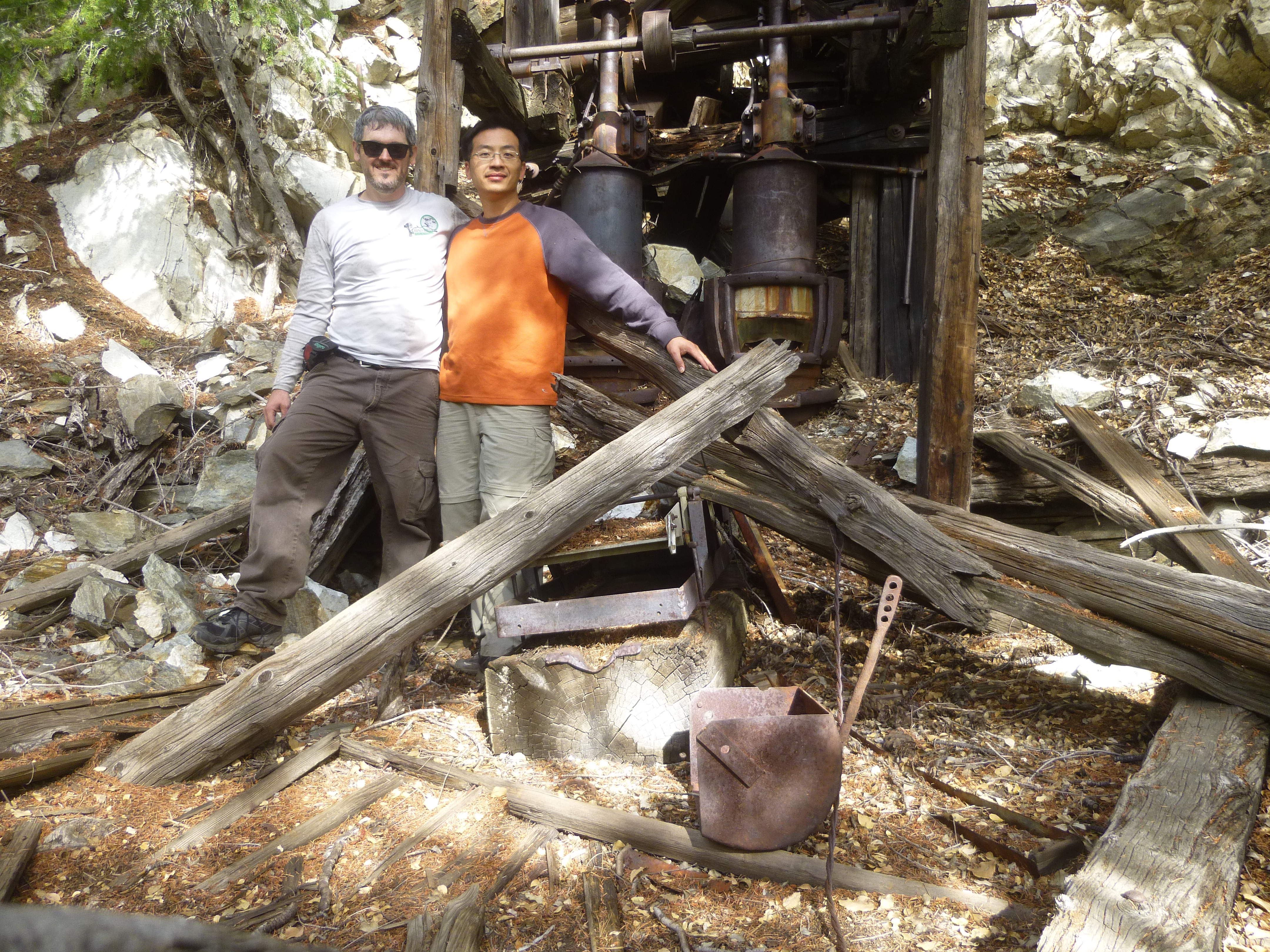
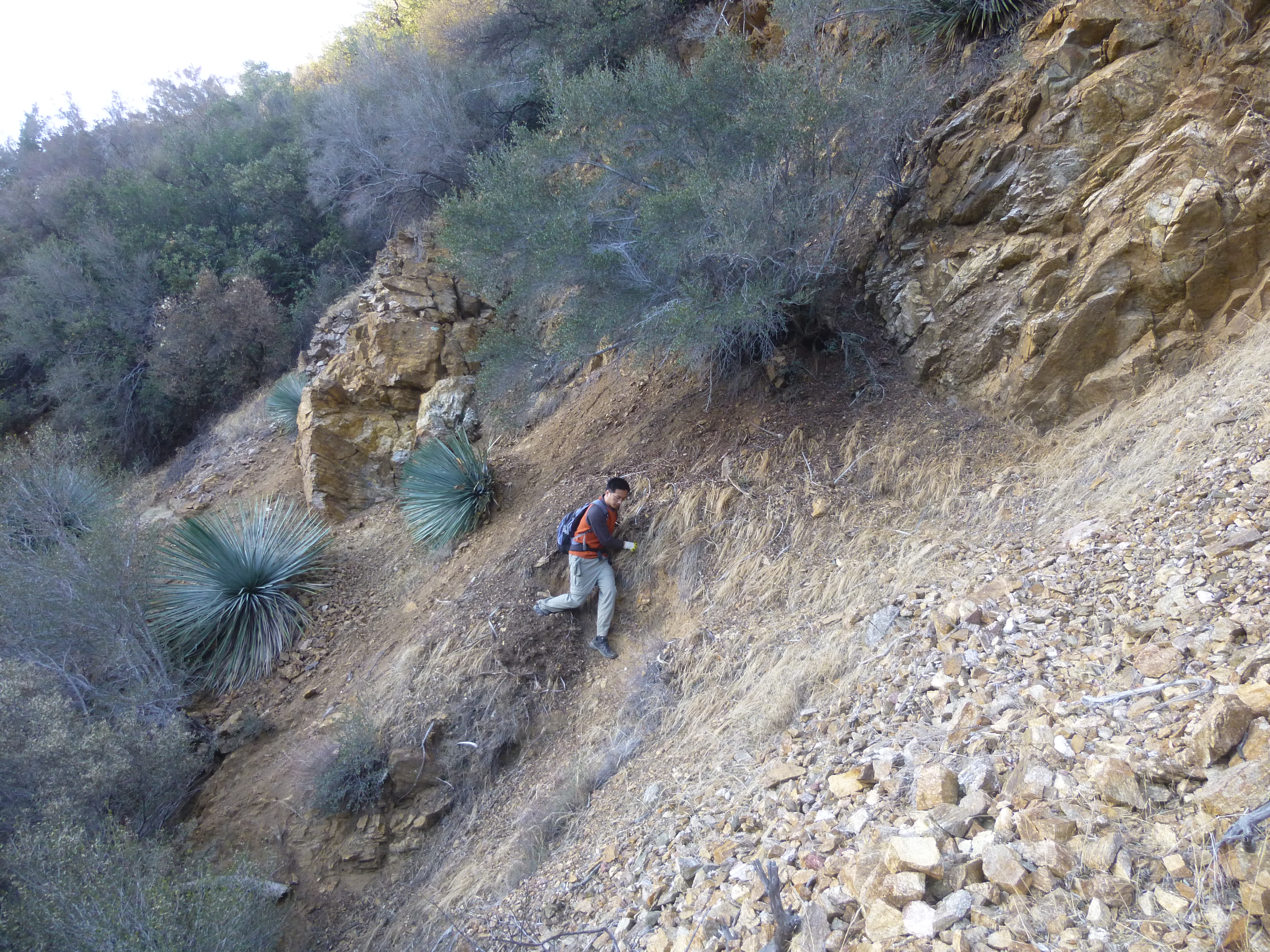
We enjoyed some rest and some lunch. I scrambled around, giving a half-hearted effort to find the tunnel entrance. But rather than continue further up the slope, I settled for the machinery and called it a victory.

Image

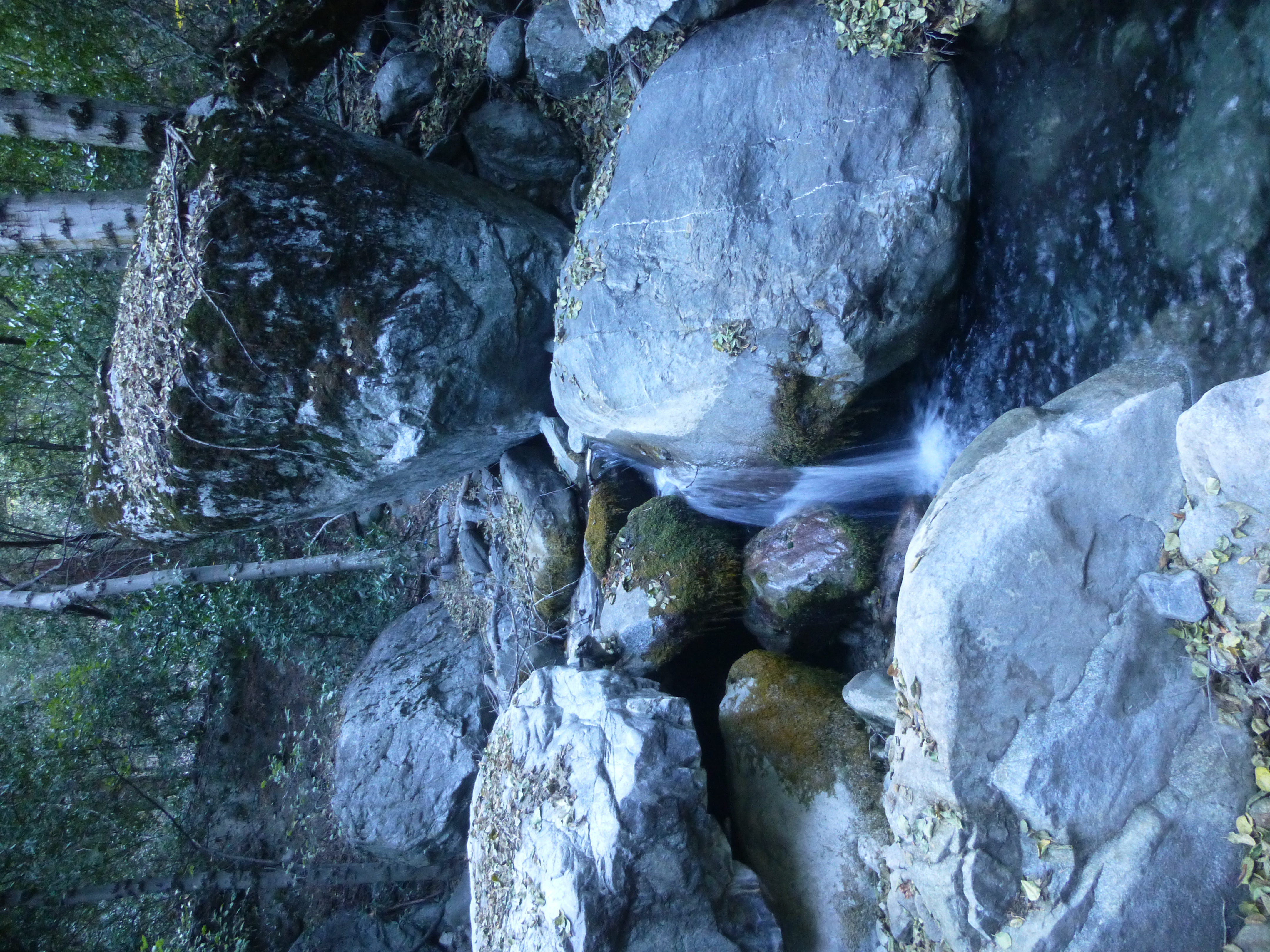
At 2pm we decided to descend via Eagle Mine Canyon to its outlet at Coldwater Canyon.

Image

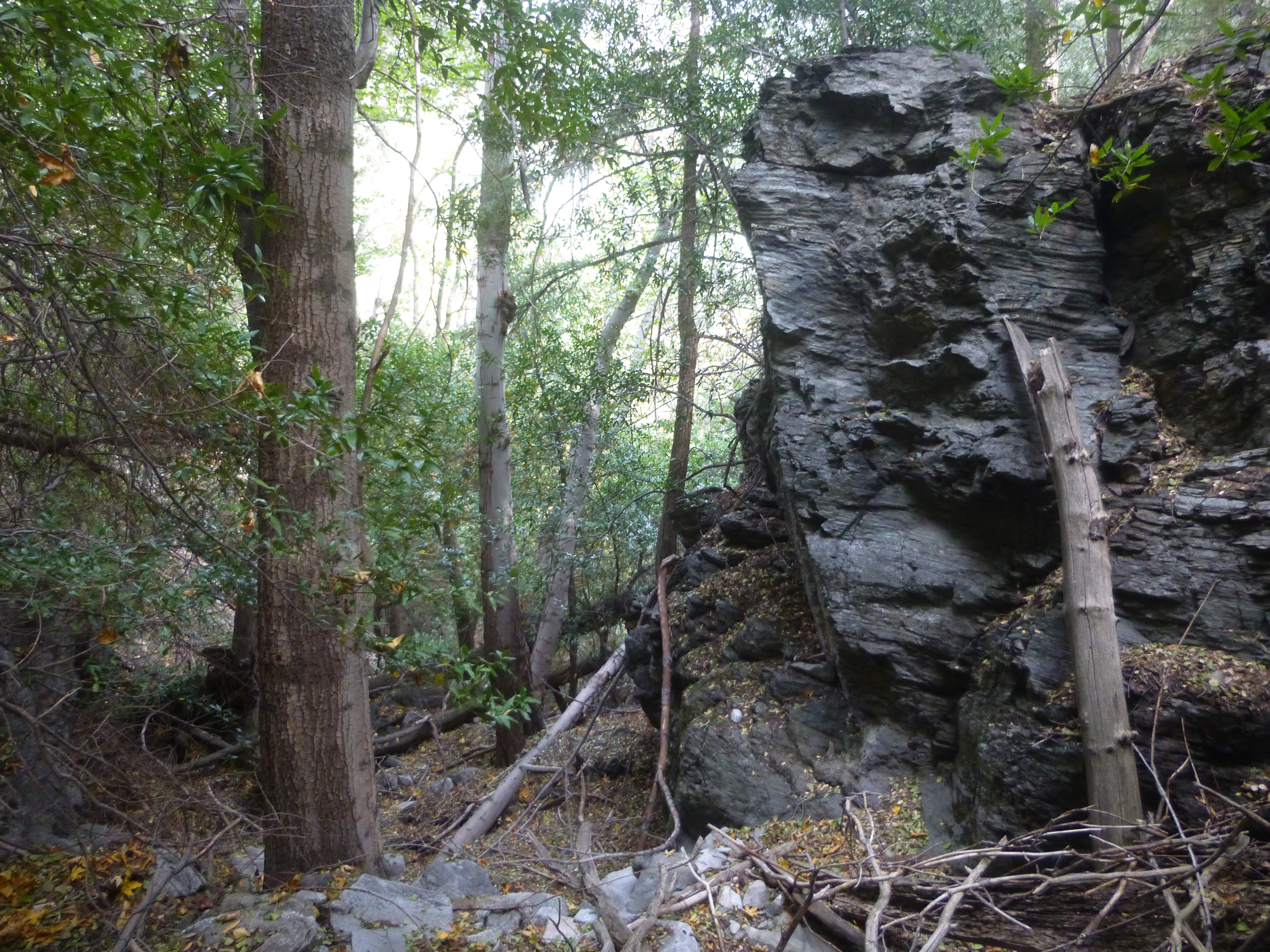
Easy bouldering and bushwhacking turned into increasingly more difficult rockclimbing. The canyon mouth was cliffed out, and we spent considerable time contemplating whether we could get down to Coldwater, whose stream could be seen a mere hundred feet below. Ultimately we found an obscure class 3 side chute and carefully slid down on our butts.

Image

I grabbed more water,

Image

and then we stomped through the canyon for two miles to the fire road and Widman Ranch.

Image

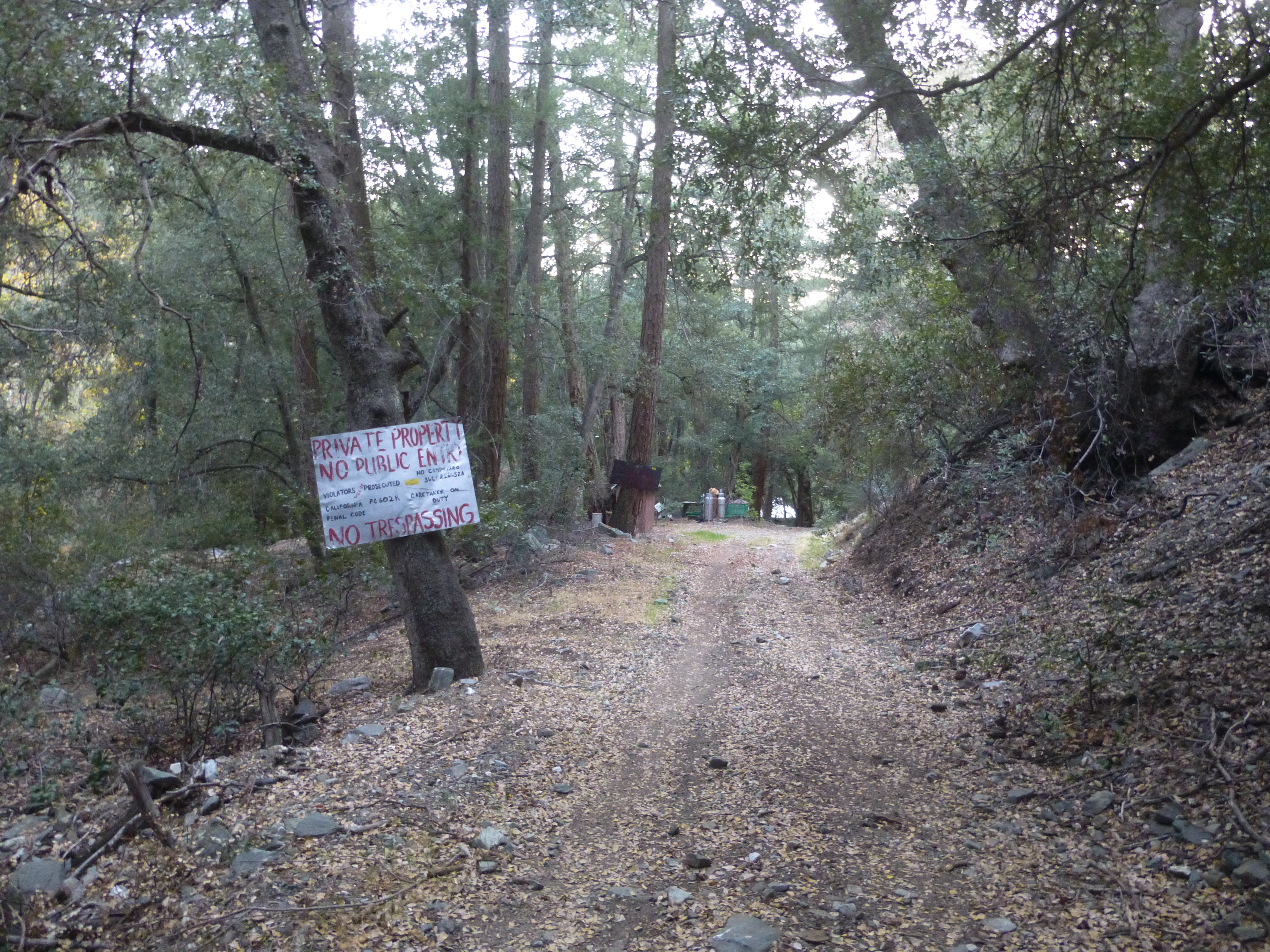
The sun had started to set, and the idea of attempting the Allison Sort-of-a-Trail in darkness did not appeal to our weary spirits and bodies. Instead we would risk an encounter at the ranch.

Henry and I zombie-walked past the "No Trespassing" signs at Widman Ranch, still eight long miles from our cars. Suddenly we heard someone exclaim, "What the fuck!!!" It was a man, drinking a beer, outside the main building. He seemed peeved.

After I explained our situation, his tone mellowed, and he granted us permission to walk through the property along the road. But he threatened legal action against any future violation.

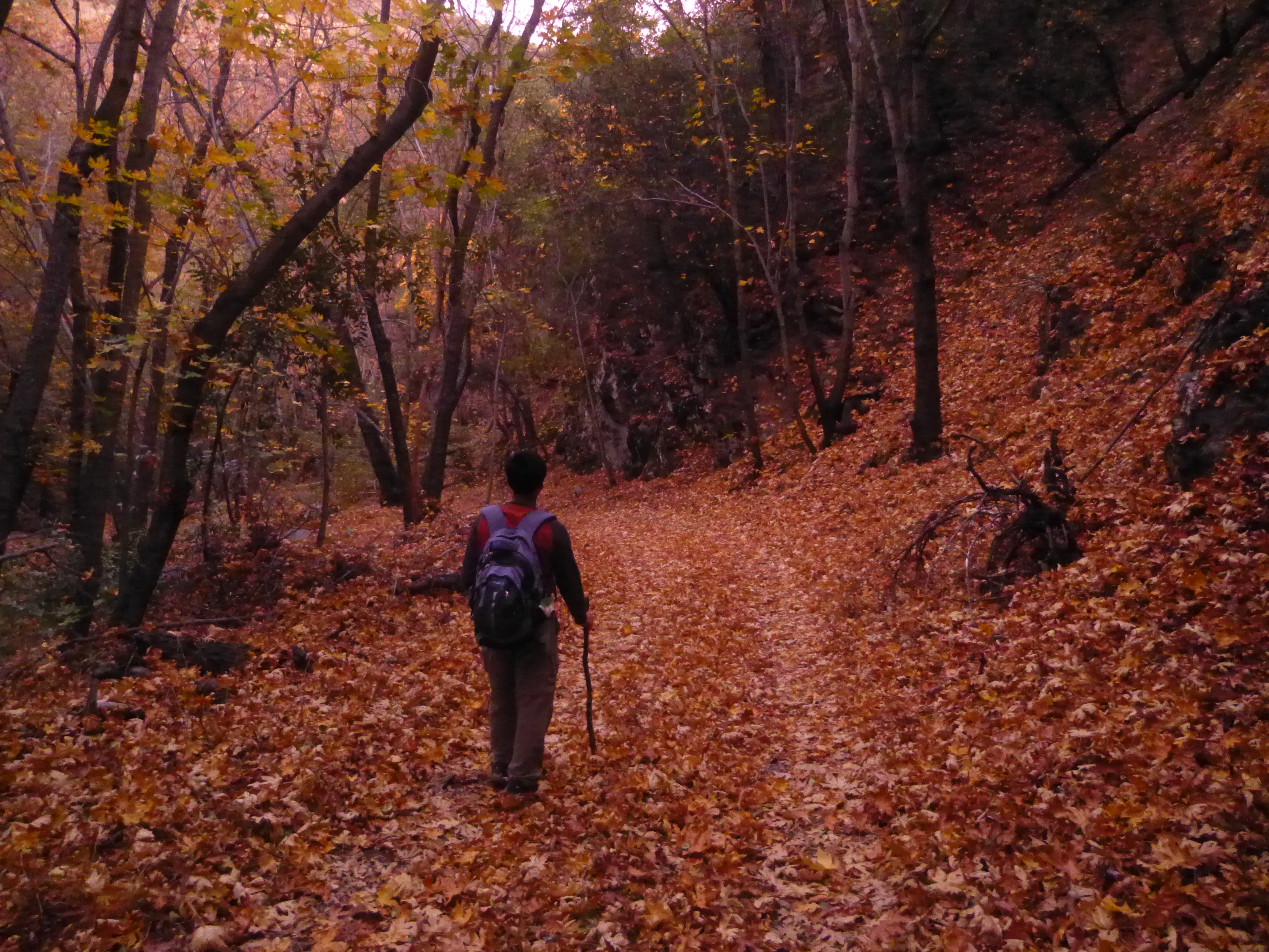
Grateful, we continued on our way. The road was blanketed by colorful leaves.

Image

Then darkness descended upon the canyon. We crossed and recrossed the stream about 30 or 40 times, sometimes having to toss stepping stones into the creekbed. My ankle turned quite badly during one crossing, but it recovered. We stopped for a quick snack near Thompson Flat and reached our cars by 10pm.
User avatar
HikeUp
Posts: 3861
Joined: Thu Sep 27, 2007 9:21 pm

Post by HikeUp »

Cool trip.

Did you notice the condition of Weber Camp (down stream from Widman)? Notice it at all?

Any troubles/encounters/no trespassing signs getting through Thompson Ranch?
User avatar
Sewellymon
Posts: 97
Joined: Tue Feb 12, 2008 8:55 pm

Post by Sewellymon »

Wow!!!

That takes me back... from '75 to '80 I went into Coldwater Canyon and up the the Gold Dollar Mine and San Antonio Ridge once or twice a year.

The trail from the saddle to Coldwater Canyon was never that sketchy- but i recall one dangerously exposed spot. No doubt it's worse.

The use trail to Gold Dollar Mine used to be in pretty good shape, too.

Too bad access past Widman and Thompson Ranches sucks. Truth is there are very likely laws that allow easement access, but somebody would have to take the 2 landholders to court to enforce? I think we've had this conversation on this forum B4.....
User avatar
Ze Hiker
Posts: 1430
Joined: Mon Jul 28, 2008 7:14 pm

Post by Ze Hiker »

Going straight up Gold Dollar ridge seems to add more of a challenge to this trek!

If you ever go back for Gold Dollar, I would suggest going into Dry Gulch and then going up the east side to the ridge. While this is annoying steep, there is much less brush and probably faster overall.
User avatar
Sean
Cucamonga
Posts: 3787
Joined: Wed Jul 27, 2011 12:32 pm

Post by Sean »

wrote: If you ever go back for Gold Dollar, I would suggest going into Dry Gulch and then going up the east side to the ridge. While this is annoying steep, there is much less brush and probably faster overall.
After reading your report, I wanted to avoid the climb from Dry Gulch up to Gold Dollar Ridge. It sounded like the sort of stuff that aggravates my inferior lower back.

Going up the ridge can be done much more quickly. We had a somewhat moderate pace, as Henry hadn't hiked in awhile, and I was taking a lot of pictures. The bushwhacking was tough, but a little sporadic, mixed with some nice, open stretches.

My thinking now is that I would prefer going up our down route. That is, follow Coldwater Canyon to Eagle Mine Canyon, and climb the side chute to bypass the cliffs. Then proceed up canyon to Eagle Mine.

You wouldn't have to carry any water. There would be shade with relatively easy bushwhacking, as there is an old trail you can follow much of the way up Coldwater. Then Eagle Mine Canyon is a lot of fun with some easy class 3.
User avatar
Sean
Cucamonga
Posts: 3787
Joined: Wed Jul 27, 2011 12:32 pm

Post by Sean »

HikeUp wrote: Cool trip.

Did you notice the condition of Weber Camp (down stream from Widman)? Notice it at all?

Any troubles/encounters/no trespassing signs getting through Thompson Ranch?
Sorry, it was getting dark and, at the time, I wasn't looking for Weber Camp. There was something on the left shortly after Widman, though. Maybe Henry remembers it.

Thompson Ranch house was occupied, but we walked by silently under the cover of darkness without incident. There is a "No Trespassing" sign on the west gate, which we had to hop over.
User avatar
HikeUp
Posts: 3861
Joined: Thu Sep 27, 2007 9:21 pm

Post by HikeUp »

Thanks. Great trip!
User avatar
Phil B
Posts: 101
Joined: Wed Oct 03, 2007 12:47 pm

Post by Phil B »

Sean, Henry,
Way to go guys, thats one tough day hike and a great trip report.

You mentioned coming back from Eagle Mine that you found a Class 3 chute which gave access into Coldwater Canyon. How far was the Class 3 chute from where the Eagle Mine Cyn cliffs out above that 100' drop off, and I'm assuming that it was down stream from the drop off. The reason I ask is because once I was caught in a storm at the Eagle Mine (Rain/snow/clouds), I headed down the EM Cyn to where it cliffs out and not wanting to risk a descent in those conditions back tracked and went up and over the Ridge to come down above Widco Mine. I was always sure there was a better way out and you seem to have found it.

As for the hostile/unfriendly signs at the Widman Ranch - they suck, especially when you consider the alternative route is going back on the Heaton Flat trial often in the dark. Is somebody meant to maintain it? or is it now just a use trail? sounds like those Yuccas need cutting back as well.

Thanks for the report,
Phil
User avatar
Sean
Cucamonga
Posts: 3787
Joined: Wed Jul 27, 2011 12:32 pm

Post by Sean »

Phil B wrote: How far was the Class 3 chute from where the Eagle Mine Cyn cliffs out above that 100' drop off, and I'm assuming that it was down stream from the drop off.
This snapshot of my GPS track might help you understand what we did:

Image

Eagle Mine Canyon cliffs out 80-100 feet above Coldwater Canyon. We then turned around and scrambled along the rocky east bank, looking for a possible way down. After maybe 40 or 50 feet of climbing back up, a steep but doable route appeared on the other side of the bank, leading down to Coldwater on the right. If I recall correctly, there were three aspects to the bypass, all of which could not be seen initially. First we slid down one little chute, bracing our weight with our feet forward against the rock walls, then we sidehilled leftward to a second chute with a small tree at the top of it. From there it was a short, easy scree hop to the stream.

I believe this picture shows the second small chute with the tree at the top.

Image

Regarding the Allison Trail, there was a water stash a short distance into it, but clearly it doesn't receive regular maintenance.
Post Reply