
Vincent Gap Trail (Mt. Baden-Powell)
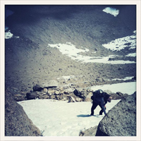
Was up there yesterday. From 8000' there is solid snow cover, but you can manage without crampons. There is a good boot track and even if you fall you won't slide into the abyss. I also tagged Ross Mountain which is a very nice sidetrip since it does not get visited very often.
-
tpfishnfool

- Posts: 62
- Joined: Sun Feb 20, 2011 10:50 am
Was up there yesterday and snow from 8600 to summit. Did not have crampons and wanted them coming down fron summit to 8600. A bit scetchy coming down that part of the mountain. You lose the the trail and its a scramble the last 1/2 mile.
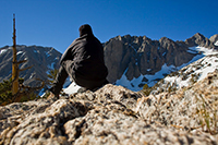
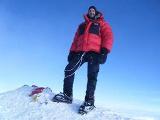
Great trip with great friends to tag BP and Burnham today. We broke trail in 6"-12" of rather gooey snow from Vincent Gap to BP and onward to Burnham. Winds were terrific from the NW at a sustained 35mph with gusts that just about knocked me over. Spindrift was tasty as well. Still a beautiful day! We could see downtown LA, Catalina, Channel Is, and San Clemente. Even the ships in Long Beach Harbor. Very cool!
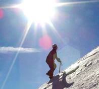
Going was relatively slow (RT 8 hours) due to inconsistencies in snowpack and wind. Frozen slab under 6" of wet snow. Wind scoured icy sections. Cornices. Thigh deep plunging into powder. All in all, I thought the snow conditions were wonderfully setting up for some ski descents.
Crampons absolutely necessary. Snowshoes never left our packs.
BTW, the summit register box of BP is broken and filled with snow. Book is wet. damn
Burnham was an anti-climatic summit but at least that's one more peak tagged for us.
Have fun out there!

I hiked up last weekend, 5/5. The trail is clear to about mile 3. There are patches of snow/ice in the shady spots after that. It's necessary to go off trail for about .75 mile on and off to get around the ice and snow. I hit the trail about 9 AM. I recommend microspikes or old crampons due to mixed conditions and poles. I made it without the spikes, but is slowed me down. Clear the last .25 mile or so from Wally to the summit. Softened by the time I headed down mid day. Have fun!

Thanks so much Karen, your post was helpful !
I hiked up today, 5/12. Trail conditions have not changed much from your description. I hit the trail at 11:00 a.m. The trail was clear until mile 3 and then there were patches of slushy snow. Needed to go off the trail to get around some of it, but it's easy to follow. I went with just my trail runners and no poles, and I was just fine. My first time to Baden Powell , it was beautiful!!
I hiked up today, 5/12. Trail conditions have not changed much from your description. I hit the trail at 11:00 a.m. The trail was clear until mile 3 and then there were patches of slushy snow. Needed to go off the trail to get around some of it, but it's easy to follow. I went with just my trail runners and no poles, and I was just fine. My first time to Baden Powell , it was beautiful!!
Here's a link to CalTrans which updates the 2.Logan wrote: Hey Guys,
Can anyone please tell me the trail conditions for Baden Powell via Vincent Gap? Also, how is the road coming in through Wrightwood.
Thanks,
Logan
http://www.dot.ca.gov/hq/roadinfo/display.php?page=sr2
Remember though that it looks like Mountain High opened this weekend so you can expect a ton of traffic coming up from Wrightwood.
Last year it seemed there were only a handful of days the 2 was closed between Islip and Big Pines. I was always curious about why they closed the road when snow plows were available so I asked a driver and he said it had more to do with falling rock than snow.
-
Uncle Rico

- Posts: 1466
- Joined: Thu Mar 20, 2008 7:48 pm
Anybody been up Baden Powell from Vincent Gap lately that can comment on current trail conditions? If so, what does the ridgeline down to Ross look like? Snow/ice-free?
Thx.
Thx.
I went up Friday. It was clear the first mile, patchy the second mile and 100% coverage the rest of the way. It was knee deep and higher in a lot of areas to. The southern exposed ridges and faces are pretty clear. I made the mistake of leaving my snowshoes in the trunk. Blazed up the first two miles and postholed my way through the rest of the way. It was brutal but a great workout. Followed previous snowshoes tracks up. Because of the warm weather everything was really soft and deep.


hey guys one more question, is route 2 angeles crest highway closed or open? i used to ride motorcycles up there and remberer it was closed a long time ago, then it reopened and you could go thru to wrightwood, and then it closed again (due to another landslide?) did it ever re-open?
Per the caltrans website: http://www.dot.ca.gov/cgi-bin/roads.cgi
SR 2
[IN THE SOUTHERN CALIFORNIA AREA]
IS CLOSED FROM ISLIP SADDLE TO 5 MI WEST OF BIG PINES (LOS ANGELES CO)
- FOR THE WINTER - MOTORISTS ARE ADVISED TO USE AN ALTERNATE ROUTE
ALL TRACTOR-SEMI TRAILER COMBINATIONS WITH 3 AXLES OR GREATER ARE
PROHIBITED FROM THE JCT OF I 210 /IN LA CANADA-FLINTRIDGE/ TO THE
ANGELES FOREST HIGHWAY (LOS ANGELES CO) - ALTERNATE ROUTES ARE AVAILABLE
I haven't been up there recently. But the CalTrans website says the road is still closed between Islip Saddle and 5 miles west of Big Pines. That sounds like you might be able to reach Vincent Gap coming from Wrightwood, but don't sue me if I'm wrong.
http://www.dot.ca.gov/cgi-bin/roads.cgi
http://www.dot.ca.gov/cgi-bin/roads.cgi
The Wrightwood forum may have the very latest or someone who could give first hand knowledge...
This is where the "Road Condition" topic is located...
http://www.wrightwoodcalif.com/forum/in ... d,3.0.html
This is where the "Road Condition" topic is located...
http://www.wrightwoodcalif.com/forum/in ... d,3.0.html