
Looking to get some elevation this weekend, ive only been doing mt wilson in the San Gs, whats good now with no snow and ice? ive wanted to do ice house canyon to the saddle to ontario or bighorn i think it is, don't have my map in fron of me now. looking for 15 miles RT plus lots of elevation!
thanks
Hikes / peaks clear of snow and ice for this weekend
-
Sean

- Cucamonga
- Posts: 4249
- Joined: Wed Jul 27, 2011 12:32 pm
The north side of Bighorn and Ontario is still decently covered in snow/ice. You might try the 3Ts, or do Baldy from the village.
-
Beantown
- Posts: 45
- Joined: Wed Mar 21, 2012 9:06 am
hey thanks!.. is this the trail from the village? the hard way..i like it haha!
http://www.simpsoncity.com/hiking/baldytrail.html
http://www.simpsoncity.com/hiking/baldytrail.html
-
Sean
- Cucamonga
- Posts: 4249
- Joined: Wed Jul 27, 2011 12:32 pm
Yeah, that's it. You could also hit West Baldy for some bonus gain.
-
robnokshus
- Posts: 130
- Joined: Fri Apr 04, 2008 7:25 am
Hey Sean, I checked out your TR on the Verdugos. Being a Burbank resident, I have hiked all of those trails, but never ALL IN ONE DAY! Pretty studly achievment there!
One of my favorites is to get dropped off at The Grotto on La Tuna late on a summer afternoon and hike over the hill home. Hitting the top of the ridge at sundown, the city lights are spectacular and provide enough ambient light to easily hike down without a headlamp, even if there is no moon.
One of my favorites is to get dropped off at The Grotto on La Tuna late on a summer afternoon and hike over the hill home. Hitting the top of the ridge at sundown, the city lights are spectacular and provide enough ambient light to easily hike down without a headlamp, even if there is no moon.
-
Beantown
- Posts: 45
- Joined: Wed Mar 21, 2012 9:06 am
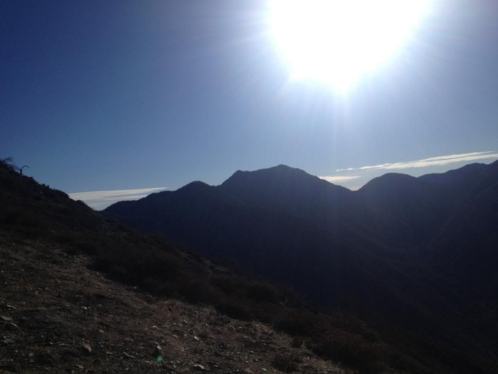
Hey Sean thanks again the trail did not disappoint was a good tuff hike. Started at 630 on the summit at 1030. Met a guy on the way up we thought we were gonna have the top to our selves then lots of others showed up from the other ways to the top. Great day, just a little snow near the top.
-
Sean
- Cucamonga
- Posts: 4249
- Joined: Wed Jul 27, 2011 12:32 pm
Thanks, Rob. Have you ever gone from the Grotto to the La Tuna Canyon Trail without using the street? I hate walking along that street but don't know of an alternative.robnokshus wrote: Hey Sean, I checked out your TR on the Verdugos. Being a Burbank resident, I have hiked all of those trails...
It's a great trail. I think you'd also like Register Ridge. It's shorter, but tougher.Beantown wrote: Hey Sean thanks again the trail did not disappoint was a good tuff hike.
http://danshikingblog.blogspot.com/2011 ... y-and.html
-
Uncle Rico

- Posts: 1481
- Joined: Thu Mar 20, 2008 7:48 pm
Can you still "legally" ascend Register Ridge? I thought I read somewhere that the forest service had tried to put the squash on use of that route. Then again, I could have dreamed it too.Sean wrote: I think you'd also like Register Ridge. It's shorter, but tougher.
-
Sean
- Cucamonga
- Posts: 4249
- Joined: Wed Jul 27, 2011 12:32 pm
It's not in any of the official closure areas. A few times somebody has placed logs or rocks across the trailhead. I don't know who did this, but it might have been the Forest Service trying to obscure the entrance so that the unacquainted hiker never notices it and becomes confused. They can't stop you from using the route without a federal closure order. It's public land.Uncle Rico wrote: Can you still "legally" ascend Register Ridge? I thought I read somewhere that the forest service had tried to put the squash on use of that route.
-
Beantown
- Posts: 45
- Joined: Wed Mar 21, 2012 9:06 am
I want to go this hike again this coming weekend but want to make it a loop. what are the options, go down the ski hut trail, or do the backbone trail to the resturant? if the backbone way it looks like a long hike down from there but can you take the ski lift? how many miles are we talking? thanks.
-
mcphersonm80

- Posts: 243
- Joined: Mon Aug 23, 2010 11:46 am
Beantown wrote: I want to go this hike again this coming weekend but want to make it a loop. what are the options, go down the ski hut trail, or do the backbone trail to the resturant? if the backbone way it looks like a long hike down from there but can you take the ski lift? how many miles are we talking? thanks.
I always recommend going up the Ski Hut Trail, then down the Devil's Backbone. Once you reach the ski area, you can either:
a) hike the fire road back down to where you started (approx 3.5 fast miles)
b) pay $10 and ride the ski lift down, or
c) scramble down a steep use trail directly beneath the ski lift, the legality of which has been put into question by some, but I've never heard of anyone having a problem doing so.
The fire road isn't nearly as bad as everyone seems to suggest. Sure, it's not that exciting, but it's easy and goes by fast. The total loop clocks in around 11.3 miles or so without any shortcuts. Not bad at all.
You could also reverse the route, getting the boring fire road out of the way first, but descending the Ski Hut Trail can be tough on the knees.
Whichever way you go, the loop is definitely the best way to get the full Baldy experience.
GPS of the full loop from someone named Seth:
http://goo.gl/maps/wdNRx
-
Sean
- Cucamonga
- Posts: 4249
- Joined: Wed Jul 27, 2011 12:32 pm
So you go up Bear Canyon from the Visitor Center, that's about 6.5 miles. Then, to make it a loop, you have two official options, Ski Hut or Devil's Backbone.Beantown wrote: I want to go this hike again this coming weekend but want to make it a loop. what are the options...
Ski Hut descends down the south face of Baldy, turns left and drops pretty sharply into the bowl, crosses the boulder-strewn bowl to a stream and the Sierra Club hut, then follows San Antonio Canyon down to the fire road, which then descends past the waterfall and out to Manker Flats. That's about 4.2 miles. Then you have to bum a ride back to the village unless you previously set up a car shuttle. I've walked to the village from there before, but it's a long way.
Devil's Backbone escapes off the top down the east slope of Baldy, passes alongside Mt. Harwood, then follows a narrow ridgecrest around the head of Manker Canyon, ultimately putting you at the top of Chair 4 of the ski resort. From here you have a few options. To your right is the Turkey Shoot ski run. That's what I usually take to get to the Notch. Then there's the service road which is longer and winds around a bit. There's also Rollercoaster (to the left) or Spring Ridge (straight ahead), two other ski runs from the lift. Basically you want to head southeast to the Notch restaurant, which you can see from the Backbone Trail.
From the Notch I usually bomb down the westbound shortcut trail which runs through the middle of the gully, underneath the lift, down to the ski resort parking lot. It's pretty steep. You can also take the much longer service road down.
Using Turkey Shoot and the lift trail, Baldy to the resort parking lot is 3.6 miles. Tack on 2-3 more miles if you use the service roads. Then you still need to hitch a ride back to the village.
If you're into long strenuous days, from the Notch you could head up to Thunder Mountain, then take the Three Tees to Icehouse Saddle. Then descend through Icehouse Canyon to Mt. Baldy Road. From there the walk into the village is not as bad.
-
VermillionPearlGirl
- Posts: 239
- Joined: Wed Apr 06, 2011 9:57 am
This is my usual route. And I'll be like "if I'm tired, I'll take the ski lift down". But very often I don't make it to the ski lift in time to do so. So be mindful of thatmcphersonm80 wrote: I always recommend going up the Ski Hut Trail, then down the Devil's Backbone. Once you reach the ski area, you can either:
a) hike the fire road back down to where you started (approx 3.5 fast miles)
b) pay $10 and ride the ski lift down, or
-
Beantown
- Posts: 45
- Joined: Wed Mar 21, 2012 9:06 am
great thanks for all the info. going with some friends this time so I'll see what they want to do for the route, we will be starting around 6 for plenty of time to make it around.
-
Langley
- Posts: 2
- Joined: Sun Jul 01, 2012 8:43 pm
My favorite way on Baldy used to be up the Ski Hut and down the Backbone and fire road. As previously mentioned it's a good loop. However, last summer I finally went up Bear Canyon and it became my favorite loop due to the challenge, varied scenery, and less crowds. I solved the "how to get back to the car" problem by driving up to the start of the Ski Hut trail and locking my bike and helmet to a nearby tree, then driving back down to the church parking lot to begin my hike - this also works on the Three Ts trail if you start out of Icehouse. It's a very easy coast downhill back to the church. I'm not much of a daredevil, so the only problem, for me, is my hands get tired from squeezing the brakes. This actually is a pretty enjoyable way to end the hike. Much easier than the guys and gals you'll see riding their bikes up!
-
Beantown
- Posts: 45
- Joined: Wed Mar 21, 2012 9:06 am
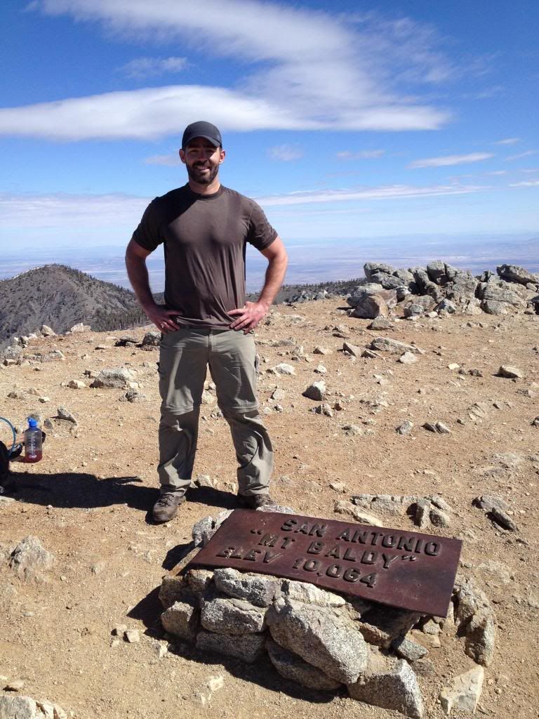
So we hiked up the bear creek trail to mt baldy and down the devils backbone. It was a great hike, really enjoyed the devils backbone trail and the views above the clouds were epic! we had a few brews and food at the baldy ski resturant and took the lift down.
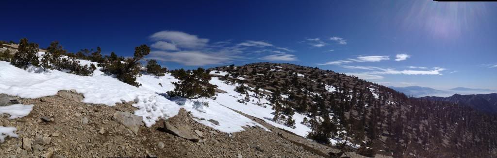
incredible view of baldy bowl and the clouds! We saw three people attempting to hike up the bowl, you cant see them but they are there.
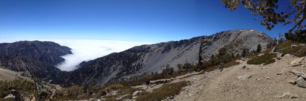
incredible view of baldy bowl and the clouds! We saw three people attempting to hike up the bowl, you cant see them but they are there.