Up Millard and Grand Canyons

TRs for the San Gabriel Mountains.
Post Reply
User avatar
Sean
Cucamonga
Posts: 3787
Joined: Wed Jul 27, 2011 12:32 pm

Post by Sean »

Saturday proved ideal for working one's way up a canyon or two. It was slightly cloudy and chilly, but not too cold for shorts and t-shirt. The lack of sun kept most of the angrier bugs away, too.

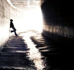
I parked at Millard Campground and headed up the Sunset Ridge Trail. Above Millard Falls I abandoned the nice singletrack and began boulder-hopping and sometimes following remains of the old trail up Millard stream, which flowed through a maze of wind-damaged, fallen trees. Further up-canyon the forest grew more lively and upright. I climbed over a significant boulder field where some seepage comes in from a steep gully on the right. A few groups of people were also exploring the area, including some at Dawn Mine, where I snacked for a bit and peaked inside the dark hole.

Further upstream a second mine opening on the left warranted a quick glance. I then proceeded to the junction with Grand Canyon, which slowly poured in from the right. Here I half-heartedly looked for the trail that used to continue up Millard to Tom Sloane Saddle, but didn't find much.

Beginning up Grand Canyon was relatively easy. For the most part the canyon was plenty wide with a gentle grade. I found traces of an old trail here and there. A handful of side gullies and tributaries sometimes made navigation an issue, especially during a stretch where the main streambed was dry and my options looked similar. However, thanks in part to my GPS device, I quickly realized that keeping to the right was key in most cases.

I passed the ruins of an old cabin in a relatively flat, open area. I'm not sure who built it, but a long time ago Joe Chapman used to do logging here, and the place became known as Chapman's Glen. Perhaps the cabin was his.

Beyond the glen a little snow lingered on the ground. To the left rockfaces closed in and rose vertically. I entered a narrow, enticing, high-walled tributary, following the sound of splashing water. Suddenly I found myself stopped at the base of spectacular, multi-tiered Alpine Falls. A small amount of water plummeted down maybe 200 feet from the top.

Backtracking, I continued up Grand only a short distance before again being stopped, this time by what I assume was Grand Canyon Falls, tucked inside a very narrow slot now filled with sediment, rocks, and fallen tree trunks. This debris makes it possible to climb most of the way up the slot to maybe fifteen or twenty feet below the top of the waterfall. However, the final hurdle requires some advanced rockclimbing skills. I'm not a technical rockclimber, but I think the counter-balancing technique is called stemming. I tried going up the slot using such a move, but the slippery and slightly crumbly rock convinced me to search for a bypass, which I found easily enough down at the confluence with Alpine Canyon. It's possible to scramble around the south slope of the canyon. Once on this slope, I decided to stay there, managing to follow some bits of the old trail which bypassed both the waterfall and a series of cascades above it. After one or two little slips and slides, the slope dropped me below Mt. Lowe Campground, where a boisterous group of Scouts were setting up tents for the night.

A mossy boulder in Grand Canyon
Image

Some more of Grand Canyon
Image

Alpine Falls
Image

Debris in Grand Canyon Falls
Image

Looking into slot where technical moves are required
Image

Close-up of technical climb
Image
User avatar
HikeUp
Posts: 3861
Joined: Thu Sep 27, 2007 9:21 pm

Post by HikeUp »

Interesting area that I (and others) have been contemplating doing as a descent. Thanks for the information regarding the falls and the pictures.

What was your return route?
User avatar
mattmaxon
Posts: 1137
Joined: Mon Mar 24, 2008 12:48 pm

Post by mattmaxon »

HikeUp wrote: Interesting area that I (and others) have been contemplating doing as a descent. Thanks for the information regarding the falls and the pictures.

What was your return route?
http://www.dankat.com/advents/alpine.htm

You can "easily" ascend the south side of grand canyon to Mt Lowe road.
User avatar
mattmaxon
Posts: 1137
Joined: Mon Mar 24, 2008 12:48 pm

Post by mattmaxon »

Sean wrote: Saturday proved ideal for working one's way up a canyon or two.
So you didn't see the airplane wreckage?
User avatar
Sean
Cucamonga
Posts: 3787
Joined: Wed Jul 27, 2011 12:32 pm

Post by Sean »

HikeUp wrote: What was your return route?
I returned via Middle Sam Merrill (Sunset) Trail to Echo Mtn, where I chatted with a few groups and took pictures for people. Then I took the Echo Mtn Trail to Cape of Good Hope and hopped on the Sunset Ridge Trail back down to Millard campground. I made it to the car a half hour after sunset, but had to jog most of Sunset Ridge.
mattmaxon wrote:So you didn't see the airplane wreckage?
No, I missed it. Is that in Grand Canyon?
User avatar
mattmaxon
Posts: 1137
Joined: Mon Mar 24, 2008 12:48 pm

Post by mattmaxon »

yeah
it is the steel tubing cage for the plane, and some other stuff
User avatar
Sean
Cucamonga
Posts: 3787
Joined: Wed Jul 27, 2011 12:32 pm

Post by Sean »

Got any tips for narrowing my search for the wreckage? I'm sure I'll be returning again soon. I want to see Alpine Falls at peak flow.

BTW - I did find a used Budweiser can (circa 1960s). If someone on this board lost it, you'd better claim it quick. I'm making a trip to the recycling center later this week.
User avatar
mattmaxon
Posts: 1137
Joined: Mon Mar 24, 2008 12:48 pm

Post by mattmaxon »

it's well below Alpine Cyn in the water course and above trail to Tom Sloane Saddle. or at least it was before the station fire
User avatar
Sean
Cucamonga
Posts: 3787
Joined: Wed Jul 27, 2011 12:32 pm

Post by Sean »

mattmaxon wrote: it's well below Alpine Cyn in the water course and above trail to Tom Sloane Saddle. or at least it was before the station fire
For a little bit I was following an old trail along the north bank instead of the streambed. That's probably how I missed it. Thanks.
User avatar
davantalus
Posts: 203
Joined: Mon Jun 08, 2009 9:09 am

Post by davantalus »

Second mine opening? You don't mean the upper entrance to the Dawn, but a second mine? Did you look inside?
User avatar
Sean
Cucamonga
Posts: 3787
Joined: Wed Jul 27, 2011 12:32 pm

Post by Sean »

davantalus wrote: Second mine opening? You don't mean the upper entrance to the Dawn, but a second mine? Did you look inside?
It's not the upper tunnel of Dawn. I mean a separate tunnel about 0.3 miles further upstream. From a quick glance it appeared to extend at least 30 feet, possibly much more.
User avatar
outwhere
Posts: 323
Joined: Sun Jan 25, 2009 5:40 pm

Post by outwhere »

Been meaning to compliment you on this TR and your Brown Mt. TR --- nicely written with lots of good trail info...

That Brown Mt. TR, 10.5 hours, wow, a fun but long day ehh :wink: Pretty cool that you didn't settle for a car shuttle or 'pick me up when I'm done' finish...

Back to your Grand Canyon ascent... a few years ago, I posted a question about Grand Canyon... cougarmagic shared these informative links...

Grand Canyon TR, west to east approach by Christopher Earls Brennen

http://www.dankat.com/advents/alpine.htm

Grand Canyon TR, east to west approach by Christopher Earls Brennen

http://www.dankat.com/advents/grandc.htm
Sean wrote: I passed the ruins of an old cabin in a relatively flat, open area. I'm not sure who built it, but a long time ago Joe Chapman used to do logging here, and the place became known as Chapman's Glen. Perhaps the cabin was his.
On your trip back to the Grand Canyon, any chance of you snappin' a few cabin remains pivcs? What an interesting place for a cabin... in fact, one of Brennen's TRs mentions 'several cabins'... btw, cool find on the Budweiser can :wink: :P
Post Reply