HikeUp wrote: Started at the Rubio TH and went up Lone Tree Trail to just about 3050', turned around and took the SCE Tractor Road back down.
I've been restoring the Lone Tree and am glad to see people actually using it. The trail can be followed rather easily up to Panorama Pt, thus enabling many loop opportunities, but right now I'm only working up to the plateau just north of Summit 3681 (West Fuji), where I recently placed a register. Also, at 3240' there is a flagged off-trail route leading to a couple different historic mines (Summit and Carrie). Getting to Summit is easy, but accessing Carrie is a bit dangerous, though manageable without ropes. Anyone interested in a map to these mines or more info can email me.
I highly recommend continuing on the Lone Tree to at least the plateau, where the views are unique and striking. Just before the plateau is a nice grove of oak trees where I usually have lunch or take a nap.
Great stuff Sean! Perhaps I'll run into you out there and thank you in person for some really tough work.
I turned around this time at 3050' as I said, but AW and I have been up to 3681 via a x-country route up from Leontine Falls, which in hindsight must have gone throught the same grove of oaks. This was back in 2010 I believe. Didn't see any signs of a trail then but we sure saw a lot of bear crap. We continued on up to Panorama Pt. - the ridge was pretty clear at that time above 3681.
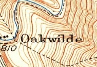
I'm not aware of another name for Panorama Pt. The Lone Tree between 3681 and Panorama is basically a straight shot up the ridge, as depicted on your map. But some of the original trail is gone, so today it is a use trail roughly approximating the original. At one point, it is still possible to follow a couple overgrown switchbacks (part of an old road) rather than scramble up the steepest section. See attached GPS track of the route I took. Overall, the trip between 3681 and Panorama should be straightforward and clear of tall brush, which is why I haven't bothered flagging or improving it.
I think Panorama Point is an unofficial name of same vague point near what is labeled Muir Peak (4688') on some maps. Perhaps some even think 4688 is also or even should be Panorama Point or Inspiration Point. T Chester speculates it is point 4504 just ESE of 4688. It's all very unclear.
Older USGS topos label point 4714 as "Inspiration Point". Newer USGS topos have renamed that high point to "Muir Peak." I've always considered point 4688 to be Muir Peak. Who knows what's what on that ridge?
It's just good to know one can go all the way up that ridge. Soon.
HikeUp wrote: I think Panorama Point is an unofficial name of same vague point near what is labeled Muir Peak (4688') on some maps. Perhaps some even think 4688 is also or even should be Panorama Point or Inspiration Point. T Chester speculates it is point 4504 just ESE of 4688. It's all very unclear.
My guess is that 4504 is Morning Glory Point, where Ed Tobin and his mule used to take passengers on the One Man & Mule Railway. According to a 1939 topo map I have, the railway stops just before 4504 with only a trail continuing to Panorama Point and connecting with the Lone Tree Trail. Also, I think the name "Morning Glory Point" makes sense for this overlook, because it's where tourists would experience the best sunrise views over Eaton Canyon.
Perhaps the trail extended to Panorama Point in order to access the water tank or simply connect with the Lone Tree, which itself was originally built by the water company to access equipment in upper Rubio Canyon.
Hikin_Jim wrote: So, Sean, what do you think is Inspiration Point? Is point 4685 on your map (above) Inspiration Point?
I consider Inspiration Point to be where Thaddeus Lowe built the ramada in 1925. The Point's original location, before the ramada, could have been summit 4714 directly NW of the ramada, which is where the current USGS map appears to place it. There is also a pre-ramada postcard that puts Inspiration Point somewhere near the top of Castle Canyon Trail.
I'm not aware of maps that place Inspiration Point at or near 4685. But it's very possible. I know mapmakers (eg, Tom Harrison) have confused the location of Muir Peak, sometimes placing it at 4714.
Additionally, I tried to find out more about Panorama Point, but I still haven't discovered anything significant. It doesn't appear on some old maps I have. I call it Panorama Point because that is what it's labelled on my Tom Harrison map, and it seems to be the commonly accepted name for the area just below the water tank where the Lone Tree meets the fire road.
Hi guys, I saw this thread and had to jump on. I was working as a USDA-FS volunteer in 1993 when the Kinneloa fire swept through Rubio. Trail beds covered for decades were exposed and I made it my task to map and mark the trails before they disappeared again. since then I have put out a number of maps based on my work, identified by my initials "PRA". I am going to start with the oldest and come forward in time. My first map, from 1995, was of the old trails associated with Echo Mountain. I called them the "Research Trails" to ensure that the Forest Service didn't think I was restoring them. there is a report that goes with this; if you want to see it I will e-mail it to you.
Hi Paul. Welcome to the forum! I was one of the two guys (me and Hikin Jim) who ran into you as we descended the Lower Old Echo Mtn Trail (I asked if you knew AW).
The stuff you're doing in the Rubio area is really cool, and once it actually cools down I'll definitely be exploring the trails more. I'm a local so am very interested in the new trails and would like to help where physically possible. I wasn't able to make the Altadena Crest Trail Restoration Working Group (ACTRWG) meeting this past Tuesday but am interested in contributing what I can. Are you associated with the group?
Hey HikeUp-I was the original chair of the ACTRWG [2002-2003] but got off because I became involved as an attorney in the trails case involving the La Vina development and it caused a conflict. My main formal trail thing right now is restoring trails for the AFC on their parcels in lower Rubio Canyon [they own roughly everything south of the SCE lines]; I am in the 3rd year of a five year contract. I run a trail crew every other Friday morning. Sean who has posted on this thread is a member of the crew. We are having our first workday after summer hiatus on 9/21. I am also going to try to do the first Saturday every month in Rubio as I have school and scout groups looking for work.
Attached find the complete "Trails of Echo Mountain" map. This map shows all the trails I currently use, including those that I do not promote to the public, i.e., the A & A Trail and the Pole Line Trail. I have also include a specialized little map that shows the connection to the A & A from the Incline Trail. If I were doing the
A & A the first time I would do it from the Incline. It gets a little steep in there and you don't want to get lost.
If anyone's interested, next weekend I'll be going up the Lone Tree Trail from Rubio Canyon to Panorama Point on Saturday or Sunday depending on the weather. Hopefully Saturday. I will be starting early (around 8AM), traveling at a leisurely pace, perhaps cutting a branch here and there, and possibly visiting two mines and West Fuji (3681'). From Panorama I'll take the road to Inspiration Point and then decide which way to return.
Finally got out to explore the Rubio trails up to Echo. Started at Pleasantridge. My original idea was to take the Lower Old Echo Trail then loop back on the Sam Merrill. I spotted that trailhead easily, but went ahead a bit further to see if I could find the Chalet or Incline Trail. The advice given here was perfect and I didn't have any trouble finding that trail. I ditched my original idea and started up the Incline Trail. Had no trouble keeping on the trail and I'd say it was in pretty good shape. Made my way to Echo then went down Sam Merrill to the towers and descended down Lower Old Echo Trail to Rubio and my car.
I really enjoyed climbing the incline trail. A fun little adventure and neat to see a few burnt out rail ties and the foundations of the incline. Higher up on the incline trail I could see a waterfall on the other side of Rubio. Anyone know the name of this one? Fun loop and I look forward to exploring more.
The only negative were the leftovers on the trail left by animals. Not four legged ones, but two legged ones. I noticed more trash than usual on top of Echo. Also a lot of tissues at the top of both The Incline Trail and top of Lower Old Echo Trail.
Nice paper maps left in the box at the Pleasantview trailhead.
shreddy wrote: Higher up on the incline trail I could see a waterfall on the other side of Rubio. Anyone know the name of this one?
After you cross over to the Chalet Trail you can see Leontine Falls. The Throne Trail continues down a short distance from the Chalet/(Upper) Old Echo junction to an overlook directly across from the waterfall. It's easy enough to follow but some bushwhacking is involved.
Thanks Sean. It was a lot of fun getting to Echo from a new trail. Exciting to not know what was ahead. I'll definitely do this one again.
I had to look up "crux" and it's relationship to hiking / climbing. The red rope was appreciated. Was a bit concerned that the "tree" it's attached to would hold... tested it and still seems strong. Got my heart racing a bit.
Next up I'd like to check out some of the other routes featured on this thread. Lone Tree especially. I didn't spot the Throne Trail but I wasn't looking for it. I'll re-read this thread as I recall it is mentioned in a previous post.
It's been years since I was in Rubio. Nice to know I can now use other routes that don't stop me at the first waterfall.