Mt Lowe, San Gabriel Peak, Mueller Tunnel - Storm - 3/17/12

TRs for the San Gabriel Mountains.
Post Reply
User avatar
rallison
Posts: 9
Joined: Sun Mar 18, 2012 1:11 am

Post by rallison »

First time posting here - might as well start with a nice winter storm hike up Mt. Lowe and San Gabriel Peak.

Ended up hiking just over 5 miles. Basically, Eaton Saddle through Mueller Tunnel to Markham Saddle to Mt. Lowe. Returned to Markham Saddle and hiked up to San Gabriel Peak before finally returning back down to Eaton Saddle.

Conditions were quite windy in exposed sections. Had a few sections with very strong winds sandblasting me with graupel. Aside from the sandblasting, it was a quite excellent hike.

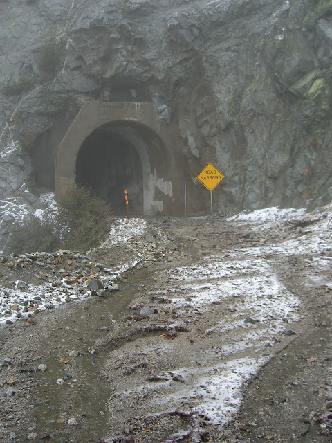
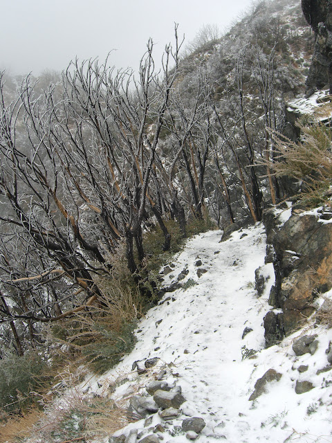
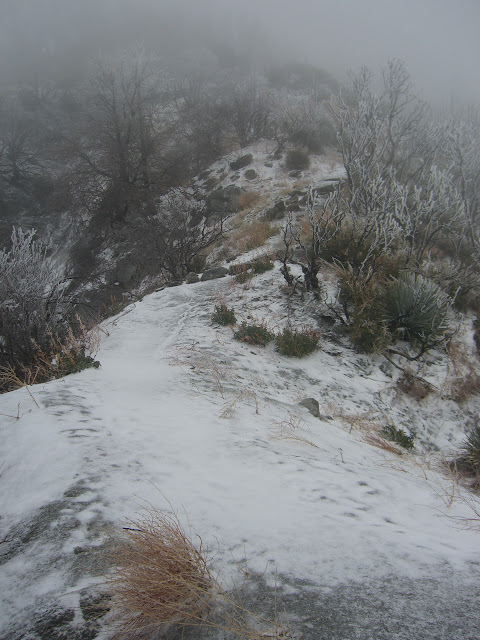
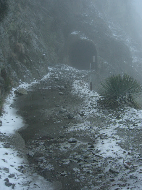
Leading up to the tunnel:
Image

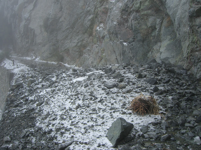
New rock slide just exiting the tunnel (a little amazing, considering that the pictures from HikeUp from a week ago showed a perfectly clear path):

Image

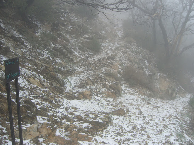
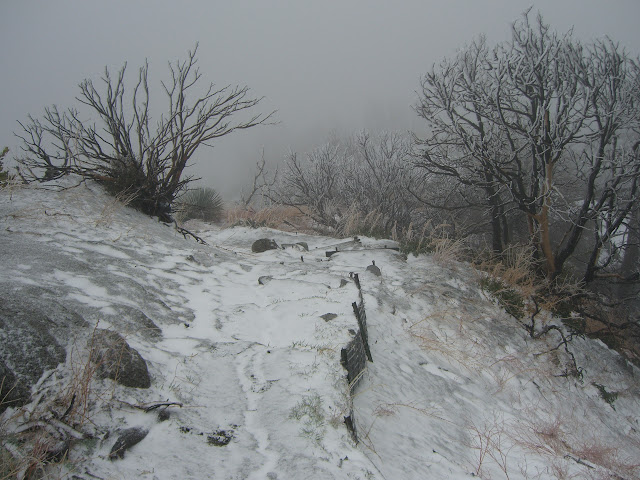
The last intersection before the final, short climb to Mt Lowe:

Image

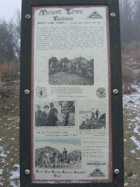
Mount Lowe Railway Sign at the top:

Image

Heavy clouds at the summit of Mt Lowe:

Image

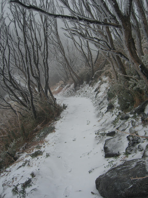
Along the trail to San Gabriel Peak, getting sandblasted (snowblasted?) with some graupel:

Image

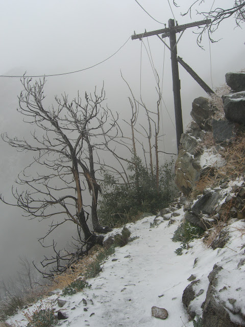
Downed power lines and burned poles:

Image

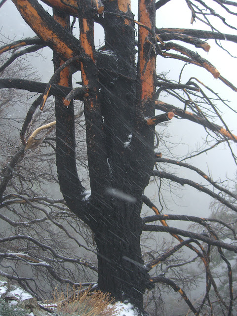
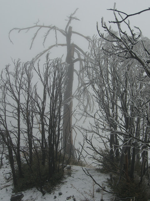
Snow covered burnt trees and path along the way:
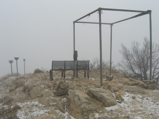
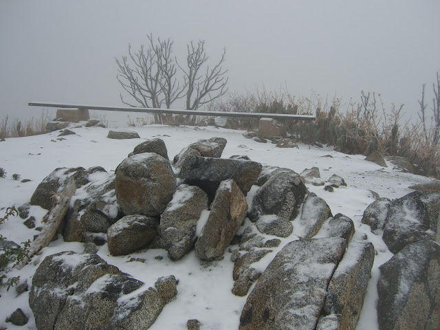
Image

The icy overlook:

Image

Image

Snow-blasted tree skeletons:

Image

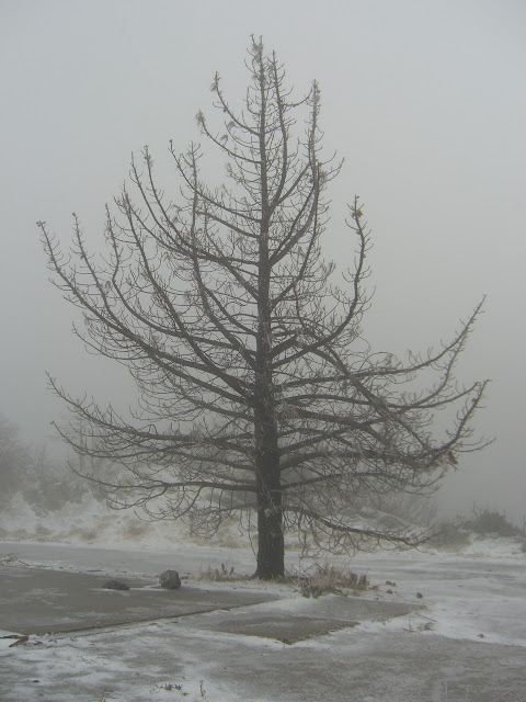
Finally a winter scene this year (after such a weak year, it is nice to see a cold, winter scene out here):

Image

Image

More skeletons:

Image

The 6161ft San Gabriel Peak:

Image

Unrelenting clouds on the way back:

Image

Back to the car - snow starting up again:

Image

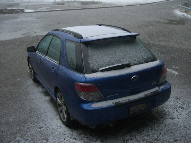
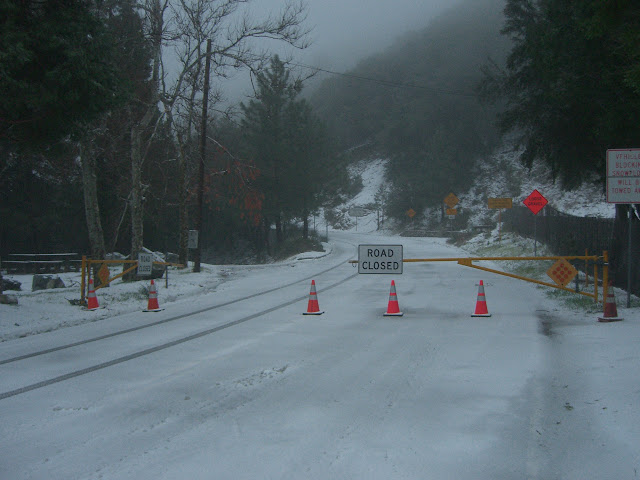
Looks like they closed Mt Wilson Red Box Rd sometime after I drove up:

Image

(Yes, those singular tire tracks are mine. Guess they left the gate open for me to get down. Thanks!)

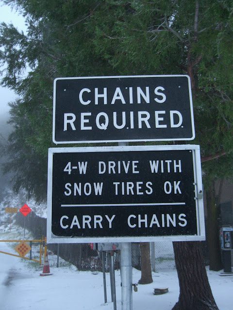
Meh, not that necessary:

Image

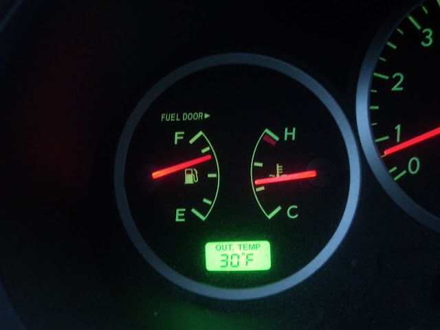
Was chilly, but not that cold:

Image

The wind was more of a factor than the temperature.

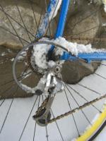
Oh yeah, looked like a cyclist was getting a ride back down at dark along Angeles Crest:

Image

Crazy? Maybe. Of course, I cycle, and have ridden in similar conditions, so I can relate.

Anyway, not a bad couple of relatively easy winter summits.

Garmin Connect for the hike

Full photo set

Enjoy.
User avatar
HikeUp
Posts: 3861
Joined: Thu Sep 27, 2007 9:21 pm

Post by HikeUp »

Nice! Great pictures of the trail conditions. Disappointed in seeing the rock slide already at the west end of the tunnel - jeez.

Snow level is down to about 3400' this morning in the front range.
User avatar
Hayduke
Posts: 36
Joined: Sun Sep 06, 2009 2:18 pm

Post by Hayduke »

Great photos, thanks for sharing.

I can't believe someone tried to ride their bike up there - or actually did ride their bike up there.
User avatar
Taco
Snownado survivor
Posts: 6010
Joined: Thu Sep 27, 2007 4:35 pm

Post by Taco »

Nice conditions. Nice WRX. :-)
User avatar
rallison
Posts: 9
Joined: Sun Mar 18, 2012 1:11 am

Post by rallison »

HikeUp wrote: Disappointed in seeing the rock slide already at the west end of the tunnel - jeez.
After the hike, I stumbled upon your pictures from a week ago and was amazed at the difference. On the plus side, it looked like the new slide caused no structural damage, so hopefully it is just a matter of clearing away the rocks.
HikeUp wrote: Snow level is down to about 3400' this morning in the front range.
Driving back, snow was falling, but not sticking, as low as ~2500ft. That said, this afternoon, from cycling up 39, snow was not sticking until above the 4000ft level. Still not bad though, and 5000ft had a few inches with a bit more at 6000ft.
Hayduke wrote: Great photos, thanks for sharing.

I can't believe someone tried to ride their bike up there - or actually did ride their bike up there.
Thanks. And yes, pretty amazing cycling route yesterday. Of course, he isn't the only crazy one out there. I cycled up 39 to Crystal Lake today, so yeah.
Taco wrote: Nice conditions. Nice WRX. :-)
Perfect car for a road like AC. Always fun.
User avatar
Sewellymon
Posts: 97
Joined: Tue Feb 12, 2008 8:55 pm

Post by Sewellymon »

Rallison- pretty stout conditions for a snow ride. I was in a black Audi driving down and saw you riding uphill a couple miles below Crystal Lake. I actually thought you were a madman who started down in Azusa or Glendora. Starting from above West Fork only confers 1/2 madman status..

I got a flat tire on my car from a rock in the road (19" performance tires suck sometimes).

So anyway, pics from our hike up the Windy Gap trail

Image[/code]

Image

Image
User avatar
rallison
Posts: 9
Joined: Sun Mar 18, 2012 1:11 am

Post by rallison »

Sewellymon wrote: Rallison- pretty stout conditions for a snow ride. I was in a black Audi driving down and saw you riding uphill a couple miles below Crystal Lake. I actually thought you were a madman who started down in Azusa or Glendora. Starting from above West Fork only confers 1/2 madman status..

I got a flat tire on my car from a rock in the road (19" performance tires suck sometimes).
I'll take that 1/2 madman status. I'll have to add it to my business cards.

You know, I think I remember your exact car. If it's the one I'm thinking of, nice car.

How far did you hike on Windy Gap?
User avatar
Sewellymon
Posts: 97
Joined: Tue Feb 12, 2008 8:55 pm

Post by Sewellymon »

rallison wrote:
Sewellymon wrote: You know, I think I remember your exact car. If it's the one I'm thinking of, nice car.

How far did you hike on Windy Gap?
My car was a black Audi A4 S Line w bike racks.. i waved or gave a gentle honk.

We did not hike too far up trail. Couple miles; maybe half-way to Windy Gap. Was the fiance's 1st snow hike. Just casual fun..
Post Reply