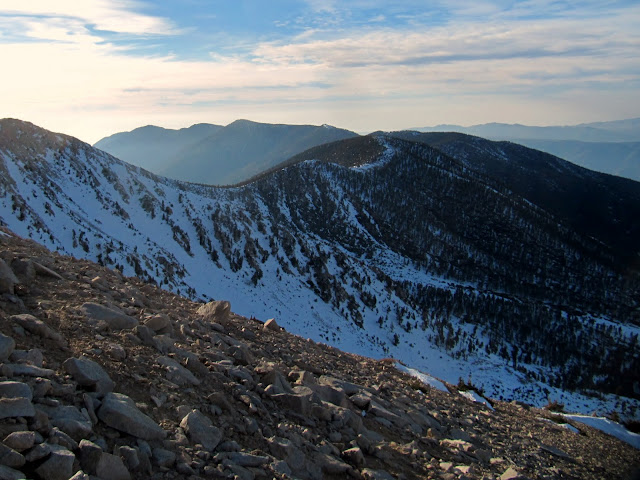
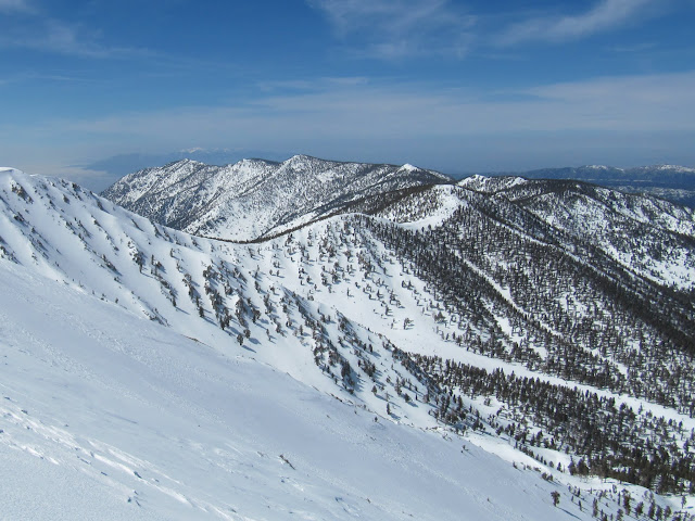
View of the ridge line from the northwest slope on 3-10-12 and 3-12-11
We took a fairly relaxed pace most of the day and reached the summit just before sunset. The rock shelters on the summit had snow drifted inside and we didn't feel like digging them out so we walked down to the plateau south west of the peak. We camped on a nice sandy flat with a nearby drift we used to make water. The wind was blowing like normal but not too crazy. After setting up the tents the rest of the evening was spent melting snow and relaxing. I couldn't sleep that great so I got up a little before sunset and walked back up to the peak to watch the sunrise. The wind had picked up and my water bottle began to freeze in the short time it took to walk from our camp to the peak.
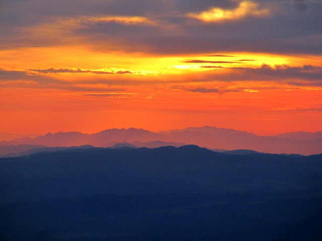
Sunrise from San Gorgonio
After the sunrise I walked back down to camp and the others were crawling out thier tents. We sat around, ate breakfast and had warm drinks before packing up and hiking out. When we were walking back to the northwest slope we found a newer looking aircraft part. Ron thought it was a piece of the landing gear and it turns out he was right. There were model numbers and "piper" on the part so I looked it up when I got home. I came across this post from San Gorgonio SAR and another article in the news paper about a single-engine Piper Cherokee that crashed near Dobbs peak in 2008. I assume its from that plane. Anybody remember this crash? I dont recall hearing anything about it. Once back to the meadow and on the trail we saw a few groups along the way but otherwise, the walk out was muddy, but uneventful. Not many cars in the parking lot when we got back but there was an eispiraten.com sticker sighting.
The rest of my pictures are here.