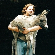
The meltdown plan:start at the A-crest hwy and the Upper Big Tujunga rd where the Silver Moccasin trl heads down to West Fork camp. Then up to Wilson via Kenyon Devore trl. Parked the car at Red Box and hoped for a ride to the start of the trek.In no time to my surprise, I got a ride from a snowboarder who was not enjoying the ACH cause it had too many turns as I got off to walk I assured him that is good training for the snowboarding.
The trail starts going downhill for a mile or so with a continuous pano view of the Wilson area and the tallest antenna, the end marker of the trek. The Rincon rd looked like it had been worked on. The sad view of the big burn show is evident everywhere you glance except the upper part of the Wilson area. A cool winter,bug-free, downhill walk on a nice trail, passing a lot poodle dog plants and lots of fried trees and brushes. You also get a view of the Markham,Occidental and Gabriel peaks along with the rd going to the top of Wilson but they all disappear as you reach the floor of the Shortcut cyn . What a serene,cool trek through streams,fall colors, wet green grass,live and burned canopy, plenty of crossings and a few red flags as a guide to help you reach the West Fork Camp. Once there, at this secluded area you can relax, reflect and have a snack on any of the deserted picnic tables.
A bit past the camp, the trail starts the uphill side of the rim, cool and under the shade with tall trees, zizgy-zags past tiny ornamental falls until you get to view of the tallest antenna and the anticipated feeling, with tired legs,that end is near. Not quite, the ascension continues until you get to view Gabriel and Lawlor mts,and more emf emitting antennas. Finally the newly planted brown info signs come to view as I step on the paved road.
All I need to do now is hitch a ride to Red Box or walk 5 more miles. I figured I would stand a better chance to get a ride here than the ACH. A few city rats passed me with no ride success. I was wondering if I looked like trouble and then a nice city person gave me a ride to Markham Sdle. I checked out the tunnel,then got another ride to Red Box. Not too bad for a trek lasting 5hrs. I would say that from now on and until the bugs and the heat show up, this less travelled place is an amazing place to be in nature.... 666
The Mt Wilson rim to rim turkey melt trek
-
PackerGreg

- Posts: 623
- Joined: Sat Sep 12, 2009 9:31 pm
Oh, you look like trouble for sure, G. Next time try tucking those horns under a hat, you'll have an easier time hitching a ride.666-THE BEAST wrote: I was wondering if I looked like trouble...
-
666-The Beast

- Posts: 124
- Joined: Wed Jun 15, 2011 8:08 pm
For a more saintly look I need a popes hat! The city rats are always afraid and no hikers use the Wilson rd, they all walk up on a trail..
The hike was awsome!!!! 666
The hike was awsome!!!! 666
-
HikeUp

- Posts: 4028
- Joined: Thu Sep 27, 2007 9:21 pm
#18's (666) pics and comments...
Edit: Deleted by request.
Edit: Deleted by request.
