------------------------------------------------------------------------
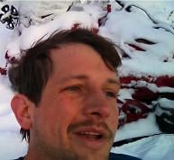
I met with the group of 13 people at 1:00am at the Ramon trailhead and started climbing at about 1:20am. There were thunderstorm warnings all over the mountain. A few hours ago I could see distant thunderheads exploding with lightning over Joshua Tree National Park, but now there were no clouds in the sky. The temp was about 80 degrees and kind of humid, making for good starting weather, considering that in the day time it was supposed to be over 100. I jumped to the first 2 people in the group and started hiking with them. When we reached 3,500ft, I realized I didnt have breakfast yet and my energy would soon die if I didnt eat (the previous day my only food was a burrito). I stopped to eat at 4,500ft and set up the camera on a big rock for some pictures.


I stayed at 4,500ft for about 20 minutes before sprinting up the trail again. The middle section of C2C (4,500-6,000ft) is a series of uphills and downhills that dont seem to gain any elevation. You go up a hill and then go back down the same distance, but finally you get to a couple hills that seem to be increasing the overall elevation. The section from 6,500ft to 8,500ft are what most consider the most grueling. Its a continuous steep uphill that dosent seem to end. I love this section, partly because the views get really good and partly because its a butt kicking workout.
I had never hiked this portion of C2C at night. Normally I would start at the trailhead after sunrise, and not reach this part till late morning. The city lights were stunning, and I just had to stop a few times to get some pictures.
Palm Springs from 6,700ft


from 7,000ft

from 7,500ft


I caught up to the first group of people at the top of the skyline portion of the route, known as Long Valley at 5:48am, a little over 4 hours after I started. At this time the entire group was all spread out one by one on different parts of C2C from 4,000ft to 8,500ft. I walked half a mile to Long Valley ranger station to fill up water. After getting water, I heard on my radio that someone in the group was in trouble further down the route. I turned and started walking back down the Skyline portion. Another person in our group, Michael, that I happened to meet on the way down said he would go too. We descended a mile down to 7,200ft and I saw Joe, another person in our group, walking up. He was pooped out but not in any sort of trouble. At this point Michael was walking down to help out the person who was in trouble and I was going to climb back up with Joe.
At this point the sun was rising and lit up the entire valley


After reaching Long Valley again I took off and sprinted the 2.5 miles towards Round Valley to catch up with the rest of the group. Joe, Micheal, and the others ended up taking the tram down.
Trees at long valley


I reached the middle portion of the group at Round Valley right when they were finishing their rest break. As they were leaving, I stopped to get a drink of water and then started running up the trail leading to San Jacinto Peak. After a little more than half a mile of running I got a call on my radio that the others gone the wrong way and were lost. They told me to scream so they know what direction the correct trail was, but they were too far to hear it. Suddenly the radio began to die and I spent a confusing 20 minutes standing there trying to hear what they were saying through the loud crackling of static. Then the radio completely died and I began walking back, assuming that they would turn back and find the right trail instead of bushwhacking. After another 15 minutes I saw them coming up. We met up again and began hiking up to Wellmans Divide where we would have lunch.

After lunch at Wellmans divide it was an easy 2.5 miles to the summit


We reached the summit at a little past noon. Its was over 100 in palm springs where we started and in the 50s at the summit.


We stayed 20 minutes on the summit and descended


5.5 miles later back at Long valley, me and Steven decided we would hike back down to the cars instead of riding the tram, which everyone else was doing. I was not keen on paying the $12 for the tram either.


At 4,000ft it began there was a dramatic temperature change. It felt like it rose 30 degrees in the last thousand feet.


We were back at the bottom at about 8:15pm, climbing for about 19 hours.