North Backbone - Pine, Dawson, Baldy 8/7/2011

TRs for the San Gabriel Mountains.
Post Reply
User avatar
mcphersonm80
Posts: 243
Joined: Mon Aug 23, 2010 11:46 am

Post by mcphersonm80 »

The road up to this trail is in pretty terrible shape. It's possible, but I don't recommend anyone in a regular car drive up there.

Image
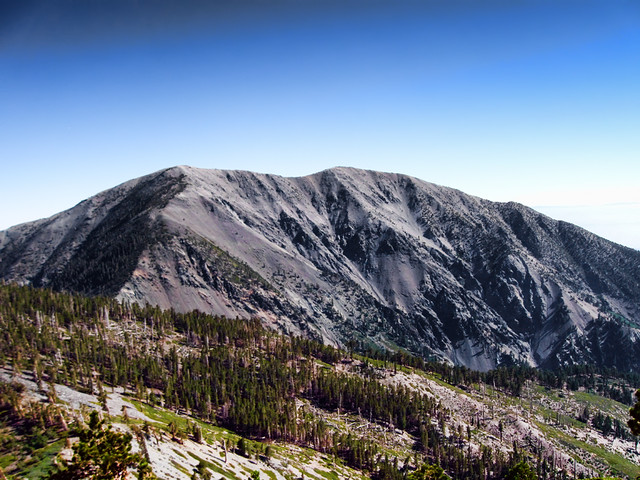
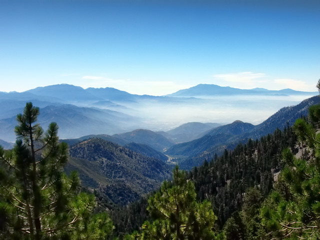
Mount San Antonio by Wattifoto, on Flickr

We parked about a quarter of a mile past Guffy in a small turnout where the PCT crosses the road, which added about a mile of easy walking to get to the actual trailhead.

Once you hit the trail, it's down, then up, then down, then up, then down, then up, then way down, then waaaaaaay up. :shock:

Image
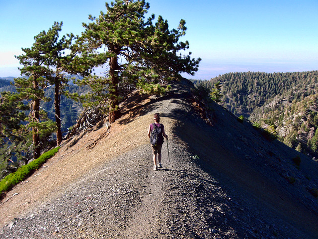
Ridge Route by Wattifoto, on Flickr

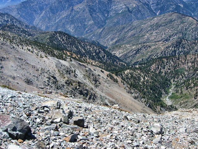
Hands down some of the most jaw-dropping scenery in the SGs. Great views across the whole range and also out to the San Bernardino and San Jacinto ranges.

Image
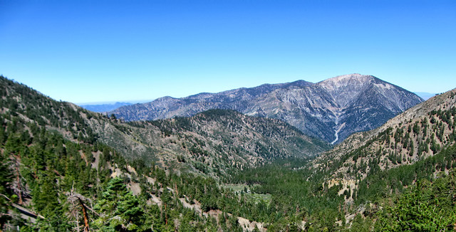
Overlooking Prarie Fork by Wattifoto, on Flickr

Image
San Gorgonio and San Jacinto by Wattifoto, on Flickr


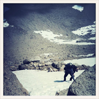
The trail was very scrambly in spots, particularly on Pine Mountain's north face. I'd say Class 2, for sure, but just take your time and be careful, it's doable.

Came across a large pile of old tin cans around Pine's summit... any idea what's up with these?

Image
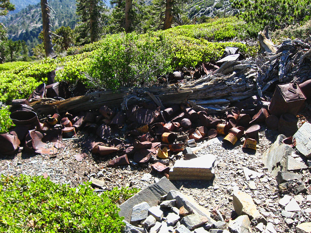
Tin Cans by Wattifoto, on Flickr


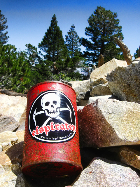
Also did a little bit of decorating on Dawson's register can:

Image
Dawson Peak Summit Register by Wattifoto, on Flickr

8)

Awesome views of Iron, the drop-offs on either side, huge imposing view of Baldy that doesn't translate in photos from the Dawson/Baldy saddle, and then a nice cool AB on the summit, as usual.

Image
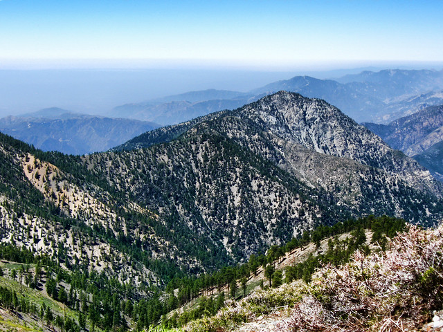
Iron Mountain by Wattifoto, on Flickr

Image
Fish Fork by Wattifoto, on Flickr

Image
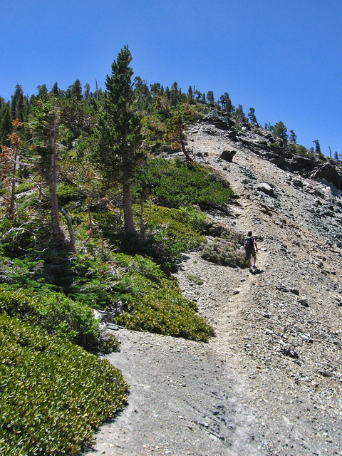
Snaking Up by Wattifoto, on Flickr

Image
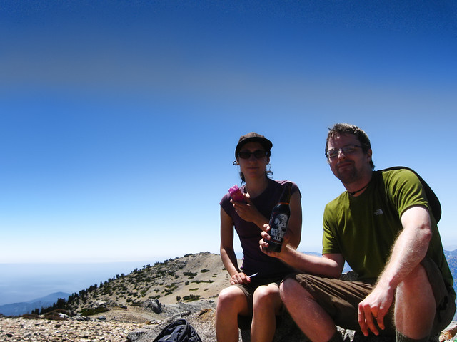
Relaxing on Baldy by Wattifoto, on Flickr


All in all, an incredibly awesome hike. If it weren't for the drive up Blue Ridge Rd, I'd do it again in a heartbeat. As it is now, might work my way up to Guffy, spend a night, then dayhike the next morning.

Lots more pics here:

http://www.flickr.com/photos/wattifoto/ ... 391259878/
User avatar
HikeUp
Posts: 3855
Joined: Thu Sep 27, 2007 9:21 pm

Post by HikeUp »

Nice hike and great pictures. Thanks for the update on the road conditions too! 8)
User avatar
Hikin_Jim
Posts: 4686
Joined: Thu Sep 27, 2007 9:04 pm

Post by Hikin_Jim »

Cool stuff!

Not sure what those cans are about although there was logging going on up there during the war. May have been a loggers camp.

HJ
User avatar
Marty
Posts: 50
Joined: Wed Apr 13, 2011 1:16 pm

Post by Marty »

Great work, love the photos and TR.
User avatar
406
Posts: 321
Joined: Thu Jan 17, 2008 10:36 am

Post by 406 »

Nice tr. One could hike up Acorn trail from Wrightwood and skip the drive on Blue Ridge road.
User avatar
mcphersonm80
Posts: 243
Joined: Mon Aug 23, 2010 11:46 am

Post by mcphersonm80 »

406 wrote: Nice tr. One could hike up Acorn trail from Wrightwood and skip the drive on Blue Ridge road.
Yeah, we were considering that route, but I didn't like the sound of 2000' extra gain/loss and 2.5 extra miles. After HikeUp described the road, we decided to give Blue Ridge a shot.

It was definitely worth it, but next time up I'll most likely go the Acorn route, unless I find someone with a monster truck they can lend me...
User avatar
rokclimbr
Posts: 124
Joined: Mon Jan 03, 2011 5:32 pm

Post by rokclimbr »

I drove up to the trailhead a few weeks back in my Honda FIT stopped half a dozen times to clear some bigger rocks. I didn't think it was to bad (used to drive my car deep into Holcomb Valley Big Bear so compared to that this road might as well be paved).
How long did it take you to get to Baldy and back (car to car)?

Not that it's worth much but I'd have to say this is my favorite hike in the SG.
User avatar
outwhere
Posts: 323
Joined: Sun Jan 25, 2009 5:40 pm

Post by outwhere »

Some seriously beautiful pictures... screen saver type material.

Ahhhh, and an Arrogant Bastard to 'top' it off :!:

My neighbor gave me one of those the other week - I really really liked it - wonderful, bit different flavor and it had a nice kick to it too...
User avatar
mcphersonm80
Posts: 243
Joined: Mon Aug 23, 2010 11:46 am

Post by mcphersonm80 »

rokclimbr wrote: How long did it take you to get to Baldy and back (car to car)?

Not that it's worth much but I'd have to say this is my favorite hike in the SG.
Car to car was about 9 hours, I think, which included generous breaks at each summit (45 min on Baldy alone). And I have to agree, this is now THE way to hike Baldy and probably the best summer hike in the entire range.

outwhere wrote:Some seriously beautiful pictures... screen saver type material.

Ahhhh, and an Arrogant Bastard to 'top' it off

My neighbor gave me one of those the other week - I really really liked it - wonderful, bit different flavor and it had a nice kick to it too...
Thanks, and if you like Arrogant Bastard at home, wait till you taste it at elevation! 8)

- - - - -

If anyone's interested, I created a Route page on summitpost for this hike:

http://www.summitpost.org/north-backbone-trail/737045
User avatar
tpfishnfool
Posts: 62
Joined: Sun Feb 20, 2011 10:50 am

Post by tpfishnfool »

Great trip report and pics ! Been wanting to do that rout for a couple years, what was total distance miles from start to finish ?
User avatar
mcphersonm80
Posts: 243
Joined: Mon Aug 23, 2010 11:46 am

Post by mcphersonm80 »

tpfishnfool wrote: Great trip report and pics ! Been wanting to do that rout for a couple years, what was total distance miles from start to finish ?
Total distance according to my GPS was 10.826 miles.

But keep in mind we parked just past Guffy, which added about 1 1/4 miles of an easy walk each way, so if you're able to make it to the actual trailhead parking area, the mileage is just about 8 miles round trip.
Post Reply