Retreat from South Iron Fork 7/12-7/13

TRs for the San Gabriel Mountains.
Post Reply
User avatar
AW~
Posts: 2040
Joined: Mon Oct 01, 2007 12:00 pm

Post by AW~ »

Cheated and hiked from Crystal Lake to S.Hawkins 7/11/11, letting the shade do the advancing. Neat place to camp.

Next morning headed NE from the helipad/turnoff ,down to S.Iron Fork. That met up with the Sierra club report down there to elevation 6300 http://angeles.sierraclub.org/hps/archives/hps01549.htm
Heading downstream, just minutes later encountered obstacle#1, a series of drops, one of unknown height. There was an easy bypass along a plateau with a nice view of the canyon, ending in a brushfree rock scramble back down to the creek. A few downclimbs later(one of which with more water would have been a rappel), the creek canyoned up bigtime and I retreated after encountering a 70ftish waterfall.

I came back up the same ridge the Sierra Club had come down. Then from there back to S. Hawkins, then err....down the hot sun steep hellish Pigeon ridge trying to shortcut it and paying for it. Finally down to Hwy39 and almost straight into the North Fork SG waters. Interecepted by the police who were surprised that I was happy to see them patroling Hwy39 so late an night. Overnight at the West Fork. And then a hike to the East Fork. Gulp. Needless to say, a lot of trash left over from July 4th. A lotttt of trash.

Heading up the trail from Crystal Lake at elevation 5900 or so, a neat little short lookout point off trail.
Image

The moon was bright(S Hawkins fireroad)....did a short explore of Snowslide canyon and it does have one non-descript rappel just below the fireroad.
Image

Next day...first part of obstacle#1 at appox elev 6100....a 15ft rappel into a deep pool then a short drop into another pool
Image

Tier 1,2 and beginning of 3 of obstacle #1
Image

Last part of obstacle#1
Image

Downclimb yards before the absolute point of no return
Image

Looking down the point of no return into a deep pool
Image

South Iron Fork canyon from lookout point-hiking out
Image

Looking down from lookout point(above this its much less steep)
Image

S Iron Fork with Baldy in the background
Image

One of the big horn sheep group below SHawkins
Image

Down Pidgeon ridge, ughhh
Image

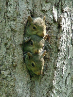
Lone deer the next day
Image

rest
Image

One of my fav spots
Image

Log swing along the East fork at Oaks picnic area
Image
User avatar
Elwood
Posts: 612
Joined: Fri Aug 15, 2008 5:23 pm

Post by Elwood »

Nicely done! Nice critter pix too.
User avatar
cougarmagic
Posts: 1409
Joined: Wed May 07, 2008 5:21 pm

Post by cougarmagic »

Oh brother...there's another one. :cry:

:lol: Great photos and a very cool trip. Which fork (North or South) do you think is "better", from a canyoneering standpoint?
User avatar
Taco
Snownado survivor
Posts: 6010
Joined: Thu Sep 27, 2007 4:35 pm

Post by Taco »

Brilliant! Thank you for giving me my next goal!!!!! 8)
User avatar
AW~
Posts: 2040
Joined: Mon Oct 01, 2007 12:00 pm

Post by AW~ »

cougarmagic wrote: Which fork (North or South) do you think is "better", from a canyoneering standpoint?
I think the only canyoneering "must do" trade canyon/smiles all around is the lower portion when both forks are combined and I would say thats almost a prerequiste to a trip down either fork anyway. Its an open question if I could have continued or not....it could have been double or triple the water in less space.

I think from a canyoneering perspective, the south fork is what sells for the 'trouble' of committing to it with actually needing ropes....but either way, its going to be water-filled. Once the elevation gradient eases in either one, you get to deal with short drops such as this one in the north fork.

Image

Take another swim and feel that heavy pack again or scramble akwardly to avoid it or some combination of the two...all for net 5ft loss...not to worry the next one is probably right around the corner :evil:

It looks nifty, but it just continues on and on and not taking to ice cold water for the most measly of elevation loss can get more akward
Image
User avatar
AW~
Posts: 2040
Joined: Mon Oct 01, 2007 12:00 pm

Post by AW~ »

Taco wrote: Brilliant! Thank you for giving me my next goal!!!!! 8)
My only request is that the place doesnt get mass distributed.
and if it had been left up to the secret keepers, the so called elitists, the aging and jaded elders, it would still remain that way to this very day.
For sure, but that doesnt mean it should be popular either......or it ends up like one of fav spots(the picture) that has grafitti a lot of places....even though it has a lot of secrecy(and very limited parking).
User avatar
Taco
Snownado survivor
Posts: 6010
Joined: Thu Sep 27, 2007 4:35 pm

Post by Taco »

AW wrote:
Taco wrote: Brilliant! Thank you for giving me my next goal!!!!! 8)
My only request is that the place doesnt get mass distributed.
and if it had been left up to the secret keepers, the so called elitists, the aging and jaded elders, it would still remain that way to this very day.
For sure, but that doesnt mean it should be popular either......or it ends up like one of fav spots(the picture) that has grafitti a lot of places....even though it has a lot of secrecy(and very limited parking).
So you wouldn't want a page for it on the internet (Summitpost). No problem. There would be other canyoneers very interested in it after a descent or two, ones I know personally. I don't see other forms of traffic becoming commonplace.

This being a canyon you always spoke to me about, I will honor any requests you may have on the matter. I wouldn't know about it if it weren't for you.

Have you been in the 'main fork' coming down from Mt Burnham?

Those pics you posted got me motivated. They have a beautiful alpine feel to them, in contrast to how shaded Fish Fork is. It looks like you actually have some long distance views.
User avatar
Ze Hiker
Posts: 1430
Joined: Mon Jul 28, 2008 7:14 pm

Post by Ze Hiker »

real nice :)
User avatar
AW~
Posts: 2040
Joined: Mon Oct 01, 2007 12:00 pm

Post by AW~ »

Taco wrote: Have you been in the 'main fork' coming down from Mt Burnham?

Those pics you posted got me motivated. They have a beautiful alpine feel to them, in contrast to how shaded Fish Fork is. It looks like you actually have some long distance views.
I saw that route from MtBurnham(which had 2 big drops), but the main fork comes from Hawkins. I recommend (strongly) on the north fork to meet it near elev 5000. Its just a constantly changing place. The first time, from elev 5700, it was pretty much easy. The second time, at elev 5000 it was a of downed trees, not nearly as pretty.

As far as the alpine feel, defintely the drop-ins are alpine feel. The only part where I could say Iron beats Fish easily hands down is the lower elevations...well, and the short main narrows of the north fork....hehe, which route is #1? I always like that discussion for some reason.
Caltech&Eaton vs Fall Creek Extension&GFF vs Iron ForkSFork vs Iron Fork vs Fish Fork. The last 3 usually result in "Yeah, but its two days" and then the first 2 are "Yeah, but its 2 distinct canyons"
User avatar
Burchey
Posts: 304
Joined: Tue Dec 28, 2010 11:28 am

Post by Burchey »

AW wrote: My only request is that the place doesnt get mass distributed.
Too late - I'm in talks with my guy right now - Starbucks going in midway down the canyon November 2011.
User avatar
Taco
Snownado survivor
Posts: 6010
Joined: Thu Sep 27, 2007 4:35 pm

Post by Taco »

LOL and thanks. :-)

I Google Erf'ed the whole thing, and the north/whatever fork from Burnham looks quite boring. West/Hawkins it is!

I musn't forget my spraypaint bottles this time.
User avatar
everyday
Posts: 455
Joined: Tue Mar 15, 2011 12:36 pm

Post by everyday »

thats really pretty!

Ryan-can we go there!? or is it something i cant/shouldnt do yet?...
User avatar
Taco
Snownado survivor
Posts: 6010
Joined: Thu Sep 27, 2007 4:35 pm

Post by Taco »

Gotta send a scout party down first. :-)
User avatar
TracieB
Posts: 216
Joined: Mon Feb 22, 2010 8:57 am

Post by TracieB »

Great Pix Dave! I can be an armchair canyoneer :lol:
Post Reply