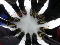
headed out to the wilderness campsite via west fork thursday. we bushwacked a lot of it and had quite a bit of fun. here's some pics and a TR, as promised in another thread on here.
http://pasadenahiker.wordpress.com/2011 ... west-fork/
bear creek via west fork
-
Hikin_Jim

- Posts: 4688
- Joined: Thu Sep 27, 2007 9:04 pm
Nice report. What was that string that was strung up in one of the photos? Was that one of the camp sites?
Don't suppose you've got the location of that photo plotted on a topo, do you?
HJ
Don't suppose you've got the location of that photo plotted on a topo, do you?
HJ
-
MattCav

- Posts: 356
- Joined: Thu Sep 23, 2010 4:13 am
thanks jim. I think that string was a clothesline?
I can't find the coord for that campsite but here's my fitness monitor map printout...maybe this helps?
http://connect.garmin.com/activity/85335792[url]
I can't find the coord for that campsite but here's my fitness monitor map printout...maybe this helps?
http://connect.garmin.com/activity/85335792[url]
-
Hikin_Jim

- Posts: 4688
- Joined: Thu Sep 27, 2007 9:04 pm
Interesting page. The elevations can't be right though if that's for Echo/Inspiration/Muir. And the map doesn't show up; just the charts.
HJ
HJ
-
norma r

- Posts: 707
- Joined: Thu Nov 06, 2008 4:22 pm
nice! i liked the Swallowtail sighting. since i'm only 5'3" i'll be avoiding that creek for a while. i don't own a snorkle. 
-
Hikin_Jim

- Posts: 4688
- Joined: Thu Sep 27, 2007 9:04 pm
Just use the strap from Dave's "Ghetto Cam" to clip a length of garden hose to your climbing helmet. What could go wrong?norma r wrote: nice! i liked the Swallowtail sighting. since i'm only 5'3" i'll be avoiding that creek for a while. i don't own a snorkle.
HJ
