Cascade Canyon_Bighorn Mine_Ontario Pk

TRs for the San Gabriel Mountains.
Post Reply
User avatar
LD
Posts: 93
Joined: Sat Jan 31, 2009 10:03 pm

Post by LD »

I thought I would have to wait until springtime to try and locate Bighorn Mine. I had been up there earlier before the big rains came a few months back and found out later that there was an old Lapis Lazuli mine and I had been only a couple hundred feet away from the supposed location. http://www.mindat.org/loc-88088.html

So with this dry spell Mace and I started up Saturday morning from Barrett-Stoddard parking area to Cascade Canyon. Staying mainly on the left side of the stream there is an obvious little use track until you get to elevation 4500’. Here we left Cascade Canyon (devil canyon full of not fun obstacles) and started up a spur ridge staying just off the north side of the ridgeline. The first time I went up here I had spent a lot of time finding a decent route. Once you know the route you can pick up a trace of an old use trail. There’s only about 2 or 3 places you have to be careful climbing over some very loose rock with potential of serious injury of falling down into the dry creek bed below. Other then that it’s a pretty neat navigational challenge if you like that sort of think. You’re pretty much in the shade the whole time under a canopy of trees. We then crossed over the streambed to our left at 5700’ and then climbed up another ridge overlooking Barrett Canyon. We then headed east up this ridgeline and 3 hours from the start we were at bump 6566’. We then used my GPS, which had coordinates for the mine and started searching below us. The hillside was fairly steep and full of rocks. After spreading out and looking for an hour we still couldn’t find it. Nor did we find any evidence of anything man made.

So apparently the coordinates were wrong that I had found on the Internet. Or maybe I just don’t know what a Lapis Lazuli mine looks like. Guess I’ll have to go back up there again when I have more time to search but for now we wanted to head over to the top of Ontario Ridge and check it out.

Making your way over and then up to 7792’ entails a lot of Yucca and Buckthorn avoidance so it was slow going. There was evidence of a large fire up here but the stuff is growing back fast. There was also a lot of animal use trails on this ridge. (Wildlife sighting was 4 deer and 2 Bighorn)

Once we were up to 7800’ it was nice to find the ridgeline to Ontario Peak was fairly broad with some patches of snow. It was then we had the ideal of continuing on to Ontario. Since we didn’t bring any winter equipment, as long as the top continued to be easy hiking and we could stay away from the sides we would continue. I had seen the snow coverage from Telegraph Pk last week and I knew if we could make it to Ontario I was confident we could make it down the ridgeline to Sugarloaf Saddle and then down Falling Rock Canyon without crampons.

As we continued on the snow coverage soon became 100%. With the temp being around 38 degrees and a brisk wind the snow was pretty well consolidated and felt like ice with our trail runners. As long as we stayed in the middle we felt pretty safe.

As luck would have it we soon came upon 4 ice axes or as most people would call them
‘Shovel heads’. We had come across an old firefighter camp and they had left their shovels behind. The handles had rotted away leaving the metal shovel part. Throwing away one of our sticks we had renewed confidence. After debating the proper way to self-arrest with a shovel (concave or convex facing away) we continued.
Except for a couple of large rock formations which we had to climb straight over to avoid the sides of the ridge the hike over to Ontario was uneventful with only a couple of slip and slides.

Once on Ontario, while we rested and ate I was able to phone a friend to pick us up at Ice House Canyon. We really didn’t want to walk those 3 miles back through town to my truck if we could avoid it

Our new ice axes came in handy a few times coming down from the peak as the snow was pretty hard by now especially in the shade. Once on the FRC ridgeline it was fairly easy to pick our way down mainly staying to the left hand side where there were more areas without snow. Once at the sugarloaf saddle we ditched our shovels and headed down FRC and our ride making it back to just as it got dark at 5:20.

On a side note on the way back home my left hand started to lock up and by 9:00 that night I could barely move my fingers and it felt like it was burning up. A Yucca had poked me that day in that hand so I thought I might be having an allergic reaction to that even though I’ve been poked many times by Yuccas and never had that happen before. By Monday night me hand was back to normal.
Just curious if anyone else has had a reaction like that?

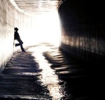
3 long ropes and a steel cable above a steep dropoff. Not sure what this is all about
Image

Cascade Canyon
Image

Barrett Canyon
Image

Looking for mine
Image

Coordinates of Bighorn Mine "not"
Image

Ontario Ridgeline
Image

Bighorn
Image

Beginning of broad top
Image

Rockpile
Image

Ontario Peak
Image

Last rock pile
Image

Looking back
Image

Mountaineering for Dummies
Image
User avatar
norma r
Posts: 707
Joined: Thu Nov 06, 2008 4:22 pm

Post by norma r »

Sounds ike a fun day to me! :D I had no idea Lapis is mined in Calif. Hope you find the mine eventually. Really like your makeshift axes. Quite creative! You had great weather and views since winter showed its face on Sunday. I can't comment on the hand reaction, any doctors out there?...
User avatar
davantalus
Posts: 203
Joined: Mon Jun 08, 2009 9:09 am

Post by davantalus »

I had a buddy describe coming down Cascade as "Not so much hiking, but falling in slow motion."

I've done the hike it a few times myself but I never thought to head to the top and keep going!

As far as I know this is the only place in the USA you can find Lapis. You can also find little purple sapphires if you know where to look. ;)

On a completely unrelated note, I do a little jewelry making sometimes.
Image
That's the rough stone underneath the ring.

As a side note for any mine explorers - this is the location of a mine named the Big Horn Mine but it is not THE Big Horn mine. In fact this mine was blown shut. and is nothing more than a surface dig now. Nothing fun or underground left (except for that cable and the ropes).
User avatar
Dave G
Posts: 321
Joined: Sun Jun 22, 2008 9:51 am

Post by Dave G »

Nice TR, LD!
:D :twisted: Cascade Canyon :twisted: :D
User avatar
lilbitmo
Posts: 1092
Joined: Tue Mar 04, 2008 9:44 pm

Post by lilbitmo »

LD That's one hell of a way to earn the summit of Ontario :shock: , nice work, sorry you could not find the mine, maybe davantalus has the coordinates?

Thanks for the great trip report and pictures

I'm also amazed that you went down FRC without crampons, we did a week ago (with crampons) and it was still quite slick in the afternoon when we headed down from Ontario.

Keep all the great reports coming, this is a great season to be in our mountains :D
User avatar
Taco
Snownado survivor
Posts: 6010
Joined: Thu Sep 27, 2007 4:35 pm

Post by Taco »

You read my mind. I wanted to go check that out as well.

I have another project in the area involving a rope, if you're interested...
User avatar
LD
Posts: 93
Joined: Sat Jan 31, 2009 10:03 pm

Post by LD »

norma r wrote: Sounds ike a fun day to me! :D I had no idea Lapis is mined in Calif. Hope you find the mine eventually. Really like your makeshift axes. Quite creative! You had great weather and views since winter showed its face on Sunday. I can't comment on the hand reaction, any doctors out there?...
Thanks Norma. Yes. We picked a great day to do this. That area is actually pretty cool back in there. Definitely the road less traveled.Don’t think I’ll be bringing my new tools to Baldy Bowl anytime soon. Glissading down might be interesting though

davantalus wrote: As a side note for any mine explorers - this is the location of a mine named the Big Horn Mine but it is not THE Big Horn mine. In fact this mine was blown shut. and is nothing more than a surface dig now. Nothing fun or underground left (except for that cable and the ropes).
Hi Davantalus. Looks like you be the mine man. OK now I’m confused. So the rope location we passed on the ridge was the Lapis mine? It did look like some kind of mine that was caved in.
So do you know what mine is located at the coordinates on that website?
Dave G wrote: Nice TR, LD!
:D :twisted: Cascade Canyon :twisted: :D
Hi Dave. Sounds like you’ve been up Cascade also. Have you been up Barrett Canyon? Looks even worse
lilbitmo wrote: I'm also amazed that you went down FRC without crampons, we did a week ago (with crampons) and it was still quite slick in the afternoon when we headed down from Ontario.
:D
Hey Lilbitmo, thanks. It was slow going. Probably took an hour longer then if we had crampons. Staying away from FRC and mainly going down on the west side of the ridge it actually wasn’t so bad.
Taco wrote: You read my mind. I wanted to go check that out as well.
I have another project in the area involving a rope, if you're interested...
PM me. I’m curious
User avatar
Taco
Snownado survivor
Posts: 6010
Joined: Thu Sep 27, 2007 4:35 pm

Post by Taco »

Hey, nice BD pack. :wink:

PM on the way.
User avatar
davantalus
Posts: 203
Joined: Mon Jun 08, 2009 9:09 am

Post by davantalus »

BTW, here's a movie my buddy made about the trip - http://www.youtube.com/watch?v=QkMTLtimjHI&NR=1
User avatar
Taco
Snownado survivor
Posts: 6010
Joined: Thu Sep 27, 2007 4:35 pm

Post by Taco »

Thanks, davantalus. Very cool.
User avatar
LD
Posts: 93
Joined: Sat Jan 31, 2009 10:03 pm

Post by LD »

Nice! Looks like you went straight up stream while we went up higher on the ridge. It looked nasty down there.
Post Reply