
Griffith Park Map - does one exist?
-
atomicoyote

- Posts: 173
- Joined: Fri Dec 24, 2010 2:16 pm
The City of L.A. doesn't seem to publish one (you'd think they would, since its a city park and fairly large?). Something like a Tom Harrison map showing all the fire roads would work great. After doing a short hike on Tuesday from Los Feliz/Ferndell to Mt. Hollywood (major 'wimp' hike with my wimpy bro'), thought it might be interesting to explore the place a little further. Anyone aware of where to get one?
-
AW~

- Posts: 2093
- Joined: Mon Oct 01, 2007 12:00 pm
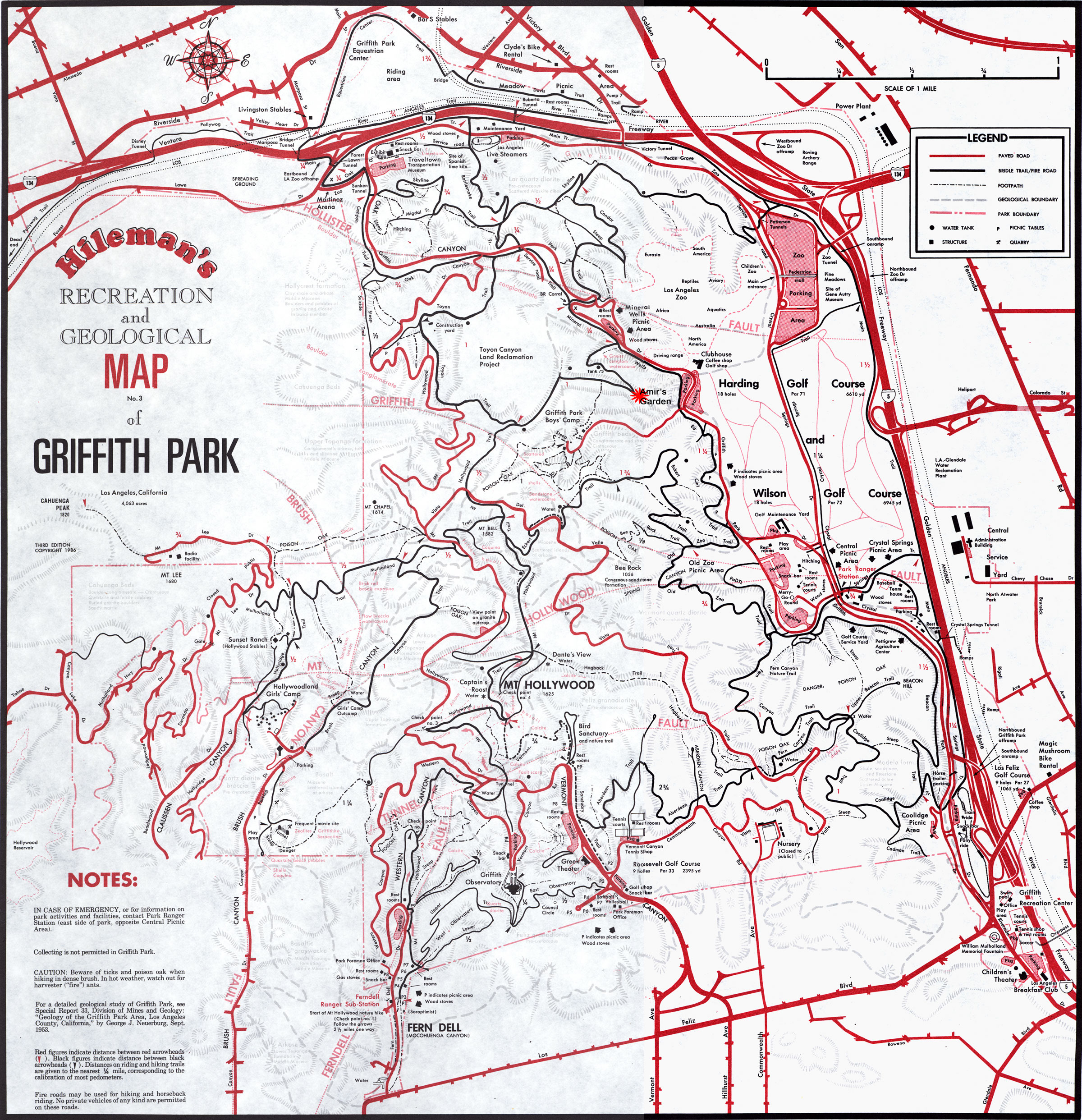
printable maps you could use...
http://amirsgarden.org/image1/GPMap.jpg
for planning there is also...
http://www.latrails.com/hike/gp.html
or pretty much overkill....
http://cartifact.com/webmaps/griffith/index.shtml
http://amirsgarden.org/image1/GPMap.jpg
for planning there is also...
http://www.latrails.com/hike/gp.html
or pretty much overkill....
http://cartifact.com/webmaps/griffith/index.shtml
-
PackerGreg

- Posts: 623
- Joined: Sat Sep 12, 2009 9:31 pm
-
robnokshus
- Posts: 130
- Joined: Fri Apr 04, 2008 7:25 am
You can pick up a trail map at the ranger station. The station is over by where the bike rentals are, near the carousel.