Baldy North Face, 13-APR-2008

TRs for the San Gabriel Mountains.
Post Reply
User avatar
Tim
Posts: 560
Joined: Tue Apr 08, 2008 8:55 pm

Post by Tim »

I went up Baldy from Manker Flats on Sunday to scope out the North Face. I was solo so I wasn't sure if I would actually try to climb it. From the summit it didn't look too bad--just a straight snow climb like TDR said. I decided to give it a go.

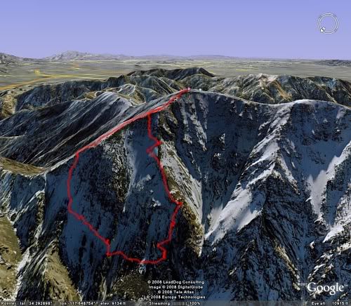
I walked down the ridge to Dawson then veered left and down the first snow chute just before the saddle. From what I could see there seemed to be no easy way down to Fish Fork from Dawson. Maybe there is a way further north but I didn't feel like going up and over Dawson like I just did with Baldy.

After descending for awhile, I decided to abort the idea of going all the way down to Fish Fork. The topo map showed a steep cliff at 8200 ft in the couloir and I didn't want to get trapped if I went lower. I started traversing west to intersect the couloir. This 1/3 mile long traverse was rather unpleasant. By the time I got to the last ridge before the couloir, I had had enough. A steep gully still needed to be crossed to get to it and this was already taking way too long. I was at 8150 ft and it was 11am so I decided to start climbing.

I stayed near the ridge paralleling the couloir until I exited the route a couple of hundred feet from the top. I don't like traversing on crampons so I usually made direct ascents. The slope angle seemed to be consistently around 40 degrees. Progress was slow. It took 2h45min to finish the climb. No rockfall at all the whole day.

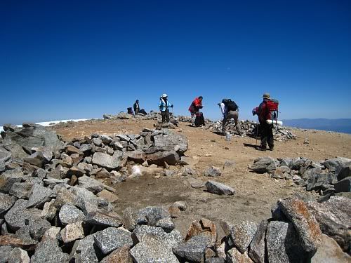
It was extremely pleasant on the summit. The temperature was perfect and it was not windy at all--just a nice cool breeze. The visibility was amazing. I could see Catalina to the west, Lake Elsinore to the south and the dry lake beds to the north. Downtown LA looked so close I think that with a running start and Kobe's Hyperdunk shoes, I could have jumped over it.

Car to car it took about 12 hours.

Image

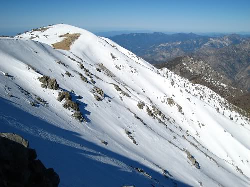
Baldy Bowl season is definitely over:
Image

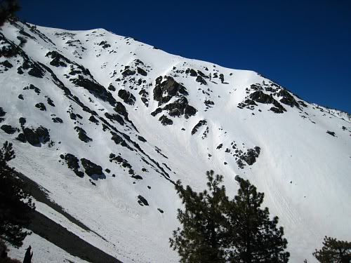
View of North Face from the summit:
Image

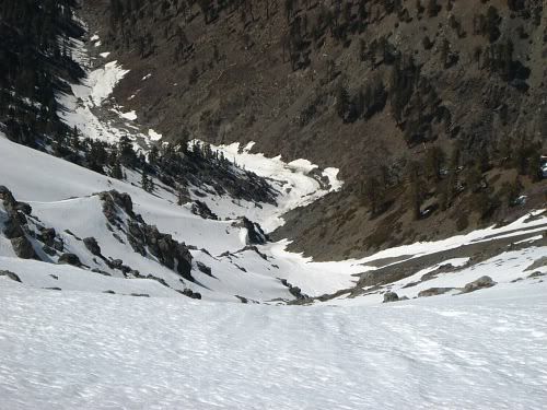
Telephoto view straight down the NF couloir (from the summit):
Image

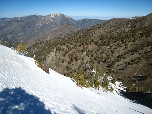
Descending towards Fish Fork (Baden-Powell in the BG):
Image

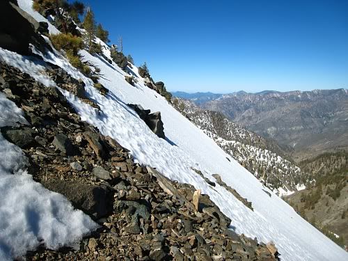
Obligatory steep slope angle pic:
Image

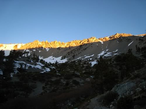
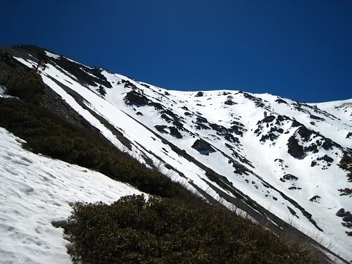
View from around 8500 ft:
Image

View looking up:
Image

Nice day to be on the summit:
Image
User avatar
hvydrt
Posts: 494
Joined: Thu Sep 27, 2007 8:18 pm

Post by hvydrt »

great pics Tim, that looks like a great route. It sure is nice to be up high on such a clear day. I think you were probably seeing lake Mathews rather than Elsinore.
User avatar
Lance
Posts: 12
Joined: Sat Mar 15, 2008 8:24 pm

Post by Lance »

Tim - Nice pics, looks like you had an awesome day.
User avatar
Tim
Posts: 560
Joined: Tue Apr 08, 2008 8:55 pm

Post by Tim »

Thanks guys. I could be wrong, but I saw another body of water (or something that looked like it) above Lake Mathews so I figured it was Elsinore. It sure was clear though. These kind of days will be over soon :(
User avatar
hvydrt
Posts: 494
Joined: Thu Sep 27, 2007 8:18 pm

Post by hvydrt »

maybe you did see Elsinore then... What do you mean days like this will be over soon????
User avatar
HikeUp
Posts: 3861
Joined: Thu Sep 27, 2007 9:21 pm

Post by HikeUp »

Nice TR and pics! These mountains rule!
User avatar
Taco
Snownado survivor
Posts: 6010
Joined: Thu Sep 27, 2007 4:35 pm

Post by Taco »

Very cool, glad to see you were able to go do it!

Those traverses can be a pain.
User avatar
KathyW
Posts: 212
Joined: Thu Sep 27, 2007 9:00 pm

Post by KathyW »

Tim: Really nice report and pictures - getting off the beaten path always makes for a great day.
User avatar
Rick M
Posts: 61
Joined: Mon Mar 17, 2008 4:11 pm

Post by Rick M »

Nice spring trip Tim. Love the pic [i]View from around 8500 ft[/i] of the north face. We used to play around on it in spring for later Cascades and Canada trips as it always seemed to have snow when most other SoCal places were patchy. From my home in the high desert it's hard to judge the snow conditions (I can see the amount coverage). After noon would it be condusive to standing glissades or is it still to hard?
User avatar
Tim
Posts: 560
Joined: Tue Apr 08, 2008 8:55 pm

Post by Tim »

hvydrt, just meant that the smog/marine layer will be back soon.

Rick, I'm not that experienced with glissading but the snow seemed too hard to attempt one, standing or sitting. However, I was able to do some standing glissades on the way down the regular ski hut trail and that was a lot of fun.

Most of the northern slopes still have about 2 feet of snow (I often staked the entire length of my 60 cm axe), but in some areas it's beginning to thin or are already bare. I wish I had taken a panoramic of the north face while down there. It's hard to show in one picture how massive and impressive that face is when filled with snow. What a cool mountain!
User avatar
Rick M
Posts: 61
Joined: Mon Mar 17, 2008 4:11 pm

Post by Rick M »

Tim said
...I was able to do some standing glissades on the way down the regular ski hut trail and that was a lot of fun.
I hear you there. Nothing like "Skiing" down and cutting turns on your boots in a standing glissade when conditions are just right. I don't think we had enough snow this year to have it last long enough into the year to allow a May/June high overhead sun to soften the north side before it melts away for this...to bad cause as you said, it's a lot of fun! :)
Post Reply