http://www.everytrail.com/view_trip.php?trip_id=884984
This was my first attempt to Iron Mtn. Despite the forecast I assumed the weather would be ideal.... Wrong.
The "trail" is south facing with zero shade, I brought water for a cooler day.
The trail is typical of wilderness trails in the area, no official maintenance. The trail becomes unmaintained about 1.75 miles in from the parking lot at the locked gate.
It is a "Tunnel O Brush" to where I turned around following bits of the former trail in segments and not in others.
The old road shown on maps to the Allison Mine has been reclaimed by the mountain, there are hints of it but it is mostly gone.
I looked for the VABM "Bonita" on the way back and found no trace of it. I did locate the LPS Peak Register but lacked a pen/pencil to log my visit.
I measured 4.4 miles to the saddle 0.6 miles further than I'd expected, it'd also taken about 1hr longer to get here than I'd planned making the climb to the summit estimate longer too, getting me back to the trailhead 4-5 pm
Not today!
Iron Mtn FAIL! Sunday 11/14/2010
-
Bill

- Posts: 332
- Joined: Thu Jul 24, 2008 6:09 pm
I always appreciate the detail of your trip reports. The day I hiked it was an over-cast drizzly day, which made it very pleasant. Sounds like you plan on doing some exploring in the future. I look forward to your reports. 8)mattmaxon wrote:http://www.everytrail.com/view_trip.php?trip_id=884984
This was my first attempt to Iron Mtn. Despite the forecast I assumed the weather would be ideal.... Wrong.
The "trail" is south facing with zero shade, I brought water for a cooler day.
The trail is typical of wilderness trails in the area, no official maintenance. The trail becomes unmaintained about 1.75 miles in from the parking lot at the locked gate.
It is a "Tunnel O Brush" to where I turned around following bits of the former trail in segments and not in others.
The old road shown on maps to the Allison Mine has been reclaimed by the mountain, there are hints of it but it is mostly gone.
I looked for the VABM "Bonita" on the way back and found no trace of it. I did locate the LPS Peak Register but lacked a pen/pencil to log my visit.
I measured 4.4 miles to the saddle 0.6 miles further than I'd expected, it'd also taken about 1hr longer to get here than I'd planned making the climb to the summit estimate longer too, getting me back to the trailhead 4-5 pm
Not today!
-
asbufra

- Posts: 135
- Joined: Sun Oct 26, 2008 10:27 pm
It is not a failure; it is a "learning experience". It would be nicer if they installed a few water fountains along that trail.
It amazes me how the Allison Mine trail seems to disappear more each time I go. You can barely see it anymore. It seems like it might be easier to go up Iron to the top of the first steep part and then go left and cross country down into the canyon that way and avoid the trail.
It amazes me how the Allison Mine trail seems to disappear more each time I go. You can barely see it anymore. It seems like it might be easier to go up Iron to the top of the first steep part and then go left and cross country down into the canyon that way and avoid the trail.
-
Taco

- Snownado survivor
- Posts: 6125
- Joined: Thu Sep 27, 2007 4:35 pm
One tends to learn and grow more through failures than successes.
Also, rebrand it as a stunning NHPS success, and profit.
Also, rebrand it as a stunning NHPS success, and profit.
-
HikeUp

- Posts: 4025
- Joined: Thu Sep 27, 2007 9:21 pm
Been there, done that. I hate that pile of rocks.
-
Ze Hiker

- Posts: 1432
- Joined: Mon Jul 28, 2008 7:14 pm
Allison mine is more easily accessible via a trail up Allison gulch, btw
-
mattmaxon

- Posts: 1137
- Joined: Mon Mar 24, 2008 12:48 pm
A day in the mountains is never a failure!asbufra wrote:It is not a failure; it is a "learning experience". It would be nicer if they installed a few water fountains along that trail..
The NHPS board convened in special session and agreed this was an amazing non-achievement!
It was certified as a successful non-summit with the route placed in the non-summit guides for the ages.
Though I was thinking Gunga Din or some young ladies bearing ice water & fans for weary hikers would be nice. Some peeled grapes would be the pièce de résistance
Piped water is so utilitarian
-
Tim

- Posts: 560
- Joined: Tue Apr 08, 2008 8:55 pm
You managed to avoid Iron Mtn. I'd say that's a success!
I use to say I've never met a mountain I didn't like. That is, until I met Iron Mtn. I guess the feeling is mutual because almost every time I've been there it has tried to kill me. If there were maidens with peeled grapes and spring water, I wouldn't trust 'em. Damn Iron Mtn Medusas I tell you.
I was on the Alison Mine trail (going from the mine back to Iron Mtn) a few years ago and it didn't seem too bad to follow. Of course, by now that has probably changed. I just remember it taking forever. It's a really long trail.
-
cougarmagic

- Posts: 1410
- Joined: Wed May 07, 2008 5:21 pm
Yes - we are proud that though Matt could have summited that day, and had come very close, he turned around in order to get home at a reasonable time. (And not, instead, about an hour or so later). The world has so few reasonable mountaineers!mattmaxon wrote:The NHPS board convened in special session and agreed this was an amazing non-achievement!
-
Rick Kent

- Posts: 150
- Joined: Tue Oct 02, 2007 11:21 am
The only failure would be to have not tried at all.
You were just getting to the good part!
You were just getting to the good part!
-
asbufra

- Posts: 135
- Joined: Sun Oct 26, 2008 10:27 pm
I am not particularly fond of pain but, for the record, I like Iron Mountain. Talk about solitude! No bus loads of Hiking Club members, often there is nobody at all. And it is quite beautiful once you get to where the big pine trees are. The views are incredible.
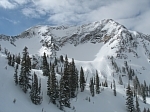
Here is a picture of what Rick calls “the good part”. Zoom in on this picture and see the couple working up that section. I am still not sure how I make it down that part. A controlled stumble I guess.
Even though I bleed climbing Iron, both figuratively and literally (damn yuccas) I enjoy Iron and am thankful that I can do it.
-
Taco

- Snownado survivor
- Posts: 6125
- Joined: Thu Sep 27, 2007 4:35 pm
Frank, that's a real good point. It's pretty much always a nice quiet place out there, and when you do run into people, they're always friendly and willing to talk about the day.
