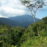
posted a trip report on my blog here: http://pasadenahiker.wordpress.com/2010 ... flat-loop/
weather was absolutely beautiful today, low 40's and sunny. I love that kinda weather.
Few quick questions:
1. Y'all think the Blue Ridge gate is going to be locked from now til Spring?
2. Any thoughts on the footprint? They were all over the PCT and were BIG (I have a size 14 shoe and you can see the comparison in that one photo I posted)
3. I've seen it several times and saw it again today: that remote control drone. What's the deal on that? Is that DEA, looking for pot fields? I've seen sketch stuff up in the Dawson area before, is there something going on?
4. Was great to see Mtn High getting massive business today. Their West parking lot was totally packed.
5. The bean and cheese burrito's at Cinnamon's in Wrightwood may be the best thing in the world.
11.12.10 - pct from inspiration vista to jackson flat
-
HikeUp

- Posts: 4028
- Joined: Thu Sep 27, 2007 9:21 pm
Nice pictures.
If Mountain High is making snow then I'd guess blue ridge road is closed for the season since the road crosses through the ski runs.
Alternative way up to Pine Mtn. is from Wrightwood via the Acorn Trail which starts at the top of Acorn Drive. Adds significant elevation gain and distance. Parking for that trail has always been a mystery to me but others might know more.
-
Bill

- Posts: 332
- Joined: Thu Jul 24, 2008 6:09 pm
Parking is a problem at Acorn since the trail head is accessed near pvt property. There is another lesser known route that follows an old fire road and tops Blue-ridge/PCT at Guffy CG. PM for parking details.HikeUp wrote:Nice pictures.
If Mountain High is making snow then I'd guess blue ridge road is closed for the season since the road crosses through the ski runs.
Alternative way up to Pine Mtn. is from Wrightwood via the Acorn Trail which starts at the top of Acorn Drive. Adds significant elevation gain and distance. Parking for that trail has always been a mystery to me but others might know more.
Cinnemons is the bomb. 8)
-
cougarmagic

- Posts: 1410
- Joined: Wed May 07, 2008 5:21 pm
Great report and photos. I've been up there once or twice, but always in the summer - it must have been a gorgeous day with that weather.
The track in the photo is pretty scuffed up - did you take any others? The only thing that big is going to be a bear, and they are certainly around. Bears don't really "growl" though, that I know of. They do more of a "chuff" sound, or grunt. Could have been a cat...?
The track in the photo is pretty scuffed up - did you take any others? The only thing that big is going to be a bear, and they are certainly around. Bears don't really "growl" though, that I know of. They do more of a "chuff" sound, or grunt. Could have been a cat...?
-
MattCav

- Posts: 356
- Joined: Thu Sep 23, 2010 4:13 am
yeah, i had a thought that it may have been a lion. along that trail, there are sections of pretty high grass. either way, it left me alone once i started making some noise. 
unfortunately that is the only pic i have of the print. there were dozens on that trail though.
and thanks for the recs on acorn ridge, guys. that sounds fun. i may do that or go up baldy via the usual route and hit those peaks. either way, fun shall be had.
unfortunately that is the only pic i have of the print. there were dozens on that trail though.
and thanks for the recs on acorn ridge, guys. that sounds fun. i may do that or go up baldy via the usual route and hit those peaks. either way, fun shall be had.
