TRs for the San Gabriel Mountains.
MattCav
Posts: 356Joined: Thu Sep 23, 2010 4:13 am
Post by MattCav Fri Oct 29, 2010 11:22 pm
went for an extremely windblown, sunrise hike today - from dawson to mt hawkins. trip report is here:
http://pasadenahiker.wordpress.com/2010 ... ins-windy/
i also added a new sign for the pct. the old one seemed to have perished and some hikers have struggled recently with finding the pct/throop trail junction. hopefully my little sign helps
Taco
Snownado survivor
Posts: 6125Joined: Thu Sep 27, 2007 4:35 pm
Post by Taco Sat Oct 30, 2010 12:19 am
Nice sign, good on your for replacing it.
MattCav
Posts: 356Joined: Thu Sep 23, 2010 4:13 am
Post by MattCav Sat Oct 30, 2010 7:44 am
Thanks Taco
norma r
Posts: 707Joined: Thu Nov 06, 2008 4:22 pm
Post by norma r Sat Oct 30, 2010 9:44 am
MattCav,
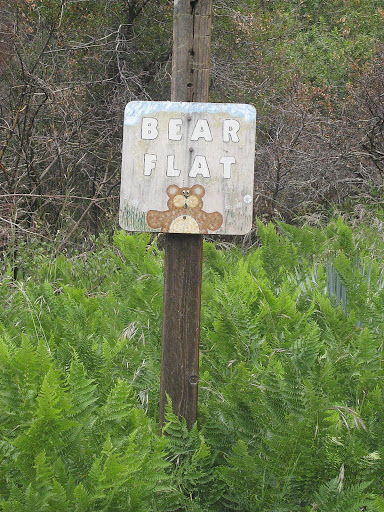
second cutest sign i''ve ever seen on a trail!! first cutest goes to the now-missing (RIP) Bear Flat Trail sign. maybe someone from this Board (you?) could repaint another. gonna miss that little guy.
EManBevHills
Posts: 387Joined: Fri Sep 28, 2007 12:40 am
Post by EManBevHills Sat Oct 30, 2010 5:23 pm
Well that was right neighborly of you! Thanks for being so thoughtful.
And you were rewarded in spite of the winds. The sunrise looked splendiferous.
MattCav
Posts: 356Joined: Thu Sep 23, 2010 4:13 am
Post by MattCav Sat Oct 30, 2010 7:54 pm
i loooved that bear flat sign! where'd it go?! i haven't done that hike since last year and didn't know the sign was gone
and thanks eman. i'm just trying to fulfill my duty to take care of our beloved trails and forest.
Taco
Snownado survivor
Posts: 6125Joined: Thu Sep 27, 2007 4:35 pm
Post by Taco Sat Oct 30, 2010 8:51 pm
I believe that sign burned up in the fire.
HikeUp
Posts: 4028Joined: Thu Sep 27, 2007 9:21 pm
Post by HikeUp Sat Oct 30, 2010 9:29 pm
The cute sign
survived the fire back in May, 2008 (Bighorn Fire I think it was called). It for some reason
didn''t survive the Winter of 2009-2010.
If I were a betting man, I''d bet that Alan has taken more pictures of that sign than anyone else!!!
HikeUp
Posts: 4028Joined: Thu Sep 27, 2007 9:21 pm
Post by HikeUp Sat Oct 30, 2010 9:39 pm
Here''s the PCT sign that you replaced from back on 8-8-2009...
Here it was on 8-16-2009...
MattCav
Posts: 356Joined: Thu Sep 23, 2010 4:13 am
Post by MattCav Sun Oct 31, 2010 12:54 pm
wow, that post didn't seem to ever really have its footing in the ground. heh.
lilbitmo
Posts: 1092Joined: Tue Mar 04, 2008 9:44 pm
Post by lilbitmo Sun Oct 31, 2010 2:40 pm
MattCav and HikeUp
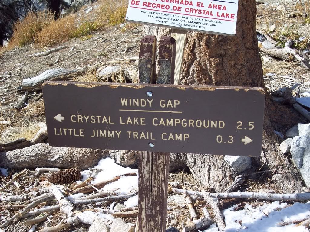
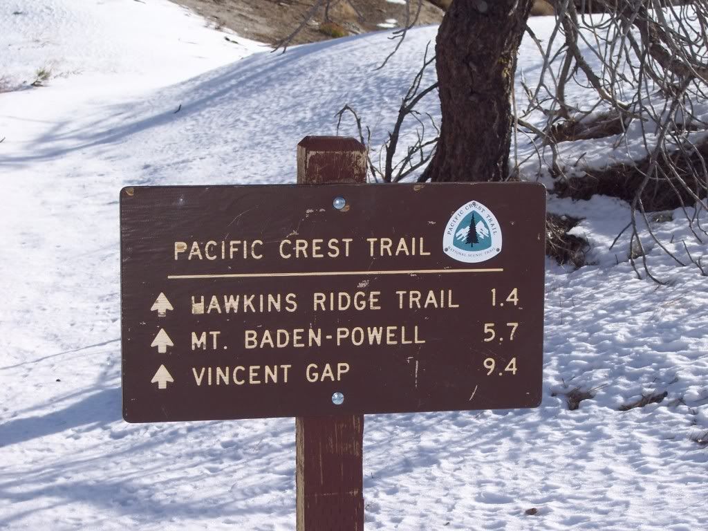
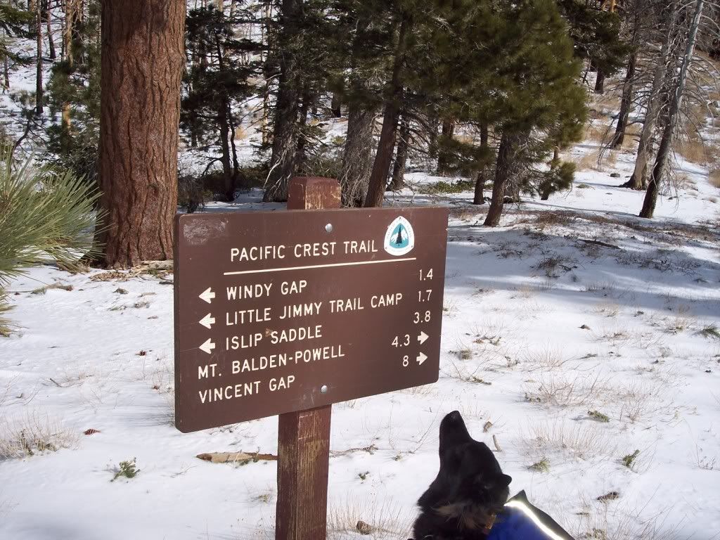
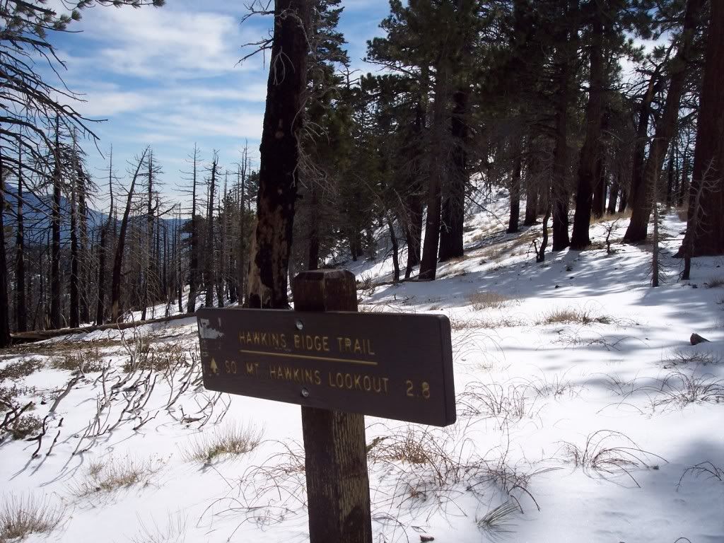
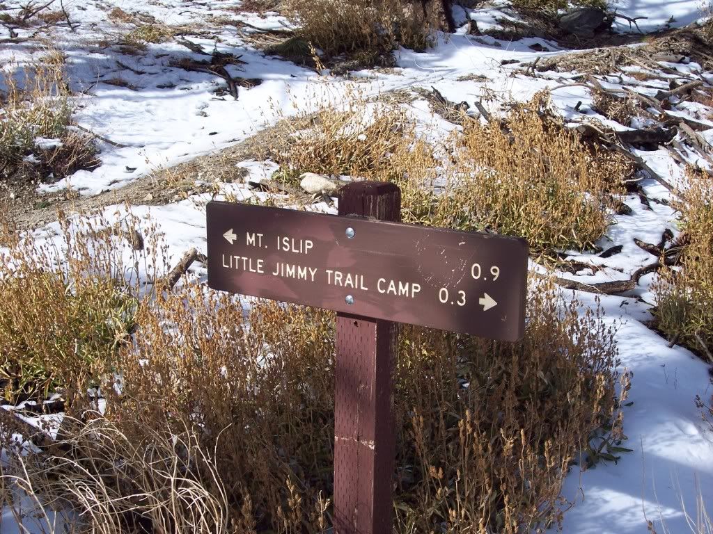
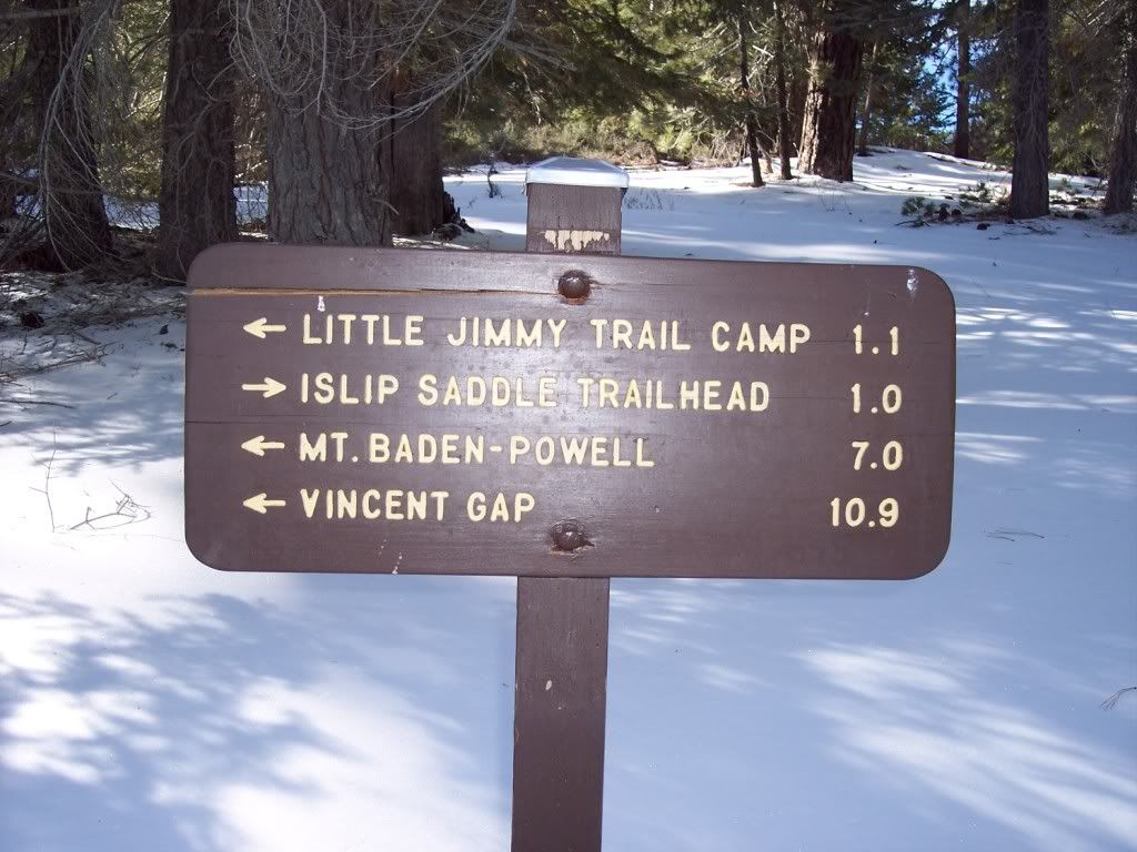
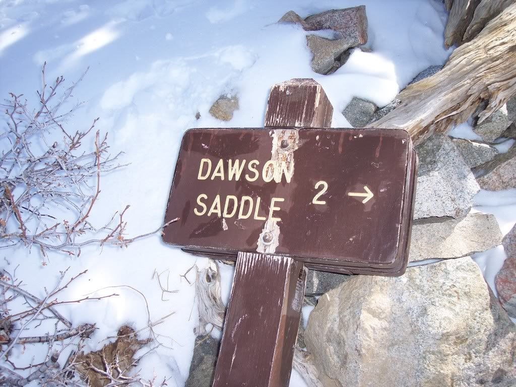
I have these pictures from 02-02-07 when I did the Islip Saddle/Vincent Gap section of the PCT - can anyone tell which sign it was from the ones below?
#1
#2
#3
#4
#5 same as #
http://i908.photobucket.com/albums/ac28 ... 00041.jpg4 better view
#6
#7
#8
Long time since I did this and the snow makes that area look so different?
Thanks in advance
HikeUp
Posts: 4028Joined: Thu Sep 27, 2007 9:21 pm
Post by HikeUp Sun Oct 31, 2010 4:23 pm
LOL@your pooch reading sign #3!!!
lilbitmo
Posts: 1092Joined: Tue Mar 04, 2008 9:44 pm
Post by lilbitmo Sun Oct 31, 2010 4:59 pm
HikeUp wrote:LOL@your pooch reading sign #3!!!
The sign is/was probably #8 since it is located at the intersection of the PCT and the trail to Dawson Saddle (just east of Throop's summit).
Thanks I thought that might be the one since it was lying there even back then.
Pooch - she was special I miss her dearly - she loved the trail as much as I did if not more - cancer sucks