San Gorgonio Wilderness traverse, 3-6 Sep 2010

Archived TRs for ranges in California.
Post Reply
User avatar
simonov
Posts: 1087
Joined: Tue Nov 27, 2007 5:44 pm
Location: Reno, NV
Contact:

Post by simonov »

After thinking about it for literally decades, I finally executed a multi-day traverse of the San Gorgonio Wilderness via the San Bernardino Divide Trail. Basically, I took four days to make the hike Elwood made the week before. Frank and Ingrid came with me.

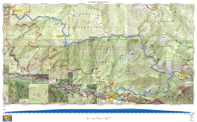
The route started at Angelus Oaks and basically followed the San Bernardino Divide east to the summit of Mt San Gorgonio (11,503 feet), where we spent the third and last night. We exited via the Vivian Creek Trail.

Total distance: 26 miles.
Elevation gain: 5,539 feet in three days

Image

Day 1: (5.7 miles; 3,400' elevation gain). On the first day we climbed up to Limber Pine Bench trail camp, which is my favorite trail camp in the San Gorgonio Wilderness. There aren't many photos of this part of the hike as I have already documented it in the following Flickr sets:

Limber Pine Bench overnight, 10-11 May 2008
San Bernardino Peak overnight, 6-7 Jun 2009

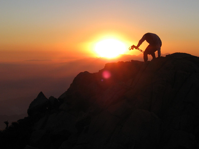
We did enjoy a fantastic sunset.

Image

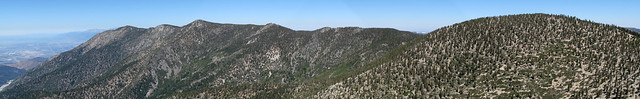
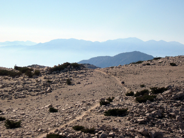
Day 2: (8.2 miles; 960' net elevation gain). After climbing to the top of San Bernardino Peak (10,649 feet), we hiked along the San Bernardino Divide Trail to High Meadow Springs trail camp, nearly losing our way at one point when I inadvertently led us for a short distance down the unmaintained trace trail from San Bernardino East Peak down to Forest Falls.

Image

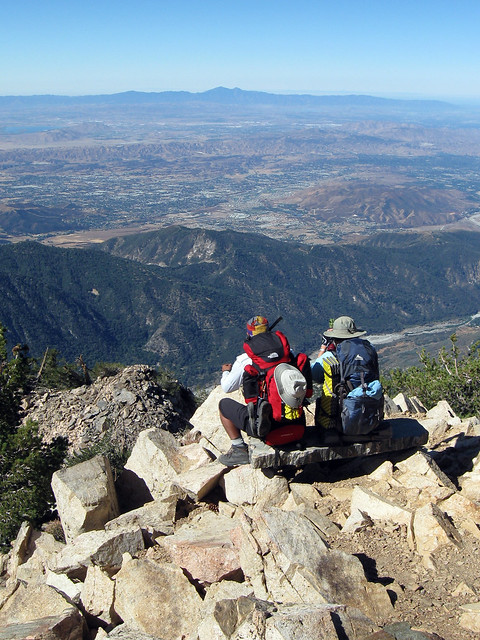
Day 3: (4.4 miles; 1,179 elevation gain). This was a relatively short climb up to the summit of Mt San Gorgonio, made challenging by all the water we were carrying. The wind blew furiously all day and all night.

Image

Image

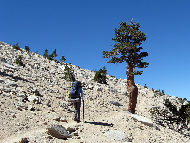
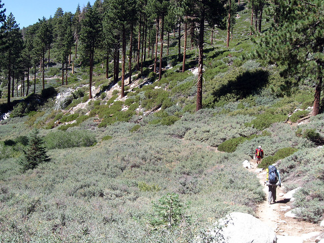
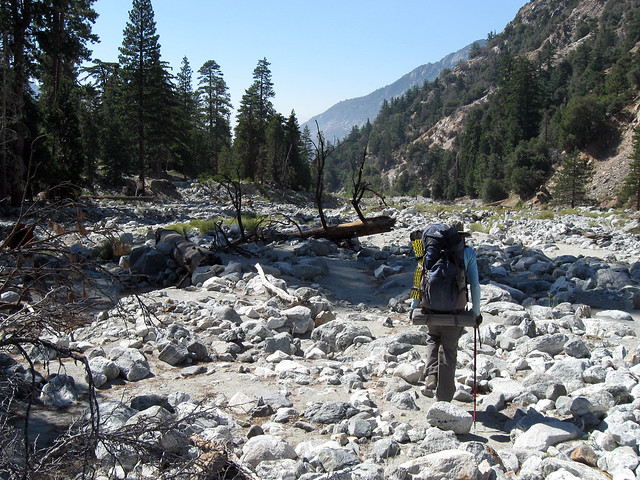
Day 4: (8 miles; 5,419 elevation loss). This was a fairly grueling hike down the Vivian Creek trail to Forest Falls.

Image

Image

Image

Here is a slide show of the entire hike.

When you spend enough time up there, you realize the San Gorgonio Wilderness, despite it's proximity to Greater LA, can be as wild and beautiful as any mountain in the Sierra Nevada, and it requires a lot less driving, too.
Nunc est bibendum
User avatar
Hikin_Jim
Posts: 4686
Joined: Thu Sep 27, 2007 9:04 pm

Post by Hikin_Jim »

Nice TR. GREAT sunset shot.

On your map, I notice the upper Momyer Creek Trail has what appears to be another trail shown in fuchsia roughly paralleling it to the east. What is that trail in fuchsia?

HJ
User avatar
lilbitmo
Posts: 1092
Joined: Tue Mar 04, 2008 9:44 pm

Post by lilbitmo »

Nice work Mitch, that's one of my favorite, Rick Kent only adds 7 peaks in a day to that, if only I had that in me :shock:

Pictures are great as well, thanks for the TR.

When's the next outing for the kids?

Let me know.

I'm out this month but maybe next month.

Patrick
User avatar
Dave G
Posts: 321
Joined: Sun Jun 22, 2008 9:51 am

Post by Dave G »

Awesome outing--one that should be on everyone's "Bucket List". Nice too, to have the time to do it at a reasonable pace for maximum enjoyment. All too often we're forced to rush these trips to the point where we have to look at the pics to make sure we were even there. :shock:
User avatar
simonov
Posts: 1087
Joined: Tue Nov 27, 2007 5:44 pm
Location: Reno, NV
Contact:

Post by simonov »

Hikin_Jim wrote:On your map, I notice the upper Momyer Creek Trail has what appears to be another trail shown in fuchsia roughly paralleling it to the east. What is that trail in fuchsia?
I'm using the National Geographic TOPO! software, which has this weird overlay in red. You'll notice there's a parallel San Bernardino Divide trail in red on the map as well, mostly a little south of the normal black dashed line (highlighted in light blue by me). Those red overlays sometimes make the maps really hard to read.

So I guess it's just another version of the route, on the red overlay.
lilbitmo wrote:When's the next outing for the kids?
We take them up the third Saturday of the month. This month we are hiking from Dawson Saddle to Mt Baden-Powell (they now have a taste for summits, having done Mt San Jacinto and Mt Whitney this summer). I haven't decided on where to go in October, but it will have to be somewhere high. Any suggestions? Baldy is still a bit too challenging, I think, for most of them.
Dave G wrote:Nice too, to have the time to do it at a reasonable pace for maximum enjoyment. All too often we're forced to rush these trips to the point where we have to look at the pics to make sure we were even there.
That's one reason I hardly ever go to the Sierra. Eight or ten extra hours in a car cuts too much into my mountain time. We have almost everything right here in the San Berdoos, a couple hours from OC.

One thing I failed to emphasize was how, during a holiday weekend, we saw fewer than half a dozen people for the first three days until we came close to Mt San Gorgonio.

That's more solitude than you will find on a lot of Sierra hikes.
Nunc est bibendum
User avatar
Hikin_Jim
Posts: 4686
Joined: Thu Sep 27, 2007 9:04 pm

Post by Hikin_Jim »

simonov wrote: This month we are hiking from Dawson Saddle to Mt Baden-Powell (they now have a taste for summits, having done Mt San Jacinto and Mt Whitney this summer). I haven't decided on where to go in October, but it will have to be somewhere high. Any suggestions? Baldy is still a bit too challenging, I think, for most of them.
From Dawson Saddle, of course there's also Throop or Hawkins. Throop and Hawkins can also be done via little Jimmy. I've always thought that Mt. Islip was a nice one. Mt. Williamson from ACH is an easy one, and you can walk out as far as you like along Pleasant view ridge. Mt. Pacifico is fun from Angeles Forest Hwy and has great desert views -- although it may be under fire closure right now. The peaks you just did (San Bernardino and E San Bernardino) are good from either Forsee Creek, Angeles Oaks, or if they're up for it, Momyer Creek. Shields from Forsee Creek is another option. Tahquitz Peak via the South Ridge Trail is another nice one. The Sugarloaf above Big Bear Lake is a nice one.

Just some thoughts.

HJ
Post Reply