Trip planning, history, announcements, books, movies, opinions, etc.
HikeUp
Posts: 3932 Joined: Thu Sep 27, 2007 9:21 pm
Post
by HikeUp Fri Jul 30, 2010 12:56 pm
Hikin_Jim wrote:Am I more wrong or less wrong?
LOL. Less wrong! Least wrong yet! woohoooo
Ze Hiker
Posts: 1432 Joined: Mon Jul 28, 2008 7:14 pm
Post
by Ze Hiker Fri Jul 30, 2010 1:48 pm
i think you've just made this photo up to trick us. hope you feel good about yourself
HikeUp
Posts: 3932 Joined: Thu Sep 27, 2007 9:21 pm
Post
by HikeUp Fri Jul 30, 2010 1:56 pm
Correct.
Yes! I enjoyed it very much.
Big picture, taken from point 3529 just east of Heaton Flat...
Hikin_Jim
Posts: 4686 Joined: Thu Sep 27, 2007 9:04 pm
Post
by Hikin_Jim Fri Jul 30, 2010 3:07 pm
Zé wrote:on the HPS list
Hmph. That's not far enough away to see the outline of the mountain.
Looks vaguely like Winston Ridge.
HJ
Ze Hiker
Posts: 1432 Joined: Mon Jul 28, 2008 7:14 pm
Post
by Ze Hiker Fri Jul 30, 2010 3:10 pm
vaguely? looks exactly like Winston Ridge. enough info for you to get it!
Hikin_Jim
Posts: 4686 Joined: Thu Sep 27, 2007 9:04 pm
Post
by Hikin_Jim Fri Jul 30, 2010 3:50 pm
Zé wrote:vaguely? looks
exactly like Winston Ridge. enough info for you to get it!
I was there on July 3rd otherwise I'd have never guessed it in a million years.
What is peak is this (HPS list) and (extra credit) where am I?
HJ
Hikin_Jim
Posts: 4686 Joined: Thu Sep 27, 2007 9:04 pm
Post
by Hikin_Jim Mon Aug 02, 2010 7:39 am
What? Is this really that much of a stumper?
HikeUp
Posts: 3932 Joined: Thu Sep 27, 2007 9:21 pm
Post
by HikeUp Mon Aug 02, 2010 10:08 am
Goodykoontz, from Pallett?
Hikin_Jim
Posts: 4686 Joined: Thu Sep 27, 2007 9:04 pm
Post
by Hikin_Jim Mon Aug 02, 2010 10:20 am
Dang. Obviously not a stumper.
Yes, Goodykoontz. No, not from Pallet. This was shot from "across the way" on Thrall.
HJ
HikeUp
Posts: 3932 Joined: Thu Sep 27, 2007 9:21 pm
Post
by HikeUp Mon Aug 02, 2010 11:32 am
Took me awhile to figure that one out.
What peak and where from...
Ze Hiker
Posts: 1432 Joined: Mon Jul 28, 2008 7:14 pm
Post
by Ze Hiker Mon Aug 02, 2010 4:46 pm
will thrall from goodykoontz?
HikeUp
Posts: 3932 Joined: Thu Sep 27, 2007 9:21 pm
Post
by HikeUp Mon Aug 02, 2010 5:24 pm
Yeah. Couldn't resist.
Taco
Snownado survivor
Posts: 6036 Joined: Thu Sep 27, 2007 4:35 pm
Post
by Taco Mon Aug 02, 2010 5:55 pm
Cheesedick Mountain!
Mike P
Posts: 1005 Joined: Tue Oct 02, 2007 10:48 pm
Post
by Mike P Mon Aug 02, 2010 10:50 pm
East Twin??
Hikin_Jim
Posts: 4686 Joined: Thu Sep 27, 2007 9:04 pm
Post
by Hikin_Jim Tue Aug 03, 2010 8:14 am
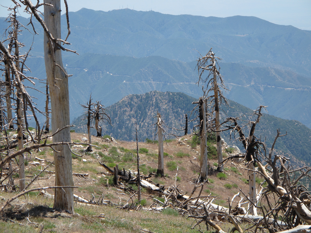
Well, I'm not 100% sure, but that looks like the Glendora Ridge Road on the ridge in the mid distance of the photo. If that were true, then you'd be further east.
Hikin_Jim
Posts: 4686 Joined: Thu Sep 27, 2007 9:04 pm
Post
by Hikin_Jim Tue Aug 03, 2010 8:45 am
Hmm. Well, I'm pretty sure it's middle high country.
Elwood
Posts: 613 Joined: Fri Aug 15, 2008 5:23 pm
Post
by Elwood Tue Aug 03, 2010 9:37 am
I'm inclined to agree with Hikin Jim. Triplets' ridge, Smith Mountain, but what looked like GRR confuses me.
HikeUp
Posts: 3932 Joined: Thu Sep 27, 2007 9:21 pm
Post
by HikeUp Tue Aug 03, 2010 9:50 am
Definitely Hawkins.
Elwood
Posts: 613 Joined: Fri Aug 15, 2008 5:23 pm
Post
by Elwood Tue Aug 03, 2010 10:29 am
Of course. I amaze myself with my dumbassedness. I took this from South Hawkins two frakkin weeks ago!
Hikin_Jim
Posts: 4686 Joined: Thu Sep 27, 2007 9:04 pm
Post
by Hikin_Jim Tue Aug 03, 2010 10:31 am
HikeUp wrote:Definitely Hawkins.
Isn't Hawkins too small on top? I guess we'll see what Zé says.
HJ
HikeUp
Posts: 3932 Joined: Thu Sep 27, 2007 9:21 pm
Post
by HikeUp Tue Aug 03, 2010 10:37 am
I think there are some piles of rocks sorta between where they keep the register and where Copter Ridge really begins to descend to the south/southeast. That'd be Rattlesnake Peak in the near distance.
HikeUp
Posts: 3932 Joined: Thu Sep 27, 2007 9:21 pm
Post
by HikeUp Tue Aug 03, 2010 11:19 am
What peak am I on...


