Jepson Peak & San Gorgonio Mtn 5-2-10
-
Dave G

- Posts: 321
- Joined: Sun Jun 22, 2008 9:51 am
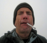
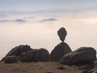
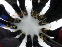
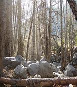
On Sunday I climbed Jepson and San Gorgonio from the South Fork TH. The original plan was to climb one of Jepson's direct NE chutes, but after getting a good look at the current conditions which included strong winds up high, we decided instead to access Jepson via the saddle between it and Little Charlton. After continuing over to San G, we came back and descended Big Draw, generally following the drainage down to Dry Lake, and then back out onto the trail. The snow is melting fast! Heading back down in the afternoon the trail was like a creek once we were below 9K'. Pics are here: http://www.flickr.com/photos/21042415@N ... 862299851/
-
EManBevHills

- Posts: 387
- Joined: Fri Sep 28, 2007 12:40 am
Dave, we sorta crossed paths. It sure was gusty up high, above 10,750, where I ditched my skis due to glazed, windblown, crappy snow. Sure was a fun run down, though. Sorry I missed 'ya. Nice hike, you did!
-
norma r

- Posts: 707
- Joined: Thu Nov 06, 2008 4:22 pm
Nice day hike Dave & Norris! A two'fer. Extra points for not getting blown away!  Boy, that north side of San G and Jepson sure is pretty, isn't it?
-
Dave G

- Posts: 321
- Joined: Sun Jun 22, 2008 9:51 am
Hey Eman, I was warned that you and Calico Cat were up thereEManBevHills wrote:Dave, we sorta crossed paths. It sure was gusty up high, above 10,750, where I ditched my skis due to glazed, windblown, crappy snow. Sure was a fun run down, though. Sorry I missed 'ya. Nice hike, you did!
-
MarkI

- Posts: 20
- Joined: Mon Apr 05, 2010 2:44 am
Nice pics Dave, good climb! Wow that avalanche must have been a pretty good one to knock all that stuff down, and it was fairly low on the slopes too eh? How about Big Draw and those other chutes, do they avi on a regular basis or are they usually fairly stable?
-
EManBevHills

- Posts: 387
- Joined: Fri Sep 28, 2007 12:40 am
Dave,
Yeah, we saw them on our way out, so you probably saw my tracks.
We only ran into 2 youthful looking folks on Sunday near the westernmost false summit as they were battling the winds to stay upright.
Our route was straightforward: we hugged the treeline just east of the major ridge adjacent to the Jepson Bowl and descended the westernmost chute.
Since calicokat was along with his pro foto gear, I only took a few pics, and none up top in the wind. They were so strong, Jim's brand new helmet blew down to Vivian Creek!
http://picasaweb.google.com/EManBevHill ... directlink
-
Elwood

- Posts: 620
- Joined: Fri Aug 15, 2008 5:23 pm
Hey Dave G!
Is that a radio attached to the coiley-cord in your picture? If so, what kind? If not, never mind.
Is that a radio attached to the coiley-cord in your picture? If so, what kind? If not, never mind.
-
Dave G

- Posts: 321
- Joined: Sun Jun 22, 2008 9:51 am
Hey Elwood, that's just the leash off my [rock climbing] nut tool which I have clipped to my camera. I've got a long, sad history of dropping, smashing and losing cameras.Elwood wrote:Hey Dave G!
Is that a radio attached to the coiley-cord in your picture? If so, what kind? If not, never mind.
-
jimqpublic
- Posts: 58
- Joined: Mon Dec 15, 2008 10:05 am
Any postholio report? Thoughts on snow conditions this Friday 5/7?
Thanks
Jim
Thanks
Jim
-
James
- Posts: 79
- Joined: Thu Feb 04, 2010 3:28 pm
Postholio....good one.
Dave, besides wind, what conditions did you encounter that steered you away from the Jepson chutes?
Dave, besides wind, what conditions did you encounter that steered you away from the Jepson chutes?
-
Dave G

- Posts: 321
- Joined: Sun Jun 22, 2008 9:51 am
Well, not exactly. While it's true that Norris is more cautious than I am (which has probably saved my butt on a few of our rock climbs), we both could see that a headwall/cornice had formed at the top. That, combined with the strong winds convinced him that we ought to be using two ice tools to be safe, which we didn't have. Since there were other options for getting to the summit, it seemed reasonable to me.

-
EManBevHills

- Posts: 387
- Joined: Fri Sep 28, 2007 12:40 am
Looks like you made the correct decision. 
