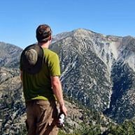
North Devil's Backbone
-
Zach

- Posts: 522
- Joined: Sun Jan 04, 2009 4:25 pm
Has anyone traversed this section in winter? What kind of condition do you think its in?
-
Taco

- Snownado survivor
- Posts: 6134
- Joined: Thu Sep 27, 2007 4:35 pm
It's all easy and non-technical. Probably not too bad at the moment, even with the weather. Being on the ridge means you should be able to find at least a strip of decent hardpack.
-
mcphersonm80

- Posts: 243
- Joined: Mon Aug 23, 2010 11:46 am
Thinking about heading up the North Backbone route this weekend as part of our Whitney training (Whitney on Aug 31), but the only problem is I have absolutely no idea where the trailhead is... I've read Guffy Campground and/or Blue Ridge Rd, but neither sounds particularly friendly to a 2wd low-clearance Honda Civic.
How exactly do you get to the trailhead? I can't seem to find anything online regarding that small detail...
Also, I know it's an unmaintained trail and I've read some people have a hard time finding the Pine Mt summit. Any tips?
Thanks 8)
How exactly do you get to the trailhead? I can't seem to find anything online regarding that small detail...
Also, I know it's an unmaintained trail and I've read some people have a hard time finding the Pine Mt summit. Any tips?
Thanks 8)
-
HikeUp

- Posts: 4036
- Joined: Thu Sep 27, 2007 9:21 pm
ACME-FU map.
A - trail head.
B - Guffy
C- intersection of blue ridge road and ACH
Drive from C to A. If you can't get all the way to C, then park at B and walk the road to A. You could also take the PCT from B to Wright Mtn., then roll down the hill to A.
I was up there last year (pics) in a Honda CRV and have been there before in a Honda Accord. No clearance problems - just keep an eye out for big rocks that may have rolled out onto the road.
Edit: seems ACMU FU is all fu-tard right now and the topo map isn't showing up on my computer. Blue Ridge road or 3N06 is the road to take from ACH to the trail head. Make note on the map where the trail is and keep an eye out for the obvious ridge to Pine - park in the wide part of the road at the point where the ridge meets the road.
Edit 2: it's hard to miss the summit of Pine - I'm scared to think someone couldn't find it, unless it was a white out. Hint: it's at the top.
-
mcphersonm80

- Posts: 243
- Joined: Mon Aug 23, 2010 11:46 am
Perfect, thanks! I'll post a report after 8)
-
mcphersonm80

- Posts: 243
- Joined: Mon Aug 23, 2010 11:46 am
Didn't quite make it all the way to the trailhead, but parked in a small turnout just past Guffy. Doable, and the hike makes it absolutely worth it, but yeah those huge rocks and potholes galore made it pretty tricky in my poor little Civic.
TR here: https://eispiraten.com/viewtopic.php?t=4070
Thanks again for your help!
TR here: https://eispiraten.com/viewtopic.php?t=4070
Thanks again for your help!
