
This is nice to have a forum for SG canyoneering. I've done quite a bit of canyoneering in Utah (Zion, Canyonlands) but only recently started checking out the canyons in the San Gabriels. So far I've been rather impressed. There's quite a lot of fun to bad had here.
Mike Schasch and I did 3 weekends of canyoneering in the San Gabriels last month. Canyons included:
9/8/2007 - Silver on the Side
9/8/2007 - Lower Fusier Canyon
9/9/2007 - Eaton Canyon
9/15/2007 - Great Falls of the Fox
9/16/2007 - East Rubio & Lower Rubio
9/26/2007 - Hall Beckley Canyon
9/26/2007 - CCC Canyon
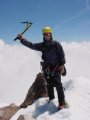
Photos are here:
http://www.rickkent.net
One canyon that stands out is Eaton Canyon. This one's a classic and I've done it twice now. What makes it so outstanding is all the non-stop pools. This is an exceptionally wet experience and requires jumping, sliding, rappelling, and swimming across countless deep pools. You may also have to do one or two swimming disconnects (tricky) so it's good if you've done a few other canyons first. On the last rappel (of Eaton Falls) you usually have an audience. It's definitely a sweet canyon.
The most challenging one we did so far was a combination of East Fork Rubio and Lower Rubio. This combination required 18 rappels which I believe is the most for any canyon in the San Gabriels. The bushwhacking was a bit on the extreme side and there are some anchor challenges. There are also a million ways to get a rope stuck in this one so it's more for the experienced canyoneer. The East Fork has a 4B rating. Lower Rubio is bolted with a 3B rating and is suitable for beginners.
The Great Falls of the Fox is supposed to be another classic one but currently it's mostly dry which makes it less challenging and takes away quite a bit of character. I'd like to do this one again some time when the falls are flowing.
As for dry canyons Silver on the Side was a nice one despite some bushwhacking. There are a couple big rappels (120 ft & 180 ft) that are pretty sweet. The big rappels are from "bush" anchors but fortunately they're pretty substantial bushes.
I'm hoping to do quite a few more canyons in the next few months.
I even did some solo canyoneering in Death Valley last month.
-Rick
SG Canyoneering Sept
-
AlanK

- Posts: 1069
- Joined: Thu Sep 27, 2007 9:28 pm
Rick -- I enjoyed your pictures as usual. I came across the pictures of an abandoned pot farm in your Mt. Lukens album. I have often wondered what faaction of those hills is devoted to pot farming. There were a couple of sizeable raids recently in the Verdugos, wiich puts them pretty close to civilization. I'm glad you encountered an abandoned one!
-
Rick Kent
- Posts: 150
- Joined: Tue Oct 02, 2007 11:21 am
Yes, the description we had mentioned something about an "operational" pot farm but fortunately it was either raided or was previously harvested. Perhaps standard SG canyoneering gear should include a gun (or a sword)? The sword might be helpful for bushwhacking too!

-Rick
-Rick
-
AlanK
- Posts: 1069
- Joined: Thu Sep 27, 2007 9:28 pm
There is a rumor going around that swords will have to be registered, at least in Baldy Village.
But a machete is not a sword, so one can still hope to be properly equipped up there.
But a machete is not a sword, so one can still hope to be properly equipped up there.
-
Taco

- Snownado survivor
- Posts: 6136
- Joined: Thu Sep 27, 2007 4:35 pm
I'm glad to see that there isn't any moderating to be done in this thread! Everyone is right on topic, as you can see.
Anyway, cool stuff Rick. As always! Mike's pages on SP are great!
Anyway, cool stuff Rick. As always! Mike's pages on SP are great!
-
Taco
- Snownado survivor
- Posts: 6136
- Joined: Thu Sep 27, 2007 4:35 pm
Have you tried San Antonio Canyon? Looks like a pretty easy one with a bunch of smaller rappels.
It is unfortunate that there are pot farms here in the San Gabriels. I had a run-in with some folks who didn't quite belong. A story for another day. 8)
It is unfortunate that there are pot farms here in the San Gabriels. I had a run-in with some folks who didn't quite belong. A story for another day. 8)
-
Taco
- Snownado survivor
- Posts: 6136
- Joined: Thu Sep 27, 2007 4:35 pm
Very cool, thanks for posting that! Still have not been to that mine.
I've only been up above the first waterfall off the road. I always wonder what it would take for that thing to freeze solid...
I've only been up above the first waterfall off the road. I always wonder what it would take for that thing to freeze solid...
-
Rick Kent
- Posts: 150
- Joined: Tue Oct 02, 2007 11:21 am
That's also one I want to do. Brennen gave it a 3 star rating so it's probably fairly good. I'd like to do all the 3 star canyons. I'd be interested in joining you guys for Supercloud Canyon but I'll be doing some canyoneering in Utah that weekend.
-Rick
-Rick
-
Taco
- Snownado survivor
- Posts: 6136
- Joined: Thu Sep 27, 2007 4:35 pm
Not a bad tradeoff! Supercloud will always be here.
-
Taco
- Snownado survivor
- Posts: 6136
- Joined: Thu Sep 27, 2007 4:35 pm
Taco is just fantastic.
Thank you for your cooperation.
Thank you for your cooperation.
-
AW~

- Posts: 2093
- Joined: Mon Oct 01, 2007 12:00 pm
Oct - try and catch some fall colors later in the month.
Canyon: Middle Fork Lytle Creek
Hiking: West Fork San Gabriel River to Cogswell Dam with exploring the endings of Weatherby ,Butterfield, or Big Mermaid canyons so as to get a canyoneering atmosphere.
The best time for canyoneering in my opinion is anytime its cold or rainy, which last year was well into Jan.

-
AW~
- Posts: 2093
- Joined: Mon Oct 01, 2007 12:00 pm
Allison Gulch, just another good canyon in the SGs and somewhere on my list..LOL...my problem is the Iron Fork is a big time magnet and is a classic...not to mention BTN canyon, which everytime I pass I vow to check out. Best would be to split up the area in 2 days. Clean descent from Mount South Hawkins on Hawkins ridge, rappel into the west fork of Iron Fork. Coming from Copter Ridge is a bad idea, a lot of kickazz vegetation near both sides of the Iron Fork.Have to see if BTN canyon is better than Allison Gulch...to complete the rest of that idea. BTN canyon is right in your face past the bridge. Its exit(dry) is an approx 50ft white drop
Since Im drawn to waterfalls, also am wondering what Falls Gulch is all about. On the return from Iron Fork one time, I did check out Clark Gulch...what a horrible canyon exit, always looks like something coming up, but who cares???!!! The only thing consistent was a branch in the face. I'll note I didnt bring a map and thought it was Falls Gulch hehehe...
Since Im drawn to waterfalls, also am wondering what Falls Gulch is all about. On the return from Iron Fork one time, I did check out Clark Gulch...what a horrible canyon exit, always looks like something coming up, but who cares???!!! The only thing consistent was a branch in the face. I'll note I didnt bring a map and thought it was Falls Gulch hehehe...
-
Rick M
- Posts: 61
- Joined: Mon Mar 17, 2008 4:11 pm
This has been very interesting reading. Just how long has “Canyoneering” been a means to an end? I’ve done it for years but almost always as a means for access to climb peaks. And just recently got a chance to do some canyoneering when dropped off by helicopter for a SAR mission. I think the others didn’t mind the water or rocks but did not like the bushwhacking (can’t say I’m fond of it myself).
I remember skiing on Baldy Bowl and having a ski come off and in a near white out, heard it disappear into the mists of San Antonio Canyon. While my friends skied and hiked down the trail, I went scrabbling down the canyon alternating between post holing, cramponing, and rock climbing as I hit various conditions down the canyon. I did have the sense to not try down climbing the wet icy rock of San Antonio Falls proper. I did pass along the way the Gold Ridge Mine, which was very much accessible in the 1970s along with a fair amount of relics. We visited that death trap on a few occasions never going in pass waist deep. As a rescue person and former mining geologist, I was glad to see it was getting covered over by rock fall. As Rick G said
I remember dreading the times fording streams and rivers to gain access to peaks and feel the cold water squishing in your boot and knowing it would be cold going when reaching the snow. Or going up the seldom used trails at the time like Heaton Flats to Allison mine, up Sheep Mt (Iron Mt) and over to Baldy and once using, as someone mentioned, a machete to try to get through the overgrown brush obscuring passage (they may work great in tropical foliage but not so great in twiggy brush). And I remember climbing around falls (dry or wet) or worst still, having to set up these stupid little 20-50’ or more rappels and sometimes getting wet in the process.
I recall absolutely hating hitting dry falls while prospecting up canyons because of the time and energy I would lose in deciding how to negotiate them (usually solo when prospecting). Sometimes rock climbing them, or scrambling around or maybe try bushwhacking (try crawling on hands and knees under big manzanita for hundreds of feet) following game trails…uuuhhhhheeerrrggg while carrying packs loaded with rock samples.
But you know, after all these years, I look back on it with fondness and can see the allure it can have on people. It has also given me (besides poison oak) a better understanding of just where people can go given survival situations or lost (for SAR purposes).
BTW, first time I was at Allison, two cabins were standing and the last time only one was still up. Is it still standing (if it hasn’t burned)?
ps Always had this funny feeling about people carrying 5-gallon buckets of water up trails
I remember skiing on Baldy Bowl and having a ski come off and in a near white out, heard it disappear into the mists of San Antonio Canyon. While my friends skied and hiked down the trail, I went scrabbling down the canyon alternating between post holing, cramponing, and rock climbing as I hit various conditions down the canyon. I did have the sense to not try down climbing the wet icy rock of San Antonio Falls proper. I did pass along the way the Gold Ridge Mine, which was very much accessible in the 1970s along with a fair amount of relics. We visited that death trap on a few occasions never going in pass waist deep. As a rescue person and former mining geologist, I was glad to see it was getting covered over by rock fall. As Rick G said
Stay out and stay alive is what I tell people about abandoned unmaintained mines. Even when they are active and inspected, mines can be dangerous places.Although I didn’t see any mine shaft (and I ain’t never not going in any stinking mine shaft or cave, yuck!)
I remember dreading the times fording streams and rivers to gain access to peaks and feel the cold water squishing in your boot and knowing it would be cold going when reaching the snow. Or going up the seldom used trails at the time like Heaton Flats to Allison mine, up Sheep Mt (Iron Mt) and over to Baldy and once using, as someone mentioned, a machete to try to get through the overgrown brush obscuring passage (they may work great in tropical foliage but not so great in twiggy brush). And I remember climbing around falls (dry or wet) or worst still, having to set up these stupid little 20-50’ or more rappels and sometimes getting wet in the process.
I recall absolutely hating hitting dry falls while prospecting up canyons because of the time and energy I would lose in deciding how to negotiate them (usually solo when prospecting). Sometimes rock climbing them, or scrambling around or maybe try bushwhacking (try crawling on hands and knees under big manzanita for hundreds of feet) following game trails…uuuhhhhheeerrrggg while carrying packs loaded with rock samples.
But you know, after all these years, I look back on it with fondness and can see the allure it can have on people. It has also given me (besides poison oak) a better understanding of just where people can go given survival situations or lost (for SAR purposes).
BTW, first time I was at Allison, two cabins were standing and the last time only one was still up. Is it still standing (if it hasn’t burned)?
ps Always had this funny feeling about people carrying 5-gallon buckets of water up trails