What do you do when a winter storm is coming to socal? You go climb a mountain of course! (as long as you feel comfortable in such conditions).
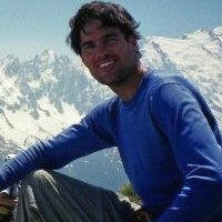
My buddy Arthur and I climbed San Gorgonio via the Southfork trail on Saturday. We both are very familiar with this mountain and felt we could navigate our way even in the harshest of weather, if needed. Although we were warned that the weather could get ugly, it really never materialized and we only had light wind and snow all day. We left the trailhead just after 6am, hiked up to Mineshaft Saddle and ascended the North ridge (?) and made the summit around 12:30. The temperature on the summit was around 15 degrees and -7 with wind chill. We descended one of the North chutes back down to the trail above Dry Lake and hiked back out. We were both hoping for worse weather, but it was still a great day in the mountains.
Yeah Mike & Arthur! a winter ascent of San G. i high-five you for braving that wind chill! Brrr... Looks like a decent amount of snow fell. i would love to see it continue.
Mike, how hard was the wind blowing yesterday? any idea of the speed?
I climbed Falling Rock Canyon today and it was darn windy up at saddle. hope to post pix later tonight or tomorrow.
Great pictures Mike. Hopefully we get a good storm soon that will dump enough to stick for more than a few days. I was on baldy early this morning and most of the snow has been blown off by the wind already. http://picasaweb.google.com/markshiking ... MtBaldy06#
Nice hike Mike, looks like you were the only ones out there yesterday.
Pictures are great, couple questions
1) When you say the north ridge is the way you went up, is that the ridge just east of the big bowl below Jepson?
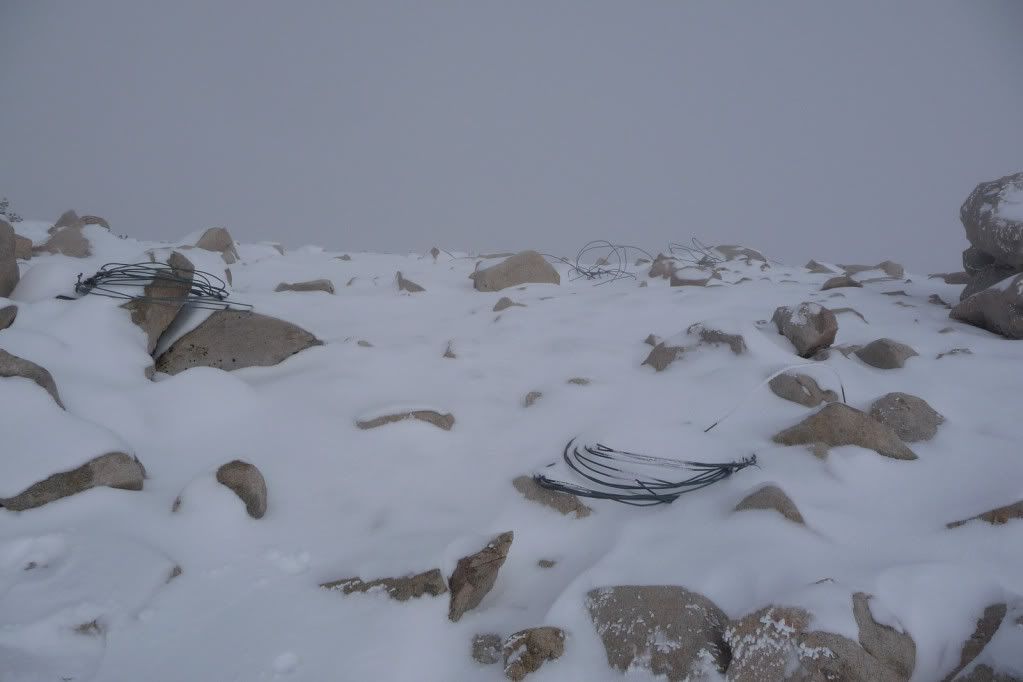
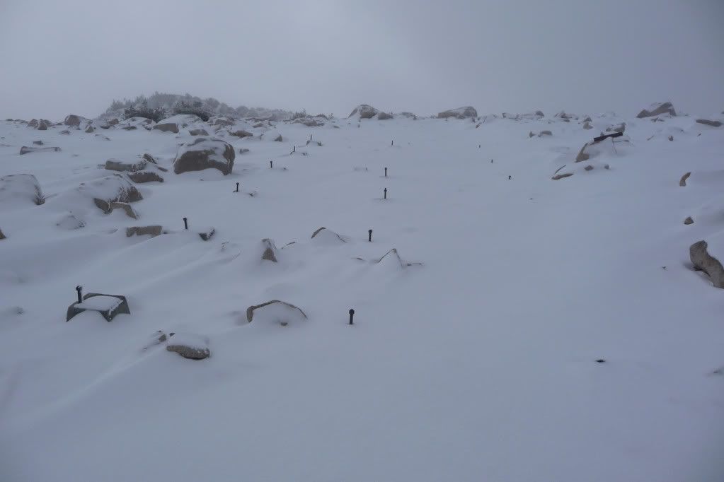
2)Can you identify where you saw these items below?
And this one? Don't remember ever seeing these anchors sticking up on that mountain anywhere? Like a structure was going to be built?
Lastly, how far down the mountain (driving wise) did the snow extend?
We went up the ridge from Mine Shaft saddle. I'm not sure if that would be the North ridge or not...
We saw the wire on top of bump "11490" on the topo map and the cement anchor blocks were a little ways below on the SE side. I can't remember ever seeing them before.
It was dark when we drove out, but I could still see snow around 5,000 feet.
Hi Mike and Arthur,
Congratulations to both of you.
Mike, you amaze me all the time by setting up a new challenge and reach the goal almost without any efforts. Both of you have a nerve of steel.
I want to hike with you guys someday.
Hi hvydrt,
What time did you start? The "The city lights " picture is the best of Mt Baldy ever. I like it very much.
I couldn't make it this week but next week I'll be up there.
I think I've seen those anchors on San G before, but my mind could be playing tricks on me. Like Mike said, I remember them being near that 11490 bump. Although I don't remember them being in a neat row like that. Most people don't run into them if they're coming from Vivian or Mine Shaft Saddle since the trail is below it a ways. I've only seen them when climbing San G's north slope in the winter because after you top out you go over that bump to get to the summit.
Wondering, did you wear crampons? Or were just boots sufficient? Looking into doing more hiking this winter and wondering what I can get away with. I see you had poles, but did you also pack an ice axe. Love the conditions though. Looks like a perfect late fall outing.
We went up the ridge from Mine Shaft saddle. I'm not sure if that would be the North ridge or not...
We saw the wire on top of bump "11490" on the topo map and the cement anchor blocks were a little ways below on the SE side. I can't remember ever seeing them before.
It was dark when we drove out, but I could still see snow around 5,000 feet.
Thanks Mike, If I had to guess maybe they were getting ready at one point to put in weather gear? Next time I'm up in weather permitting, I will scrable over there and take a closer look.
There used to be a large stone monument at the summit of Mt San Gorgonio. There's a photo of it in John Robinson's A Wilderness Preserved. I don't know where it was, but there are obviously remains from it in the summit rockpile, as you can find many boulders and rocks with mortar on them.
Those anchors look like they could have been part of the foundation for that monument.
Those concrete pedestals have been there for many years; the earliest pics I have of them that are findable are from 2001 (digital), but I had some on film stock from many years ago.
As simonov mentions, they likely are remnants of the old monument.
Zach wrote:Weren't they trying to put a ski lift in a long, long time ago? I've seen that wire stuff more than once on the northern slopes of San G as well.
The ski lift wars raged for 20 years, but it was all in committee rooms, op-ed pages and public auditoriums. No one ever came close to actually building a ski resort on San Gorgonio.
Thanks for checking out that N/NE ridge Mike! I'll have to get your description of it but it didn't look too bad from the photos. Why did you descend the north slope though? Seems like that would kinda suck without complete snow coverage.
Taco- I don't have a Facebook account, yet, but you know my email. Send me some info when you can and I'll work on the Facebook thing.
simonov & arocknoid- Great info, thanks!
Rick- The N/NE ridge was pretty good, even with a few inches of fresh powder on the scree. There is actually a use trail up there, so it must get used fairly often. And yes, the North slope did suck. I'm not sure why we chose that route .