Icehouse Canyon Exploration, 10-Oct-2009

TRs for the San Gabriel Mountains.
Post Reply
User avatar
Tim
Posts: 560
Joined: Tue Apr 08, 2008 8:55 pm

Post by Tim »

Sorry, no pictures. I brought my camera but forgot the memory card.

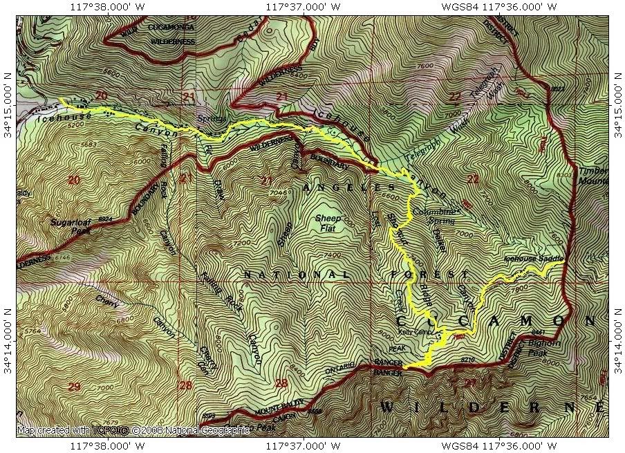
Continuing my series on random ridges, I descended one instead of climbed one this time. I hiked to Kelly Camp and then up to the Ontario-Bighorn ridge. As a proud new member of NHPS I didn't bother attempting either peak. I just sat there by the Bighorn Trail Marker and gazed down at the smog filled metropolis below. After eating some kettle popcorn and a caramel apple, I left for Shortcut Ridge. At Kelly Camp, a father and son were ahead of me and descending the normal route to Icehouse Saddle and IHC. This was a perfect test to see if I could beat them.

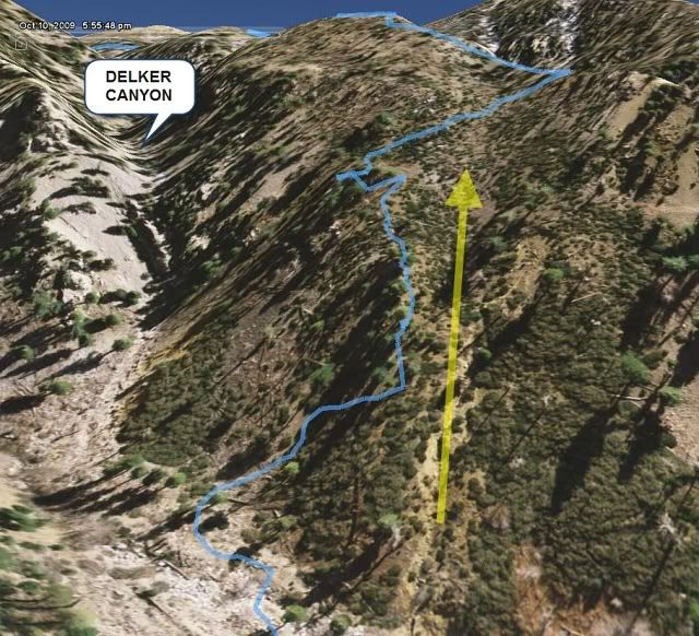
I didn't do any research on the route and was too lazy to look it up on Google Earth beforehand. I just had my GPS loaded with 20 ft topo data and my printed topo map. But on the way up the IHC trail, I did some recon and looked for the best descent route from the ridge. I spotted a fairly benign gully west of Delker Canyon. I definitely did not want to descend Delker because there was a big chockstone or something like that near the bottom.

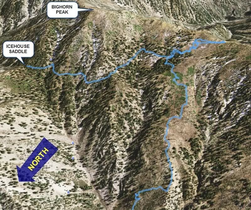
After leaving Kelly Camp, I aimed for a flat spot on the topo but this turned out to be a huge brush field. It was like a giant maze, but eventually I made it out to a clearing. The brush was actually fairly "friendly." It was waist high dense brush, but it wasn't thorny and amazingly you could walk straight through it if you really had to. I did this once for about 20 ft but I wouldn't make a habit of it. Looking at the route now on Google Earth, I should have started higher and to the west.

The rest of the way down was straightforward. It was very steep in spots but traction was relatively good. I found several game trails near the bottom and that helped out a lot. It took a little over an hour to get to the bottom of IHC and I ended up slightly east of my intended descent gully. When I got there, I saw the father and son on the normal trail above me. I just barely beat them as I regained the trail just below the 2 mile marker. They were going kind of slow so this wasn't much of a shortcut. The route descended about 1600 ft.

Image
Image

Yellow arrow was my target descent gully. I veered east because straight ahead looked liked a bunch of buckthorn.
Image
User avatar
Ze Hiker
Posts: 1432
Joined: Mon Jul 28, 2008 7:14 pm

Post by Ze Hiker »

no pics? FAIL :lol:

what's the next random ridge?

south ridge to Ross Mt

Leatherneck Ridge to Tram?
User avatar
EnFuego
Posts: 677
Joined: Mon Dec 15, 2008 11:14 am

Post by EnFuego »

wrote:no pics? FAIL :lol:

what's the next random ridge?

south ridge to Ross Mt

Leatherneck Ridge to Tram?
If anybody is doing Leatherneck, I want in. Only 6 weeks left or so to do it.
User avatar
AW~
Posts: 2044
Joined: Mon Oct 01, 2007 12:00 pm

Post by AW~ »

Hehehe, this guy is getting more agressive on these...Tim is this your first blind first descent?

Ze, Ive got some excellent routes in the mix...and they adhere to strict NHPS standards! As this route did.
User avatar
Taco
Snownado survivor
Posts: 6014
Joined: Thu Sep 27, 2007 4:35 pm

Post by Taco »

COUGHkimchiridgeCOUGH
User avatar
Tim
Posts: 560
Joined: Tue Apr 08, 2008 8:55 pm

Post by Tim »

wrote:no pics? FAIL :lol:

what's the next random ridge?

south ridge to Ross Mt

Leatherneck Ridge to Tram?
This is like the 4th time I've forgotten the memory card. So stupid! I need to leave an extra SD card permanently in my 10 essentials bag.

Those ridges look intriguing. The view of the two escarpments at the top of Leatherneck Ridge must be a sight to behold.
AW wrote:Tim is this your first blind first descent?
I've done a few semi-blind descents before but not very often. They make me really nervous. This wasn't too big a deal because it was short and the worst that could happen was I had to climb back up. I don't think I would do a blind descent of a canyon unless the route has been done before and I knew what to expect. I keep having this feeling that my luck is going to run out one of these days.
TacoDelRio wrote:COUGHkimchiridgeCOUGH
That's west of Sheep Canyon? Can you go up and down Kimchi Ridge without pro?
User avatar
Taco
Snownado survivor
Posts: 6014
Joined: Thu Sep 27, 2007 4:35 pm

Post by Taco »

Yes and no. :lol:

I'd bring a basic rapp kit.
Post Reply