Lake Peak, San G, Dragons Head and Bighorn 9-04-09

Archived TRs for ranges in California.
Post Reply
User avatar
lilbitmo
Posts: 1092
Joined: Tue Mar 04, 2008 9:44 pm

Post by lilbitmo »

Felt ambitious so two friends met me at my house at 10 PM Friday night.
Made it to Fish Creek Trail Head at Midnight and headed up to Fish Creek Trail Camp and made it by 1 AM, put up tents and fell asleep by 2ish, at 4 AM two hikers walked past talking louder than a 747 on takeoff and continued that way all the way to the next ridgeline. :x :evil:
Up at 7, and heading uphill by 8, decided to bag Lake Peak on the way to San Gorgonio. I went over the top while my two friends continued to Mine Shaft Saddle on the regular trail and the approach to San G., at the top of the switchbacks when you get to the section facing due south we encountered a solitary "bighorn sheep coming over the ridgeline heading directly towards the "Tarn" and Bighorn Mountain", :D then we headed up to San G, spent ten minutes there then headed southwest to Dragons Head. Speant ten minutes there and I left them there resting while I headed over to grab Bighorn Mountain.
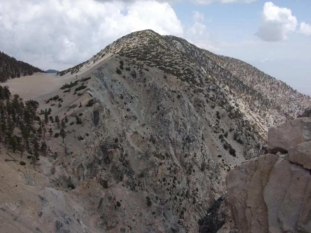
As I came over the last little ridge just below the summit block I paused to catch my breath with hands on my hips leaning forward not looking ahead but rather looking down just for the moment, when I did look up there was a male and female Bighorn couple standing 50 feet to my left just below the summit blocks, I reached for my camera and they took off fast - I so wanted a picture of the proud couple standing at the top of the mountian named in their honor :(
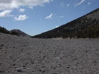
From the summit I scrambled down into the "Tarn" and took a breather with my friends who were waiting in the shade on the north side of the "Tarn" before we did the 400 foot scramble up the southern flank of San G to catch the main trail back to Fish Creek Trail Camp.
Temperatures were perfect throughout the day, had a great day. :D

Pictures here - http://s728.photobucket.com/albums/ww28 ... =slideshow
User avatar
edenooch
Posts: 504
Joined: Fri Jul 03, 2009 7:42 pm

Post by edenooch »

whats the name of those mountains withthat sandy area inbetween the 2?

Image
User avatar
lilbitmo
Posts: 1092
Joined: Tue Mar 04, 2008 9:44 pm

Post by lilbitmo »

The point of view of the picture you captured is the Summit of Dragons Head, looking due east at the ridgeline that makes up Bighorn Mountain. The sandy stuff is the "Tarn" as they call it. It sits below San Gorgonio summit by 900 feet to the south of it, and below Dragons Head by 250 and below Bighorn by 300+ feet.

That ridgeline is about 3/4 of a mile long maybe a little more, when you come around the very last switchback from the north side of the flanks of San Gorgonio heading southwest that mountain and it's full ridgeline are directly if front of you with that "sandy Tarn" separating you from Bighorn Mountain. You would drop down 450 to 500 feet into that sandy stuff, cross it and then scramble up from the west to the east, or you could try going straight up it but it's fairly loose scree.

Hope this helps :D
User avatar
Hikin_Jim
Posts: 4686
Joined: Thu Sep 27, 2007 9:04 pm

Post by Hikin_Jim »

Good job, bro! Nice hikin'.
User avatar
lilbitmo
Posts: 1092
Joined: Tue Mar 04, 2008 9:44 pm

Post by lilbitmo »

Hikin_Jim wrote:Good job, bro! Nice hikin'.
Thanks Jim, did the wife have the baby yet? If so, congrats from the Orange County hikers - a new hiker on the horizon, new trailname HJ Junior :D or Juniorette :?:
User avatar
Hikin_Jim
Posts: 4686
Joined: Thu Sep 27, 2007 9:04 pm

Post by Hikin_Jim »

lilbitmo wrote:
Hikin_Jim wrote:Good job, bro! Nice hikin'.
Thanks Jim, did the wife have the baby yet? If so, congrats from the Orange County hikers - a new hiker on the horizon, new trailname HJ Junior :D or Juniorette :?:
No baby yet. Michiko is due this Sunday. :shock: Been in the hospital a lot 'cause the baby's heart did a couple of wierd flip flops, but it looks like all is OK.

Baby extremely active according to Michiko. I think she's doing push ups just to show up her old man once she gets out on the trail... :D
User avatar
He219
Posts: 386
Joined: Thu Sep 27, 2007 11:18 pm

Post by He219 »

edenooch wrote:.. with that sandy area ?
This calls for a quick Geologic explanation:

Dragon's Head is a Headwall, an outcropping of rock at the end of a dry lakebed called the Tarn.
This is an old glacial cirque and previous site of one of the southernmost glaciers in California; also known as Tosh's Tarn.

Source

Image
User avatar
lilbitmo
Posts: 1092
Joined: Tue Mar 04, 2008 9:44 pm

Post by lilbitmo »

He219 wrote:
edenooch wrote:.. with that sandy area ?
This calls for a quick Geologic explanation:

Dragon's Head is a Headwall, an outcropping of rock at the end of a dry lakebed called the Tarn.
This is an old glacial cirque and previous site of one of the southernmost glaciers in California; also known as Tosh's Tarn.

Source

Image
Now that's a complete explanation if ever someone posted one :D Nice, thanks HE219
User avatar
He219
Posts: 386
Joined: Thu Sep 27, 2007 11:18 pm

Post by He219 »

Not quite ..
:wink:

The word is derived from the Old Norse word tjörn meaning pond.
User avatar
Taco
Snownado survivor
Posts: 6010
Joined: Thu Sep 27, 2007 4:35 pm

Post by Taco »

That's a nice plucking tarn.
User avatar
He219
Posts: 386
Joined: Thu Sep 27, 2007 11:18 pm

Post by He219 »

Nixe TR, lilbitmo!
TacoDelRio wrote:That's a nice plucking tarn.
Tøtål verplückt!
:wink:


We're hittin' that plucking headwall this winter ..
User avatar
Taco
Snownado survivor
Posts: 6010
Joined: Thu Sep 27, 2007 4:35 pm

Post by Taco »

We're gonna pluck that wall up.
User avatar
Hikin_Jim
Posts: 4686
Joined: Thu Sep 27, 2007 9:04 pm

Post by Hikin_Jim »

He219 wrote:
edenooch wrote:.. with that sandy area ?
This calls for a quick Geologic explanation:

Dragon's Head is a Headwall, an outcropping of rock at the end of a dry lakebed called the Tarn.
This is an old glacial cirque and previous site of one of the southernmost glaciers in California; also known as Tosh's Tarn.

Source

Image
Is the Dragon's head the Headwall or is San G? Seems like it's downhill from the E end of the tarn to the W end, yes?

Or did the big gap between Bighorn and the Dragon's Head come later and ... ?
User avatar
lilbitmo
Posts: 1092
Joined: Tue Mar 04, 2008 9:44 pm

Post by lilbitmo »

HJ Wrote
Is the Dragon's head the Headwall or is San G? Seems like it's downhill from the E end of the tarn to the W end, yes?

Or did the big gap between Bighorn and the Dragon's Head come later and ... ?
Good question, your observations are correct is does taper more towards the west but there is a slight saddle in the middle, that I noticed when I came off Bighorn through the center of the tarn (dead in the middle between both ends) I took the photo below looking from the East to the West, my guess is that San G was the "Zone of Plucking" "Headwall", so much of the area direct between Bighorn and Dragon's head drop off severly, like something heavy was there at one time and caused it all to cave in?

Image
User avatar
hvydrt
Posts: 494
Joined: Thu Sep 27, 2007 8:18 pm

Post by hvydrt »

Check out this article from the 1892 New York Times about glaciers in southern California: http://query.nytimes.com/mem/archive-fr ... 94639ED7CF
The existence of an active glacier in Southern California of such heroic proportions as to justify comparison with the minor Continental glaciers of the Alps, Andes, and Himalayas, can be added to the local category of stupendous works in the economy of nature to be found in sub-tropical California.
User avatar
EnFuego
Posts: 677
Joined: Mon Dec 15, 2008 11:14 am

Post by EnFuego »

Looks like a nice hike Patrick. Looks like you had some nice clear weather.
Post Reply