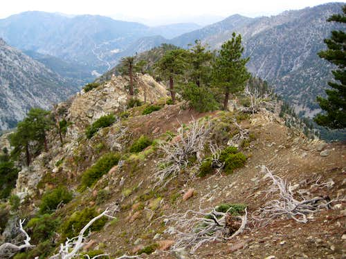
From Manker Flat, I descended the stream bed to the base of a scree-covered rib that ascends about 1400 vertical feet from the campground to the crest of the southwest ridge. I followed tracks most of the way up the rib, encountering steep scree in places and one wall of thick brush that was circumvented on the left. Once on the southwest ridge, I followed it for roughly 1000 vertical feet to the anti-climactic summit of Thunder Mountain. The southwest ridge is pleasant with a few tricky and somewhat exposed third class spots where it narrows. It has a wild, untraveled feel. It took me about 2.5 hours to ascend the route and 45 minutes to jog down via Baldy Notch (that jog down made my thighs very sore for the next few days). Though there were many cars parked at Manker Flat, I saw nobody on my ascent route.