Kern River area 8/16 thru 8/19

Archived TRs for Sierra Nevada ranges.
Post Reply
User avatar
mattmaxon
Posts: 1137
Joined: Mon Mar 24, 2008 12:48 pm

Post by mattmaxon »

I made what is becoming an annual tradition of Seven Tea Cups, this year was to celebrate CougarMagic's B-Day Hope it was a happy one.....

I left from home after work and got to Rincon camp around 10pm, I t'was bleary eyed and should have had a better look where I threw my mattress down as I was sleeping in a field of cow pies :shock:

The next day I did my long postponed day hike down to the NF Kern river via Peppermint Creek Trail. The trail shown on the map have seen little / no traffic in many many years.

Previously this was accessible by hiking through private property in section 35 but this has been closed to public use for some time. I skirted the PP on the south and east, the trail is nice with a few down trees and boulders that have rolled onto the trail but it's easy to follow.

Nice camps along the river there is plenty of campsites

Peppermint Creek photos

Since the weather forecast was obviously way off , with temps around 100°+ I headed up to the west high country and wound up at a camp The Needles

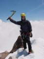
The following AM I headed up to the lookout which isn't open until 9am, but there are certainly worse places to hang around and wait.

The views from here are amazing will worth a trip IMO

Needles LO photos

Later I headed over to Horse Meadow Cpgd off Cheery Hill Rd (SqNF 22S12) who should I see there but CougarMagic! Wow what a coincidence, well not really but we both arrived about the same time.

Holy Crap! $17 to camp here WTF? AHh... we headed back down the road to Poison Meadow Creek fire safe area much better $0 and water a plenty if you don't mind poison! :lol: Well I ain't dead yet... :shock:

As with all things plans change burnttoast never showed up (Swine Flu) and azurecheeetah showed up late after a 6hr drive from SD

The following day we explored Salmon Creek down to the falls, had I been paying attention to the map I'd not have seen the parts of the creek we did. Salmon creek trail (SqNF 33E36) makes a left across the creek a short was out of the TH near the camp and skirts Horse Meadow to a trailhead about 1½ - 2 miles on SqNF 23S08 ('SPUR 5" on the road sign)

There are many good backpacker camps down here easy access nice area

We got to the end of the trail and scrambled down to the pools and polished slick rock very nice spot , we continued down to the falls but you can't see'em from here, guess that's why I couldn't find any photos on the web!

Salmon Creek Photos

We stuck around Poison Meadow cpgd until about 6:30pm as Rincon is a hot hot place this time of year, more of our group was there and another showed up later making our number 6 for 7T-Cups sweet!

We hiked in via Chris Brennan's drop-in a short way up from Johnsondale bridge, even at 7:30am it was quite hot no GPS needed for this hike I've done it 3 other times. At the 4WD primitive camp near Dry Meadow Creek there was a group camped, we asked if they saw the cougar connected with the very fresh tracks we saw a short way from their camp? "Nope mountain lions" was the reply.

Our descent of 7T-Cups was great fun, I was expecting a bit more water since this is the earliest I've done this route but it wasn't to be. I didn't turn my head sideways in "The Spout" this time, and we used the anchor canyon left into the deep pool near the end of the route.

The 4WD group hiked in the upper canyon and where amazed to see us in the water... "Slick Rock Slim" was traversing and going up & down the canyon wall oblivious to the danger, it's a wonder he's lived as long as he has

I forgot about the second anchor below the deep pool that keeps you our of the hydraulic in the slot, someone has modified it so you just clip your rope into it to redirect your rappel and you don't need to setup another rope THANKS!

Crossing the river was a bit of a problem

I tried to wade across as I've done in the past... no way I was swept away 3 times

We setup a highline to send the packs across and used it to send 3 of the canyoneers across, the final one across had a pull line assist

I checked the flow in Kernville where the flow was 505cfs @ 1-2pm when we where crossing, I've been told the high end of the safe crossing level is around 850cfs I'd like to have some training on doing it before trying that.

Along with a PFD and paid up life insurance

:shock:

Thanks to all who made this trip a great one!

Matt
User avatar
Rick Kent
Posts: 150
Joined: Tue Oct 02, 2007 11:21 am

Post by Rick Kent »

Nice! I too made the journey down to Salmon Creek falls staying on the wrong side most of the way down (definitely an adventure). Found the nice trail on the other side on the way back. I got down pretty close to where the falls spill over but still the view isn't that great.

7 Teacups is great fun. When I did it with Mike Schasch I slipped going down the corkscrew spout. Went inverted and then just dropped into the pool below. Good stuff. Got our rope stuck real good on that one somehow too.
User avatar
mattmaxon
Posts: 1137
Joined: Mon Mar 24, 2008 12:48 pm

Post by mattmaxon »

Rick Kent wrote:Nice! I too made the journey down to Salmon Creek falls staying on the wrong side most of the way down (definitely an adventure). Found the nice trail on the other side on the way back. I got down pretty close to where the falls spill over but still the view isn't that great.
Seems to be a common refrain, one of the people We met up with down at Rincon Camp had done the hike before and had done the same thing too....
Rick Kent wrote:7 Teacups is great fun. When I did it with Mike Schasch I slipped going down the corkscrew spout. Went inverted and then just dropped into the pool below. Good stuff. Got our rope stuck real good on that one somehow too.
Yeah there's video of one of our group....

Hopefully cougarmagic will post it on line....
User avatar
cougarmagic
Posts: 1409
Joined: Wed May 07, 2008 5:21 pm

Post by cougarmagic »

This was a great trip! I love the Kern/Domeland/Sequoia NF for so many reasons - it's close, it has a little bit of everything the Sierra has to offer (canyons, granite, pine forest, meadows) with none of the crowds, restrictions, and hassle of the parks. Just go, camp where you want, take your dog, who cares?

All the trail descriptions of Salmon Creek taunted me by saying there was no way to see the falls from the rim. I am slowly coming to terms with the fact that that is absolutely true. Still, Salmon Creek Falls has not seen the last of me, nor I, it (them? what?)

http://s484.photobucket.com/albums/rr20 ... n%20Creek/

Teacups were great fun, as usual. My video is here:

http://www.youtube.com/watch?v=VfqTVyiERqk

There are a couple of outtakes at the end - including the sudden disappearance of one of our group at the "spout". There was more algae slime this time than I remember.

Oh, and I have to post the mountain lion tracks from the hike in - those are just great. They were fresher than the tire tracks made by the family we saw camping - and walked right by their tent the previous night. AWESOME!! :D
User avatar
Ze Hiker
Posts: 1432
Joined: Mon Jul 28, 2008 7:14 pm

Post by Ze Hiker »

nice pics!
User avatar
yobtaf
Posts: 297
Joined: Fri Jun 12, 2009 8:52 am

Post by yobtaf »

have you been to the peppermint creek falls up there? http://www.waterfallswest.com/waterfall.php?id=405 You cant camp at lower peppermint anymore because of all the fires they had but there are a few places to camp b4 you get to peppermint creek. I use to make 2 to 3 trips up there every year to camp with my cousins. Just went up there in May and the fishing in the creek was unbelievable.
User avatar
cougarmagic
Posts: 1409
Joined: Wed May 07, 2008 5:21 pm

Post by cougarmagic »

I've only driven by Lower Peppermint camp a few times - I know where it is, but that's about it. So that road is open pretty early huh? That's good to know!
User avatar
mattmaxon
Posts: 1137
Joined: Mon Mar 24, 2008 12:48 pm

Post by mattmaxon »

yobtaf wrote:have you been to the peppermint creek falls up there?
Yes
I've been to the "Lower Falls"

I think you're referring to, this area I went to is below those falls near Lloyd Meadows Rd

I hiked down to the North Fork Kern River near Durwood Camp

You used to be able to access this by hiking where the locked gate posted private property no trespassing is (on Lloyd Meadows Rd). I don't know why you're no longer able to do this but I was very careful to not trespass...

mapper.acme.com Map

Matt
User avatar
cougarmagic
Posts: 1409
Joined: Wed May 07, 2008 5:21 pm

Post by cougarmagic »

Image
Image

Heel pad is nearly 6 cm in width = a 125+ lb adult male lion, about 7 feet in length from head to tail. Happy cows come from California....but the free range cattle around here probably have some anxiety issues.... :lol:
User avatar
mattmaxon
Posts: 1137
Joined: Mon Mar 24, 2008 12:48 pm

Post by mattmaxon »

cougarmagic wrote:Heel pad is nearly 6 cm in width = a 125+ lb adult male lion, about 7 feet in length from head to tail.
Here Kitty kitty kitty.....Here kitty kitty kitty....

:shock:

ZOINKS!
User avatar
yobtaf
Posts: 297
Joined: Fri Jun 12, 2009 8:52 am

Post by yobtaf »

cougarmagic wrote:I've only driven by Lower Peppermint camp a few times - I know where it is, but that's about it. So that road is open pretty early huh? That's good to know!
when we came through the road just opened 2 days before. We came up 65 to the 190 this time, and it was just beautiful going up that way. We try to always camp up at upper peppermint just because the camping is a bit better, not as many people and always cooler.
OK I see where you are on the map. We usually come in off of Great western divide and camp up that area. I will have to go into the area you are talking about next time. :D
User avatar
kgw
Posts: 133
Joined: Fri Jul 18, 2008 11:48 am

Post by kgw »

Do you need bear canisters in this area?

Thx.

Kim
User avatar
mattmaxon
Posts: 1137
Joined: Mon Mar 24, 2008 12:48 pm

Post by mattmaxon »

kgw wrote:Do you need bear canisters in this area?
No
User avatar
kgw
Posts: 133
Joined: Fri Jul 18, 2008 11:48 am

Post by kgw »

cougarmagic wrote: Teacups were great fun, as usual. My video is here:

http://www.youtube.com/watch?v=VfqTVyiERqk

There are a couple of outtakes at the end - including the sudden disappearance of one of our group at the "spout". There was more algae slime this time than I remember.
How was the water temp? Were your teeth chattering? :lol:
User avatar
mattmaxon
Posts: 1137
Joined: Mon Mar 24, 2008 12:48 pm

Post by mattmaxon »

kgw wrote:How was the water temp? Were your teeth chattering? :lol:
The water was FINE!

But seriously I wore a shorty farmer john, and sealskinz gloves

CM wore a full wetsuit, on this hot day waiting for people to get off rope it seemed to me people where getting hot.

Our newbie Alisse forgot her wetsuit and was shivering

Matt
User avatar
Hikin_Jim
Posts: 4686
Joined: Thu Sep 27, 2007 9:04 pm

Post by Hikin_Jim »

Hi, Matt, a couple of the links* in your orginal post appear to not be working, and I think you mean 7/16 thru 7/19 not 8/16 thru 8/19 -- unless you've invented a time machine in which case my stock broker and I would like to sit down with you ASAP.

*Just by the structure of your post, I think:
The Needles
and
Needles LO photos
were supposed to be links, yes?
Post Reply