Stockton Flat Icehouse Saddle, July 4th

TRs for the San Gabriel Mountains.
Post Reply
User avatar
Elwood
Posts: 612
Joined: Fri Aug 15, 2008 5:23 pm

Post by Elwood »

I've been ruminating over this hike since Mike P posted his report on May 16th. Getting tired of bouncing around on my street tires, I parked around 0700 at the 3N06A/B Split. All told, there were about 10 vehicles further ahead; some dirt-biking, some camping, and a couple of good-sized parties. It was a bit hazy in the morning, clearing up as the day progressed. Temperatures across the Notch and the 'Ts' were perfect, maybe a little on the warm side, but offset by great breezes over the saddles. All trails were in great shape. Traffic across Three T's was light, I think I passed seven hikers over the entire out and back, excepting the folks hanging out at the Baldy Notch and Icehouse Saddle. I hate to be greedy, but does this hike qualify me for two holes punched out on my NHPS card, having successfully avoided summiting Telegraph and Timber? I accidentally stumbled across the top of Thunder while approaching the Trailhead. I don't think I was close enough to Baldy, Harwood, Cucamonga or Bighorn to qualify for NHPS. FYI: there was a bona fide ranger doing enforcement activities on the flat as I returned to my car.

Image
The car and an indication of the adjacent "road" condition

Image
Stockton Flat from the road, looking west-ish

Image
The road to Baldy Notch, complete with requisite tagging

Image
Baldy Bowl and some of next season's snow in the reservoir

Image
A view of Devil's Backbone, from Thunder Mtn.

Image
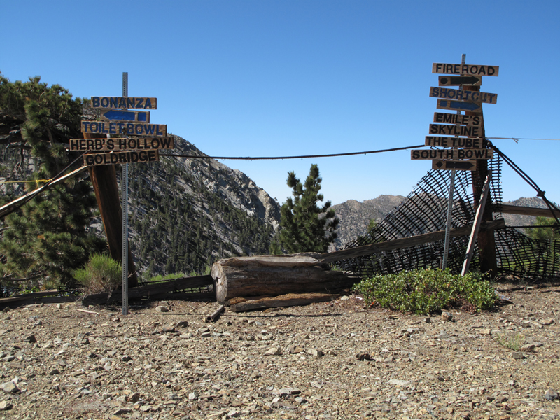
Those black diamonds don't seem so scary now

Image
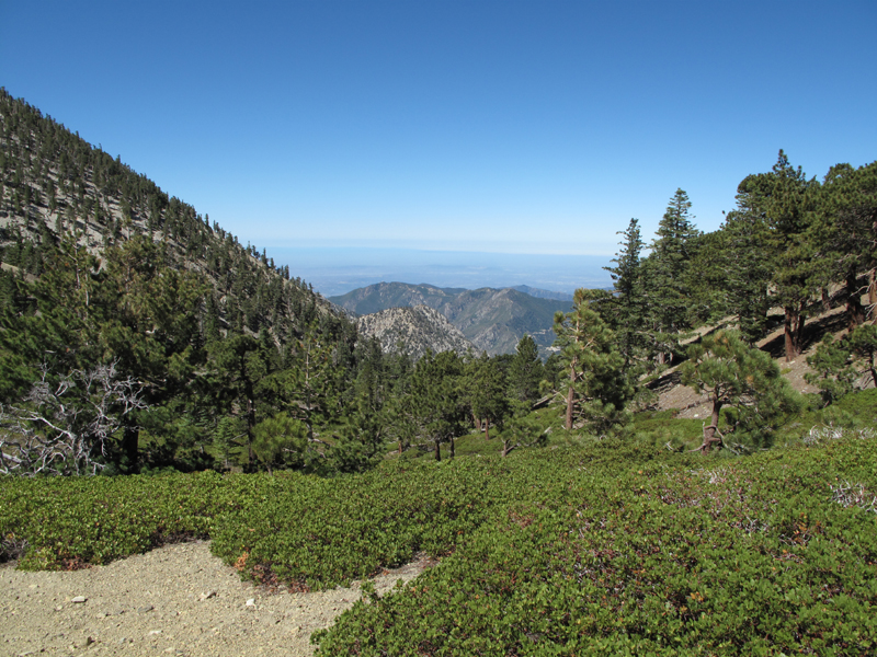
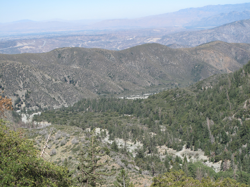
Glendora Ridge and points south from 8200' saddle

Image
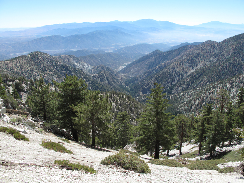
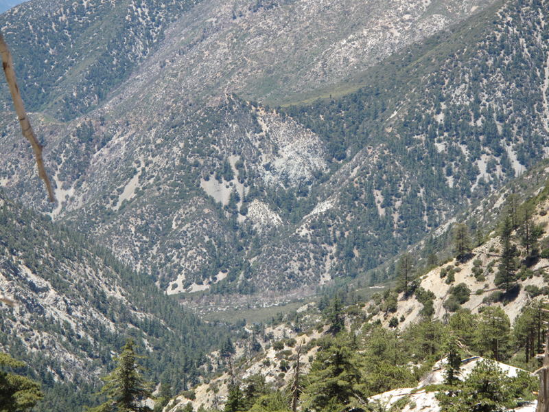
Middle Fork, Lytle Creek, San G, San J, etc.

Image
The way back up Telegraph from down Timber

Image
Proximity of Cedar Glen (Chapman Trail) and Bear Flat seen from saddle 7750'

Image
Baldy Village from Telegraph. Buckhorn Lodge roof almost discernible.

Image
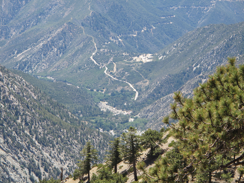
North Fork, Lytle Creek Looking towards Coldwater Campground (1996 USGS Topo) site.

Image
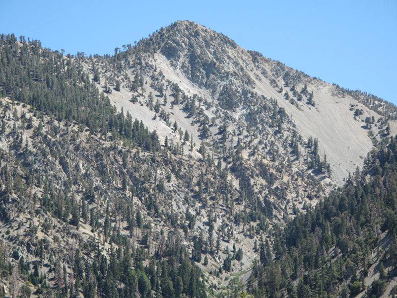
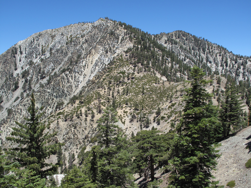
Peak 8540', I think, N.E. of Telegraph Peak.

Image
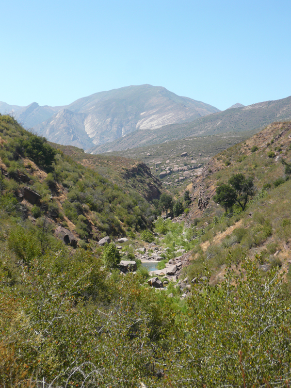
My wife and I hiked down to Tar Creek in Los Padres N.F. Yesterday. Here's Topatopa from the creek.
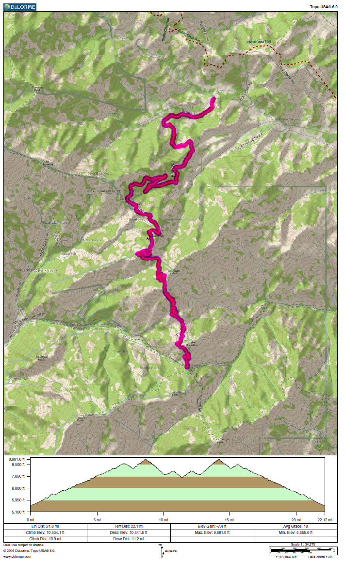
Image
Saturday's stats
User avatar
Taco
Snownado survivor
Posts: 6014
Joined: Thu Sep 27, 2007 4:35 pm

Post by Taco »

That last shot of Telegraph is actually Telegraph's main summit at 8985. The south summit of Tele is the broad one you see from Ontario and Icehouse. 8821 or so, I believe. Great views on both.

Sespe Wilderness is great. Did a lot of stuff there a while ago.
User avatar
406
Posts: 321
Joined: Thu Jan 17, 2008 10:36 am

Post by 406 »

looks fun
User avatar
Mike P
Posts: 1005
Joined: Tue Oct 02, 2007 10:48 pm

Post by Mike P »

Thanks for the TR, Elwood!
That is a very nice area, for sure. The picture with your car looked like the 'smooth' section of road :)
User avatar
EnFuego
Posts: 677
Joined: Mon Dec 15, 2008 11:14 am

Post by EnFuego »

Nice TR and nice pictures. A fellow SGMDF'r and I were in Sespe Creek area a couple weeks ago. Pretty nice up there. I also jsut did the Three T's on Saturday night under a full moon. That was a really nice hike.

How many miles total did you do on this last hike? And what does NHPS stand for?
User avatar
Hikin_Jim
Posts: 4686
Joined: Thu Sep 27, 2007 9:04 pm

Post by Hikin_Jim »

EnFuego wrote:What does NHPS stand for?
NHPS = Near Hundred Peaks Section. It's sort of an inside SGMDF joke re the Sierra Club's HPS section. It's for people who go by peaks but don't actually summit.
Image
User avatar
Elwood
Posts: 612
Joined: Fri Aug 15, 2008 5:23 pm

Post by Elwood »

GPS recorded the track at 22 miles. I was on the hoof for just short of nine hours, not working very hard. Incremental climb was around 10,500 ft.

Image
User avatar
Taco
Snownado survivor
Posts: 6014
Joined: Thu Sep 27, 2007 4:35 pm

Post by Taco »

Someone start a thread for NHPS! 8)
User avatar
Hikin_Jim
Posts: 4686
Joined: Thu Sep 27, 2007 9:04 pm

Post by Hikin_Jim »

Elwood wrote:Image
:lol: :lol: :lol: The hole punches kill me.

Taco!, give that man a sub title ("Mr. NHPS" or something)
User avatar
cougarmagic
Posts: 1409
Joined: Wed May 07, 2008 5:21 pm

Post by cougarmagic »

Elwood wrote: I don't think I was close enough to Baldy, Harwood, Cucamonga or Bighorn to qualify for NHPS.
Hey, you didn't summit them - that's all you need to (not) do!

Beautiful photos. Great TR. Thanks!
User avatar
Ze Hiker
Posts: 1432
Joined: Mon Jul 28, 2008 7:14 pm

Post by Ze Hiker »

Elwood wrote:GPS recorded the track at 22 miles. I was on the hoof for just short of nine hours, not working very hard. Incremental climb was around 10,500 ft.

Image
gotta be tons of error in that measurement, can't be close to 10,500 gain... :?:
User avatar
Taco
Snownado survivor
Posts: 6014
Joined: Thu Sep 27, 2007 4:35 pm

Post by Taco »

So how close must someone be to a summit to qualify for NHPS?
User avatar
Tim
Posts: 560
Joined: Tue Apr 08, 2008 8:55 pm

Post by Tim »

I'd say something really close, like 100 ft, to inflict as much psychological trauma as possible. Ze would go insane by the time he hits his 5th non-summit after doing all that climbing!
User avatar
Ze Hiker
Posts: 1432
Joined: Mon Jul 28, 2008 7:14 pm

Post by Ze Hiker »

indeed! Olancha (600 ft) was painful.

I stared at my wrist for a while when I realized I passed up Mt Hawkins the first time (few hundred feet).

5 would just ....be....too...much...
Post Reply