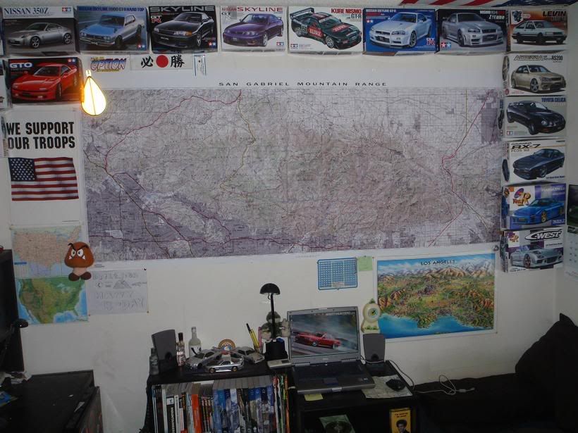
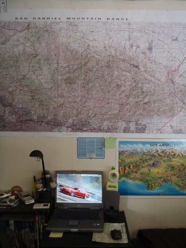
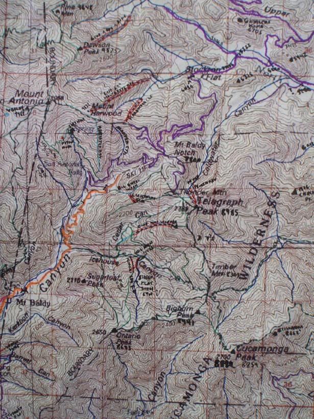
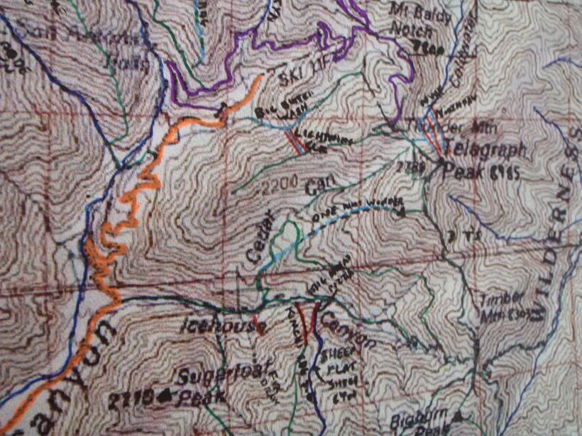
Taco - see ya have some of those LA maps too - ya got this one?:
It's by Jack Moffett... pretty cool map. I might have an extra one if you don't have one already - can't promise, since everytime I find an extra, a friend one wants one.
AFAIK, you don't install the data. When you zoom in to Level 4 or Level 5, it will ask for the disc. At all other zoom levels you don't need the disc. Instead of putting the disc in each time, you can copy the data to your hard drive using VIEW > TOPO! Product Setup
Tim wrote:AFAIK, you don't install the data. When you zoom in to Level 4 or Level 5, it will ask for the disc. At all other zoom levels you don't need the disc. Instead of putting the disc in each time, you can copy the data to your hard drive using VIEW > TOPO! Product Setup
I'll second what Tim has said. I don't have the latest version, so I was glad to see someone else take on the question. But Tim's experience with this product sounds the same as mine. It's definitely worth copying the data for Levels 4 and 5 to your hard disk. In fact, maybe you did that with an older version so it's already there.
I'm not sure what version being used either.
But, LA is disk #1 - so if that disk was copied you might not need to even put it in at the highest zoom levels.
Of all I've used, Nat Geo has the best maps; but the most difficult interface ('cept maybe DeLorme) and instructions/help.
Interesting. I've about given up on Nat Geo TOPO. The resolution is so bad, I can barely pick out the trails. It's just about worthless to me.
Of course, I bought mine around 1999, so perhaps they've improved the product some since then, but I don't feel the need with Harrison Maps and free downloadable USGS maps available.
P.S. Pretty cool map ya got there Taco. What scale is it? 1:24,000?1:36,360? 1:50,000? 1:62,500? It looks like it's got a lot more detail than a 1:100,000.
AlanK wrote:I've had versions of TOPO! since 1997 and have never noticed a difference in resolution between the maps and the paper USGS ones (which I still love).
Wow. I obviously got the lemon version. The printed (or pdf downloadable) USGS maps are like night and day compared to the TOPO! stuff I have. Weird.
Rumpled wrote:I'm not sure what version being used either.
But, LA is disk #1 - so if that disk was copied you might not need to even put it in at the highest zoom levels.
Of all I've used, Nat Geo has the best maps; but the most difficult interface ('cept maybe DeLorme) and instructions/help.
Hmm, maybe I spoke too soon. I'm using Version 4.5.0 but my map data was bought in 2004 and the LA area is Disc 9, not Disc 1. So maybe they changed it and now it installs some map data on its own? Oh well, beats me. Simonov hasn't updated us on what he found so the mystery continues.
Anyhow, I agree with HJ about the resolution. My NatGeo maps are definitely not as good as the 20 MB PDFs from the USGS. I can zoom into the USGS PDF up to 400% and it's as clear as can be. The NatGeo TOPO! maps are decent but pretty much suck compared to the PDFs. It looks like it has a maximum resolution equal to the screen resolution (72 dpi), unless I'm doing something wrong.
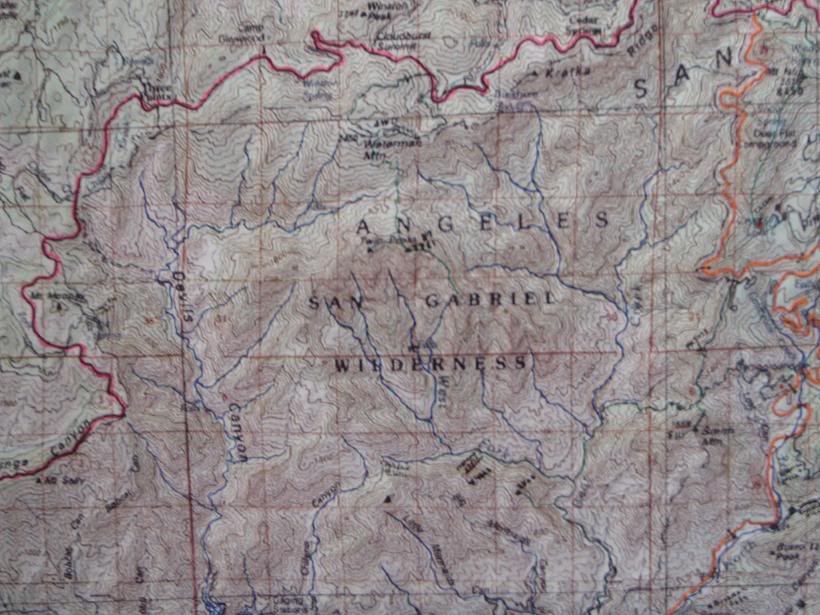
Also, my NatGeo maps appear to use a later version of the map data than the free USGS PDF maps. The PDF maps have a photorevised date of 1988 or 1994. I don't know what date the NG maps are, but they are definitely different because a lot of the labels are different. The most annoying thing of all are these dark shaded areas.
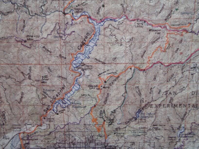
What do these shaded areas mean? Does this designate private property?
I've used Topo since it was made by Wildflower (?) I've always had good luck with it.
Thanks Mike. This might be a long shot, but is there a way to turn this off? I noticed that on older maps when TOPO! was made by Wildflower Productions, they did not have this shading and the maps actually looked more legible overall.
Tim wrote:Hmm, maybe I spoke too soon. I'm using Version 4.5.0 but my map data was bought in 2004 and the LA area is Disc 9, not Disc 1. So maybe they changed it and now it installs some map data on its own? Oh well, beats me. Simonov hasn't updated us on what he found so the mystery continues.
Indeed.
I popped disk #9 into the drive and when nothing happened I found a command somewhere on the TOPO interface that said read map data from disk. Then it said disk #9 had already been read. So maybe I loaded disk #9 last year before I wiped my system and the data was still on my hard drive (except I don't remember loading from the data disks then, either).
TOPO was a huge disappoint for me last year when I first ran it. The maps look crappy and the user interface is wonky. But I use it now to trace trails and routes which I then convert into Google Earth paths, to show other hikers where we are going on a backpacking trip. I also use it to make custom route maps, but these never look as good as the Tom Harrison maps I also try to take with me.
My statement yesterday concerning resolution was too glib. I don't recall ever missing features on TOPO! maps that I can make out on the equivalent USGS ones, but I should not have said that the resolution is the same. I am satisfied with the use I have gotten from TOPO! maps over 12 years. What I need to do is sit down at home sometime and do a more careful comparison to really talk about resolution.


