Punchbowl Pallett Williamson South Fork Loop

TRs for the San Gabriel Mountains.
Post Reply
User avatar
Elwood
Posts: 612
Joined: Fri Aug 15, 2008 5:23 pm

Post by Elwood »

With Southland temperatures headed for the nineties, I thought the eastern end of Pleasant View Ridge would offer some relief, or at least a breeze. No such luck. A great day of hiking was had nonetheless. Mine was the only car in the Punchbowl County Park lot at 0600. Incidentally, this is the wrong hike to try and break-in a new pair of half-size-too-small Asolos on. Before the descent to Cruther's Creek I heard rustling up-slope; this was my closest encounter to date with an adult Ursus Americanus. Damn those bears are big. I made Burkhart Saddle by a leisurely 0930 and was on top of Pallett at 1035. At 1230 I was relaxing on Williamson summit, treating my bleeding feet and chatting on the radio (via repeater) with a gentleman in Huntington Beach. The east PCT descent to Islip Saddle was a welcome downhill stroll. The South Fork Trail is as gorgeous as ever, despite rockfalls and slides in spots where falling would be perilous at best. There were people frolicking in Big Rock Creek, which made me very squeamish about drawing needed water, but that's what sterilization protocols are for, I guess. After my usual, unnecessary brush bash back to the Devils Chair trail, the hike was uneventful though seemingly endless. The pitch-roofed cistern near the Burkhart trailhead was a welcome landmark. I was back on the road home just before 1900.

Image
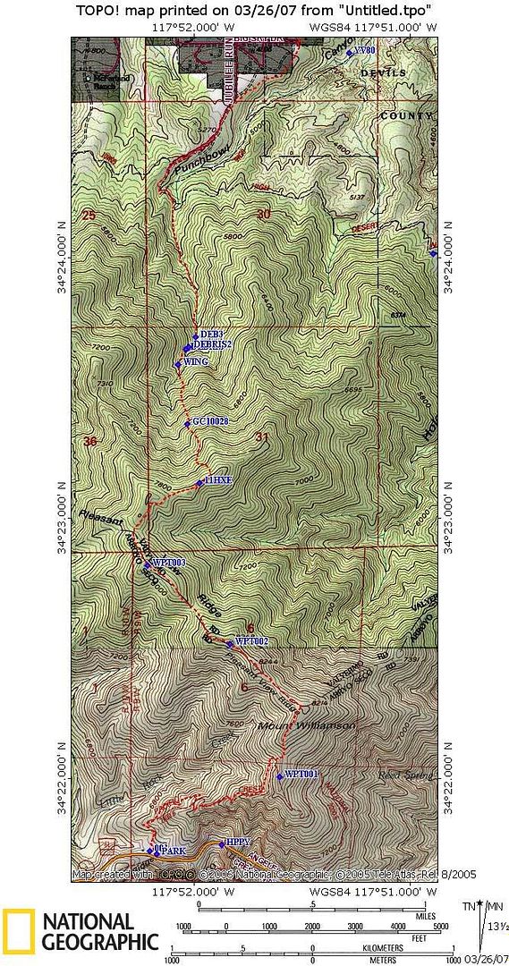
Devils Punchbowl in the beautiful High Desert morning light.

Image
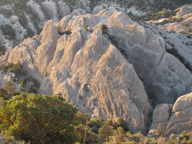
The brown blob in the center is sadly the best shot I got of this bear.

Image
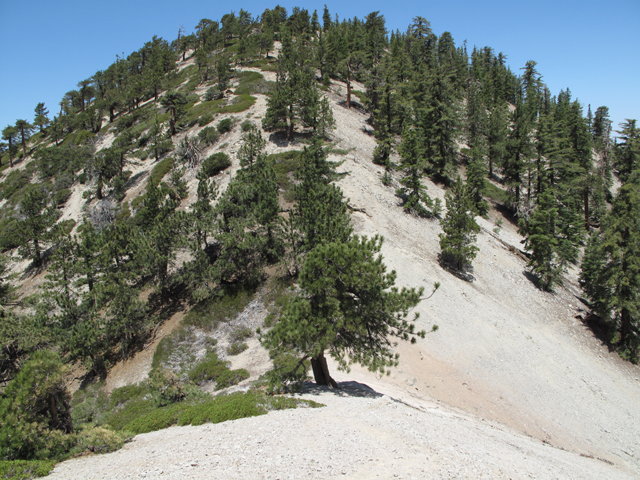
Looking west on Pallett Mountain summit

Image
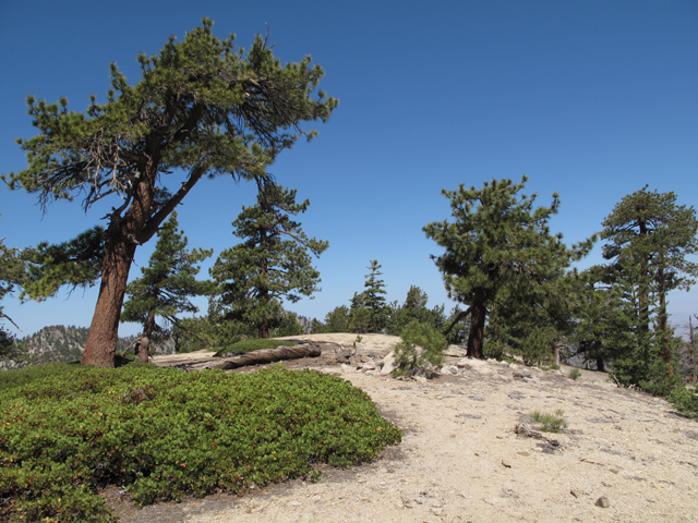
The final climb up to Mt. Williamson summit

Image
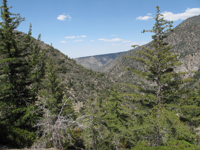
Looking north towards Pinyon Ridge (?) from the South Fork Trail

Image
A welcome Punchbowl view from the High Desert NRT

Image
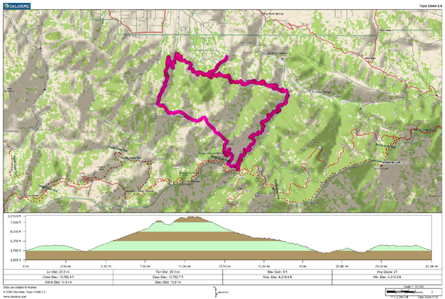
Track of the day's hike
User avatar
Bill
Posts: 332
Joined: Thu Jul 24, 2008 6:09 pm

Post by Bill »

Nice trip report. 8)
Was Reed spring still flowing when you came through? I will be doing the loop starting at Vincent gap down Manzanita, up Southfork trail to Islip and over Throop to Baden and down to Vincent Gap next week.
User avatar
cougarmagic
Posts: 1409
Joined: Wed May 07, 2008 5:21 pm

Post by cougarmagic »

That photo of the punchbowl is really cool - seeing the big white band of rock like that, and knowing it's the San Andreas Fault!

Great bear sighting!!
User avatar
Elwood
Posts: 612
Joined: Fri Aug 15, 2008 5:23 pm

Post by Elwood »

Reed Spring was still springing, though not very vigorously,
User avatar
Kit Fox
Posts: 152
Joined: Tue Dec 25, 2007 11:33 am

Post by Kit Fox »

cougarmagic wrote:That photo of the punchbowl is really cool - seeing the big white band of rock like that, and knowing it's the San Andreas Fault!

Great bear sighting!!
What you are seeing are two transitions. First is the transition between the sandstone "Punchbowl formation" (light colored rock) and the "San Francisquito Formation" (dark colored rock). The band of Sandstone visible to the rear of the image is the transition between the Punchbowl formation and the Pinyon ridge formation. The San Andreas fault is on the Northside of that red mountatin.

Image

I studied the area for an Earthcache I created, called San Francisquito Formation (Big Rock Creek Area).
User avatar
Kit Fox
Posts: 152
Joined: Tue Dec 25, 2007 11:33 am

Post by Kit Fox »

Elwood,


What were your total trip stats? I have good eyes, but can't read your map. Did you see and water in any of the valleys as you approached Burkhart saddle (like Cruther's creek)?

If I recall correctly, the trip from the Punchbowl to Burkhart saddle is close to 4000 feet of elevation gain. Great photos, and you are the man!
User avatar
406
Posts: 321
Joined: Thu Jan 17, 2008 10:36 am

Post by 406 »

nice tr
User avatar
Elwood
Posts: 612
Joined: Fri Aug 15, 2008 5:23 pm

Post by Elwood »

Assuming reasonable accuracy on the part of my GPS, 26.3 miles and 13,762 ft. of cumulative climb. Max elevation recorded at 8,219 ft. (USGS puts Williamson Summit at 8,214, so I'll accept the 5 foot delta from consumer equipment). Minimum elevation was 4,514 ft.

There was definitely water running well in Cruther's Creek. I scared something off that was down for a drink, but couldn't see it. I was still about 4.5 litres heavy at that point and didn't need to fill up.

PDF of the track (filename date is wrong)
GPX of the track
User avatar
Hikin_Jim
Posts: 4686
Joined: Thu Sep 27, 2007 9:04 pm

Post by Hikin_Jim »

Elwood wrote:...26.3 miles and 13,762 ft. of cumulative climb.
Slacker. :lol:

Great stuff. I love PVR. Beautiful country.
User avatar
simonov
Posts: 1087
Joined: Tue Nov 27, 2007 5:44 pm
Location: Reno, NV
Contact:

Post by simonov »

Thanks for the GPX.

Did you say you had to bushwack this route or was it along established trails?
Nunc est bibendum
User avatar
Hikin_Jim
Posts: 4686
Joined: Thu Sep 27, 2007 9:04 pm

Post by Hikin_Jim »

simonov wrote:Thanks for the GPX.

Did you say you had to bushwack this route or was it along established trails?
There's a trail from the Punchbowl to Burkhart Saddle. From Burkhart Saddle, you trend east XC along the ridge. No brush problems that I can remember. From Mt. Willamson, you connect with the PCT, and then the S. Fork Trail. The S. Fork Trail was at one time an old mining road. I believe there is a trail to connect you back to the Punchbowl from the lower end of the S. Fork Trail, but I notice that Elwood mentions brush, so either it's overgrown or my memory is poor. It's been a while, but I have hiked from the vicinity of the lower end of the S. Fork Trail to the Devil's Chair where you meet the trail coming in from Devil's Punchbowl. Perhaps he took a shortcut?
User avatar
Kit Fox
Posts: 152
Joined: Tue Dec 25, 2007 11:33 am

Post by Kit Fox »

There is no way he took a shortcut between the Southfork Trail and the Punchbowl trail. There is a long line ridgeline with several mini summits that would need to be summited.
User avatar
Elwood
Posts: 612
Joined: Fri Aug 15, 2008 5:23 pm

Post by Elwood »

This trail is wide open from start to finish. I have twice managed through my own lameness to get too close to South Fork CG and briefly lose the trail back to the Devil's Chair segment. The climbers' trails up the west slopes of Pallett and Williamson are indistinct in spots, but hard to lose.
User avatar
AW~
Posts: 2043
Joined: Mon Oct 01, 2007 12:00 pm

Post by AW~ »

awesome...
User avatar
KathyW
Posts: 212
Joined: Thu Sep 27, 2007 9:00 pm

Post by KathyW »

I've always thought the punchbowl to Pallett and the other nearby peaks would be a great hike, but I've never done it. Thanks for the report - I think I'll wait until it cools down in the fall to give the hike a try.
User avatar
Kit Fox
Posts: 152
Joined: Tue Dec 25, 2007 11:33 am

Post by Kit Fox »

Elwood wrote:This trail is wide open from start to finish. I have twice managed through my own lameness to get too close to South Fork CG and briefly lose the trail back to the Devil's Chair segment. The climbers' trails up the west slopes of Pallett and Williamson are indistinct in spots, but hard to lose.
If you ever want to make that trip again, and add an added twist, go north over the face of Mt. Williamson, and visit the two plane wrecks. There is a C-119 Boxcar wreck, and a C-46A Commando crash that you were super close to.

11HXE is the C-119 and GC10028 is the C-46 wreck.

Image

Here are my photo albums for both wrecks.

http://s4.photobucket.com/albums/y144/sgbofav/C-46/
http://s4.photobucket.com/albums/y144/sgbofav/C-119/
User avatar
Elwood
Posts: 612
Joined: Fri Aug 15, 2008 5:23 pm

Post by Elwood »

Hey Kit Fox!

Thanks for the info and pix of the plane wrecks.
Post Reply