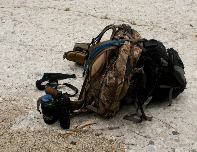
When you said "Pianobox" that rang a bell for me. Years and years ago (maybe when I was in Jr. High -- 70's), my dad, my uncle, and I did a loop out to the Gillette Mine from Cienaga Campground through Pianobox to the Gillette Mine Trail to the mine itself, and then returning via Bear, Cienga, and Redrock Canyons.
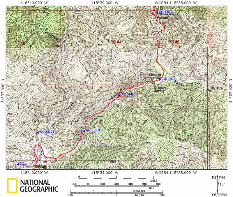
Here's a
map of our route. You'll need to scroll around and zoom in to make any sense out of the map.
A = Cienaga CG
B = Pianobox
C = Windy spot in Fish Canyon
D = Jct with Burnt Pk Trail (actually, I marked this one confluence South of true jct)
E = Jct with Gillette Mine Trail
F = Gillette Mine
G = Confluence of Bear and Cienaga Canyons
H = Exit point out of Cienaga Canyon
I = Pt. on route to Redrock Canyon
J = Jct with trail back to Pianobox (our intended route)
K & L = points along our intended return route to Pianobox
M = Actual return route down Redrock Can.
N = Approx. loc of trailhead in Redrock Can.
It was a long hike. I remember being impressed that there were pines and such back in and not just chapparal. We did finally get to the mine area, but we were running way late. To complicate matters, the routes down Bear, Cienaga, and Redrock canyon were in poor shape. There had been a lot of rain recently, and there were a lot of water crossings which were difficult in the dark. We opted not to take the trail back to Pianobox since it was dark and continued down Redrock Canyon to the trailhead where we hitched a ride back to our car at Cienaga CG. We got back to the car at about 1:00 A.M. give or take. It was a long hike and a real test of endurance and perserverance. Oddly enough, I do remember some of the nice things like pine trees and scenery. Odder still, I still remember our route.
I have no idea what the trails would be like back there now, 30 or so years later. That part of the forest has never gotten the kind of hiking traffic that the main section does.
QUESTION: Is the "Redrock Mine" you were talking about one and the same as the "Gillette Mine" marked on the map or is it another mine? If so, can you plot it on an Acme map and post it here on the forum? I'm just curious.